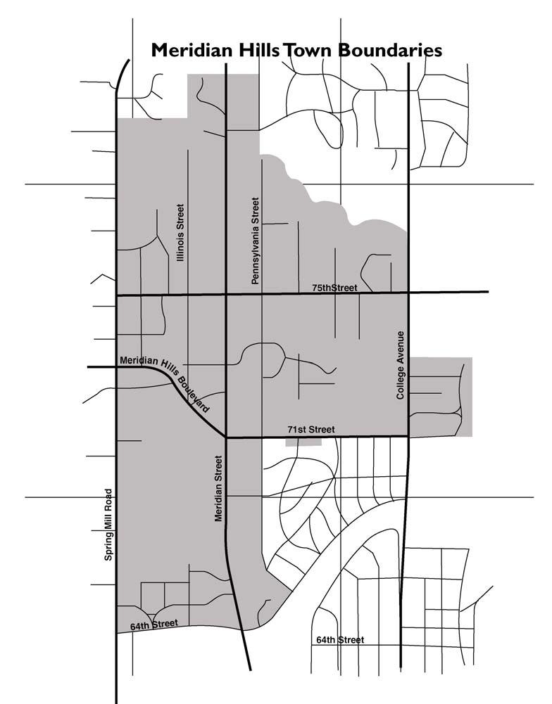
Meridian Hills Improvements
|
|
|
- Rodney Martin
- 5 years ago
- Views:
Transcription
1 Meridian Hills Improvements Public Information Meeting
2 Background The Town Planning Committee - ad hoc committee established December 2005 Volunteer members Create a long-range plan of improvements that will increase public safety, improve property values and resident livability, and create a stronger sense of identity and community for the Town of Meridian Hills.
3 Background The members of the committee include: Sue Welch Laura Hays Mathieu Nunery Bill Nunery John Taylor Rose Scovel (Committee Vice Chairperson) Terry O'Brien (Committee Chairperson)
4 Background Town planning committee is charged with discussing long-range planning issues including activity paths/sidewalks burying utility lines on the main thoroughfares decorative streetlights decorative stop sign poles at high visibility intersections decorative street name signs landscaped gateways with town entry signs cul-de-sacs roundabouts drainage as affected by these possible projects
5 Survey Survey was sent to most residents in the Town approximately 750 sent Received approximately 300 responses to date; results will be statistically significant Results and comments will be presented to the Town Council
6 Maps of Improvements Shows where improvements would have the greatest impact Tool for discussing locations
7 Preference Survey Presents a variety of images in each topical area Allows participants to choose their preferred level of treatment Asks participants to select the priority of a particular topic Highlighted image is the committee s preferred option
8 Research Town Planning Committee members were assigned topics to research reported Recommendation
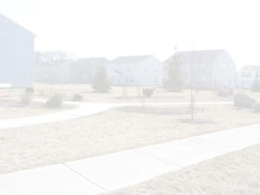
9 Sidewalks and Activity Paths Existing Proposed


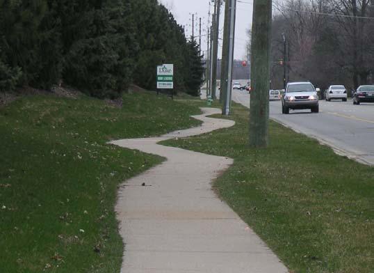
10 Sidewalks and Activity Paths 1 2 3
11 Sidewalks Would improve public safety and provide better connectivity Safer access to the Monon, Marrott Park, and Holliday Park Preferred over traditional sidewalks as they serve pedestrians, joggers, skaters, and bicyclists Qualify for some of the available government grants geared specifically toward improving multipurpose connectivity to parks, churches and schools
12 Sidewalks Could wind along the road rather than be exactly parallel Allow for the preservation of established trees when possible Working with the varying topography. Traditional Indianapolis sidewalks are 5 feet wide (meet ADA standards)
13 Sidewalks The Monon is 10 feet wide. Ideal width would be 6-8 feet wide Consistent with Indianapolis pedestrian and circulation plans
14 Sidewalks A street 22 feet wide can serve school buses, dump trucks, and emergency vehicles Multi-phase installation can coincide with other improvements & funding: Phase 1 75th Street Phase 2 Spring Mill Phase 3 Pennsylvania Phase 4 64th Street Phase 5 71st Street Phase 6 - College
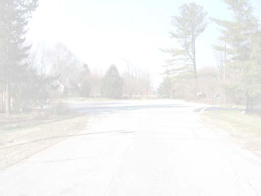
15 Utility Lines Proposed

16 Utility Lines 1 2 3
17 Utility Lines The utility lines along these locations are main lines, and more costly than burying lower rated lines. Burying feeder lines that run behind homes and connect to homes would improve the safety and landscape of the town and reduce necessary utility trimming, however the Town would not participate financially but act as a catalyst for residents that inquire.
18 Utility Lines Burying utility lines along main roads could reduce traffic and safety hazards, reduce power outages, reduce necessary utility trimming and improve the appearance of the town. Locations with the greatest public impact include: 75th Street Pennsylvania Street Spring Mill College 71st Street
19 Utility Lines Multi-phase installation can coincide with other improvements & funding: Phase 1 75th Street Phase 2 Pennsylvania Phase 3 Spring Mill Phase 4 71st Street Phase 5 - College
20 Utility Lines Main Line Primaries would cost $200 per linear foot Additional Switch Gear ( $6,000-10,000 each) would need to be placed every 500 ft. The estimated cost for the Town s 15,000 linear feet of Main Line Primary would be $3,000,000
21 Utility Lines 32,500 linear feet of Distribution Primary at $30 per linear foot; total cost of burying these lines would be $975,000. Estimated cost for each homeowner to bury the power lines to the homes would be on average 150 linear feet at a cost of $20 per foot
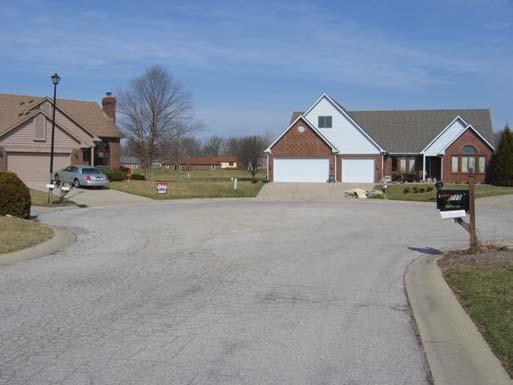
22 Streetlights Cobra Decorative Decorative 2
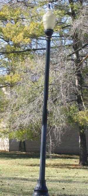
23 Streetlights 1 2 3
24 Streetlights Existing streetlights: 40 x 175W MV Overhead - $ 9.69 each per month 13 x 175W MV Metal Column - $15.93 each per month 2 x 175W MV Fiberglass 55 streetlights total - $15.16 each per month - $ per month A consistent decorative style will unify the look of the town and improve the image and sense of community
25 Streetlights Unlimited options from private vendors would require warehousing parts and hiring a private contractor to service and repair. IPL provides service and parts and offers two decorative styles as an option: Traditional Somerset neighborhood Washington Sycamore Springs, North Meridian neighborhoods
26 Streetlights The Washington is $24.32 each per month or $1, total per month. Multi-phase installation can coincide with other improvements & funding: Phase 1 Along 75th Street & Along Pennsylvania Street (16 lights) Phase 2 West of Pennsylvania (15 lights) Phase 3 East of Pennsylvania (10 lights) Phase 4 Wellington (14 lights)
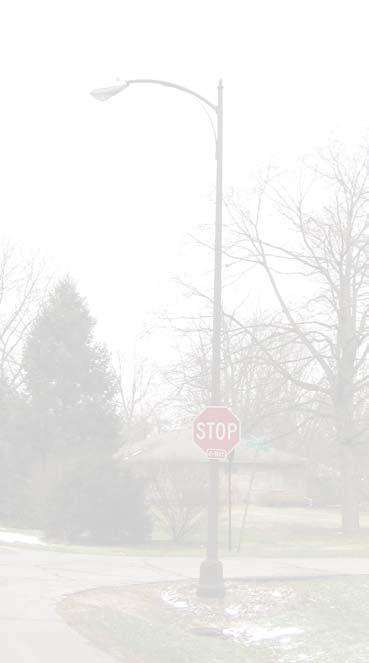
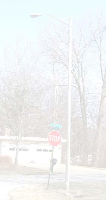
27 Stop Signs Proposed


28 Stop Signs 1 2 3
29 Stop Signs A consistent decorative style sign pole at high traffic intersections will unify the look of the town and improve the image and sense of community. A decorative stop sign pole cost approx. $349 - $397 plus shipping and installation. Possible roundabouts would replace decorative stop sign poles with decorative yield poles
30 Stop Signs There are primarily three grades of traffic signs: Engineer Grade High-Intensity Grade approx 3x more reflective than EG Diamond Grade approx 10x more reflective than HI and a longer life Town s newly approved sign standard exceeds MUTCD compliance and uses Diamond Grade for: Stop approx. $98.96 Stop Ahead/ Signal Ahead yellow/green fluorescent - $ School Crossing yellow/green fluorescent - $ Children Playing yellow/green fluorescent - $ and High-Intensity for: Yield $73.72 Speed Limit $62.04
31 Stop Signs Town s newly approved sign standard includes black powder-coated breakaway pole with black painted sign and finial approx $68.62 plus cost of sign and installation
32 Stop Signs Multi-phase installation can coincide with other improvements & funding: Phase 1 Along 75th Street & Along Pennsylvania Street (26 poles) Phase 2 Arden and 64th Street (3 poles)/balance of 3 & 4 way signs (19 poles) Phase 3 (if desired) Balance of signs (39 poles)
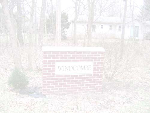
33 Street Name Signs


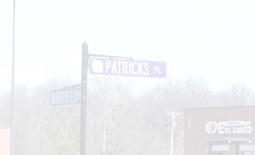
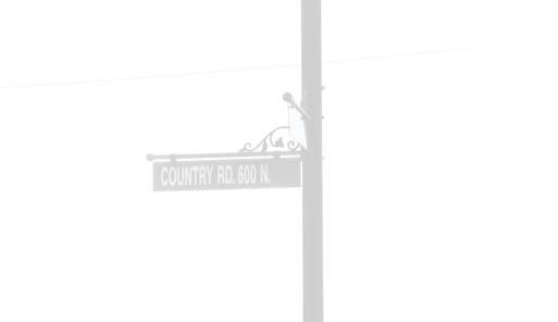
34 Street Name Signs
35 Street Name Signs Existing street name signs are a combination of old white signs with black letters and newer Indianapolis bright green with white letters. A consistent decorative style will unify the look of the town and improve the image and sense of community. The street name signs can incorporate Meridian Hills as well as the tree line silhouette and a unique color to differentiate the Town from the surrounding city.
36 Street Name Signs Multi-phase installation can coincide with other improvements & funding: Phase 1 Along 75th Street & Along Pennsylvania Street Phase 2 West of Pennsylvania Phase 3 East of Pennsylvania Phase 4 Wellington
37 Gateways Existing Proposed

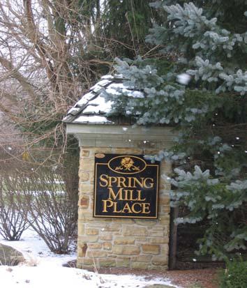
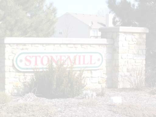
38 Gateways
39 Gateways Many existing town entry signs are damaged, missing or extremely weathered. New town entry signs with professional landscaping at gateway locations would create improve the appearance and image of the town and improve the sense of community. An illuminated monument sign using limestone could tie into some of the larger landmark public buildings within the town.
40 Gateways The carved slab could include The Town of Meridian Hills Est and could incorporate the tree line silhouette
41 Gateways Gateway locations could include: 71st & College (2) 75th & College (2) 64th & Meridian (2) 80th & Meridian (2) 64th & Spring Mill (1) 73rd & Spring Mill (2) 79th & Spring Mill (1)
42 Gateways Possible roundabouts would reduce the number of town entry signs if a single sign was installed within the roundabout.
43 Gateways The town entry signs could be installed on mounded, professionally landscaped beds using low maintenance, location appropriate, salt & traffic resistant plants spruces, ornamental grasses, dogwoods, ground cover, etc.
44 Gateways Multi-phase installation can coincide with other improvements & funding: Phase 1 71st & College & 75th & College (4 signs) Phase 2 64th & Spring Mill, 73rd & Spring Mill, 79th & Spring Mill (4 signs) Phase 3 64th & Meridian, 80th & Meridian (4 signs)
45 Landscape Treatments Proposed

46 Landscape Treatments 1 2 3
47 Landscape Treatment Public rights-of-way in high visibility locations would benefit from improved professional landscaping. The landscaping could include mounded, professionally landscaped beds using low maintenance, location appropriate, salt & traffic resistant plants spruces, ornamental grasses, dogwoods, ground cover, etc.
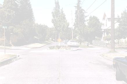
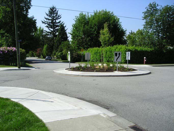
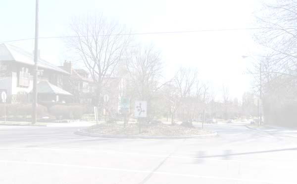
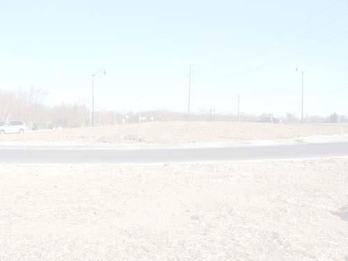
48 Landscape Treatment High visibility locations include gateway locations, islands in Wellington & Sherwood Village, landscaping necessary if any through streets are closed, and neglected pockets on public rights-of-way. Beds could be sponsored with an Adopt-a- Median type program.
49 Landscape Treatment Multi-phase installation can coincide with other improvements & funding: Phase 1 Gateways along College & adjacent sites Phase 2 Gateways along Spring Mill & adjacent sites Phase 3 Gateways along Meridian & adjacent sites
50 Cul-de-sacs Existing Proposed

51 Cul-de-sacs 1 2 3
52 Cul-de-sacs Closing non-primary residential streets that feed into high speed and high traffic roads could reduce traffic accidents and cut-through traffic, while providing better traffic control, more security, and safer neighborhoods for pedestrians. The mounding and landscaping could allow for a pedestrian access path.
53 Cul-de-sacs A paved cul-de-sac with mounded professional landscaping would provide a seamless closure that s attractive and integrated into the neighborhood Typically 100 to 120 diameter of right of way is needed for a cul-de-sac and 80 to 100 is paved Cul-de-sacs should not terminate a street that is more than 600 to 800 long Less through traffic once drivers become aware of the change in street connectivity
54 Cul-de-sacs Would need to make changes on official Census map prior to 2010 Census Would need to submit map changes to Census for TIGER files, Mapquest, IndyGIS, and emergency service providers (Meridian Hills police, Indy/Marion County police/sheriff s department, Washington Township fire)
55 Roundabouts Proposed
56 Roundabouts
57 Roundabouts The interior of the roundabout could include a town entry sign where appropriate, and mounded professional landscaping that is lowmaintenance and resistant to traffic and salt. Multi-phase installation can coincide with other improvements & funding: Phase 1 75th & Spring Mill, 75th & Pennsylvania, 75th & College Phase 2 Spring Mill & 73rd, Pennsylvania & 71st, College & 71st Phase 3 Williams Creek Blvd & Pennsylvania, 64th & Pennsylvania
58 Roundabouts Appropriately sized, landscaped roundabouts that fit within the town rights-of-way could improve speed control, calm traffic, reduce the number of accidents, and be an improvement in the town. Approach right of way needs to be considered; sizing for fire trucks and busses Roundabout delay emergency response between 5 and 8 seconds per circle
59 Funding Town funding, no tax increase may allow for possible installation of smaller improvements while possibly deferring other responsibilities, but will not allow for completion of larger improvements Town funding, small tax increase The Public Works Project allows the town to borrow approx. $1,200,000 for designated projects and pay off with interest within 6 years.
60 Funding Grant funding The Transportation Enhancement Grant is specifically targeted to improved connectivity using multiuse paths, landscaping, etc. Other grants may be possible for landscaping Private donations The town could explain the fiscal limitations of our budget and solicit donations from residents to accomplish specific improvements
61 Funding Sponsorship - Following are some sponsorship possibilities: Sponsorship plaques on sides of Town Entry signs Adopt-a-median for roundabouts, landscape beds, etc. Buy-a-brick for activity paths
62 Survey If you have not returned your survey, please do so no later than May 12 th One survey per household Copies will not be tabulated Results will be presented to the Town Council
63 Thank you
The Arlington County Park and Recreation Commission and Department of Parks, Recreation and Cultural Resources. PEG APPLICATION FORM Fiscal Year 2012
 The Arlington County Park and Recreation Commission and Department of Parks, Recreation and Cultural Resources PEG APPLICATION FORM Fiscal Year 2012 I. Location of Proposed Project: Park Name (if applicable):
Project Goal. RRRC Living Towns Planning Workshp. Town of Halifax Revitalization Project. Dynamic Planning & Management Duo: July 12, 2006
 Project Goal Town of Halifax Revitalization Project RRRC Living Towns Planning Workshp July 12, 2006 Town of Halifax Halifax County *** Revitalization Project Goal*** To create Economic Opportunity and
4-Town Comprehensive Plan DRAFT 7/30/07
 4-Town Comprehensive Plan DRAFT 7/30/07 Acknowledgements ning Committee Town of Harrisburg Norman Roof Randy Nicol Town of Martinsburg Terry Thisse Paul Kelly Town of Montague Jan Bagdanowicz Wendy Perry
ARTICLE 13 STREETS General
 ARTICLE 13 STREETS 13.1 General Streets shall be designed to suit their functions. Many streets have purposes other than vehicular traffic. As an alternative to current N.C. Department of Transportation
ARTICLE 13 STREETS General
 ARTICLE 13 STREETS 13.1 General Streets shall be designed to suit their functions. Many streets have purposes other than vehicular traffic. As an alternative to current N.C. Department of Transportation
Hillsborough County Residential Street Lighting Program
 Hillsborough County Residential Street Lighting Program Public Works HCFLGov.net/PublicWorks (813) 635-5400 Neighborhood street lights in unincorporated Hillsborough County are paid for by property owners
Citizen Advisory Group Meeting 5: Land Use April 14, 2011
 Citizen Advisory Group Meeting 5: Land Use April 14, 2011 Meeting Agenda 1. Background Review 2. Transportation Follow-up 3. PED Overlay Approach 4. Land Use Mapping 5. Group Exercise 6. Wrap-up and Next
3. VISION AND GOALS. Vision Statement. Goals, Objectives and Policies
 Vision Statement Queen Creek s interconnected network of parks, trails, open spaces and recreation opportunities provide safe and diverse activities and programs that sustain its unique, small town, equestrian
West Dennis Center: Bass River to Old Main Street. West Dennis Business District: Old Main Street to Dennis Commons
 West Dennis Center: Bass River to Old Main Street West Dennis Business District: Old Main Street to Dennis Commons Dennisport Center: Dennis Commons to Division Street Main Street Project Goals Project
Roanoke Rapids Streetscape Master Plan. City Council Presentation
 SCHEDULE: Stakeholder Meeting/Kick off November,2016 Master Planning Phase (November March 2017) Public Meeting #1 December 13, 2016 Review Meeting with Key Stakeholders Refine Concepts Based on Input
LED LIGHTING DOWNTOWN OKEMOS
 LED LIGHTING DOWNTOWN OKEMOS Michigan State University Practicum 2010 Agenda Introduction Project Background Site Background Importance of Illumination LED Advantages/Disadvantages Application in Other
I-70/71 Innerbelt Project
 I-70/71 Innerbelt Project Project Progress Meeting and Design Enhancement Update November 9, 2009 Ohio Department of Transportation MS Consultants MSI Design Overview of Presentation 1. Recap Recent Project
Implementation. A plan is a list of actions arranged in whatever sequence is thought likely to achieve an objective. John Argenti
 A plan is a list of actions arranged in whatever sequence is thought likely to achieve an objective. John Argenti This Implementation section is structured into a coordinated action program so that elected
CONFORMED AGREEMENT INCORPORATED REVISIONS PER AMENDMENT DATED: APRIL 2, 2013 FOR REFERENCE
 CONFORMED AGREEMENT INCORPORATED REVISIONS PER AMENDMENT DATED: APRIL 2, 2013 FOR REFERENCE CITY STREETS AS PART OF STATE HIGHWAYS GUIDELINES REACHED BY THE WASHINGTON STATE DEPARTMENT OF TRANSPORTATION
Transportation Projects Quarterly Report. Morrisville Planning Department May 22, 2018
 Transportation Projects Quarterly Report Morrisville Planning Department May 22, 2018 Transportation Improvements Most Common Ways the Town secures transportation improvements: 1. Development 2. Grant
Community Design Plan
 Gardena General Plan 2006 Authority While the is not a required element of a General Plan, it is included because improving the community appearance and image is paramount to the overall quality of life
CITY OF CALABASAS FINAL ENGINEER S REPORT. LANDSCAPE LIGHTING ACT DISTRICTS NOS. 22, 24, 27 & 32 (1972 Act Districts) FISCAL YEAR
 FISCAL YEAR") CITY OF CALABASAS FINAL ENGINEER S REPORT LANDSCAPE LIGHTING ACT DISTRICTS NOS. 22, 24, 27 & 32 (1972 Act Districts) FISCAL YEAR 2016-17 Landscape Lighting Act District No. 22 (CALABASAS PARK AREA) Landscape
CITY OF CALABASAS FINAL ENGINEER S REPORT LANDSCAPE LIGHTING ACT DISTRICTS NOS. 22, 24, 27 & 32 (1972 Act Districts) FISCAL YEAR 2016-17 Landscape Lighting Act District No. 22 (CALABASAS PARK AREA) Landscape
Corridor Identity. Section 9. Introduction. Corridor Guiding Principles
 Corridor Identity An attractive and healthy community is a critical element of a quality place, and the design of quality places is a balance between environmental, economic, and social considerations.
Village of Algonquin Beautification Plan
 Village of Algonquin Beautification Plan May 2011 Introduction The Village of Algonquin strives to set itself apart from surrounding municipalities and to define Algonquin as a unique area within the region.
10 Implementation. Implementation. Responsibility for Implementation. Blueprint for Bloomsburg. Town of Bloomsburg Comprehensive Plan 10-1
 Implementation 10 Implementation This chapter overviews how to use the comprehensive plan as a land use and programming tool for the Town of Bloomsburg and recommends annual review of the plan by the Town
PUBLIC RIGHT-OF-WAY IN THIS CHAPTER PUBLIC REALM
 PUBLIC RIGHT-OF-WAY This section provides design guidelines for improvements in the public right-of-way. The public right-of-way refers to streets, sidewalks, non-vehicular thoroughfares, parks and greenways
The Vision. Photo provided by The Minervini Group. 46 Vision, Objectives & Strategies
 Vision, Objectives & Strategies The is the public framework and guide for future development of the Grand Traverse Commons. The establishes public polices for infrastructure, the preservation of natural
section five BEAUTIFICATION PLAN
 section five BEAUTIFICATION PLAN BEAUTIFICATION PLAN Section Five Beautification Plan The goal of the Beautification Plan is to improve the Route 8-Sunnyland Corridor in terms of aesthetics and to create
City of Kearney Capital Improvement Update October 1, TH STREET AND 17TH AVENUE IMPROVEMENTS
 56TH STREET AND 17TH AVENUE IMPROVEMENTS FUNDING: Bonded ESTIMATED COST: $3,885,000 COMPLETION DATE: Fall 2018 SCOPE OF PROJECT: Widening of 56th Street from 6th Avenue to 19th Avenue, and widening 17th
CONCLUSION AND IMPLEMENTATION
 Lisbon s Vision CONCLUSION AND IMPLEMENTATION 7 Lisbon residents clearly appreciate the character, amenities, and opportunities that define our community. This Plan of Conservation and Development identifies
Yadkin River Greenway Feasibility Study Fact Sheet Village of Clemmons, Town of Lewisville, Town of Bermuda Run
 Fact Sheet Village of Clemmons, Town of Lewisville, Town of Bermuda Run Project Background The Yadkin River Greenway Feasibility Study is a joint project with the Village of Clemmons, the Town of Bermuda
Sustainably Repositioning Greyfield Sites. Greyfield Sites Anywhere
 Sustainably Repositioning Greyfield Sites Jim Constantine Looney Ricks Kiss Architects Todd Poole 4ward Planning Greyfield Sites Anywhere Pennsylvania Chapter American Planning Association Conference 2009
Rt. 29 Solutions Project Delivery Advisory Panel. December 3, 2015
 Rt. 29 Solutions Project Delivery Advisory Panel December 3, 2015 Agenda item 1: Introductions Project Delivery Advisory Panel Technical Team 2 Agenda item 2: Interaction and Feedback Live Streaming Nov
Davie Village Public Space Improvements
 Davie Village Public Space Improvements Phase 2: April 2015 Conceptual Design Options Questionnaire Summary Background In April 2015, City of Vancouver staff, with design consultant PFS Studio, hosted
Complete Streets Master Plan for Downtown New Britain CRCOG Transportation Committee Meeting Monday, December 9, 2013
 CRCOG Transportation Committee Meeting Monday, December 9, 2013 Introduction Why the Project was Initiated About Downtown New Britain Master Plan Goals Master Plan Overview Master Plan Study Areas and
STAFF REPORT SPECIAL USE DISTRICT REZONING
 STAFF REPORT SPECIAL USE DISTRICT REZONING ZONING DOCKET: K-751 PLANNING BOARD: March 13, 2017 PETITIONER: Abigaile Pittman, Agent for Owner OWNERS: Greenwood and Charles, Inc. PROPOSED ZONING AMENDMENT:
The Center Street Project
 The Center Street Project Mission Statement To develop a vision of how we, the citizens of Folly, want Center Street to be transformed into the Gateway to our city. Then deliver this vision to the City
2010 Plan of Conservation and Development
 2010 Plan of Conservation and Development Wilton Planning and Zoning Commission Adopted November 2, 2009 Effective January 1, 2010 WILTON 2010 PLAN OF CONSERVATION & DEVELOPMENT PARTICIPANTS Planning &
Public input has been an important part of the plan development process.
 Lakewood s Comprehensive Plan recognizes that transportation helps shape the community, and that the way the community provides for the safe and efficient movement of people affects the character of the
TOWN OF CORNELIUS STREET/SIDEWALK LIGHTING POLICY. Adopted by the Cornelius Board of Commissioners on March 15, Amended on January 22, 2013
 TOWN OF CORNELIUS STREET/SIDEWALK LIGHTING POLICY Adopted by the Cornelius Board of Commissioners on March 15, 1999 Amended on January 22, 2013 I. Purpose The Purpose of this policy is to promote safety
ITEM #8. Regional Smart Growth Program. Regional Smart Growth Program. Presentation Overview. Coast Highway Vision and Stategic Plan.
 Regional Smart Growth Program Economic Development Commission What is Smart Growth? Adopted as part of the Regional Comprehensive Plan (RCP) RCP provides vision for region based on Smart Growth and sustainability
3.0 master plan concept
 3.0 master plan concept 3.1 introduction The purpose of the Huron Church Road Master Plan Concept is to provide an overview of the Master Plan design process, identify preliminary streetscape installations
Hidden Pointe Landscape Master Plan. June, archi terra
 Hidden Pointe Landscape Master Plan June, 2006 t h e archi terra g r o u p 1 Table of Contents Background Purpose and Goals of the Master Plan Master Plan Process Existing Conditions Entrance Hidden Pointe
Executive Summary. NY 7 / NY 2 Corridor
 Executive Summary NY 7 / NY 2 Corridor Transportation and Land Use Study December 2005 Prepared for: Town of Colonie Capital District Transportation Committee Prepared by: Introduction: Land use decisions
Public Forum. Kelley s Corner: The Corner that Connects Us. The Cecil Group. March 7, Acton 2020 Town of Acton.
 Public Forum Acton 2020 Town of Acton March 7, 2013 AGENDA Purpose of Forum Kelley s Corner Project Examples of the Planning Processes Next Steps Dialogue: Questions and Answers PURPOSE Acton 2020 April
GUIDELINES REGARDING PERMANENT ARTWORK IN PUBLIC SPACES
 GUIDELINES REGARDING PERMANENT ARTWORK IN PUBLIC SPACES The Folsom City Council and the Folsom Arts and Cultural Commission (FACC) have determined that the expansion of arts and cultural activities within
New York Avenue Streetscape and Trail Project Public Meeting #1 Summary
 New York Avenue Streetscape and Trail Project Public Meeting #1 Summary I. King Jordan Student Academic Center (SAC) Gallaudet University, Washington, DC February 23, 2017 Table of Contents 1.0 Introduction...
The Illinois Department of Transportation and Lake County Division of Transportation. Route 173, including the Millburn Bypass
 The Illinois Department of Transportation and Lake County Division of Transportation welcome you to this Public Hearing for U.S. Route 45 from Illinois Route 132 to Illinois Route 173, including the Millburn
OVERVIEW OF PLANS FOR THE JEFFERSON COUNTY COUNTRYSIDE FARM In the Context of Quality Place Characteristics
 OVERVIEW OF PLANS FOR THE JEFFERSON COUNTY COUNTRYSIDE FARM In the Context of Quality Place Characteristics By Steve Grabow, Professor and Community Development Educator University of Wisconsin-Extension,
Rights-of-Way Preservation Guidelines
 Rights-of-Way Preservation Guidelines Summary of Policy The purpose of the Rights-of-Way Preservation Guidelines is to help staff make decisions about preserving rights-ofway for future transportation
Please see attached for more detailed project information. Project Schedule Designer Award by SBC Executive Sub-Committee December 21, 2015
 Project Title Campus Beautification Projects Volunteer Blvd Ph 1 540/009-08-2015 Institution Description UT Knoxville This project will improve Volunteer Boulevard from West Cumberland Ave. to East Cumberland
Public Art Guidelines And Public Art Donation Program
 Public Art Guidelines And Public Art Donation Program Adopted by City Council Resolution No. 3787 October 12, 2004 Ordinance No. 557 October 26, 2004 Amended by City Council Resolution No. 4411 November
Section 9 NEIGHBORHOOD DESIGN
 Section 9 NEIGHBORHOOD DESIGN City of Lancaster Comprehensive Plan D u n k i n, S e f k o & A s s o c i a t e s, I n c. NEIGHBORHOOD DESIGN INTRODUCTION There are many ways in which a neighborhood can
Shell Beach Road Streetscape Frequently asked Questions
 Shell Beach Road Streetscape Frequently asked Questions General What is the Shell Beach Road Streetscape Improvements Project? The overall goal of the Shell Beach Road Streetscape Improvement project is
Scope of Services. River Oaks Boulevard (SH 183) Corridor Master Plan
 Corridor Master Plan") Scope of Services River Oaks Boulevard (SH 183) Corridor Master Plan PROJECT AREA The project area consists of the River Oaks Boulevard (SH 183) corridor bounded by SH 199 at the northern end and the Trinity
Scope of Services River Oaks Boulevard (SH 183) Corridor Master Plan PROJECT AREA The project area consists of the River Oaks Boulevard (SH 183) corridor bounded by SH 199 at the northern end and the Trinity
July 12, Columbus City Council City Hall 90 West Broad Street Columbus, OH RE: I-70/71 Columbus Crossroads Project
 OHIO DEPARTMENT OF TRANSPORTATION DISTRICT 6 400 EAST WILLIAM STREET DELAWARE, OHIO 43015 800.372.7714 Columbus City Council City Hall 90 West Broad Street Columbus, OH 43215-9015 RE: I-70/71 Columbus
COMMERCIAL DESIGN REVIEW APPLICATION
 CITY OF LACEY Community Development Department 420 College Street Lacey, WA 98503 (360) 491-5642 COMMERCIAL DESIGN REVIEW APPLICATION OFFICIAL USE ONLY Case Number: Date Received: By: Related Case Numbers:
DRAFT SCOPE OF SERVICES PEER REVIEW OF BAKER PARK. Request for Qualifications (RFQ)
") DRAFT SCOPE OF SERVICES PEER REVIEW OF BAKER PARK Request for Qualifications (RFQ) The following scope of services is presented for consideration and development of firm qualifications submittal. Some
DRAFT SCOPE OF SERVICES PEER REVIEW OF BAKER PARK Request for Qualifications (RFQ) The following scope of services is presented for consideration and development of firm qualifications submittal. Some
Executive Summary. Parks and Recreation Plan. Executive Summary
 Parks and Recreation Plan Executive Summary The Whitemarsh Township Parks and Recreation Plan sets forth a vision for how Whitemarsh Township can provide a premiere parks and recreation system reflective
A larger version of this map is located on the last page of this PDF.
 MAP Committee Input McLoughlin Area Draft Vision Map A larger version of this map is located on the last page of this PDF. 1. The map above is intended to portray a vision for the McLoughlin area. It highlights
Port Lavaca Future Land Use
 Port Lavaca Future Land Use Introduction The City of Port Lavaca is beginning to see sustained growth, after many years of relative stable population. New single family homes, apartments, and businesses
Beatties Ford Road & Mt. Holly-Huntersville Road Small Area Plan
 Beatties Ford Road & Mt. Holly-Huntersville Road Small Area Plan Town of Huntersville October 2005 Town of Huntersville Planning Department 101 Huntersville Concord Road Post Office Box 664 Huntersville,
13. PRELIMINARY PLAT NO MILLS FARM - Vicinity of the southeast corner of 159 th Street and Quivira Road
 13. corner of 159 th Street and Quivira Road 1. APPLICANT: HNTB Corporation is the applicant for this request. 2. REQUESTED ACTION: The applicant is requesting approval of a preliminary plat for a 383-lot
Evaluation of Strobe Lights in Red Lens of Traffic Signals
 36 TRANSPORTATION RESEARCH RECORD 1495 Evaluation of Strobe Lights in Red Lens of Traffic Signals BENJAMIN H. COTTRELL, JR. Strobe lights are used as a supplement to the red lens to draw the attention
Department of Community Development Engineering Office NJDOT Municipal Aid Program - Cottrell Road Pedestrian Safety
 Department of Community Development Engineering Office Nicole S. Shapiro, PE, PP, CME Director of Community Development & Township Engineer Parminder Sumal, PE, PP, CME Assistant Engineer MEMO TO: Mayor
Lincoln County Board of Commissioner s Agenda Item Cover Sheet
 Lincoln County Board of Commissioner s Agenda Item Cover Sheet Board Meeting Date: Agenda Item Type: Consent Agenda: Public Hearing: Regular Agenda: Presentation Time (est): Submitting Person: Phone Number/Ext:
Section 4: Goals, Objectives, and Strategies
 99 Section 4: Goals, Objectives, and Strategies Goal 1 Resource Protection, Maintenance, Preservation, and Enhancement Protect, preserve, maintain, and enhance the natural, recreational, archaeological,
Atlanta BeltLine Subarea 3 Master Plan Update
 Atlanta BeltLine Subarea 3 Master Plan Update April 14, 2018 Workshop Meeting 1 22 miles, connecting 45 neighborhoods 22 MILES of transit 46 MILES of streetscapes and complete streets 33 MILES of urban
Allen Street Civic District Redevelopment Area Plan Redevelopment Plan & Proposal State College Planning Commission State College Redevelopment
 Allen Street Civic District Redevelopment Area Plan Redevelopment Plan & Proposal State College Planning Commission State College Redevelopment Authority September 17, 2015 Discussion Points Overview of
Arts Council update Landscape Contest! st Place: Front Yard
 Arts Council update Art Detour is a joint effort by the Lee s Summit Arts Council and Downtown Lee s Summit Main Street, Inc. to bring three (3) public art exhibits to the downtown area during the reconstruction
Inventory of the Hamlets
 THE HERITAGE CORRIDORS OF BATH Inventory of the Hamlets 28 AN OHIO SCENIC BYWA Y GHENT The historic Ghent area extends to the east on Yellow Creek Road where the creek passes beneath the road, to the west
COMMUNICATION URBAN DESIGN REVIEW BOARD CITY OF DES MOINES, IOWA MAY 16, 2017 MEETING
 COMMUNICATION URBAN DESIGN REVIEW BOARD CITY OF DES MOINES, IOWA MAY 16, 2017 MEETING Subject: Recommendation Prepared by: PRELIMINARY DESIGN REVIEW OF LOCUST STREET BRIDGE CONSTRUCTION & COURT AVENUE,
Main Street Reconstruction From Ninth Line to Stouffer Street. Town of Whitchurch-Stouffville. Public Information Centre
 Main Street Reconstruction From Ninth Line to Stouffer Street Town of Whitchurch-Stouffville Public Information Centre November 23, 2016 4:30 to 6:00 pm & 7:00 to 8:00 pm 6240 Main Street, Stouffville
Carson Street Streetscape Improvements. Request for Proposals
 Carson Street Streetscape Improvements Request for Proposals Complete Design Services for a Landscape/Streetscape Plan for Carson Street (Pioneer Boulevard to Norwalk Boulevard) Submittal Deadline: October
TOWN OF PALM BEACH FOR IMMEDIATE RELEASE. Patricia Strayer, P.E., Town Engineer Phone: ,
 TOWN OF PALM BEACH DATE: October 18, 2018 FOR IMMEDIATE RELEASE MEDIA CONTACT: Patricia Strayer, P.E., Town Engineer Phone: 561-838-5440, Email: pstrayer@townofpalmbeach.com Construction and Traffic Highlights
5.0 WAYFINDING STREETSCAPE DESIGN MASTER PLAN 55
 OVERVIEW 57 SIGN TYPE A: GATEWAY 57 SIGN TYPES B & C: WAYFINDING KIOSKS & BOLLARDS 58 SIGN TYPES D: POLE MOUNTED ELEMENTS 59 SIGN TYPE E: LARGE-SCALE TYPOGRAPHIC INSTALLATION 60 SIGN TYPE F: VERTICAL CHOPSTICKS
Comprehensive Roadside Management Project (CRMP)
") Caroline County Comprehensive Roadside Management Project (CRMP) DEPARTMENT OF PUBLIC WORKS/UTILITIES 12613 Mill Creek Rd Ruther Glen, Virginia 22427 CARMEL CHURCH CRMP MASTER PLAN Table of Contents Introduction
Caroline County Comprehensive Roadside Management Project (CRMP) DEPARTMENT OF PUBLIC WORKS/UTILITIES 12613 Mill Creek Rd Ruther Glen, Virginia 22427 CARMEL CHURCH CRMP MASTER PLAN Table of Contents Introduction
The Auburn Plan Designing the Future of Auburn February 28, 2005
 The Auburn Plan Designing the Future of Auburn February 28, 2005 Block-by-Block Bicycle Tour Aerial survey Focus Group Meetings September 7 and 8 Design Workshops October 11, 14, and 21 Revitalization
A BILL FOR AN ORDINANCE TO AMEND CHAPTER 9, KAUAI COUNTY CODE 1987, RELATING TO STREET REQUIRE:MENTS FOR SUBDIVISIONS
 ORDINANCE NO. BILL NO. { vy"yj1j A BILL FOR AN ORDINANCE TO AMEND CHAPTER 9, KAUAI COUNTY CODE 1987, RELATING TO STREET REQUIRE:MENTS FOR SUBDIVISIONS BE IT ORDAINED BY THE COUNCIL OF THE COUNTY OF KAUA'I,
PennDOT Public Meeting. S.R. 3044, Section A01 Castle Shannon Boulevard Roadway Improvement Project
 PennDOT Public Meeting S.R. 3044, Section A01 Castle Shannon Boulevard Roadway Improvement Project Mt Lebanon Township, Allegheny County Mt Lebanon Township Municipal Building November 6, 2014 1 Project
Campus Sign Plan. Adopted by the Campus Planning Committee Adopted: June 26, 2006 Revised: April 14, 2016
 Campus Sign Plan Adopted by the Campus Planning Committee Adopted: June 26, 2006 Revised: April 14, 2016 INTRODUCTION Oregon State University requires an effective system of visual communication that projects
hermitage town center
 hermitage town center A Community Vision prepared by Strada for The City of Hermitage and The Mercer County Regional Planning Commission January 2007 table of contents introduction 3 design principles
City of Farmington. Downtown Plan. Amendment to the 1998 Master Plan Adopted October 11, 2004
 City of Farmington Amendment to the 1998 Master Plan Adopted October 11, 2004 Introduction Planning Background 1 Scope and Components of the Plan Amendment 2 Concept Introduction 3 Plan Concepts 3 Conceptual
Asbury Chapel Subdivision Sketch Plan
 Asbury Chapel Subdivision Sketch Plan PART 1: PROJECT SUMMARY Applicant: NVR Inc. Project Size: +/- 76.13 acres Parcel Numbers: 02101112,02116101,02116112, 02116113 Current Zoning: Transitional Residential
Monterey Downtown Lighting Strategy
 Monterey Downtown Lighting Strategy design standards and guidelines July 2013 public review draft 1 content Introduction 1 Scope of the Project 1 Project Process 2 Character Areas 3 Project Goals 3 The
PAOLI FIRE COMPANY. Volunteer Fire and Emergency Ser vice Since Paoli Fire Company Volunteers Save Lives, Property, and Tax Dollars
 PAOLI FIRE COMPANY Volunteer Fire and Emergency Ser vice Since 1909 NEIGHB OR HE LPING NE IGHB OR Paoli Fire Company Volunteers Save Lives, Property, and Tax Dollars Dear Neighbor, Paoli Fire Company s
Chapter 14 Streetscape Improvements
 This chapter presents streetscape design concepts for key streets and gateways in the Downtown Specific Plan area. This chapter is organized as follows: 14 Streetscape Improvements 14.1 Streetscape Treatments
Thanksgiving Point Office Site Plan Approval Planning Commission Report
 Lehi City Planning Commission Staff Report Meeting Date: March 24, 2016 Thanksgiving Point Office Site Plan Approval Planning Commission Report Applicant: Sean Onyon VCBO Architecture Requested Action/Purpose:
VEHICULAR AND PEDESTRIAN CIRCULATION
 This perspective sketch communicates the intended character and quality of a proposed streetscape design. Locate benches near a major intersection where people tend to gather. Seating and lighting provide
Small Area Plan. South Gateway
 Small Area Plan Adopted May 12, 2008 South Gateway Purpose. The South Gateway Small Area Plan defines the City s expectations for the future of the southern entrance to the City at Interstate 85 and Highway
PROCEEDINGS OF THE ST. CLOUD PLANNING COMMISSION. A meeting of the St. Cloud Planning Commission was held on June 12, 2012, at 6:00 p.m.
 PROCEEDINGS OF THE ST. CLOUD PLANNING COMMISSION A meeting of the St. Cloud Planning Commission was held on June 12, 2012, at 6:00 p.m. in the City Hall Council Chambers. Members present were Anderson,
Section4 Design Vision & Implementation Plan
 Section4 Design Vision & Implementation Plan W Woodschurch Rd 4.1 Design Focus Areas The Framework Plan is simply the starting point for directing the design and implementation of a wide range of transportation
CITY OF CALABASAS PRELIMINARY ENGINEER S REPORT. LANDSCAPE LIGHTING ACT DISTRICTS NOS. 22, 24, 27 & 32 (1972 Act Districts) FISCAL YEAR
 FISCAL YEAR") CITY OF CALABASAS PRELIMINARY ENGINEER S REPORT LANDSCAPE LIGHTING ACT DISTRICTS NOS. 22, 24, 27 & 32 (1972 Act Districts) FISCAL YEAR 2012-13 Landscape Lighting Act District No. 22 (CALABASAS PARK AREA)
CITY OF CALABASAS PRELIMINARY ENGINEER S REPORT LANDSCAPE LIGHTING ACT DISTRICTS NOS. 22, 24, 27 & 32 (1972 Act Districts) FISCAL YEAR 2012-13 Landscape Lighting Act District No. 22 (CALABASAS PARK AREA)
Green Infrastructure The Indianapolis Greenways Connection
 Green Infrastructure The Indianapolis Greenways Connection Fewer things in the transportation industry today make better since than combining the needs for pedestrian and bike trails with the need to locate,
Fifth and Detroit Street Design May 2017 Capital Improvements Committee. DOWNTOWN Street Design
 1 Fifth and Detroit Street Design May 2017 Capital Improvements Committee Agenda 2 Review Street Configuration Prior Meeting Review Outreach Synopsis Functional Street Design Refinements Curb Edge, Turning
Draft Memorandum #1: Goals and Vision for Revitalization
 Keizer Revitalization Plan Draft Memorandum #1: Goals and Vision for Revitalization Submitted to: City of Keizer April 12, 2018 (revised) Prepared By: Angelo Planning Group and Otak, Inc. Project No. 17482.A
#8) T-1409 CENTENNIAL & LAMB TENTATIVE MAP
 T-1409 CENTENNIAL & LAMB TENTATIVE MAP") #8) T-1409 CENTENNIAL & LAMB TENTATIVE MAP STAFF REPORT To: Planning Commission Meeting Date: June 14, 2017 Item: T-1409 Prepared By: Robert Eastman GENERAL INFORMATION: Applicant: Property Owner(s): Requested
#8) T-1409 CENTENNIAL & LAMB TENTATIVE MAP STAFF REPORT To: Planning Commission Meeting Date: June 14, 2017 Item: T-1409 Prepared By: Robert Eastman GENERAL INFORMATION: Applicant: Property Owner(s): Requested
Figure Example of out door dining in the public right-of-way.
 Section 2 Core Area Goal 2.2.1 To maintain and enhance the character of existing streets in the Downtown Area. Character Figure 2.2.1 Example of out door dining in the public right-of-way. A. Provide street
ALTERNATIVES WHAT ELSE IS POSSIBLE?
 ALTERNATIVES WHAT ELSE IS POSSIBLE? VISION STATEMENT Rather than make a ±$250 million investment that will lock in place and exacerbate the current dysfunctional system for at least 5 more decades Let
The transportation system in a community is an
 7 TRANSPORTATION The transportation system in a community is an important factor contributing to the quality of life of the residents. Without a sound transportation system to bring both goods and patrons
Elgin O Hare Western Access Project Local Advisory Committee. February 10, 2014
 Elgin O Hare Western Access Project Local Advisory Committee February 10, 2014 Agenda Project status update Design and construction Funding Aesthetics Project events and outreach Land acquisition Next
4. INDUSTRIAL 53 CASTLE ROCK DESIGN
 4. INDUSTRIAL 53 CASTLE ROCK DESIGN CASTLE ROCK DESIGN 54 4. INDUSTRIAL Overview Well-designed and attractive industrial centers are the product of blending economic realities with both functional and
Urban Greening Plan Proposed Policies and Programs Matrix Existing City Plans and Goals Programs Policies Notes/Comments
 Urban Greening Plan Circulation Plan for Bicyclists and Pedestrians (2007) 1.1 - Develop a coordinated Trail Maintenance Volunteer Program that identifies funding and leverages community efforts and partnerships
St. Anthony Park Community Council 10-year Planning Community Forum
 St. Anthony Park Community Council 10-year Planning Community Forum Introductions: Who are we? North SAP (North of Energy Park) South SAP (South of Energy Park) Introductions: Who are we? Live Play Work
TOWN OF PALM BEACH FOR IMMEDIATE RELEASE. Patricia Strayer, P.E., Town Engineer Phone: ,
 TOWN OF PALM BEACH DATE: October 19, 2017 FOR IMMEDIATE RELEASE MEDIA CONTACT: Patricia Strayer, P.E., Town Engineer Phone: 561-838-5440, Email: pstrayer@townofpalmbeach.com Construction and Traffic Highlights