Rosemont SGA virginia beach, va
|
|
|
- Bernice Holland
- 5 years ago
- Views:
Transcription
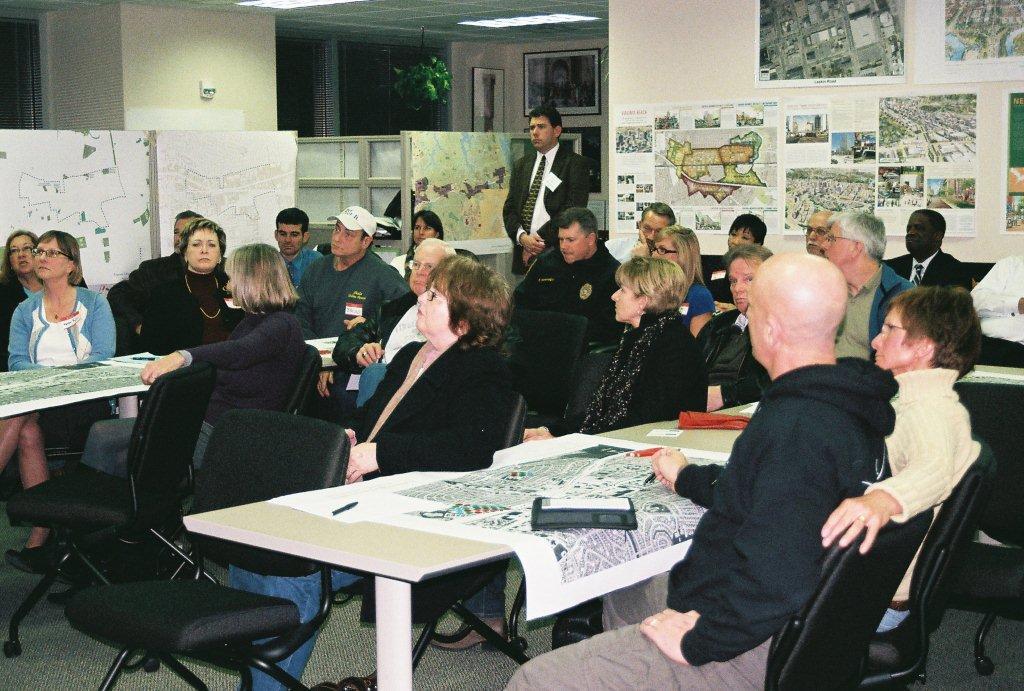
1 Rosemont SGA virginia beach, va Prepared for the City of Virginia Beach 14 March, 2011 urban design associates miles agency, rclco, urs, vhb & wpl urban design associates, miles agency, rclco, urs, vhb & wpl rosemont sga
2 A Three Phase Process 1. Understanding: Figuring out what is going on. 2. Exploring: Trying out some ideas. 3. Deciding: Choosing what to do. (All with broad based participation) urban design associates, miles agency, rclco, urs, vhb & wpl rosemont sga
3
4 Three Questions: 1. What are the strengths? 2. What are the weaknesses? 3. What are the opportunities? urban design associates, miles agency, rclco, urs, vhb & wpl rosemont sga
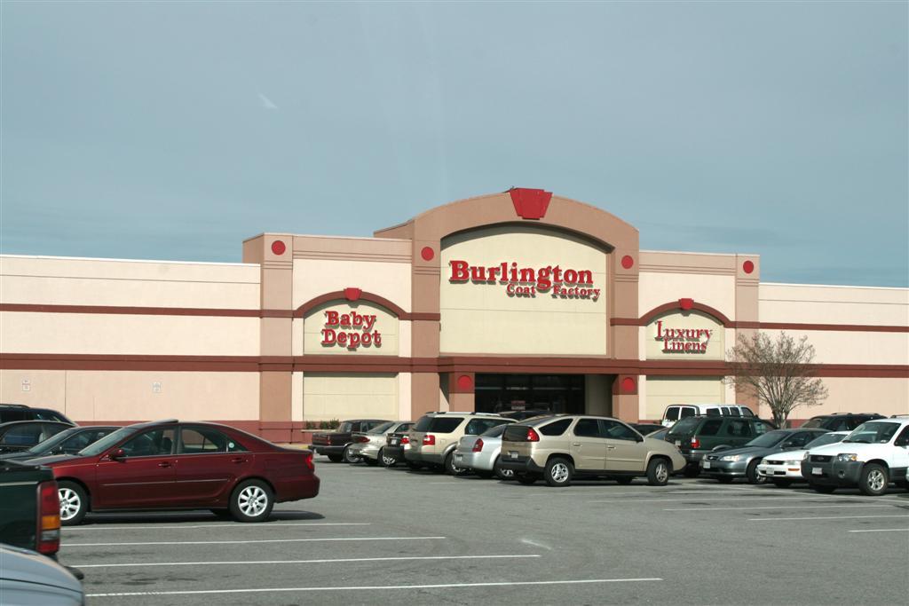
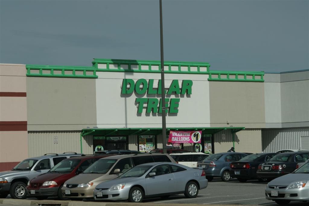
5 Strengths of Rosemont Nearby amenities such as Mt. Trashmore and Little Neck bike path Institutions such as the library Geographically central to the city Low vacancies and recent investment in Loehmann s Plaza, Princess Anne Plaza, and Collins Square Neighborhoods such as Windsor Oaks, Windsor Woods, Thalia, and Little Neck Diverse and affordable retailing options with several grocers urban design associates, miles agency, rclco, urs, vhb & wpl rosemont sga
6 Strengths of Rosemont (cont.) Highest bus service level in city along Virginia Beach Boulevard East-west routes of Virginia Beach Boulevard and Bonney Road Amount of under-utilized land available for redevelopment Low crime Good neighboring schools Potential for Light Rail urban design associates, miles agency, rclco, urs, vhb & wpl rosemont sga
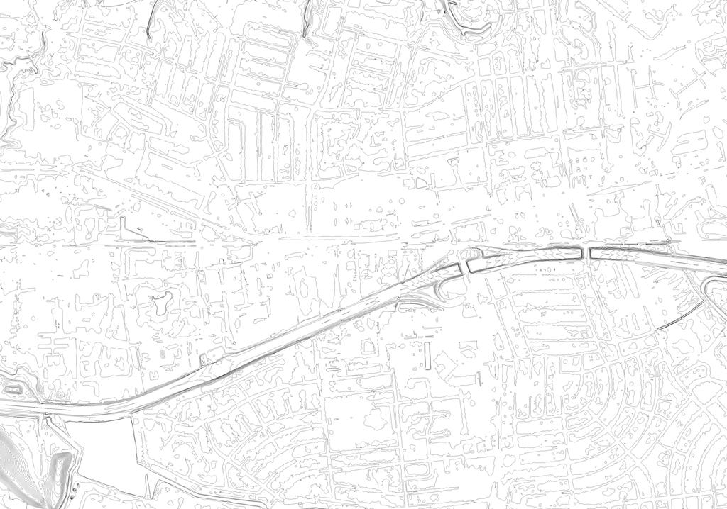
7 N. Lynnhaven Road Little Neck Road Lynn Shore Drive Thalia Road Road Bonney Road Road Windsor Woods Malibu Princess Anne Plaza Baptist Preschool Little Angels Montessori Lynnhaven South Plaza Trail South Rosemont Road Edinburgh Edinburgh Drive Drive Virginia Beach Beach Blvd Blvd Caren Drive Catalina Avenue 264- Virginia Virginia Beach Beach Expy Expy Mt. Trashmore Park Loehmanns Plaza Collins Square Great American Outlet Mall Birchwood Mall Sentara Nursing Center Presidential Blvd Palace Green Blvd South Plaza Plaza Trail Trail Edinburgh Edinburgh Drive Drive Thalia Sschool
8
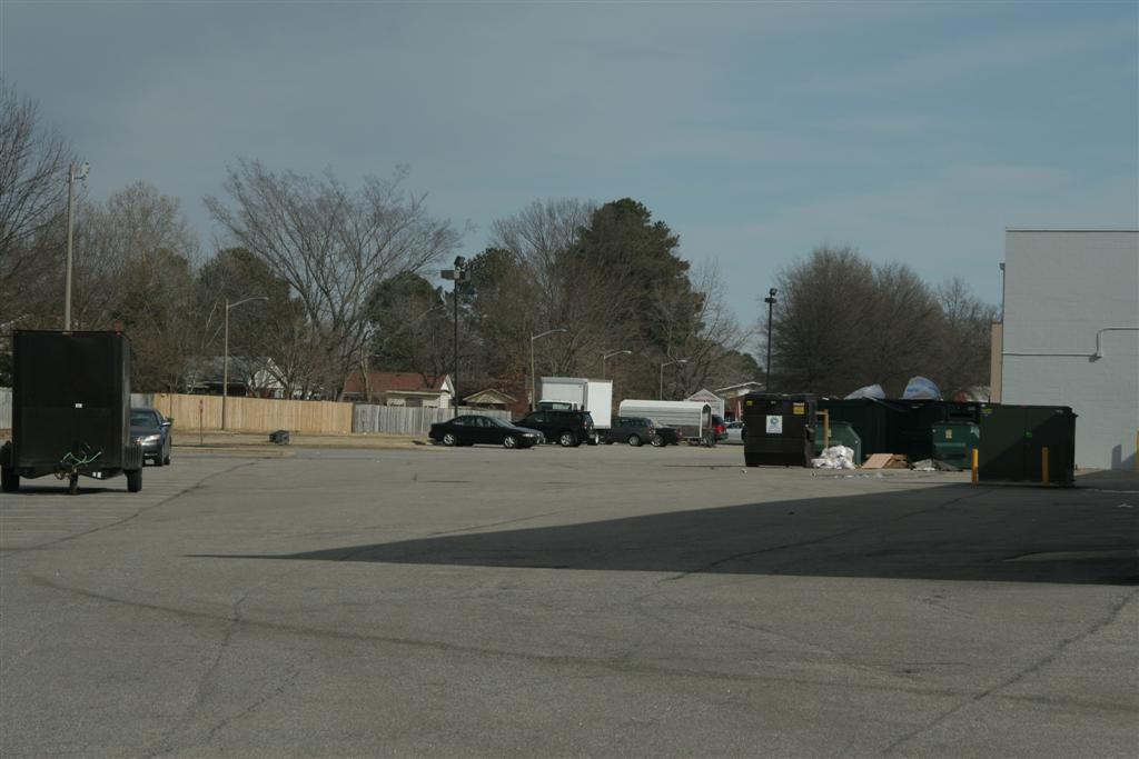
9 Weaknesses of Rosemont No there there: lack of identity or memorable places Virginia Beach Boulevard and I-264 are barriers Dangerous and confusing intersections such as Rosemont/ Bonney/I-264, Bonney Road and Kentucky, and the Little Neck/ Rosemont jog Lack of pedestrian accommodation and meaningful open spaces Car-oriented: parking lots and road travel lanes are prevailing land use urban design associates, miles agency, rclco, urs, vhb & wpl rosemont sga
10 Weaknesses of Rosemont (cont.) Deterioration of nearby housing stock and lower-end retail properties Completely disconnected neighborhoods south of I-264 Poor transition and connectivity to northern neighborhoods Lack of access to buses from the neighborhoods Location of currently planned LRT stop is inaccessible Lack of adequate provisions for stormwater runoff Condition of above and undergound utilities urban design associates, miles agency, rclco, urs, vhb & wpl rosemont sga
11 N. Lynnhaven Road Little Neck Road Lynn Shore Drive Thalia Road Road Bonney Road Road Windsor Woods Malibu Princess Anne Plaza Baptist Preschool Little Angels Montessori Lynnhaven South Plaza Trail South Rosemont Road Edinburgh Edinburgh Drive Drive Virginia Beach Beach Blvd Blvd Caren Drive Catalina Avenue 264- Virginia Virginia Beach Beach Expy Expy Mt. Trashmore Park Loehmanns Plaza Collins Square Great American Outlet Mall Birchwood Mall Sentara Nursing Center Presidential Blvd Palace Green Blvd South Plaza Plaza Trail Trail Edinburgh Edinburgh Drive Drive Thalia Sschool
12
13 Visions for Rosemont Connect under and over I-264 Tame Virginia Beach Boulevard Reduce footprint and increase intuitiveness of I-264 access Make a reason for stopping here Increase land productivity Establish a pedestrian and bicycle realm, connecting neighborhoods to retail, open spaces, transit, and each other Provide access to nearby open space amenities such as Mt. Trashmore urban design associates, miles agency, rclco, urs, vhb & wpl rosemont sga
14 Visions for Rosemont (cont.) Create functional open spaces that address recreational and stormwater management needs Multi-modal access from potential LRT station to neighborhoods, Mt. Trashmore, and retail Increase access to Virginia Beach Boulevard busses Mid-rise mixed-use, mixed-income, mixed-age development Shrink South Plaza trail to 3 lanes to preserve neighborhood scale and functionality urban design associates, miles agency, rclco, urs, vhb & wpl rosemont sga


15 N. Lynnhaven Road Little Neck Road Lynn Shore Drive Thalia Road Road Bonney Road Road Windsor Woods Malibu Princess Anne Plaza Baptist Preschool Little Angels Montessori Lynnhaven South Plaza Trail South Rosemont Road Edinburgh Edinburgh Drive Drive Virginia Beach Beach Blvd Blvd Caren Drive Catalina Avenue 264- Virginia Virginia Beach Beach Expy Expy Mt. Trashmore Park Loehmanns Plaza Collins Square Great American Outlet Mall Birchwood Mall Sentara Nursing Center Presidential Blvd Palace Green Blvd South Plaza Plaza Trail Trail Edinburgh Edinburgh Drive Drive Thalia Sschool
16 Emerging Themes Invert the Rosemont Land Use Paradigm Remove Barriers to Mobility What s in a Name? Why Stay? Be the Stormwater Model Expanded Boundary urban design associates, miles agency, rclco, urs, vhb & wpl rosemont sga
17 Invert the Rosemont Land Use Paradigm 71% of Rosemont land area is in either in a parking lot or street 16% of land area is in a building; 13% in other forms of use, including open space The great places that we love in the region and elsewhere typically have a land use that is 50-65% in a building or habitable space urban design associates, miles agency, rclco, urs, vhb & wpl rosemont sga
18 N. Lynnhaven Road Little Neck Road Thalia Road Road Virginia Beach Beach Blvd Blvd Bonney Road Road Windsor Woods Malibu Princess Anne Plaza Baptist Preschool Little Angels Montessori Lynnhaven South Plaza Trail Noise Zone: Db Noise Zone: Db South Rosemont Road Edinburgh Drive Drive 264- Virginia Beach Expy Expy Thalia Mt. Trashmore Park Loehmanns Plaza Collins Square Great American Outlet Mall Birchwood Mall Sentara Nursing Center Windsor Woods Library SINGLE FAMILY RESIDENTIAL MULTI FAMILY RESIDENTIAL COMMERCIAL OFFICE INDUSTRIAL INSTITUTIONAL PUBLIC PARKS AND OPEN SPACE SEMI-PUBLIC OPEN SPACE COMMERCIAL AND INDUSTRIAL LAND PARKING GARAGE PARKING LOT WATER STUDY AREA EXPANDED STUDY AREA NOISE ZONES POTENTIAL TRANSIT LINE POTENTIAL STATION LOCATIONS Noise Zone: Db Caren Drive Catalina Avenue Presidential Blvd Palace Green Blvd South Plaza Trail Trail Lynn Shore Drive Edinburgh Drive Drive Central Virginia Beach Library


19


20 urban design associates, miles agency, rclco, urs, vhb & wpl rosemont sga

21 N. Lynnhaven Road Little Neck Road Thalia Thalia Road Road Virginia Beach Blvd Blvd Bonney Road Road South Plaza Trail Edinburgh Drive Drive Catalina Avenue Presidential Blvd Windsor Woods Little Angels Montessori Lynnhaven South Rosemont Road South Plaza Trail Trail Caren Drive Palace Green Blvd 264- Virginia Beach Beach Expy Expy Lynn Shore Drive Edinburgh Drive Drive Thalia Sschool Mt. Trashmore Park Sentara Nursing Center LAND USE LAND COVER (SQ. FT.) LAND COVER (ACRES) % OF TOTAL LAND COVER STREETS 4,268, % BUILDING FOOTPRINTS 2,482, % PARKING 6,534, % OTHER OPEN SPACE 1,960, % TOTAL 15,246,000 SQ. FT. 350 ACRES 100%
22 Remove Barriers to Mobility Rosemont suffers from lack of internal connectivity I-264 blocks north/south movement of all types except where vehicles are allowed to pass at South Plaza and Rosemont. Non-motorized circulation is virtually prohibited from one side of I-264 to the other Virginia Beach Boulevard is wider than its average daily trips (ADT) suggest it needs Intersection design is confusing Bus transit is limited outside of the VBB corridor urban design associates, miles agency, rclco, urs, vhb & wpl rosemont sga
23 Remove Barriers to Mobility (cont.) What will be the preffered means to accessing future transit: park-and-ride or foot/bike? The site has incredible lack of internal intersections. (11 total full-service intersections; 16% of standard) Use a completed street network to address access management urban design associates, miles agency, rclco, urs, vhb & wpl rosemont sga

24 N. Lynnhaven Road Little Neck Road Edinburgh Drive Thalia Road Virginia Beach Blvd Blvd Bonney Road South Plaza Trail MAJOR ARTERIAL MINOR ARTERIAL STREETS WATER South Plaza Trail Trail STUDY AREA POTENTIAL TRANSIT LINE POTENTIAL STATION LOCATIONS Catalina Avenue Residential Blvd Caren Drive Palace Green Blvd 264- Virginia Beach Expy Salina Drive Lynn Shore Drive Edinburgh Drive Drive
25
26

27 Thalia Road Road N. Lynnhaven Road Little Neck Road Edinburgh Drive Drive Edinburgh Drive Drive Malibu Lynn Shore Drive Caren Drive Catalina Avenue Thalia Central Virginia Beach Library Loehmanns Plaza Virginia Beach Beach Blvd Blvd Collins Square Great American Outlet Mall Birchwood Mall Bonney Road Road South Plaza Trail Sentara Nursing Center Little Angels Montessori Lynnhaven 264- Virginia Beach Expy Expy South Rosemont Road Presidential Blvd Windsor Woods Princess Anne Plaza Baptist Preschool Palace Green Blvd STREET NETWORK South Plaza Trail Trail Mt. Trashmore Park INTERSTATE 264 STUDY AREA ADDITIONAL STUDY AREA POTENTIAL TRANSIT LINE POTENTIAL STATION LOCATIONS ,200 ft Rosemont Analysis: Existing Connections 14 march 2011 Rosemont SGA Virginia Beach, Virginia

28 Thalia Road Road N. Lynnhaven Road Little Neck Road Edinburgh Drive Drive Edinburgh Drive Drive Malibu Lynn Shore Drive Caren Drive Catalina Avenue Thalia Central Virginia Beach Library Loehmanns Plaza Virginia Beach Beach Blvd Blvd Collins Square Great American Outlet Mall Birchwood Mall Bonney Road Road South Plaza Trail Sentara Nursing Center Little Angels Montessori Lynnhaven 264- Virginia Beach Expy Expy South Rosemont Road Presidential Blvd Windsor Woods Princess Anne Plaza Baptist Preschool POTENTIAL PEDESTRIAN CONNECTIONS POTENTIAL NEIGHBORHOOD CONNECTOR ROADS Palace Green Blvd NEIGHBORHOOD CONNECTOR ROADS MAJOR ARTERIALS South Plaza Trail Trail Mt. Trashmore Park INTERSTATE 264 STUDY AREA ADDITIONAL STUDY AREA POTENTIAL TRANSIT LINE POTENTIAL STATION LOCATIONS ,200 ft Rosemont Analysis: Proposed Connections 14 march 2011 Rosemont SGA Virginia Beach, Virginia

29 Thalia Road Road N. Lynnhaven Road Little Neck Road Edinburgh Drive Drive Edinburgh Drive Drive Malibu Lynn Shore Drive Caren Drive Catalina Avenue Thalia Central Virginia Beach Library Loehmanns Plaza Virginia Beach Beach Blvd Blvd Collins Square Great American Outlet Mall Birchwood Mall Bonney Road Road South Plaza Trail Sentara Nursing Center Little Angels Montessori Lynnhaven 264- Virginia Beach Expy Expy South Rosemont Road Presidential Blvd Windsor Woods Princess Anne Plaza Baptist Preschool HRT EXPRESS ROUTE 960 Palace Green Blvd HRT ROUTE 20 NO ACCESS LOW LEVEL OF ACCESS South Plaza Trail Trail Mt. Trashmore Park STUDY AREA ADDITIONAL STUDY AREA POTENTIAL TRANSIT LINE POTENTIAL STATION LOCATIONS ,200 ft Rosemont Analysis: Existing Transit Access 14 march 2011 Rosemont SGA Virginia Beach, Virginia
30 Thalia Road Road N. Lynnhaven Road Little Neck Road Edinburgh Drive Drive Edinburgh Drive Drive Malibu Lynn Shore Drive Caren Drive Catalina Avenue Thalia Central Virginia Beach Library Loehmanns Plaza Virginia Beach Beach Blvd Blvd Collins Square Great American Outlet Mall Birchwood Mall Bonney Road Road South Plaza Trail Sentara Nursing Center Little Angels Montessori Lynnhaven 264- Virginia Beach Expy Expy South Rosemont Road Presidential Blvd Windsor Woods Princess Anne Plaza Baptist Preschool HRT EXPRESS ROUTE 960 HRT ROUTE 20 NO ACCESS TO TRANSIT LOW LEVEL OF ACCESS MEDIUM-LOW LEVEL OF ACCESS Palace Green Blvd MEDIUM LEVEL OF ACCESS MEDIUM-HIGH LEVEL OF ACCESS HIGH LEVEL OF ACCESS South Plaza Trail Trail Mt. Trashmore Park STUDY AREA ADDITIONAL STUDY AREA POTENTIAL TRANSIT LINE POTENTIAL STATION LOCATIONS ,200 ft Rosemont Analysis: Transit Access with New Station 14 march 2011 Rosemont SGA Virginia Beach, Virginia

31 Thalia Road Road N. Lynnhaven Road Little Neck Road Edinburgh Drive Drive Edinburgh Drive Drive Malibu Lynn Shore Drive Caren Drive Catalina Avenue Thalia Central Virginia Beach Library Loehmanns Plaza Virginia Beach Beach Blvd Blvd Collins Square Great American Outlet Mall Birchwood Mall Bonney Road Road South Plaza Trail Sentara Nursing Center Little Angels Montessori Lynnhaven 264- Virginia Beach Expy Expy South Rosemont Road Presidential Blvd Mt. Trashmore Park Windsor Woods Princess Anne Plaza Baptist Preschool Palace Green Blvd 1 PERSON OF LIMITED MOBILITY WITHOUT ACCESS TO A CAR EXISTING AREAS WITH ACCESS TO TRANSIT ACCESS GAINED BY NEW STATION South Plaza Trail Trail STUDY AREA ADDITIONAL STUDY AREA POTENTIAL TRANSIT LINE POTENTIAL STATION LOCATIONS ,200 ft Rosemont Analysis: Households with Limited Mobility 14 march 2011 Rosemont SGA Virginia Beach, Virginia

32 Thalia Road Road N. Lynnhaven Road Little Neck Road Edinburgh Drive Drive Edinburgh Drive Drive Lynn Shore Drive Caren Drive Catalina Avenue Virginia Beach Beach Blvd Blvd Bonney Road Road South Plaza Trail 264- Virginia Beach Expy Expy South Rosemont Road Presidential Blvd Palace Green Blvd ON-SITE INTERSECTIONS OFF-SITE INTERSECTIONS South Plaza Trail Trail STUDY AREA ADDITIONAL STUDY AREA POTENTIAL TRANSIT LINE POTENTIAL STATION LOCATIONS ,200 ft Rosemont Analysis: Intersection Density 14 march 2011 Rosemont SGA Virginia Beach, Virginia
33 What s in a Name? Few people refer to Rosemont as Rosemont (prefer Thalia, Birchwood, Princess Anne Plaza) Rosemont s size and diversity create multiple associations Lack of memorable qualities limits the consensus on what Rosemont is, where it is, and what is should be called Most people refer to the study area in connection to abutting neighborhoods Therefore, it is safe to assume that the scale of redevelopment will be neighborhood center scale, not town center scale urban design associates, miles agency, rclco, urs, vhb & wpl rosemont sga
34
35 Why stay? Rosemont experiences low visitor capture Approximate visit time: twenty to 30 minutes (net travel time) Lack of spaces and environments to incentivize lingering longer What is the alternative to park-and-eat? urban design associates, miles agency, rclco, urs, vhb & wpl rosemont sga
36
37
38
39 Be the stormwater model Rosemont s infrastructure is inadequate to mitigate even minor storm events Rainwater infiltrates into sewers and overloads sewage capacity, leading to overflows State of Virginia and the EPA are elevating their stormwater standards Can Virginia Beach be the stormwater management model for low-lying, flat, coastal communities? What are the community-based solutions? urban design associates, miles agency, rclco, urs, vhb & wpl rosemont sga

40 » Potential for additional connections across the I-264 corridor, especially to provide access to Mount Trashmore from the north» Need additional cycle and multi-use paths» Strong connections to HRT station will be essential, especially at the Rosemont u r ba n de s i g n as s o c i at e s R O S EM O N T PA R K S A N D T R A I L S underpass R O S EM O N T S TO R M WAT ER» Clay soils are prevalent» No direct access to natural outfalls (land-locked), limited ability for outfall» Stormwater strategy will focus more on storage and conveyance methods of the stormwater treatment train» Minimal buffer preservation» Need to coordinate and amend stormwater codes SGA BOUNDARY P O T E N T I A L B O U N D A R Y E X PA N S I O N W AT E R W AY S T R A IL A N D CYCLE CON NEC T IONS E S S E N T I A L P E D E S T R I A N A N D C Y C L E C O N N E C T I O N S AT U N D E R PA S S E S urban design associates improvement REGIONAL BMP S CYCLE T R A IL A LONG T R A NSI T E X T ENSION CORRIDOR parks, tr a il s, a nd stor m water : rosemont sga sg a wor k shop v irgini a be ach, v irgini a workshop summary february 2011 A 17
41 Expanded Boundary Many candidate sites for early development just outside existing boundary Need for improved connections and transitions to surrounding neighborhoods requires broader area of study urban design associates, miles agency, rclco, urs, vhb & wpl rosemont sga
42 N. Lynnhaven Road Little Neck Road Thalia Road Road Virginia Beach Beach Blvd Blvd Bonney Road Road Windsor Woods Malibu Princess Anne Plaza Baptist Preschool Little Angels Montessori Lynnhaven South Plaza Trail Noise Zone: Db Noise Zone: Db South Rosemont Road Edinburgh Drive Drive 264- Virginia Beach Expy Expy Thalia Mt. Trashmore Park Loehmanns Plaza Collins Square Great American Outlet Mall Birchwood Mall Sentara Nursing Center Windsor Woods Library SINGLE FAMILY RESIDENTIAL MULTI FAMILY RESIDENTIAL COMMERCIAL OFFICE INDUSTRIAL INSTITUTIONAL PUBLIC PARKS AND OPEN SPACE SEMI-PUBLIC OPEN SPACE COMMERCIAL AND INDUSTRIAL LAND PARKING GARAGE PARKING LOT WATER STUDY AREA EXPANDED STUDY AREA NOISE ZONES POTENTIAL TRANSIT LINE POTENTIAL STATION LOCATIONS Noise Zone: Db Caren Drive Catalina Avenue Presidential Blvd Palace Green Blvd South Plaza Trail Trail Lynn Shore Drive Edinburgh Drive Drive Central Virginia Beach Library
43 Emerging Themes Invert the Rosemont Land Use Paradigm Remove Barriers to Mobility What s in a Name? Why Stay? Be the Stormwater Model Expand the Boundary urban design associates, miles agency, rclco, urs, vhb & wpl rosemont sga
44 Agenda for the Week Monday: Review of analysis, drafting of design principles, studio setup Tuesday: Development of alternatives, focus group meetings Wednesday: Open house Thursday: Finalize recommendations; public meeting Friday: debrief urban design associates, miles agency, rclco, urs, vhb & wpl rosemont sga
45 Division of Labor UDA: Urban framework, testing of program, development typologies and development blocks, illustrations RCLCo: Market study and development program VHB: Utilities and stormwater management strategies/plan WPL: Streetscape design, Illustrative street sections, public open space design, pedestrian networks URS: Interchange alternatives, Virginia Beach Boulevard alternatives, Bonney Road, South Plaza Trail Miles: Organizing focus groups and public meeting urban design associates, miles agency, rclco, urs, vhb & wpl rosemont sga
Rosemont SGA virginia beach, va
 Rosemont SGA virginia beach, va phase 3 PUBLIC Presentation Prepared for the City of Virginia Beach 14 June, 2011 urban design associates miles agency, rclco, urs, vhb & wpl Slide Title A Three Phase Process
Centerville SGA. virginia beach, va. Prepared for the City of Virginia Beach February,
 Centerville SGA virginia beach, va Phase 3 presentation Prepared for the City of 12-13 February, 2013 www.vbgov.com/centervilleplan urban design associates miles agency, rclco, urs, vhb & wpl A Three Phase
Preliminary Recommendations Tk Takoma/Langley Crossroads Sector Plan
 Preliminary Recommendations Tk Takoma/Langley Crossroads Sector Plan Vision is to achieve a Transit Oriented, pedestrian friendly Community that Celebrates and builds upon the cultural Diversity of the
Tyvola & Archdale Transit Station Area Plan. June 5, 2008
 Tyvola & Archdale Transit Station Area Plan Second Public Meeting June 5, 2008 Presentation Outline 1. Purpose and Process 2. Station Area Overview 3. Plan Recommendations 4. Comments Received and Proposed
QUESTIONS AND ANSWERS Windsor Woods, Princess Anne Plaza & The Lakes Combined Drainage Project
 QUESTIONS AND ANSWERS Windsor Woods, Princess Anne Plaza & The Lakes Combined Drainage Project Project Overview... 2 Thalia Creek (Windsor Woods) Tide Gate... 6 Club House Road Drainage Project... 9 Updated
Description of Preferred Alternative
 Chapter 2 Description of Preferred Alternative 2.1 Introduction This chapter of the programmatic Sammamish Town Center Sub-area Plan Final EIS provides a more detailed description of the Preferred Alternative
Transportation. Strategies for Action
 Transportation A major priority for the Overlake Neighborhood is to develop a multimodal transportation system. To achieve this system, a balance has to be found among travel, circulation and access needs;
Urban Development Areas James City County
 24 Urban Development Areas James City County UDA Needs Profile: Anderson s Corner James City County has designated 11 UDAs within its boundaries, and the Anderson s Corner Mixed Use Area is located along
Tyvola & Archdale Transit Station Area Plan. May 15, 2008
 Tyvola & Archdale Transit Station Area Plan First Public Meeting May 15, 2008 Presentation Outline 1. Purpose and Process 2. Station Area Overview 3. Plan Recommendations Vision Land Use Transportation
Westbound: A One-day Exploration of Growth
 Westbound: A One-day Exploration of Growth Frog Pond Area 2018 UGB Expansion Proposal June 13, 2018 Growing Out: UGB Asks Four cities submitted proposals to expand greater Portland s urban footprint by
Northwest Rail Corridor and US 36 BRT Development Oriented Transit Analysis 4.4 STATION AREA FINDINGS
 4.4 STATION AREA FINDINGS Each station is different, and each one requires a separate set of recommendations based on the vision for the site. This section outlines an initial TOD strategy and recommendations
QUESTIONS AND ANSWERS Windsor Woods, Princess Anne Plaza & The Lakes Combined Drainage Project
 QUESTIONS AND ANSWERS Windsor Woods, Princess Anne Plaza & The Lakes Combined Drainage Project PROJECT OVERVIEW Windsor Woods, Princess Anne Plaza and The Lakes are neighborhoods located in what was once
PLAN ELEMENTS WORKSHOP. April 5, 2016
 PLAN ELEMENTS WORKSHOP April 5, 2016 needs more housing. But there is no one-size fits-all solution. Every neighborhood has its own character. In some places, density is not only appropriate it is badly
Shared Principles and Emerging Plan Directions
 Shared Principles and Emerging Plan Directions Introduction Since the Fairfield Neighbourhood planning process launched in June 2016, we have heard from many residents, businesses, groups and other people
TRANSIT-ORIENTED DEVELOPMENT POLICY DRAFT. City Planning and Development Department Kansas City, Missouri
 TRANSIT-ORIENTED DEVELOPMENT POLICY DRAFT City Planning and Development Department Kansas City, Missouri What is Transit Oriented Development (TOD)? Development that focuses land uses around a transit
MONTGOMERY COUNTY METRO STATION AREA DESIGN CHARRETTE
 MONTGOMERY COUNTY METRO STATION AREA DESIGN CHARRETTE Shady Grove Metro Station Area Charrette Closing Presentation October 25-28, 2000 MONTGOMERY COUNTY, MD M-NCPPC Design Collective, Inc. Architects
2 January 14, 2015 Public Hearing
 2 January 14, 2015 Public Hearing APPLICANT & PROPERTY OWNER: PEMBROKE SQUARE ASSOCIATES, LLC STAFF PLANNER: Kevin Kemp REQUEST: Conditional Use Permit (Indoor Commercial Recreation Facility) ADDRESS /
Strategic Growth Area #1 Northampton Boulevard Corridor Area
 Strategic Growth Area #1 Northampton Boulevard Corridor Area Description Strategic Growth Area #1 has established itself as a major employment center in Southside Hampton Roads. Opportunities exist to
2015 Campus Master Plan Update
 September 15, 2015 2015 Campus Master Plan Update Campus and Community Analysis Summary Presentation A G E N D A 1. Scope & Schedule of the Master Plan 2. Planning Principles & Draft Goals 3. Background
Atlanta BeltLine. Subareas 9 & 10. Master Plan Updates. March 26, Washington Park Jamboree 1
 Atlanta BeltLine Subareas 9 & 10 Master Plan Updates March 26, 2018 Washington Park Jamboree 1 22 miles, connecting 45 neighborhoods 22 MILES of transit 46 MILES of streetscapes and complete streets 33
BROOKLYN PARK / 85TH AVE LRT STATION CDI DEVELOPMENT GUIDELINES DRAFT
 August 2018 Page intentionally left blank The Brooklyn Park Library adjacent to the 85th Ave LRT Station Area. OVERVIEW The Blue Line LRT Extension / Bottineau corridor offers a unique opportunity to leverage
Property Profile 2954 WEST FRANKLIN ROAD MERIDIAN, ID
 082614 FOR SALE > MIXED-USE LAND Franklin & Ten Mile Land 2954 WEST FRANKLIN ROAD MERIDIAN, ID Property Profile > ~38 acres for sale, located on the NE corner of Franklin and Ten Mile > Power and gas running
EXISTING COMPREHENSIVE PLAN
 EXISTING COMPREHENSIVE PLAN Town Center Land Use Element: V. LAND USE POLICIES Town Center Mercer Island's business district vision as described in "Your Mercer Island Citizen-Designed Downtown" was an
PINE CURVE REZONING. Property does not meet criteria for open space preservation and is not a candidate for a park
 PINE CURVE REZONING BACKGROUND Purchased as two parcels in 2001 and 2002 Annexed and Zoned Greater Downtown District Historic Center September 25, 2002 and October 7, 2002 WHAT THE PROJECT IS AND IS NOT
BeltLine Corridor Environmental Study
 BeltLine Corridor Environmental Study Citywide Conversation on Transit and Trails April 2, 2009 Agenda & Introductions Introductions Environmental Study Process Overview of the BeltLine Project BeltLine
DOMINION BOULEVARD CORRIDOR STUDY AND ECONOMIC DEVELOPMENT STRATEGIC PLAN A MODEL FOR CHESAPEAKE S FUTURE
 DOMINION BOULEVARD CORRIDOR STUDY AND ECONOMIC DEVELOPMENT STRATEGIC PLAN A MODEL FOR CHESAPEAKE S FUTURE Overview I. Draft Plan Process II. Draft Plan Overview a. Market Analysis b. Master Land Use Plan
Danvers High Street I-1 District Study
 Danvers High Street I-1 District Study Presentation of Final Recommendations Planning Board Presentation June 26 th, 2018 1 Introductions Metropolitan Area Planning Council Sam Cleaves AICP, Principal
Welcome & Introductions
 Charrette Week Report Back - Thursday Evening April 25, 2013 Welcome & Introductions A New Master Plan Land Use and Circulation Putting data and information to work to create solutions for the master plan
Chapter 1: Introduction
 Chapter 1: Introduction The Penn Avenue Community Works Corridor Vision and Implementation Framework presents an integrated communitybased vision and a coordinated, long-term implementation framework for
BROOKHILL NEIGHBORHOOD MODEL ZONING MAP AMENDMENT PREFACE TO APPLICATION
 BROOKHILL NEIGHBORHOOD MODEL ZONING MAP AMENDMENT PREFACE TO APPLICATION June 15, 2015 Revised: August 1, 2016 I. VISION Brookhill is a proposed community based upon the principles of Albemarle County
Executive Summary. NY 7 / NY 2 Corridor
 Executive Summary NY 7 / NY 2 Corridor Transportation and Land Use Study December 2005 Prepared for: Town of Colonie Capital District Transportation Committee Prepared by: Introduction: Land use decisions
The University District envisions, in its neighborhood
 Envisioning the University District Link Light Rail in Seattle s neighborhoods CIY OF SEALE CONCEP-LEVEL SAION AREA PLANNING RECOMMENDAION RESOLUION # 30165 EXHIBI L Vision 08.2000 he University District
Plano Tomorrow Vision and Policies
 Plano Tomorrow Vision and Policies PLANO TOMORROW PILLARS The Built Environment The Social Environment The Natural Environment The Economic Environment Land Use and Urban Design Transportation Housing
Agenda. 7 Wright Crescent Urban Design Study. Public Meeting and Urban Design Workshop. 1 INTRODUCTION AND BACKGROUND (City of Kingston)
") Urban Design Study Public Meeting and Urban Design Workshop October 02, 2013 Agenda 1 INTRODUCTION AND BACKGROUND (City of Kingston) 2 URBAN DESIGN STUDY PRESENTATION (Antonio Gomez-Palacio, DIALOG) 3
Urban Design Study Public Meeting and Urban Design Workshop October 02, 2013 Agenda 1 INTRODUCTION AND BACKGROUND (City of Kingston) 2 URBAN DESIGN STUDY PRESENTATION (Antonio Gomez-Palacio, DIALOG) 3
Gold Line Bus Rapid Transit Transit Oriented Development (BRTOD) Helmo Station Area Plan
 Helmo Station Area Plan") Appendix F Gold Line Bus Rapid Transit Transit Oriented Development (BRTOD) Helmo Station Area Plan Introduction and Purpose of the Plan The Gold Line Bus Rapid Transit facility is an eleven-mile dedicated
Appendix F Gold Line Bus Rapid Transit Transit Oriented Development (BRTOD) Helmo Station Area Plan Introduction and Purpose of the Plan The Gold Line Bus Rapid Transit facility is an eleven-mile dedicated
Status Report: MD 355 Project
 Status Report: MD 355 Project OCTOBER 2006 M-NCPPC MONTGOMERY COUNTY PLANNING DEPARTMENT Summary of Community Comments, and break to the Results of the MD 355 Participation Session Brookside Gardens -
TREASURE COAST REGIONAL PLANNING COUNCIL M E M O R A N D U M. To: Council Members AGENDA ITEM 5H
 TREASURE COAST REGIONAL PLANNING COUNCIL M E M O R A N D U M To: Council Members AGENDA ITEM 5H From: Date: Subject: Staff October 17, 2008 Council Meeting Local Government Comprehensive Plan Review Draft
Subarea 4 Indian Creek. Vision The combination of park networks and transportation amenities make Subarea 4 the greenest hub in the Corridor.
 indian creek 180 extends south from 101st Street to I-435. The I-435 and Metcalf intersection is one of the primary intersections in the Kansas City Metro Area. The area includes several residential neighborhoods
Welcome to the LYNX Blue Line Extension Transit Station Area Plans Public Workshop No. 3. Presentation will begin at 6:00 P.M.
 Welcome to the LYNX Blue Line Extension Transit Station Area Plans Public Workshop No. 3 Presentation will begin at 6:00 P.M. Meeting Agenda Blue Line Extension (BLE) Project Update LYNX Blue Line Extension
The Lincoln Neighborhood Corridor Plan. The LiNC
 October 1, 2014 Planning Commission Study Session The Lincoln Neighborhood Corridor Plan The LiNC Purpose of Tonight s Meeting Introduction to The LiNC Review of Existing Conditions and Community Identified
RESEDA - WEST VAN NUYS COMMUNITY PLAN
 RESEDA - WEST VAN NUYS COMMUNITY PLAN Executive Summary As part of the initial outreach effort, the Department of City Planning hosted two workshops for the Reseda-West Van Nuys Community Plan Area during
New Partners for Smart Growth Conference February 5, 2010
 Dan Stroh, Planning Director City of Bellevue Planning and Community Development Bellevue, WA New Partners for Smart Growth Conference February 5, 2010 Summary of Project Long-range plan update for Bel-Red
Subregion 4 Central Avenue-Metro Blue Line Corridor Transit-Oriented Development (TOD) Implementation Project. Community Meeting April 27, 2011
 Implementation Project. Community Meeting April 27, 2011") Subregion 4 Central Avenue-Metro Blue Line Corridor Transit-Oriented Development (TOD) Implementation Project Community Meeting April 27, 2011 Overview Introduction to Subregion 4 TOD Implementation Program
Subregion 4 Central Avenue-Metro Blue Line Corridor Transit-Oriented Development (TOD) Implementation Project Community Meeting April 27, 2011 Overview Introduction to Subregion 4 TOD Implementation Program
Robbinsdale LRT Station. CDI Development Guidelines. August Overview
 Robbinsdale LRT Station August 2018 Overview The City of Robbinsdale may have the coolest opportunity site along the 13 mile stretch of the Bottineau LRT corridor / Blue Line extension. Located a block
CHAPTER 5: GUIDING PRINCIPLES
 CHAPTER 5: GUIDING PRINCIPLES The following 10 principles were developed based on public consultation, planning policy and the background analysis conducted during Phase 1. The Guiding Principles significantly
Staff Report and Recommendation
 Community Planning and Development Planning Services 201 W. Colfax Ave., Dept. 205 Denver, CO 80202 p: 720.865.2915 f: 720.865.3052 www.denvergov.org/cpd TO: City Council Neighborhoods and Planning Committee
INDEPENDENCE BOULEVARD AREA PLAN
 INDEPENDENCE BOULEVARD AREA PLAN Public Meeting October 28, 2008 Tonight s Agenda Introduction 4:00 4:05 Tom Warshauer Presentation 4:05 5:00 Blake Drury Group Exercises 5:00 5:50 All Wrap Up & Next Steps
Corridor Vision. 1Pursue Minnehaha-Hiawatha Community Works Project. Mission of Hennepin County Community Works Program
 1Pursue Minnehaha-Hiawatha Community Works Project Minnehaha-Hiawatha Community Works is a project within the Hennepin Community Works (HCW) program. The mission of the HCW program is to enhance how the
LEED-ND 101: Practical Strategies for Achieving Sustainability Goals. Travis Parker Lakewood Planning Director
 LEED-ND 101: Practical Strategies for Achieving Sustainability Goals Travis Parker Lakewood Planning Director Metro Vision Idea Exchange Oct 11, 2012 West Corridor Stations West Corridor Overview West
CHAPTER 7: VISION AND ACTION STATEMENTS. Noble 2025 Vision Statement
 CHAPTER 7: VISION AND ACTION STATEMENTS This chapter presents the vision, policy and action statements that transform the comprehensive planning study, an analysis of Noble s past, future trends and community
SPRINGHILL LAKE TRANSIT VILLAGE
 Greenbelt Metro Area Sector Plan - Subarea Design Policies and Guidelines - Springhill Lake Transit Village 113 SPRINGHILL LAKE TRANSIT VILLAGE Residential Neighborhood and Village Center CONCEPT Springhill
1.0 VISION STATEMENT. December 6, PRINCIPLES
 Vision Statement Lincoln Regional Airport 1.0 VISION STATEMENT 1.1 City LOCATION of AND OVERVIEW The Easton Lincoln Place Land Use Master Plan identifies the principles, goals, policies, and standards
ROBBINSDALE LRT STATION CDI DEVELOPMENT GUIDELINES
 August 2018 OVERVIEW The City of Robbinsdale has a prime-opportunity site in the middle of the 13 mile stretch of the Bottineau LRT corridor / Blue Line extension. Robbinsdale offers a prominent, vital,
University Parkway Corridor Plan. Public Workshop Sept. 18, 2017
 University Parkway Corridor Plan Public Workshop Sept. 18, 2017 AGENDA 1. Overview of Process 2. Study Area 3. Components of the Plan 4. What We Know 5. What We Have Heard 6. Tonight s Input 7. Next Steps
Information Session July 25, 2018
 Concord Pike (US 202) Master Plan Information Session July 25, 2018 1 Concord Pike (US 202) Master Plan 2018 Project Partners Wilmington Area Planning Council Delaware Department of Transportation New
City of Tacoma Planning and Development Services
 Agenda Item E-1 City of Tacoma Planning and Development Services To: Planning Commission From: Elliott Barnett, Planning Services Division Subject: Tacoma Mall Regional Center Subarea Plan and EIS Meeting
Design Fort Ord. welcome why we are here what happened this week design guidelines: ideas so far 2/12/2015. Regional Urban Design Guidelines (RUDG)
") Design Fort Ord Regional Urban Design Guidelines (RUDG) Welcome Back! Strategic Economics Alta Planning + Design National Charrette Institute Helix Environmental Planning Jeff Speck & Peter Katz Civitas
Design Fort Ord Regional Urban Design Guidelines (RUDG) Welcome Back! Strategic Economics Alta Planning + Design National Charrette Institute Helix Environmental Planning Jeff Speck & Peter Katz Civitas
C. Westerly Creek Village & The Montview Corridor
 C. Westerly Creek Village & The VISION Community Vision When the goals of the city are achieved Westerly Creek Village, a distinctive community defined by Montview Boulevard and Westerly Creek, is a strong
14 October 10, 2012 Public Hearing APPLICANT: MPB, INC
 14 October 10, 2012 Public Hearing APPLICANT: MPB, INC PROPERTY OWNER: MUNDEN & ASSOCIATES, LP STAFF PLANNER: Karen Prochilo REQUEST: Conditional Change of Zoning (AG-1 & AG-2 to Conditional O-2) ADDRESS
Existing Conditions Assessment. August 18, 2016
 Existing Conditions Assessment August 18, 2016 1 Overview Existing Conditions Assessments 1 2 3 4 Site Conditions Land Use + Zoning Market Transportation + Parking Opportunities and Constraints 2 Site
Little Neck Planning Area
 Little Neck Planning Area Current Reality The Little Neck Planning Area is characterized by established residential neighborhoods, Town Center and Pembroke. The Eastern and Western Branches of the Lynnhaven
Silverdale Regional Center
 Silverdale Regional Center Vision for Silverdale Regional Center The Silverdale Regional Center Plan (Plan) will guide the evolution of the Silverdale Regional Center from a collection of strip malls and
WELCOME and introduction
 1 WELCOME and introduction Mobility Hub Locations within Burlington STUDY OVERVIEW STUDY OBJECTIVES The City of Burlington is developing four Area Specific Plans, one for each of Burlington s Mobility
URBAN DESIGN BRIEF URBAN DESIGN BRIEF 721 FRANKLIN BLVD, CAMBRIDGE August 2018
 URBAN DESIGN BRIEF URBAN DESIGN BRIEF 721 FRANKLIN BLVD, CAMBRIDGE August 2018 DESIGN BRIEF CONTENTS PART A 1.0 INTRODUCTION 2.0 DESCRIPTION & ANALYSIS OF SITE CONTEXT 3.0 DESIGN CONSTRAINTS AND OPPORTUNITIES
Review of Opportunity Area C Draft Comprehensive Plan and Draft BOS Follow-On Motions. Special Working Group Meeting March 4, 2015
 Review of Opportunity Area C Draft Comprehensive Plan and Draft BOS Follow-On Motions Special Working Group Meeting March 4, 2015 The slides that follow identify where the draft Comprehensive Plan has
U R B A N D E S I G N & D E V E L O P M E N T P L A N
 U R B A N D E S I G N & D E V E L O P M E N T P L A N F O R T H E S K I N K E R D e B A L I V I E R E C O M M U N I T Y P U B L I C W O R K S H O P # 3 S T. L O U I S, M I S S O U R I H 3 S T U D I O M
PLANNING COMMISSION WORKSESSION AGENDA. City Hall Second Floor Conference Room 9027 Center Street. July 1, :30 PM
 MEMBERS Harry J. Clark, Chairperson Bruce Wood, Vice-Chairperson Russell Harrison Ken Johnson Robert W. Schilpp Martha Wilson PLANNING COMMISSION WORKSESSION AGENDA City Hall Second Floor Conference Room
Concord Community Reuse Project Goals and Guiding Principles. Overarching Goals (OG)
") Concord Community Reuse Project Goals and Guiding Principles Overarching Goals (OG) No priority is implied by the order of presentation of the goals and guiding principles. Overarching goals for the Concord
Concord Community Reuse Project Goals and Guiding Principles Overarching Goals (OG) No priority is implied by the order of presentation of the goals and guiding principles. Overarching goals for the Concord
Policies and Code Intent Sections Related to Town Center
 Policies and Code Intent Sections Related to Town Center The Town Center Vision is scattered throughout the Comprehensive Plan, development code and the 1994 Town Center Plan. What follows are sections
PLAN ON A PAGE SUMMARY
 Questions? Please Call - 423-989-5518. PLAN ON A PAGE SUMMARY The Plan on a Page is a tool for the City of Bristol to engage Bristol s neighborhoods, community organizations, and interest groups to organize
Secrest Short Cut and Monroe Expressway Small Area Plan AUGUST 29, 2018
 Secrest Short Cut and Monroe Expressway Small Area Plan AUGUST 29, 2018 Background and Process Monroe Expressway will be open by the end of 2018 Union County and Indian Trail identified a need to revisit
A Plan for the Heart of the Region: Tukwila, WA
 : Tukwila, WA 1 The Plan orchestrates the Restructuring of a 1,000-acre Regional Shopping Area into a Social and Symbolic for the Region. REGIONAL CONTEXT Downtown Seattle (Metropolitan ) 20 miles Bellevue
Blueprint Denver A BLUEPRINT FOR AN INCLUSIVE CITY. Executive Summary
 Blueprint Denver A BLUEPRINT FOR AN INCLUSIVE CITY Executive Summary PUBLIC REVIEW DRAFT 2 1/7/2019 DENVERIGHT BLUEPRINTDENVER Blueprint Denver: A Blueprint for an Inclusive City An Equitable City Planning
Development Agreement Public Meeting. June 26, 2013
 Development Agreement Public Meeting June 26, 2013 Process 2007 2008 2009 2010 2011 2012 2013 Neighborhood Conservation District Petition Process Original Master Plan presented Community Forum Glen Lennox
Introduction. Chapter 1. Purpose of the Comprehensive Plan Plan Organization Planning Process & Community Input 1-1
 Chapter 1 Introduction Lakewood 2025: Moving Forward Together Purpose of the Comprehensive Plan Plan Organization Planning Process & Community Input 1-1 Purpose of the Comprehensive Plan The Comprehensive
A BLUEPRINT FOR BROCKTON A CITY-WIDE COMPREHENSIVE PLAN
 A BLUEPRINT FOR BROCKTON A CITY-WIDE COMPREHENSIVE PLAN Public Meeting October 2016 1 Plan Summary and Discussion Public Meeting May 4 2017 City of Brockton Bill Carpenter, Mayor Department of Planning
Clair-Maltby Community visioning
 Clair-Maltby Community visioning workshop #1 Summary April 27th, 2017 Table of Contents INTRODUCTIon 1 PURPOSE 1 CONSULTATION STRUCTURE 2 PARTICIPANT FEEDBACK 3 VISIONING EXERCISE 8 ONLINE SURVEY RESULTS
DEVELOPMENT FRAMEWORK POST 2030 LAND USE PLAN INTRODUCTION
 INTRODUCTION Oak Grove s Comprehensive Plan identifies a future Metropolitan Urban Service Area (MUSA). The Metropolitan Council does not anticipate extending utilities to this area prior to 2030. The
Isabel Neighborhood Plan: Alternatives
 Isabel Neighborhood Plan: Alternatives Presented by: Lori Parks, Associate Planner February 2, 2015 Agenda 1. Background on BART to Livermore 2. Isabel Neighborhood Plan 3. Alternative Scenarios 4. General
This Review Is Divided Into Two Phases:
 Semiahmoo Town Centre Review The purpose of this review: To review the Semiahmoo Town Centre Concept Plan, originally approved in 1993, to ensure that this centre will continue to serve the needs of South
What. - Civic anchors including a park and an updated library branch
 SUMMARY What Master Plan aimed at delivering - A walkable, mixed-use downtown in the heart of University City anchored by UNC Charlotte and University Research Park - Civic anchors including a park and
Lehigh Acres Land Development Regulations Community Planning Project
 Lehigh Acres Land Development Regulations Planning Effort Summary In July, 2010 Commissioner Frank Mann invited the Lehigh Acres community to start discussing how to achieve their recently adopted community
South Davis County COMMUNITY SPOTLIGHT
 South Davis County COMMUNITY SPOTLIGHT Davis/SLC Community Connector Bus Rapid Transit line connecting SLC & Davis County RTP Phase 1 Project Generate 3,100 average weekday riders Relieve congestion on
2.0 THE PLATINUM TRIANGLE VISION
 2.0 THE PLATINUM TRIANGLE VISION The envisions an exciting future for the area surrounding Angel Stadium of Anaheim, the Honda Center and The Grove of Anaheim. 2.1 Planning Principles In order to further
CHARLES PUTMAN CHARLES PUTMAN AND ASSOCIATES, INC
 MEMORANDUM CHARLES PUTMAN & ASSOCIATES, INC. LAND DEVELOPMENT CONSULTANTS PLANNING ZONING PERMITTING 4722 NW Boca Raton Boulevard, Suite C-106 Boca Raton, Florida 33431 Phone: 561/994-6411 FAX: 561/994-0447
Burton Station Village Community Meeting February 26, 2014
 February 26, 2014 SGA Plan Overview Recent announcements by the City of Norfolk regarding the closure of Lake Wright Golf Course and retail development proposals Update on infrastructure improvement plans
West Kendall Corridor June 11, 2014
 June 11, 2014 Miami-Dade County Department of Regulatory and Economic Resources Development Services Division ā 1 Presentation Outline Review Study Area Review of Citizens Plans and Presentations Planning
Taming Tysons Corner Transforming the Quintessential Edge City
 Taming Tysons Corner Transforming the Quintessential Edge City Transit is the greatest catalyst for change at Tysons, but how do we take advantage of this billion-dollar investment? If transit is built
Draft Bergamot Area Plan
 ATTACHMENT 1 Draft Bergamot Area Plan Taskforce on the Environment April 15, 2013 www.bergamotplan.net 1 Overview WHAT IS THE BERGAMOT AREA PLAN? A Community-Based Planning Document Guiding the Future
Issues Requiring Future Study
 Issues Requiring Future Study Transportation planning is an ongoing process that tends to identify new issues as it finds solutions for others. Some issues are so complex that a solution to one problem
public review draft Key objectives for this chapter are:
 5 - parks & open space Providing a rich collection of outdoor places for informal gathering and recreation, as well as planned promotional activities and community events, is a key concept for Midtown.
Street Flooding Mitigation Plan KYOVA Interstate Planning Commission. Presented to AMPO National Conference October 18, 2017
 Street Flooding Mitigation Plan KYOVA Interstate Planning Commission Presented to AMPO National Conference October 18, 2017 Saleem Salameh, Ph.D., P.E., M.ASCE Chet Parsons, AICP CTP Agenda: Background
THE 355/270 CORRIDOR:
 THE 355/270 CORRIDOR: Strategic Ideas for Sustaining a Livable Work Place Project Summary ACCESS LIFE DESIGN HEALTH WORK Montgomery County Planning Department The Maryland-National Capital Park and Planning
Harlem Avenue Corridor Plan: Corridor Planning Across Municipal Boundaries
 Harlem Avenue Corridor Plan: Corridor Planning Across Municipal Boundaries Heather Tabbert, Manager, Local Planning and Programs Division Regional Transportation Authority (RTA) Jen McNeil Dhadwal, Principal
STAFF SUMMARY FOR S17-02 SPECIAL USE PERMIT APPLICATION
 APPLICATION SUMMARY Case Number: S17-02 Request: STAFF SUMMARY FOR S17-02 SPECIAL USE PERMIT APPLICATION SUP application in order to develop a convenience food store. Applicant: Property Owner(s): Cindee
Key Moves in the Plan
 Key Moves in the Plan 2 Add housing that fits the neighbourhood s character Make it easier to leave the car behind Oak Bay Avenue Village plan to be completed in future planning process Future active transportation
Agincourt Mall Planning Framework Review Public Open House #2 Consultation Summary
 Agincourt Mall Planning Framework Review Public Open House #2 Consultation Summary This summary provides a high level summary of participant feedback. It is not intended to provide a verbatim transcript
Courthouse Square Planning & Urban Design Study. Courthouse Square Working Group #13 October 15, 2014
 Courthouse Square Planning & Urban Design Study Courthouse Square Working Group #13 October 15, 2014 1 Courthouse Square Process Working Group Community Courthouse Square Advisory Groups & Civic Associations
ELMVALE ACRES SHOPPING CENTRE MASTER PLAN
 ELMVALE ACRES SHOPPING CENTRE MASTER PLAN Contents 1.0 INTRODUCTION... 2 2.0 LOCATION... 2 3.0 EXISTING CONTEXT... 2 4.0 VISION & GUIDING PRINCIPLES... 2 5.0 LAND USE AND BUILT FORM... 4 5.1 St. Laurent
REDLANDS TRANSIT VILLAGES SPECIFIC PLAN
 REDLANDS TRANSIT VILLAGES SPECIFIC PLAN CITY COUNCIL STUDY SESSION JANUARY 4, 2019 Redlands Blvd. Eureka St. Orange St. State St. Citrus Ave. Vine St. GENERAL PLAN TRANSIT VILLAGES WE ARE HERE SPECIFIC