Urban Context 3.4/ 20 Muckleneuk. Mears Train Station Elandspoort Road UNISA. Urban Frame3.5/ 21 Movement Lines Active Edges Building Fabric
|
|
|
- Darren Moore
- 5 years ago
- Views:
Transcription


1 CONTEXT STUDY 3/ CONTEXT STUDY 3/ Global Context Regional Context City Context Urban Context Urban Frame Arrival Threshold Site 3/ 001 Context is the application of idea to place: it gives reality to the idea and is the design response to the particularities of place. [Dewar [Dewar + Uytenboogaardt, 1991:15] Global Context 3.1/ Africa South Africa Mining Industry/ Tourism/ Transport/ 16 Regional Context 3.2/ Gauteng Johannesburg Pretoria 17 Site 3.7/ Elandspoort Road Mears Street Berea Street 24 Urban Frame3.5/ 21 Movement Lines Active Edges Building Fabric Arrival Threshold 3.6/ 22 Elandspoort Road Ridge Road Vehicular Movement/ Gautrain/ City Context 3.3/ Pretoria City Grid/ Movement Channels/ Typography/ Ecological Corridor/ Urban Context 3.4/ 20 Muckleneuk Elandspoort Road 3/ Built Fabric/ Union Buildings Museum of Science + Technology Bosman Station Town Hall Church Square 3/ 002 3/ 003 3/
2 3/ 041 View Down Mears Street [Author] 3/ 042 South Entrance to Pretoria CBD [Author] 3/ 043 Elandspoort Road Panoramic North-Eastwards [Author] 3/ 044 Urban Area of Focus [Author] 3/ 045 Zones of Activity [Author] 3/ 046 Lines of Movement through Urban Precinct [Author] 3/ 047 Active Edges of Urban Precinct [Author] 3/ 048 Edging Fabric of Urban Precinct [Author] 3/ 049 South Entrance to Pretoria [Author] 3/ 050 Elandspoort Road outward bound view [Author] 3/ 051 Pick-Up-and-Drop-off area on Elandspoort Road [Author] 3/ 052 Elandspoort Road viewing South Towards [Author] 3/ 053 Elandspoort Road Pedestrian Edge [Author] 3/ 054 Elandspoort Road Vehicular Entrance [Author] 3/ 055 Pedestrian Crossing on Elandspoort Road [Author] 3/ 056 Key Plan [Author] 3/ 057 Elandspoort Road outward-bound view [Author] 3/ 058 Pick-Up-and-Drop-off area on Elandspoort Road [Author] 3/ 059 Ridge Road + Elandspoort Road Junction [Author] 3/ 060 Elandspoort Road Diagram [Author] 3/ 061 [Author] 3/ 062 platforms [Author] 3/ 063 Control Tower [Author] 3/ 064 Key Plan [Author] 3/ 065 [Author] 3/ 066 Retaining wall [Author] 3/ North Edging Context [Author] 3/ 068 from Willow Road [Author] 3/ 069 Elandspoort Road Panoramic [Author] 3/ 070 Pedestrian link to Vehicular Link [Author] 3/ 071 Mears Street becomes Elandspoort Road [Author] 3/ 072 Key Plan [Author] 3/ 073 View down Mears Street towards Pretoria CBD [Author] 3/ 074 Site Elevation Facing onto Mears Street [Author] 3/ 075 Site viewing South East + Mears Street [Author] 3/ 076 Site from Berea Street Entry [Author] 3/ 077 Site Viewing South out towards [Author] 3/ 078 Site Panoramic Viewing West to North to Berea Street [Author] 3/ 079 Key Plan [Author] List of 3/ 001 Pretoria Skyline from Union Buildings [Author] 3/ 002 Africa / Asia / Europe [Author] 3/ 003 Construction Laborers [EQF Project Managers at Maponya Mall, Soweto] 3/ 004 Gauteng Province [Author] 3/ 005 South Africa Map [Author] 3/ 006 Africa / Asia / Europe [Author] 3/ yr Time Line [Author] 3/ 008 Main Vehicular Transport Network for South Africa [Author] 3/ 009 Johannesburg Skyline from N1 heading North [Author] 3/ 010 Pretoria Signpost on N1 on Midrand heading North [Author] 3/ 011 Johannesburg Skyline + Main Transport form [Author] 3/ 012 Signage on the M1 towards Johannesburg CBD [Author] 3/ 013 South Africa Map [Author] 3/ 014 Provinces in South Africa [Author] 3/ 015 Gauteng [Author] 3/ 016 Pretoria + Johannesburg Road Transport Network [Author] 3/ 017 from M7 [Author] 3/ 018 Site Workers [EQF Project Managers at Maponya Mall, Soweto] 3/ 019 Johannesburg Skyline + M1 [Author] 3/ 020 Skilled Labour at Work [EQF Project Managers at Maponya Mall, Soweto] 3/ 021 Pretoria + Johannesburg Relationship Diagram [Author] 3/ 022 Jacaranda s [Author] 3/ 023 Pretoria Aerial + Context [University of Pretoria Geography Department] 3/ 024 Pretoria CBD Movement Lines [Author] 3/ 025 Road Signage on Midrand heading Northwards [Author] 3/ 026 Union Buildings [Author] 3/ 027 Pretoria + Site Location [Author] 3/ 028 Church Square [Author] 3/ 029 Pretoria Typography [Author] 3/ 030 Tshwane Inner City Programme, Spatial Development Framework Presentation Feb 2006 [Dept. of Public Works + Dept. of Public Service + Admin] 3/ 031 Union Buildings [Author] 3/ 032 Pretoria Town Hall [Author] 3/ 033 from Groenkloof [Author] 3/ 034 Museum of Technology [Author] 3/ 035 Pretoria Train Station [Author] 3/ 036 [Author] 3/ 037 Elandspoort Road Pedestrian Edge [Author] 3/ 038 Elandspoort Road Pick-Up-and-Drop-off area inward-bound [Author] 3/ 039 from M7 [Author]
3 CONTEXT STUDY 3/ Global Context 3.1/ Global Context 3.1 South Africa South Africa is located on the Southern tip of Africa [3/ / 008] with a population of approximately people. The distribution of ethnic groups consist of 79% Black African s, 9.6% Whites, 8.9% Coloured and 2.5% Indian/ Asian. [ 2006/10/02] South Africa is termed a Developing Country still coming to terms with the suppressive effects of Apartheid resulting in the majority of the population being uneducated and having a low level of skill. Government s main initiatives are to alleviate poverty and create housing. However a very high unemployment rate of approximately 26.2% [Ballim 2005:6] means a drastic move towards Job Creation 3/ 006 and Skills Development is required to increase the general skills level of the workforce. History reflects the arrival and clashes between British and Dutch Settlers to South Africa and the native African People. The discovery of diamonds [1867] in Kimberly in the Free State and gold [1886] located in the region now known as Gauteng were and still are, the generators for development in South Africa. The South African History in the last 200 years [3/ 007] reflects a sequence of events resulting from an influx of foreigners into South Africa causing a mix of cultural conflicts. The largest change for South Africa was the abolishment of Apartheid and a move towards a multi-racial democracy with the election of Nelson Mandela in It is essentially from this point that South Africa is seen as the Rainbow Nation consisting of 11 Official Languages and a culture which attempts to move towards a more integrated existence and individual equality. The main dynamics which dictate South Africa are those of the Mining Industry and Tourism with Transport in the form of Roads and Vehicular Movement being the means to development and growth. Global Context 3.1/ Africa South Africa Mining Industry/ Tourism/ Transport/ 3/ 009 3/ 010 Vehicular movement is the main connection and transport network throughout South Africa shown in 3/ 008 whereby cities are linked via main roads such as the N1, N3, N4 and N12. South Africa is a country which relies heavily on it s Road Transport as the main generating dynamic in the movement of people and goods. Vehicular culture is a definite feature in the South African Lifestyle whether it be by car, bus or taxi. 3/ 008 3/ 013 3/ 014 3/ 011 3/ 012 3/ 007 3/ 006 Africa / Asia / Europe [Author] 3/ yr Time Line [Author] 3/ 008 Main Vehicular Transport Network for South Africa [Author] 3/ 009 Johannesburg Skyline from N1 heading North [Author] 3/ 010 Pretoria Signpost on N1 on Midrand heading North [Author] 3/ 011 Johannesburg Skyline + Main Transport form [Author] 3/ 012 Signage on the M1 towards Johannesburg CBD [Author] 3/ 013 South Africa Map [Author] 3/ 014 Provinces in South Africa [Author] 16


4 CONTEXT STUDY 3/ Regional Context 3.2/ Regional Context 3.2/ Gauteng Though the smallest geographically sized province in South Africa, Gauteng is reputed as the Economic Hub and main contributor to the GDP [Gross Domestic Product] of South Africa. Estimated as contributing more than 38% towards the GDP of South Africa and 9% of the GDP for the entire African Continent. [ 2006/10/2006] Gauteng has a population of approximately people recorded in the Census of 2001 however CSIR estimates a population of 9.5 Million with a growth of people per year. Johannesburg and Pretoria [Tshwane] are the two main cities located within Gauteng with Johannesburg as the Economic Capital and Pretoria as the Administrative Capital. Due to the Mining Industry Johannesburg has developed into the largest Economic generator and now has an array of contributors such as finance, manufacturing, technology and telecommunications. [ 2006/10/2006] Pretoria houses the Governmental Quarters located in the Union Buildings, the National Department of Education and an array of Education Facilities promoting Gauteng as the Education centre of Learning. Gauteng consists of [the University of South Africa], University of Pretoria and Tshwane University of Technology along with the University of Witswatersrand, University of Johannesburg, Vaal University of Technology and Medical University of South Africa. Large numbers of people commute every day from Pretoria to Johannesburg along two main vehicular links, the N1 and the N14 which results in traffic congestion especially along the N1 along Midrand during working hours and peak rush hour 7h00-11h00 and 16h00-18h00. The economic structure is such that Johannesburg holds a lot of economic activity however people are inclined to live in Pretoria and prefer to commute. The implementation of a High Speed Link, the Gautrain between Pretoria and Johannesburg will attempt to change this mentality of vehicular movement and promote public transport. Regional Context 3.2/ Gauteng Johannesburg Pretoira Vehicular Movement/ Gautrain/ 3/ 017 3/ 018 3/ 019 3/ 021 3/ 020 3/ 015 3/ 016 3/ 015 Gauteng [Author] 3/ 016 Pretoria + Johannesburg Road Transport Network [Author] 3/ 017 from M7 [Author] 3/ 018 Site Workers [EQF Project Managers at Maponya Mall, Soweto] 3/ 019 Johannesburg Skyline + M1 [Author] 3/ 020 Skilled Labour at Work [EQF Project Managers at Maponya Mall, Soweto] 3/ 021 Pretoria + Johannesburg Relationship Diagram [Author] 17

5 CONTEXT STUDY 3/ City Context 3.3/ City Context 3.3/ Pretoria The Urban Planning of the Jacaranda City [3/022] Pretoria, takes on a grid like pattern running North-South and East-West within two ridges forming the city valley. [3/ / 024] The North Ridge forms part of the Witwatersberge and Daspoortrant, and the South Ridge forms part of the Langeberge and Kwaggasrant. Due to this typography the two main entry points into Pretoria from Johannesburg are those from the East from the N1 [3/ 023] and N4, and from the South via the N14, M18 and R21. This dynamic typography allows for amazing views for the location of important monuments in Pretoria such as the Union Buildings [3/ / 031] viewing over Pretoria on the South side of the North Ridge of the Witwaterberge. An important line of movement for Pretoia is that of Church Street running from East to West which is both a historical and an active movement line. The centre of the CBD can be seen as the is the cutting point at which Church Street and Paul Kruger Street meet creating the historical point Church Square. [3/ 026] The implementation of Nelson Mandela Avenue as a green corridor movement channel running parallel to the Apies River creates a fast moving link into the city directly from the N14 and services the CBD Centre [3/ 027]. Elandspoort Road distributes visitors towards Sunnyside and Hatfield forming the South and Eastern edge of the CBD. City Context 3.3/ Pretoria City Grid/ Movement Channels/ Typography/ Ecological Corridor/ 3/ 025 3/ 022 3/ 026 PAUL PAUL PAUL PAUL KRUGER KRUGER KRUGER KRUGER STREET STREET STREET STREET WITWATERBERGE EAST ENTRY 3/ 024 CHURCH STREET UNION BUILDINGS CBD HATFIELD / ARCADIA CHURCH SQUARE N NELSON MANDELA AVENUE SUNNYSIDE 3/ 027 SALVOKOP MUCKLENEUK BOURKES HILL GROENKLOOF SOUTH ENTRY N 3/ 023 LANGEBERGE KLAPPERKOP 3/

6 CONTEXT STUDY 3/ City Context 3.3/ City Context 3.3/ The Inner City proposal for development [3/ 030] intends to build on the existing grid of Pretoria with the intention of accentuating the two Axis roads Church Street and Paul Kruger Street with governmental Offices creating Governmental Boulevards. Emphasis is on connection to landmarks such as the old Union Buildings and the new Freedom Park development by creating visual linkage and physical linkage to Church Square. As a Historical base Pretoria is known for the Vootrekker Monument, the Union Buildings [3/ / 031] and many Education facilities and museums such as the University of Pretoria, [3/ / 036], the Museum of Technology [3/ 034] and the Transvaal Museum. sits as a prominent landmark located on the Southern Entrance into Pretoria and is visible from the N14 highway approach. Other important features of Pretoria include Bosman Station [3/ 035], the Town Hall [3/ 032], and Church Square [3/ 028] all located in the CBD. 3/ 033 3/ 029 3/ 031 City Context 3.3/ Built Fabric/ Union Buildings Museum of Science + Technology Bosman Station Town Hall Church Square 3/ 034 3/ 035 3/ 036 3/ 030 N 3/ 032 3/ 022 Jacaranda s [Author] 3/ 023 Pretoria Aerial + Context [University of Pretoria Geography Department] 3/ 024 Pretoria CBD Movement Lines [Author] 3/ 025 Road Signage on Midrand heading Northwards [Author] 3/ 026 Union Buildings [Author] 3/ 027 Pretoria + Site Location [Author] 3/ 028 Church Square [Author] 3/ 029 Pretoria Typography [Author] 3/ 030 Tshwane Inner City Programme, Spatial Development Framework Presentation Feb 2006 [Dept. of Public Works + Dept. of Public Service + Admin] 3/ 031 Union Buildings [Author] 3/ 032 Pretoria Town Hall [Author] 3/ 033 from Groenkloof [Author] 3/ 034 Museum of Technology [Author] 3/ 035 Pretoria Train Station [Author] 3/ 036 [Author] 19


![[Author] 3/ 039 from M7 [Author] 3/ 040](/docs-images/94/120592561/images/7-5.jpg "Aerial + Local Context Diagram [Author] 3/")
![041 View Down Mears Street [Author] 3/ 042](/docs-images/94/120592561/images/7-6.jpg "South Entrance to Pretoria CBD [Author] 3/")
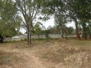
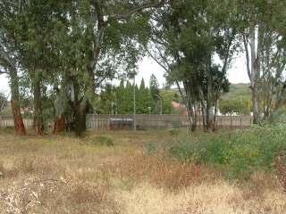
7 CONTEXT STUDY 3/ Urban Context 3.4/ Urban Context 3.4/ 3/ 041 3/ 037 Urban Context 3.4/ Muckleneuk Elandspoort Road Mears Road 3/ 038 3/ 042 3/ 039 3/ 040 N 3/ 037 Elandspoort Road Pedestrian Edge [Author] 3/ 038 Elandspoort Road Pick-Up-and-Drop-off area inward-bound [Author] 3/ 039 from M7 [Author] 3/ 040 Aerial + Local Context Diagram [Author] 3/ 041 View Down Mears Street [Author] 3/ 042 South Entrance to Pretoria CBD [Author] 3/ 043 Elandspoort Road Panoramic North-Eastwards [Author] TEXT 3/


![Activity [Author] 3/ 046 Lines of Movement through](/docs-images/94/120592561/images/8-4.jpg "Urban Precinct [Author] 3/ 047 Active Edges of")
![Urban Precinct [Author] 3/ 048 Edging Fabric of](/docs-images/94/120592561/images/8-5.jpg "Urban Precinct [Author] 3/ 049 South Entrance to")
![Pretoria [Author] 3/ 050 Elandspoort Road outward](/docs-images/94/120592561/images/8-6.jpg "bound view [Author] 3/ 051 Pick-Up-and-Drop-off")
8 CONTEXT STUDY 3/ Urban Frame 3.5/ THRESHOLD OF ENTRY Urban Frame 3.5/ Movement Lines Active Edges Building Fabric CONTEXT Urban Frame 3.5/ Movement Lines Active Edges Building Fabric N 3/ 049 N 3/ 044 3/ 045 3/ 050 LINES OF MOVEMENT ACTIVE EDGES EDGING FABRIC URBAN PRECINCT 3/ 051 POTENTIAL LOCATIONS 3/ 046 3/ 047 3/ 048 3/ 044 Urban Area of Focus [Author] 3/ 045 Zones of Activity [Author] 3/ 046 Lines of Movement through Urban Precinct [Author] 3/ 047 Active Edges of Urban Precinct [Author] 3/ 048 Edging Fabric of Urban Precinct [Author] 3/ 049 South Entrance to Pretoria [Author] 3/ 050 Elandspoort Road outward bound view [Author] 3/ 051 Pick-Up-and-Drop-off area on Elandspoort Road [Author] 21


![Road viewing South Towards [Author] 3/ 053 Elandspoort](/docs-images/94/120592561/images/9-6.jpg "Road Pedestrian Edge [Author] 3/ 054 Elandspoort Road")
![Vehicular Entrance [Author] 3/ 055 Pedestrian Crossing on](/docs-images/94/120592561/images/9-7.jpg "Elandspoort Road [Author] 3/ 056 Key Plan [Author] 3/ 057")
![Elandspoort Road outward-bound view [Author] 3/ 058](/docs-images/94/120592561/images/9-9.jpg "Pick-Up-and-Drop-off area on Elandspoort Road [Author] 3/")
9 CONTEXT STUDY 3/ Arrival Threshold 3.6/ Arrival Threshold 3.6/ CBD SOUTH TOWARDS FOUNTAINS CIRCLE 3/ 052 NORTH TOWARDS CBD ELANDSPOORT ROAD MEARS STATION Arrival Threshold 3.6/ Elandspoort Road Ridge Road ARRIVE 3/ 056 ARRIVAL THRESHOLD ELANDSPOORT ROAD TOWARDS CBD 3/ 053 3/ 054 3/ 055 ELANDSPOORT ROAD OUT OF PRETORIA 3/ 057 ELANDSPOORT ROAD ELANDSPOORT ROAD TOWARDS CBD ELANDSPOORT ROAD OUT OF PRETORIA PICK-UP UP-DROP DROP-OFF OFF POINT 3/ 058 RIDGE ROAD TO 3/ 059 3/ 060 RIDGE R ROAD TO 3/ 052 Elandspoort Road viewing South Towards [Author] 3/ 053 Elandspoort Road Pedestrian Edge [Author] 3/ 054 Elandspoort Road Vehicular Entrance [Author] 3/ 055 Pedestrian Crossing on Elandspoort Road [Author] 3/ 056 Key Plan [Author] 3/ 057 Elandspoort Road outward-bound view [Author] 3/ 058 Pick-Up-and-Drop-off area on Elandspoort Road [Author] 3/ 059 Ridge Road + Elandspoort Road Junction [Author] 3/ 060 Elandspoort Road Diagram [Author] 22


![[Author] 3/ 062 platforms](/docs-images/94/120592561/images/10-5.jpg "[Author] 3/ 063 Control")
![Tower [Author] 3/ 064 Key](/docs-images/94/120592561/images/10-6.jpg "Plan [Author] 3/ 065")
![[Author] 3/ 066 Retaining](/docs-images/94/120592561/images/10-7.jpg "wall [Author] 3/ 067 +")

10 CONTEXT STUDY 3/ Arrival Threshold 3.6/ Arrival Threshold 3.6/ CBD PROPERTY SOUTH TOWARDS FOUNTAINS CIRCLE 3/ 061 PRELLER STREET MEARS TRAIN STATION Arrival Threshold 3.6/ ARRIVE 3/ 054 3/ 055 3/ 062 3/ 053 3/ 061 [Author] 3/ 062 platforms [Author] 3/ 063 Control Tower [Author] 3/ 064 Key Plan [Author] 3/ 065 [Author] 3/ 066 Retaining wall [Author] 3/ North Edging Context [Author] 3/ 068 from Willow Road [Author] 3/ 066 3/ 067 3/


![Panoramic [Author] 3/ 070](/docs-images/94/120592561/images/11-5.jpg "Pedestrian link to Vehicular Link")
![[Author] 3/ 071 Mears Street](/docs-images/94/120592561/images/11-6.jpg "becomes Elandspoort Road [Author]")
![3/ 072 Key Plan [Author] 3/ 073](/docs-images/94/120592561/images/11-7.jpg "View down Mears Street towards")
![Pretoria CBD [Author] 3/ 074 Site](/docs-images/94/120592561/images/11-9.jpg "Elevation Facing onto Mears Street")
![[Author] MEARS STREET TOWARDS CBD](/docs-images/94/120592561/images/11-14.jpg "3/ 073 ELANDSPOORT ROAD OUT OF")
11 CONTEXT STUDY 3/ Site 3.7/ Site 3.7/ CBD MEARS TRAIN STATION 3/ 069 GREEN SPACE ELANDSPOORT ROAD MEARS STREET TOWARDS CBD Site 3.7/ Elandspoort Road becomes Mears Street ARRIVE 3/ 072 MEARS TRAIN STATION ELANDSPOORT ROAD 3/ 071 3/ 070 3/ 069 Elandspoort Road Panoramic [Author] 3/ 070 Pedestrian link to Vehicular Link [Author] 3/ 071 Mears Street becomes Elandspoort Road [Author] 3/ 072 Key Plan [Author] 3/ 073 View down Mears Street towards Pretoria CBD [Author] 3/ 074 Site Elevation Facing onto Mears Street [Author] MEARS STREET TOWARDS CBD 3/ 073 ELANDSPOORT ROAD OUT OF PRETORIA BEREA STREET MEARS STREET TOWARDS 3/


![[Author] 3/ 077](/docs-images/94/120592561/images/12-9.jpg "Site Viewing")


12 CONTEXT STUDY 3/ Site 3.7/ BEREA STREET ACCOM. 3/ 075 3/ 076 BEREA STREET ELANDSPOORT ROAD Site 3.7/ ACCESS FROM BEREA STREET MEARS TRAIN STATION ENTRY BEREA STREET Site 3.7/ Berea Street ARRIVE CBD 3/ 075 Site viewing South East + Mears Street [Author] 3/ 076 Site from Berea Street Entry [Author] 3/ 077 Site Viewing South out towards 3/ 078 Site Panoramic Viewing West to North to Berea Street [Author] 3/ 079 Key Plan [Author] 3/ 079 ELANDSPOORT ROAD TOWARDS CBD MEARS TRAIN STATION ELANDSPOORT ROAD OUT OF PRETORIA 3/ 077 3/ 078 WEST MEARS STREET TOWARDS CBD NORTH BEREA STREET MEARS STREET TOWARDS CBD 25
CONTEXT. 2. Context. are the major clients, however location has resulted in a third, minor client being involved, the Pretoria Technikon.
 are the major clients, however location has resulted in a third, minor client being involved, the Pretoria Technikon. 1.3 Ethnobotanic Research Centre [EBRC] A research facility is to be established to
UDF PLANS AND GUIDELINES
 UDF PLANS AND GUIDELINES 5 Land Use Land Use Development Plan Plan no. 3 Land Use Development Mixed Use Retail / Leisure Residential Civic and Institutional Proposed Zoning Table Development Edges Plan
University of Pretoria
 B Situating N o 2 The valley between the Ridges and the Rivers Figure 2.1 ~ Early Pretoria.psd Early Pretoria, established in the valley between the ridges and rivers Source: Hilton T 32 HYBRID 2.1 Ridges
PROJECTS OF DUBRUTO URBAN PLANNING Inc.
 PROJECTS OF DUBRUTO URBAN PLANNING Inc. PROJECT: ZWARTKOP EXTENSION 28 Dubruto Town & Regional Planning has lodged a township application on behalf of the owners and developers on land situated in the
South African Chancery in Berlin Germany
 CHAPTER 3 South African Chancery in Berlin Germany The diversity and richness of the peoples of South Africa are reflected in the new Embassy building in Berlin. Architect & Builder 2004: 20 This is an
Fig. 3.1 Three dimensional view of the site in its context in the CBD SITE AND RATIONALE 03
 44 Fig. 3.1 Three dimensional view of the site in its context in the CBD 45 SITE AND RATIONALE 03 46 Site Location The Site is located on the corner of Paul Kruger and Struben Street in the Tshwane/ Pretoria
6.2 Current condition of the Walker Spruit and Apies River
 6 Urban Framework Illus. 6.2: The Apies River and Walker Spruit running through the city. (Botha, April 2011) 6.1 Introduction The site analysis was done before the urban framework. This is due to the
3.0 CONTEXT ANALYSIS
 3.0 CONTEXT ANALYSIS 3.1 INTRODUCTION The context of the problem is also part of the solution to the problem. The process of analysing and interpreting the parts of the problem is prerequisite to reassembling
South Africa Socio-Economic overview. Ndibu Motaung Head of Research South Africa
 South Africa Socio-Economic overview Ndibu Motaung Head of Research South Africa South Africa Snapshot Population: 50,59 million (2011 mid year estimate) Johannesburg major areas population City of Johannesburg
Birmingham. Summer study!!
 Birmingham Summer study!! Urban Change in the UK - Birmingham - Part 1 Location / Facts - Birmingham is located in the centre of England - It is the 2nd largest city with a population of around 1 million
3.3. Urban Structure Defining a New Hierarchy of Routes and Spaces >Images
 Section 3.0 I The Masterplan Framework 18 >Images Examples of high quality routes and spaces 3.3. Urban Structure The success of any masterplan lies in a clear definition of the future urban structure
Chapter 2: OUTLINE PLANNING APPLICATION PROPOSALS. A New Garden Neighbourhood Matford Barton 17
 Chapter 2: OUTLINE PLANNING APPLICATION PROPOSALS A New Garden Neighbourhood Matford Barton 17 2.1. SUMMARY AND STATUS OF THE PROPOSALS 2.1.1. The parameter plans and associated wording in this chapter
TSHWANE INNER CITY REGENERATION. March 2015
 TSHWANE INNER CITY REGENERATION March 2015 LOOKING INTO THE HORIZON The Tshwane Vision 2055 envisioned the City to be a liveable, resilient and inclusive City where the citizens can enjoy a high quality
An analysis of the transportation planning for the 2010 Soccer World Cup in South Africa
 Urban Transport XV 105 An analysis of the transportation planning for the 2010 Soccer World Cup in South Africa C. B. Schoeman School for Environmental Sciences and Development, North West University (Potchefstroom
13. London Bridge London Bridge Area Vision
 13. 13.1. Area Vision 13.1.1. is: A globally significant central London business district which is home to international business headquarters; Internationally renowned for its prominent riverfront location
HOLDING 88 OF THE LYTTELTON AGRICULTURAL HOLDINGS
 PROJECTS OF DUBRUTO URBAN PLANNING ALSO FOR SALE Unique Property for development for a mixed land use with a floor area ratio of 5 and Gautrain Urban Node parking standards for flats. Site is 550m from
CHAPTER 4 CASE STUDIES & PRECEDENTS
 CHAPTER 4 CASE STUDIES & PRECEDENTS Insanity: doing the same thing over and over again and expecting different results. - Einstein (Brainyquote, 2011) In this chapter existing projects that relate to the
PART 5: DEVELOPMENT FRAMEWORK Figure 57: Proposed Height
 Figure 57: Proposed Height 103 Figure 58: Proposed Land Use 104 Figure 59: 3D Image of the Initial Height and Land Use in the Study Area 105 4.3.2 Landmarks and Nodes The growth of Sandton from an out
context, framework, site investigation of site and surroundings
 3 context, framework, site investigation of site and surroundings Figure 3.1: Aerial photo showing Ditsong: National Museum of Natural History in context 3.1 17 3.2 3.3 18 Figure 3.2: View of main entrance
Submitted by : Piet du Preez Student number : Study Supervisor : Prof. Roger Fisher
 Submitted by : Piet du Preez Student number : 25084692 Study Supervisor : Prof. Roger Fisher Submitted in fulfillment of part of the requirements for the degree Master in Architecture (Professional) in
Preci nct P l ans Figure 56 Campus Aerial Photo, 2008 CAL STATE EAST BAY, HAYWARD CAMPUS MASTER PLAN
 9 Precinct Plans This section contains a detailed discussion of the planning and design concepts for specific areas or precincts of the Cal State East Bay Hayward campus. The Precinct Plans pertain to
CONTEXT: FIRST READING
 03 CHAPTER THREE CONTEXT: FIRST READING INFRASTRUCTURE AT THE SCALE OF THE CITY Introduction Investigating Infrastructure through Boundary and Symbolism 03 CONTEXT: FIRST READING INFRASTRUCTURE AT THE
PROJECTS OF DUBRUTO URBAN PLANNING 22 February 2016 Centurion Lake Redevelopment - Symbio City
 PROJECTS OF DUBRUTO URBAN PLANNING 22 February 2016 Centurion Lake Redevelopment - Symbio City Background This is the well-known project to redevelop erf 53 Verwoerdburg Stad. DUBRUTO URBAN PLANNING Inc.
CHAPTER 4 CONTEXT CONTEXTUAL PROBLEM CONTEXT. ECOSYSTEMIC SYPPLY CHAIN l a Research and Development Centre for Urban Agriculture l
 04 52 ECOSYSTEMIC SYPPLY CHAIN l a Research and Development Centre for Urban Agriculture l CHAPTER 4 SOUTH AFRICA TSHWANE Figure 24: Pretoria Location Diagram GAUTENG PRETORIA UAL PROBLEM The site is located
DATE OF BIRTH : 23 October 1971 YEARS EXPERIENCE : 21
 POSITION NAME OF FIRM SPECIALISATION : Director : UrbanEQ Consulting Engineers (Pty) Ltd : Transportation Engineer DATE OF BIRTH : 23 October 1971 NATIONALITY : South African YEARS EXPERIENCE : 21 Andrew
Sustainable Campus: Towards a Model for the University of Pretoria
 Sustainable Campus: Towards a Model for the University of Pretoria Neal E Dunstan Resident Landscape Architect Department of Facilities Management University of Pretoria Introduction We must put the 21st
242 neighborhoods NEIGHBORHOOD 4: JORDAN AVENUE CORRIDOR
 NEIGHBORHOOD 4: JORDAN AVENUE CORRIDOR Aerial View of Jordan Avenue Corridor EXISTING CHARACTER The Jordan Avenue Corridor is the portion of North Jordan Avenue that extends north from East Third Street
2.1 Project location. Figure 2.1 Southern Africa with Pretoria, Tshwane, in the North of Gauteng (Samaps, 2009).
.") 18 2.1 Project location Figure 2.1 Southern Africa with Pretoria, Tshwane, in the North of Gauteng (Samaps, 2009). Figure 2.2 The CBD of Tshwane with Marabastad highlighted in red and the specific site
18 2.1 Project location Figure 2.1 Southern Africa with Pretoria, Tshwane, in the North of Gauteng (Samaps, 2009). Figure 2.2 The CBD of Tshwane with Marabastad highlighted in red and the specific site
GUIDELINES VICTORIA PARK AVENUE & STEELES AVENUE LOCATION URBAN DESIGN GUIDELINES
 VICTORIA PARK AVENUE & STEELES AVENUE Development in the south-east quadrant of Victoria Park Avenue and Steeles Avenue will be consistent withthe following urban design guidelines. They are to be read
Page 1 of 19 URBAN DESIGN FRAMEWORK FOR BOLTON STREET WATERFORD
 Page 1 of 19 URBAN DESIGN FRAMEWORK FOR BOLTON STREET WATERFORD 1.0 Introduction: The relocation of the City Council stores and depot from Bolton Street creates an exciting opportunity for development
Building a green infrastructure concept and process in the Gauteng City Region, South Africa. Kerry Bobbins Researcher GCRO
 Building a green infrastructure concept and process in the Gauteng City Region, South Africa Kerry Bobbins Researcher GCRO kerry.bobbins@gcro.ac.za IGU Regional Conference Krakow, Poland 1 18 22 August
The Master Plan Framework
 The Master Plan Framework The East Harbour Master Plan advances the development of 60 acres of former industrial lands east of the Don River. The Master Plan outlines a vision for a vibrant, transit-oriented
PARKWAY FOREST RE-URBANIZATION: EMERALD CITY
 PARKWAY FOREST RE-URBANIZATION: EMERALD CITY PUBLIC ART PLAN El-Ad Group (Canada) Inc. Prepared by: Public Art Management For Presentation to the Toronto Public Art Commission, February 2010 1 1.0 Introduction
WHAT MAKES A GREAT PLACE?
 ARCHITECTURAL QUALITY ARCHITECTURAL QUALITY IN THE CORRIDOR ARCHITECTURAL QUALITY The Potential of a Multimodal Terminal Would bring provide alternate forms of transportation to Atlanta s major destinations
SOCIO-ECONOMIC MOVEMENT ENVIRONMENT INFRASTRUCTURE TOWN PLANNING
 Table 7: SWOT Analysis SWOT ANALYSIS SOCIO-ECONOMIC MOVEMENT ENVIRONMENT INFRASTRUCTURE TOWN PLANNING STRENGTHS HIGH COMMUTER POPULATION DENSITY MAJORITY OF POPULATION BETWEEN AGE OF 15 & 34 LARGE AVAILABLE
1.0 INTRODUCTION & BACKGROUND
 1.0 INTRODUCTION & BACKGROUND 1.1 GENERAL The Consulting Team was retained by the City of Edmonton in 2010 to complete a for the replacement of the Walterdale Bridge and the approach roads, as required,
page 258 THE OLIFANTS RIVER VALLEY
 page 258 THE OLIFANTS RIVER VALLEY page 259 page 260 5.10 VREDENDAL (population: ± 20 400) (IDP 2012-2017) 5.10.1 SPATIAL ANALYSIS, see Figures 5.101.1 Sub-regional location Vredendal is located at the
heuston gateway: sections heuston gateway: regeneration strategy and development framework plan
 B B1 A B1 B C A heuston gateway: sections B B1 C 117 4.3.3 Zoning The station is the central hub of the area and this function must be preserved and developed. However large areas of the Heuston Station
TIER ONE - CMI URBAN DESIGN OBJECTIVES
 TIER ONE - CMI URBAN DESIGN OBJECTIVES V I S I O N TO CREATE A MOTORWAY CORRIDOR THAT: makes a positive contribution to city-wide connectivity and the urban fabric of Auckland is visually stimulating and
A DYNAMIC CITY AND ITS ASSETS
 A DYNAMIC CITY AND ITS ASSETS Great new urban projects are being completed Significant funding for public realm upgrades in the commercial core Population growth and skills on the rise Growing internal
2.1 MACRO CONTEXT STUDY
 2.1 MACRO CONTEXT STUDY The theatre industry in South Africa has developed consistently since the launch of Johannesburg's innovative Market Theatre in the mid 1970s. Today, South Africa has more than
UNDERSTANDING CUSTOMER NEEDS
 WOOLWORTHS Woolworths is a respected retail chain that offers a selected range of clothing, homeware, food and financial services, all under its own brand name. Men, women and children s clothing is known
C a m p u s I d e n t i t y
 Campus Identity Campus Identity a) Landscape Guidelines i. Materials ii. Components iii. Composition b) Wayfinding i) Entrance Features ii) Vehicular iii) Pedestrian c) Focus Areas i) Green Spine ii) Warriner
Market Place Bythell Place Queen Street Park Riverside Park. Public Spaces. Blenheim CBD Streetscape Final Report 36
 37 39 41 43 Market Place Bythell Place Queen Street Park Riverside Park Final Report 36 Market Place Market Place is a key space for Blenheim s street life, it is a meeting place, retail edge and pedestrian
COURTHOUSE CAMPUS BARNSLEY Executive Summary March 2010
 COURTHOUSE CAMPUS BARNSLEY Executive Summary March 2010 Estell Warren Cartwright Pickard Buro Happold King Sturge BWA Barnsley Metropolitan Borough Council introduction Courthouse Campus is the last major
Keystone Business Park Precinct Structure Plan North East Industrial Precinct. Part 2 Design Principles
 Keystone Business Park Precinct Structure Plan North East Industrial Precinct Part 2 Design Principles Context Issues Services Landform Issues Geotech and contamination Ecology Traffic and access Issues
Dissertation Objectives
 The aims of this dissertation are by nature firstly Architectural, then focussed towards the challenges of Housing, to South Africa, Sustainability and then finally Community. Dissertation Objectives 10
Colchester Northern Gateway Master Plan Vision Review Draft. July 2016
 Colchester Northern Gateway Master Plan Vision Review Draft July 2016 Contents Introduction 4 Context 8 Purpose of the Report 8 Strategic Position 9 Overview of the Process 11 2012 Master Plan Vision 12
Making the case for Sustainable Transport Project Potential
 Making the case for Sustainable Transport Project Potential The Structural Investment Fund (SIF) Strategy for Greater Lincolnshire identifies the barriers to growth identified by having poor transport
East Grove Public Realm
 H - - MP - Elephant Park Public Realm RO EY DN NEW KENT ROAD E AC PL The public realm has been designed to create an environment which is easy to move through, accessible to all, safe and playful. The
Project introduction and relevance:
 Project introduction and relevance: Every city has a central area or district where, most of the social and commercial activity within the city is concentrated. Norzin Lam is in the process of becoming
Tauranga City Centre Spatial Framework
 Tauranga City Centre Spatial Framework Stakeholder Engagement Workshop 15 October 2015 Project Design Team Beca & LandLAB Our team Henry Crothers (LandLab) Landscape Architect/Urban Designer Urban and
3.0 Area-Wide Strategies 30
 3.0 Area-Wide Strategies 30 3.6 Tourism Strategy This section of the plan aims to develop and improve the tourism potential of the area. Strategic Context The City Plan outlines the potential of Cork to
Kampala Declaration on Building Inclusive Growth and Liveability in African Cities
 Kampala Declaration on Building Inclusive Growth and Liveability in African Cities We, the Ministers, Governors, Mayors City Managers and Administrators of Eastern, Central and Southern African cities
Horwood Map of London, Westminster & Southwark First edition
 Barratt London is developing plans in tandem with Southwark Council and TfL to transform the southern end of Blackfriars Road. The residential-led, mixed-use scheme will deliver new private and affordable
Living with World Heritage in Africa
 INTERNATIONAL CONFERENCE Living with World Heritage in Africa [26 26-29 September 2012] South Africa BACKGROUND DOCUMENT The Government of the Republic of South Africa, in collaboration with the African
THE 355/270 CORRIDOR:
 THE 355/270 CORRIDOR: Strategic Ideas for Sustaining a Livable Work Place Project Summary ACCESS LIFE DESIGN HEALTH WORK Montgomery County Planning Department The Maryland-National Capital Park and Planning
[PLANNING RATIONALE] For Site Plan Control and Lifting of Holding Zone By-Law 101 Champagne Avenue. May 23, 2014
![[PLANNING RATIONALE] For Site Plan Control and Lifting of Holding Zone By-Law 101 Champagne Avenue. May 23, 2014](/thumbs/75/71599615.jpg "[PLANNING RATIONALE] For Site Plan Control and Lifting of Holding Zone By-Law 101 Champagne Avenue. May 23, 2014") [PLANNING RATIONALE] For Site Plan Control and Lifting of Holding Zone By-Law 101 Champagne Avenue May 23, 2014 Contents 1.0 Introduction... 2 2.0 Site Context... 2 2.1 Adjacent Uses... 2 Figure 1: Site
[PLANNING RATIONALE] For Site Plan Control and Lifting of Holding Zone By-Law 101 Champagne Avenue May 23, 2014 Contents 1.0 Introduction... 2 2.0 Site Context... 2 2.1 Adjacent Uses... 2 Figure 1: Site
TRANSPORTATION: Roads and Highways Services
 TRANSPORTATION: Roads and Highways Services Profile Our background GIBB is a leading multi-disciplinary engineering consulting firm based in South Africa with 67% Black ownership. The firm has a strong
Subarea 4 Indian Creek. Vision The combination of park networks and transportation amenities make Subarea 4 the greenest hub in the Corridor.
 indian creek 180 extends south from 101st Street to I-435. The I-435 and Metcalf intersection is one of the primary intersections in the Kansas City Metro Area. The area includes several residential neighborhoods
V. Gateways GATEWAYS / V-1
 V. GATEWAYS / V-1 Many of Chesapeake s gateways are located on highways and call for bold and attractive designs that motorists can understand, appreciate, and enjoy. can also take the form of natural
With the promotions and publicity of green. Moving Towards Sustainable Campus Design. Deciphering Green Architecture
 Deciphering Green Architecture Moving Towards Sustainable Campus Design Projects: NIIT University Campus, Neemrana and Indian Institute of Technology, Gandhinagar Architects: Space Design Consultants,
London Bridge London Bridge Area Vision Map
 Area Vision Map Borough Market Southwark Cathedral NSP54 Hay s Galleria Key: NSP Site Allocations Greenspace Low Line Thames Path Cycle Network Primary Shopping Areas Borough High Street Tube Station NSP51
12/9/2013. HOLLYWOOD/PINES CORRIDOR PROJECT AMPO 2013 Annual Conference October 24, Our Perspective. Broward.
 HOLLYWOOD/PINES CORRIDOR PROJECT AMPO 2013 Annual Conference October 24, 2013 Our Perspective Broward Fort Lauderdale 1 Broward Metropolitan Planning Organization Fort Lauderdale Fort Lauderdale Skyline
TRANSPORTATION ILISO 1
 TRANSPORTATION ILISO 1 ABOUT US ILISO Consulting (Pty) Ltd now trading as NAKO ILISO is an African Consulting Engineering and Project Management firm that specialises in engineering, environmental and
REGIONAL ACTIVITY CENTER
 DRAFT REGIONAL ACTIVITY CENTER 70 EAST BENCH MASTER PLAN DRAFT 06 Introduction The East Bench Regional Activity center is comprised of large educational, research, medical, and employment centers. These
1 Introduction. Chapter. In this chapter:
 Chapter 1 Introduction In this chapter: 1.1 A Snapshot of the Region 1.2 Towards a Sustainable Region 1.3 The Provincial Context 1.4 Purpose and Organization The Regional Municipality of York Official
Sibbesborg: Competition for Sustainable Community Development
 Sibbesborg: Competition for Sustainable Community Development Pseudonym "Sibblings" Description The urban structure of Sibbesborg is based on a combination of several mutually connected centres. Each of
MOUNTAIN VIEW HERITAGE ASSESSMENT, GAUTENG
 MOUNTAIN VIEW HERITAGE ASSESSMENT, GAUTENG A Phase I report prepared for Seaton Thompson and Associates P.O. Box 936, IRENE, 0062 Professor T.N. Huffman Archaeological Resources Management School of Geography,
Population No. households Average number of people per household. Life expectancy. Liquid petroleum/gas 3.1%
 Msunduzi @natesvw People and Households Size of city Population density in 976 people per km 2 Of all nine cities, Msunduzi has the highest average number of people per household and the highest percentage
Appendix B Figures L1 and L2 - Townscape Analysis
 The Derriford Transport Scheme WEBTag Townscape and Visual Impact Appraisal (WTVA) Appendix B Figures L1 and L2 - Townscape Analysis J:\29210 Plymouth City Modelling\Technical\Landscape\Reports\29210_De
design & access statement Proposed Erection of 68 Bedroom Hotel and Restaurant with Associated Landscaping
 Proposed Erection of 68 Bedroom Hotel and Restaurant with Associated Landscaping Promenade, design & access statement lawrencemcphersonassociates 6 new road, ayr, ka8 8ex On Behalf of July 2015 CONTENTS
Today Land & People. Northeast Nampa Gateway District. Employment. Land Use Characteristics. Demographics. Current Zoning
 Today Land & People Employment Major employers include Saint Alphonsus, the College of Western Idaho, the Auto Mall, Sorrento Lactalis and Walmart. 3,004 jobs in 2010 (COMPASS-CIM 2040 TAZ data) 4,345
NEIGHBORHOOD DESIGN ELEMENT
 NEIGHBORHOOD DESIGN ELEMENT INTRODUCTION The following recommendations constitute an urban design oriented "neighborhood analysis" of Plantation. It is an optional Comprehensive Plan Element. The five
City of Long Beach. creating vibrant and exciting places
 City of Long Beach creating vibrant and exciting places Land Use Element Urban Design Element Overview of the two draft General Plan elements Discuss areas of change Economic goals of the plans Case study
Regional Context Statement
 Regional Context Statement REGIONAL CONTEXT STATEMENT 3. REGIONAL CONTEXT STATEMENT In 1995, the Provincial Government passed into law the Growth Strategies Act. The purpose of this provincial initiative
index University of Pretoria
 2 BRIEF DEVELOPMENT AND CONTEXT STUDY University of Pretoria etd - Strydom, C (2003) List of figures 4 1. Introduction 6 Visual Culture Philosophy Reflection Visual Culture & Architecture Le Parc de la
Anatomy of A Vibrant Downtown. Anatomy of a Vibrant Downtown
 Anatomy of A Vibrant Downtown The goal of MAIN ST. REVITALIZATION PLANNING is to provide a framework that will help transform your downtown into a VIBRANT DOWNTOWN a place where people love to LIVE, WORK,
1. PLANNING CONCEPTS. Central Petaluma Specific Plan Chapter 1. Planning Concepts Page 7
 Page 7 1. PLANNING CONCEPTS Overview of Planning Concepts The plan for Central Petaluma envisions a reinvigorated central district that accommodates a greater diversity and intensity of activities, including
Response to the London Bridge Area Vision and Site Allocations within the New Southwark Plan
 1 Melior Place London SE1 3SZ 020 7407 4701 teamlondonbridge.co.uk info@teamlondonbridge.co.uk 28 April 2017 Response to the London Bridge Area Vision and Site Allocations within the New Southwark Plan
Report to: Development Services Committee Report Date: April 24, 2017
 SUBJECT: Cornell Rouge National Urban Park Gateway - Report on Design Charrette and Next Steps PREPARED BY: Lilli Duoba, MES, MCIP, RPP, Manager, Natural Heritage (ext. 7925) REVIEWED BY: Marg Wouters,
M A K E K A D E S I G N L A B. CONCEPT l CONTENT l CRAFT
 M A K E K A D E S I G N L A B CONCEPT l CONTENT l CRAFT FT ropolitan Rail Overlay 20 YEAR INTEGRATED SETTLEMENT CONCEPT DEVELOPMENT INFORMATION CONCEPT Provisional Application of Concept M A K E K A D
The Capital Design Advisory Committee St. Mary s College of Maryland & Historic St. Mary s City
 The Capital Design Advisory Committee St. Mary s College of Maryland & Historic St. Mary s City Welcome April 21, 2010 Capital Design Advisory Presentation: Relocating Margaret Brent Hall Traffic Calming
Draft for Public Review. The Market and Octavia Neighborhood Plan
 Draft for Public Review The Market and Octavia Neighborhood Plan San Francisco Planning Department As Part of the Better Neighborhoods Program December 2002 IOverview Why Plan a Better Neighborhood Here
DEVELOPMENT FRAMEWORK
 DEVELOPMENT FRAMEWORK Station building The station building just south of Marlboro Drive is the major element and focal point in the area. The station will be more visible than most other Gautrain stations
burlington mobility hubs study Downtown Burlington Mobility Hub
 burlington mobility hubs study Downtown Burlington Mobility Hub Draft Precinct Plan Workbook PIC #3, September 7, 2017 downtown mobility hub objectives City staff and their consultants are proposing an
Walnut Creek BART Station
 Walnut Creek BART Station Mixed Use Transit Oriented Project Design Review Commission Study Session May 17, 2006 Applicant: Walnut Creek Transit Lifestyles Associates Joint Venture: Transit Village Associates
INDEX INTRODUCTION. The development encompasses multifaceted living and will include the following:
 INDEX INTRODUCTION 2 THE VISION 3 RESIDENTIAL 4 SPECIALIST STUDIES 6 TRAFFIC IMPACT SUMMARY 6 NEW & UPGRADING ROADS 7 FAQ 8 CONTACT DETAILS 10 2 INTRODUCTION The Linksfield, Integrated Mixed Use Development,
01 the vision NEW LYNN IS WAITING FOR THE GREAT LEAP FORWARD
 [A] FRAMEWORK 01 the vision 02 the framework 03 urban design principles 04 c o n t e x t 05 issues a n d o p p o r t u n i t i e s 06 creating a t.o.d. 07 key recommendations 08 seven strategic areas of
Locations in Chinese Retail Industry
 David F. Miller Center For Retailing Education and Research International Retailing Education and Training (IRET ) Locations in Chinese Retail Industry David F. Miller Center For Retailing Education and
GUIDELINES EXHIBITION PLACE LOCATION: OBJECTIVES. Structure Plan URBAN DESIGN GUIDELINES
 Development in the Exhibition Place lands will be consistent with the following urban design guidelines. They provide a framework for new development of the lands and are to be read in conjunction with
WELLINGTON HOSPITAL DESIGN GUIDE TABLE OF CONTENTS
 WELLINGTON HOSPITAL DESIGN GUIDE TABLE OF CONTENTS 1.0 Introduction Page 2 The Place of Wellington Hospital 2 The Future of the Hospital 2 2.0 The Intention of the Design Guide 3 3.0 Analysis 4 General
Derry Green Corporate Business Park
 Town of Milton Derry Green Corporate Business Park Urban Design Guidelines BMI/Pace - June 2010 Draft 3 Prepared by: Brook McIlroy Planning + Urban Design / Pace Architects Suite 300-51 Camden Street Toronto,
Leveraging the Data Ecosystem for Smart, Resilient and Sustainable Cities
 Leveraging the Data Ecosystem for Smart, Resilient and Sustainable Cities -Urbanization in Uganda By Mr. Bernard Justus MUHWEZI Chairman, Geo-Information Management Working Group, Uganda Bureau of Statistics,
PROPOSED URBAN STRUCTURE
 CHAPTER 3 PROPOSED URBAN STRUCTURE PLANNING PARTNERS: CENTURY CITY URBAN DESIGN FRAMEWORK October 2005 13 THE PROPOSED URBAN STRUCTURE The urban design rationale outlined in the previous chapter provides
Images: 2010 Bill Sumner for Vizcaya Museum and Gardens.
 For Teacher: The field study visit to Vizcaya and this orientation are organized around inquirybased facilitated discussion. Vizcaya s school programs use facilitated discussion to encourage students to
2. Spatial Portrait, Vision and Objectives
 VISION & OBJECTIVES 2. Spatial Portrait, Vision and Objectives Introduction 2.1 This section sets out the spatial portrait of Uttlesford, the vision we have for the future of the area and the objectives
Clairtrell Area Context Plan
 Clairtrell Area Context Plan March 2005 Urban Development Services City Planning Contents 1. Introduction... 4 2. Development Structure... 6 2.1 Streets... 7 2.1.1 Sheppard Avenue and Bayview Avenue...
Integrated Multi Modal Public Transit Hub
 Leaders Programme in Urban Transport Planning and Management Integrated Multi Modal Public Transit Hub at Central Business District- Ahmedabad Neela Munshi (Senior Town Planner) Deepa Dave (AM Urban Planner)
Comprehensive Plan. Faribault, Minnesota. Hoisington Koegler Group Inc. Claybaugh Preservation Architecture Inc. Howard R. Green Company Bonz/REA
 Comprehensive Plan Faribault, Minnesota Adopted by the Faribault City Council July 8, 2003 prepared for: prepared by: Hoisington Koegler Group Inc. Claybaugh Preservation Architecture Inc. Howard R. Green