50 Years of Habitat Change in the Mississippi River Delta
|
|
|
- Elfrieda Phillips
- 6 years ago
- Views:
Transcription

1 50 Years of Habitat Change in the Mississippi River Delta Wells*, Chris, Larry Handley*, Jason Dugas**, Kelly Mouton**, Dennis Lichtenberg** *NWRC/USGS; **NWRC/IAP World Services U.S. Department of the Interior U.S. Geological Survey

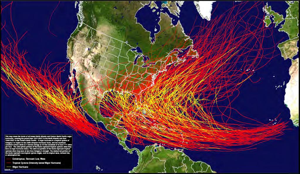
2 24 DOQQ s were mapped to evaluate impacts of Hurricanes Audrey (1957), Katrina and Rita (2005). This presentation is an overview of habitat changes to four quadrangles southeast of New Orleans: Belle Chase, Chalmette, Delacroix, and Martello Castle. The dates of photography mapped were 1956, 1988, 2004 and Chalmette Martello Castle Belle Chase Delacroix
. classification interest: Habitat (NWI + uplands) Resolution: 1956 about 2 ft; 1988 about 3 ft; 2004 & 2005 about 1 ft.")
3 Interpretation and mapping considerations Include: classification interest, photo resolution, scale, dates of imagery available, medium (digital vs film), emulsion (if film), monoscopic or stereoscopic, and scanning characteristics (if digital). classification interest: Habitat (NWI + uplands) Resolution: 1956 about 2 ft; 1988 about 3 ft; 2004 & 2005 about 1 ft. Scale: Interpreted at 1:3,000; mapped at 1:12,000; minimum mapping unit: ½ acre Photography dates interpreted and mapped: 1956, 1988, 2004, 2005 Medium: film ( panchromatic, CIR, CIR); digital ( CIR) Interpreted in stereo (all dates) mapped on-screen for 2004 & 2005.


4 Habitat Mapping - Photointerpreters use historical and current stereo aerial photography to produce wetland and upland status and trends, and habitat inventories. Maps produced from these methods are used by federal, state, local and private landowners for developing conservation plans and management decisions. National Wetlands Research Center


5 Map Production Map Development - All production follows the same rigorous methodology. High-quality final maps are produced to national mapping standards, protocols and conventions.

6 Urbanization shifts from rural toward NOLA, fresh marsh decrease, wetland forest decrease, open water increase through salt marsh degradation, leveeing, and canal dredging all changed dramatically in the 32 years from 1956 to 1988.
7 Urbanization continues to shift toward NOLA, consolidates, and expands into wetlands, fresh marsh nearly disappears, wetland and upland forest decrease, open water increase through shoreline retrogradation and salt marsh degradation, and canal dredging all changed dramatically in the 18 years from 1988 to 2004.
8 Urbanization, fresh marsh stabilization, modest forest loss, and dramatic open water increase through shoreline retrogradation and especially salt marsh degradation changed in year of Hurricane Katrina.
9 49 years of habitat change from 1956 to 2005 appear to be mostly due to the impact of man through levee building, canal dredging and urbanization. The result has been almost total loss of fresh marsh, shift of uplands from forested to urban, and unsustainable, continuous loss of salt marsh.


10 Polygons that changed to open water by 2005 from non-water 1956 polygons appear bright blue. Polygons that changed from non-urban categories in 1956 to urban categories in 2005 are deep red. Using habitat mapping from different dates we can combine different habitat types of the extended NWI classification system to track changes in ephemeral habitats like beaches and flats, woody plant vegetation on dredge spoil, and much, much more.
11 Chalmette Qudrangle Martello Castle Qudrangle Area (ha) by habitat Ch by habitat Ch by habitat Ch Area (ha) by habitat Mart by habitat Mart by habitat Mart Beaches & Flats Open Water-Fresh Salt Marsh Upland Forested Upland Scrub-Shrub Wetland Forested Fresh Marsh Open Water-Salt Upland Agriculture Upland Range Upland Urban Wetland Scrub-Shrub Beaches & Flats Open Water-Fresh Salt Marsh Upland Forested Upland Scrub-Shrub Wetland Forested Fresh Marsh Open Water-Salt Upland Agriculture Upland Range Upland Urban Wetland Scrub-Shrub Belle Chase Qudrangle Delacroix Qudrangle Area (ha) by habitat BC by habitat BC by habitat BC Area (ha) Del by habitat Del by habitat Del Beaches & Flats Open Water-Fresh Salt Marsh Upland Forested Upland Scrub-Shrub Wetland Forested Fresh Marsh Open Water-Salt Upland Agriculture Upland Range Upland Urban Wetland Scrub-Shrub Beaches & Flats Open Water-Fresh Salt Marsh Upland Forested Upland Scrub-Shrub Wetland Forested Fresh Marsh Open Water-Salt Upland Agriculture Upland Range Upland Urban Wetland Scrub-Shrub
12
The Napa River Flood Protection Project
 The Napa River Flood Protection Project Creating Flood Protection and Restoring Geomorphic and Biological Processes Jeremy Sarrow, Napa County Flood Control & Water Conservation District June 2, 2014.
Level 1: GIS-based Desktop Assessments. Meghan Burns, Landscape Ecologist
 Level 1: GIS-based Desktop Assessments Meghan Burns, Landscape Ecologist EPA three-tier framework WETLAND AND RIPARIAN MAPPING LEVEL 1 LANDSCAPE ASSESSMENT WETLAND LANDSCAPE PROFILES LEVEL 2 RAPID ASSESSMENT
Turf Grass v. Mixed Open
 Turf Grass v. Mixed Open Peter Claggett, U.S. Geological Survey March 8, 2016 Urban Stormwater Workgroup Meeting U.S. Department of the Interior U.S. Geological Survey What s the difference between turf
ELIGIBILITY CRITERIA CHECKLIST OPEN SPACE CLASSIFICATION
 THURSTON COUNTY DEVELOPMENT SERVICES OPEN SPACE TAX PROGRAM ELIGIBILITY CRITERIA CHECKLIST OPEN SPACE CLASSIFICATION Use this checklist to help you determine whether your property is eligible for open
Pontchartrain Coastal Lines of Defense Program Figure 1 Figure 2 Figure 1
 Pontchartrain Coastal Lines of Defense Program Coastal Sustainability Program February 2006 The Pontchartrain Coastal Lines of Defense Program consists of ten priority project areas within the Pontchartrain
Prioritizing Tidal Wetlands: A Landscape Approach
 Prioritizing Tidal Wetlands: A Landscape Approach Laura Brophy Director, Estuary Technical Group Institute for Applied Ecology Corvallis, OR College of Earth, Ocean and Atmospheric Sciences, Oregon State
Lessons Learned from Katrina and Reducing Vulnerability Fall 2011
 Page 1 of 9 TIDE-1220 Tulane University New Orleans & Hurricanes Prof. Stephen A. Nelson Lessons Learned from Katrina and Reducing Vulnerability Fall 2011 This document last updated on 21-Sep-2011. Why
Beneficial Use at Deer Island A Decade of Design and Implementation. Mississippi Water Resources Conference Jackson, Mississippi April 3, 2012
 Beneficial Use at Deer Island A Decade of Design and Implementation Presented by Wendell Mears and William Roth Anchor QEA, LLC Mississippi Water Resources Conference Jackson, Mississippi April 3, 2012
Information for File # MMJ; Methodist Hospital Flood Storage Mitigation and Wetland Enhancement Project
 Information for File # 2016-01223-MMJ; Methodist Hospital Flood Storage Mitigation and Wetland Enhancement Project Applicant: Park Nicollet, Attn: Robert Riesselman Corps Contact: Melissa Jenny Address:
Building Ecological Solutions to Coastal Community Hazards: Guidance and NJ Coastal Community Assistance
 Building Ecological Solutions to Coastal Community Hazards: Guidance and NJ Coastal Community Assistance Stacy Small-Lorenz National Wildlife Federation Restore America s Estuaries Summit New Orleans,
MEMORANDUM OF BOG TURTLE HABITAT INVESTIGATION
 MEMORANDUM OF BOG TURTLE HABITAT INVESTIGATION 410-728-2900 Fax: 410-728-3160 www.rkk.com To: From: CC: U.S. Fish and Wildlife Service, Pennsylvania Fish and Boat Commission Jennifer A Ottenberg Miller,
TABLE OF CONTENTS PAGE
 1989 BROWARD COUNTY LAND USE PLAN Original adoption March 1, 1989 Text amendments adopted as of March 10, 2015, are incorporated herein. BROWARD COUNTY BOARD OF COUNTY COMMISSIONERS BROWARD COUNTY PLANNING
After the Storms: Planning for Louisiana s Future. Larry Ardoin Coastal Protection and Restoration Authority Integrated Planning Team
 After the Storms: Planning for Louisiana s Future Larry Ardoin Coastal Protection and Restoration Authority Integrated Planning Team Today s Presentation Background Objectives Draft Master Plan Upcoming
Jack Creek Park Capital Improvement Project
 Jack Creek Park Capital Improvement Project Public Information Meeting October 2, 2017 Consultants & Designers, Inc. Integrating Engineering and Environment 7455 New Ridge Road, Suite T Phone: (410) 694-9401
Incorporating Traditional Ecological Knowledge and Cultural Information Into Wetland Protection, Management, and Restoration - Tulalip Reservation
 Incorporating Traditional Ecological Knowledge and Cultural Information Into Wetland Protection, Management, and Restoration - Tulalip Reservation By Jonathan Hall, Wetland Biologist, Tulalip Tribes Weallup
Airborne Imagery Potential Role in Monitoring Climate Change
 PC.DEL/773/09 13 October 2009 ENGLISH only Airborne Imagery Potential Role in Monitoring Climate Change US Department of State 5 October 2009 Briefing Topics Introduction Climate Change Threats to National
Public Visioning City of Kelso Planning Commission
 Shoreline Master Program Update Public Visioning City of Kelso Planning Commission November 13, 2012 Schedule Jurisdiction Inventory Analysis Visioning Topics Process Governing Principles Structure of
Preparing a Wetland Delineation Report
 Preparing a Wetland Delineation Report Why is the report important? In addition to documenting the wetland determination/delineation, the report often provides the basis for further regulatory permitting/compliance.
An Integrated Approach for Water Management Examples from The Netherlands. Addressing Climate Change and Sea Level Rise
 An Integrated Approach for Water Management Examples from The Netherlands Addressing Climate Change and Sea Level Rise Superstorm Sandy Forum College of Staten Island March 8 2013 Water: a challenge and
ME DOT Route 3. File No.: City and State: Bar Harbor, ME
 ME DOT Route 3 File No.: 199600361 City and State: Bar Harbor, ME General Impacts: 0.28 acre tidal emergent 0.77 acre non-tidal forested 0.15 acre non-tidal emergent 0.51 acre non-tidal scrub-shrub Functions
Tentatively Selected Plan within Harlem River, East River and Western Long Island Sound Planning Region. First Level Costs. Federal Non-Federal Total
 HARLEM RIVER, EAST RIVER AND WESTERN LONG ISLAND SOUND PLANNING REGION Flushing Bay and Creek Ecosystem Restoration Source Feasibility Study Background Study Resolution (1994), Reconnaissance Report (1996),
Digital Stereograms. for Land Use Education. in Indiana. Prepared By: Samantha Sallee. Supervising Professor: Guofan Shao
 Digital Stereograms for Land Use Education in Indiana Prepared By: Samantha Sallee Supervising Professor: Guofan Shao Department of Forestry and Natural Resources Purdue University Funded by IndianaView
Landscape Conservation Design April, 2014
 Designing Sustainable Landscapes in the Northeast A project of the North Atlantic Landscape Conservation Cooperative & Northeast Climate Science Center Landscape Conservation Design April, 2014 Conceptual
North Bellingham and Urban Growth Boundary Wetland, Stream, Habitat Conservation Area and Buffer Assessment TECHNICAL MEMORANDUM
 Northwest Ecological Services, LLC North Bellingham and Urban Growth Boundary Wetland, Stream, Habitat Conservation Area and Buffer Assessment TECHNICAL MEMORANDUM Prepared For: City of Bellingham Planning
River Road New Castle Marsh Restoration Recommendations
 University of New Hampshire University of New Hampshire Scholars' Repository PREP Reports & Publications Institute for the Study of Earth, Oceans, and Space (EOS) 6-2010 River Road New Castle Marsh Restoration
In the Mississippi Delta: Building with Water
 Page 1 of 5 POSTED 09.09.10 Elizabeth Mossop and Jeffrey Carney In the Mississippi Delta: Building with Water 20th century wetland loss, mapping by LSU professors Michael Blum and Harry Roberts. [by the
Louisiana Lawmakers Approve Historic Hurricane Protection Plan
 Louisiana Lawmakers Approve Historic Hurricane Protection Plan BATON ROUGE, Louisiana, June 1, 2007 (ENS) - The Louisiana Legislature has unanimously approved the state's first comprehensive master plan
Minnesota Department of Natural Resource - Natural Resource Guidance Checklist Conserving Natural Resources through Density Bonuses
 Minnesota Department of Natural Resource - Natural Resource Guidance Checklist Conserving Natural Resources through Density Bonuses NRDB Why Use Density Bonuses & This Checklist Local units of government
Joe Pool Lake Master Plan Revision Public Information Meeting May 23, 2017
 Joe Pool Lake Master Plan Revision Public Information Meeting May 23, 2017 Presented By Jason Owen Lake Manager U.S. Army Corps of Engineers Fort Worth District US Army Corps of Engineers Purpose of this
Balancing Conservation and Development on the Jordan River
 Balancing Conservation and Development on the Jordan River Jordan River Parkway Trail Regional Athletic Complex Conservation & Restoration Balancing Conservation and Development on the Jordan River Jordan
Farmland Classification Centre County, Pennsylvania (Student Farm Site) Web Soil Survey National Cooperative Soil Survey
 Web Soil Survey National Cooperative Soil Survey") 256300 256600 256900 257200 257500 257800 258100 77 51' 20'' W 77 53' 26'' W Farmland Classification Centre County, Pennsylvania 258400 258700 259000 40 49' 4'' N 4520600 4520900 4520900 4521200 4521200
256300 256600 256900 257200 257500 257800 258100 77 51' 20'' W 77 53' 26'' W Farmland Classification Centre County, Pennsylvania 258400 258700 259000 40 49' 4'' N 4520600 4520900 4520900 4521200 4521200
Natural Resource Adaptation Action Area Addressing Sea Level Rise in Estuarine Ecosystems TO: TOWN OF YANKEETOWN MAY
 Natural Resource Adaptation Action Area Addressing Sea Level Rise in Estuarine Ecosystems TO: TOWN OF YANKEETOWN MAY 6 2013 University of Florida Conservation Clinic Vivek Babbar, Student Associate, J.D.
Pond to Plate (digital collage/painting using aerial imagery and drone photography)
") Bios Forbes Lipschitz is an Assistant Professor of Landscape Architecture at the Knowlton School at the Ohio State University, where she teaches studio and seminar courses in landscape planning and representation.
Bios Forbes Lipschitz is an Assistant Professor of Landscape Architecture at the Knowlton School at the Ohio State University, where she teaches studio and seminar courses in landscape planning and representation.
The Salt Marsh Advancement Zone Assessment of Connecticut
 The Salt Marsh Advancement Zone Assessment of Connecticut Front cover image: Salt marsh advancement zones in Stratford, CT from the Comprehensive Map Book of Stratford, CT. Table of Contents Introduction...
Supporting Information
 Brewster Water Protection DCPC In mid February 2008, the Commission received a nomination from the Brewster Board of Selectmen to create a DCPC to protect zones of contribution (or watersheds) to public
Stevens County Partnership Shoreline Master Program Update
 Stevens County Partnership Shoreline Master Program Update Public Open Houses 1 Overview Welcome and open house purpose Overview of Shoreline Management Act (SMA) Shoreline Master Program (SMP) update
Section 1 TABLE OF CONTENTS
 Section 1 TABLE OF CONTENTS... [M]ineral fertilizer is essential to feed around half of the world s population, and will be fundamental to ensure global food security through the 21 st century. 2013 U.N.
City of Surrey Ecosystem Management Study. Integration of ecological processes with land use
 City of Surrey Ecosystem Management Study Integration of ecological processes with land use Natural areas in Surrey are changing as the City grows and evolves. Many important natural areas remain or may
Chapter XV Maps. The map is not the territory ~Alfred Korzybski
 Chapter XV Maps The map is not the territory ~Alfred Korzybski Chapter XV Maps 15.1 DISCLAIMER These maps are intended for use with the Tamworth Master Plan. The information presented is to be used for
Relevance of Scenic Resources Management:
 Relevance of Scenic Resources Management: Panel on Benefits, Applications and Challenges Joan Harn, NPS, moderator Greg Currie, BLM Lisa Klinger, USFS Susan Overson, NPS ~ 30 years 3 bridge proposals 2
STORM WATER UTILITY FREQUENTLY ASKED QUESTIONS
 STORM WATER UTILITY FREQUENTLY ASKED QUESTIONS In 2007, the City Council adopted Ordinance No. 1155 establishing a storm water utility in the City. No fee structure was adopted at that time. The idea of
Art, Wall Decor, Picture Frame & Custom Framing Report, 2013
 Introduction... 18 The Changing Face of Personal Art Collections... 18 Research Objectives... 20 Methodology... 22 Figure 1: Total Purchase Incidence, 2006-2012... 23 Sample Specifications... 24 Products
Outfall Reconnaissance Inventory & Stream Assessment
 CITY OF TUMWATER Outfall Reconnaissance Inventory & Stream Assessment City of Tumwater 555 Israel Road SW Tumwater, WA 98501 ACKNOWLEDGEMENTS City of Tumwater Outfall Reconnaissance Inventory and Stream
Virginia DCR- Natural Heritage Program. Tools for Linking Conservation and Transportation Planning
 Virginia DCR- Natural Heritage Program Tools for Linking Conservation and Transportation Planning November 9, 2009 MISSION: to conserve Virginia's biodiversity through statewide biological inventory, protection,
The Landscape Project. New Jersey Department of Environmental Protection Division of Fish and Wildlife Endangered and Nongame Species Program
 The Landscape Project New Jersey Department of Environmental Protection Division of Fish and Wildlife Endangered and Nongame Species Program New Jersey is One of the smallest states in the country Yet
LANDMAP Methodology Overview
 LANDMAP Methodology Overview June 2017 Jill Bullen, Senior Landscape Specialist jill.bullen@cyfoethnaturiolcymru.gov.uk 0300 065 4706 (Please note this is an information document and not a training presentation)
Caler Cove Lobster Company
 File No.: 199800920 City and State: Addison, ME Caler Cove Lobster Company General Impacts: 0.17 acre tidal emergent Functions and Values Lost: Production Export Nutrient Exchange Sediment Filtration Fishery
Ravenswood Working Group Mee4ng, February 10, 2011, 1-4 p.m.
 Ravenswood Working Group Mee4ng, February 10, 2011, 1-4 p.m. Today s Agenda Introduc)ons & Welcome Track Our Progress Project- wide Track Our Progress: Phase 1 at Ravenswood South San Francisco Bay Shoreline
DRAFT MAP AMENDMENT FLU 04-4
 DRAFT MAP AMENDMENT FLU 04-4 SW 24 TH AVENUE ROADWAY CORRIDOR The University of Florida participates with the Metropolitan Transportation Planning Organization (MTPO) in its responsibilities for the continuing,
Northeast Florida Estuary Restoration Initiative: A District Perspective. Ron Brockmeyer, SJRWMD And a cast of thousands!!
 Northeast Florida Estuary Restoration Initiative: A District Perspective Ron Brockmeyer, SJRWMD And a cast of thousands!! Success and Local Partners Impoundment Reconnection / Restoration (Merritt Island
Virginia s Tidal Wetlands: Managing for Resilience. Pam Mason
 Virginia s Tidal Wetlands: Managing for Resilience Pam Mason Image: Skip Stiles, Wetlands Watch PAST: City of Norfolk shallow water and wetlands Fill. Maersk Nauticus Chrysler Museum Mc Arthur Mall Opera
1/21/2014. Definitions vary widely Legal vs. functional Not always obvious. Wetlands are legally protected by Clean Water Act (1972)
") What is a Wetland? Freshwater Wetlands of Gulf Coast Plains Definitions vary widely Legal vs. functional Not always obvious What is a Wetland? Wetlands are legally protected by Clean Water Act (1972) Corps
What is a Wetland? Freshwater Wetlands of Gulf Coast Plains Definitions vary widely Legal vs. functional Not always obvious What is a Wetland? Wetlands are legally protected by Clean Water Act (1972) Corps
Design Guidelines for the Enhancement and Creation of Estuarine Habitats in the Middle Reaches of the Lower Columbia River
 Design Guidelines for the Enhancement and Creation of Estuarine Habitats in the Middle Reaches of the Lower Columbia River Astoria, May 16, 2012 1 Outline I. Nature of Project/Background II. Approach to
Restoring Water Ecosystems in NYC Parks
 Restoring Water Ecosystems in NYC Parks Hooked on our Waters Con October 19, 2013 - CUNY Graduate Center Marit Larson NYC Parks Landscape and ecosystem focus Watershed Streams Freshwater wetlands Tidal
FRI B04 ASLA 2014 DENVER Dredge Landscapes Dredge Landscapes: Sediment Flows, Earth Moving, and Dredge as Designed Landscape
 Dredge Landscapes: Sediment Flows, Earth Moving, and Dredge as Designed Landscape From river control to erosion fences, a diverse array of human activities manipulates sediments and change landscapes.
APPENDIX 1: SCOPED ENVIRONMENTAL IMPACT STATEMENT (EIS) FORM
 FORM") APPENDIX 1: SCOPED ENVIRONMENTAL IMPACT STATEMENT (EIS) FORM This form is intended for use by applicants (primarily private landowners) who need to conduct a Scoped EIS in support of minor development
APPENDIX 1: SCOPED ENVIRONMENTAL IMPACT STATEMENT (EIS) FORM This form is intended for use by applicants (primarily private landowners) who need to conduct a Scoped EIS in support of minor development
NEW ORLEANS LAKEVIEW FLOATING STREETS
 INTERCEPTOR STREETS INTERCEPTOR STREETS: EXISTING UPTOWN TO BUCKTOWN COORDINATING INVESTMENTS LAKEVIEW FLOATING STREETS Katrina Memorial Lake Avenue mixed-use waterfront Networks of bike and pedestrian
Location. Need GOAL 14 URBAN GROWTH BOUNDARY. Urban Planning in Oregon 7/8/2015
 Urban Planning in Oregon June 24, 2015 Redmond, Oregon Gordon Howard, DLCD Urban Planning Specialist GOAL 14 URBAN GROWTH BOUNDARY To provide for an orderly and efficient transition from rural to urban
Peninsular Florida Landscape Conservation Cooperative. Marine and Estuarine Priority Resources and Conservation Targets
 Peninsular Florida Landscape Conservation Cooperative Marine and Estuarine Priority Resources and Conservation Targets Why are we here today? Workshop Goals: Develop a list of potential conservation targets
Ecosystem Restoration Business Line Budgeting A Systems Approach
 Ecosystem Restoration Business Line Budgeting A Systems Approach Laura Orr (NWS), Shawn Phillips (MVM), Greg Steele (NAO) Introduction Chesapeake Bay Bridge Mouth of Mississippi River Bonneville Dam Fish
Green Infrastructure Policies and Ordinances
 Green Infrastructure Policies and Ordinances October 23, 2013 By Karen Firehock, Green Infrastructure Center 2013 Georgia Urban Forest Council s 23 rd Annual Conference The mission of the nonprofit Green
Natural Infrastructure for Coastal Resilience Unlocking Funding Resources
 Natural Infrastructure for Coastal Resilience Unlocking Funding Resources Siddharth Narayan University of California Santa Cruz / The Nature Conservancy Financing Climate- Safe, Resilient Infrastructure
AD-A SDl '"TIC --,.. AUGUST 19 A T n.. n Y E
 AD-A262 970 AUGUST 19 A T n.. n Y E 1, AGENCY USE ONLY 2, e r I REPORT DATE 13 O T Y g. a{ O D A Cultural Resources Survey of the Yazo-s-Mississippi D~lta Levee Slide Repair DeSoto Co.,MS A Negativet '":'
BEACH AND INLET PROJECTS UPDATE
 BEACH AND INLET PROJECTS UPDATE USACE DELTA PROJECT USACE Delta Project Project Extents Elevation Elevation (ft NAVD88) (ft NAVD88) USACE Delta Project Project Cross-Section 20 18 20 16 18 14 16 12 14
Land Use and Management Plan Potts Preserve. Executive Summary
 Land Use and Management Plan Potts Preserve August 2011 Table of Contents... 1 Potts Preserve at a Glance... 1 Planning Process... 2 and... 6 Resource Protection and Security Program... 6 Public Use Program...
CONSERVATION SUBDIVISIONS & SITE DESIGN
 CONSERVATION SUBDIVISIONS & SITE DESIGN A Presentation for the 2008 Tennessee Farmland Legacy Conference By the Tennessee Local Planning Assistance Office Department of Economic and Community Development
BASS PONDS, MARSH, & WETLAND HABITAT RESTORATION PROJECT
 FACT SHEET BASS PONDS, MARSH, & WETLAND HABITAT RESTORATION PROJECT MINNESOTA VALLEY NATIONAL WILDLIFE REFUGE, MINNESOTA ENVIRONMENTAL MANAGEMENT PROGRAM LOCATION Three areas located on the Minnesota Valley
Conserving Illinois North Shore Ravines
 Conserving Illinois North Shore Ravines Rebecca Grill, Natural Areas Manager, Park District of Highland Park, rgrill@pdhp.org Jeff Boeckler, Principal Water Resource Specialist, Northwater Consulting,
Custom Soil Resource Report for Craighead County, Arkansas
 United States Department of Agriculture Natural Resources Conservation Service A product of the National Cooperative Soil Survey, a joint effort of the United States Department of Agriculture and other
NJ Department of Environmental Protection
 NJ Department of Environmental Protection COASTAL AND LAND USE PLANNING New Jersey Coastal Management Program Covers NJ coastal waters to limit of tidal influence including 239 municipalities in 19 counties,
Empowering Local Action for Coastal Resilience in Massachusetts. Bruce K. Carlisle MA Office of Coastal Zone Management
 Empowering Local Action for Coastal Resilience in Massachusetts Bruce K. Carlisle MA Office of Coastal Zone Management Context Coastal communities continue to face both chronic and acute storm surge, erosion,
HAZARD MITIGATION GOALS AND OBJECTIVES
 SEWRPC Community Assistance Planning Report No. 282, 2nd Edition CITY OF MILWAUKEE ALL HAZARDS MITIGATION PLAN UPDATE Chapter IV HAZARD MITIGATION GOALS AND OBJECTIVES [NOTE: Throughout this plan update
HISTORICAL ECOLOGY OF THE DELTA Emerging Concepts about a Spatially Complex and Temporally Dynamic System
 ITEM REMOVED DUE TO COPYRIGHT STATUS HISTORICAL ECOLOGY OF THE DELTA Emerging Concepts about a Spatially Complex and Temporally Dynamic System Robin Grossinger and Alison Whipple San Francisco Estuary
Syfeld Keene Associates
 Syfeld Keene Associates File No.: 198100675 City and State: Keene, NH General Impacts: 9.8 acres PSS/PFO/PEM (permit states most of 13 acre site ) Functions and Values Lost: Floodflow alteration (only
April 11, 2016 Park Board Chair and Commissioners General Manager Vancouver Board of Parks and Recreation New Brighton Salt Marsh - Preferred Concept
 TO: FROM: SUBJECT: April 11, 2016 Park Board Chair and Commissioners General Manager Vancouver Board of Parks and Recreation New Brighton Salt Marsh - Preferred Concept RECOMMENDATION A. THAT the Vancouver
Russ J. Joffrion, P.E. Whitney Thompson, P.E.
 A Case Study and Logistics Review on the Design and Construction of the Bayou Dupont Mississippi River Sediment Marsh Creation Project Jefferson and Plaquemines Parishes, LA Russ J. Joffrion, P.E. Whitney
INTRODUCTION Key Issues and Findings Goals, Objectives, and Policies - Natural Resources - Map M18 - Environmental Resources
 Natural, Environmental, Cu INTRODUCTION This Element provides policies related to the preservation and protection of the Centre Region s natural, environmental, cultural, and historic resources. This Element
RECREATION, OPEN SPACE AND GREENWAYS ELEMENT GOALS, OBJECTIVES, AND POLICIES
 RECREATION, OPEN SPACE AND GREENWAYS ELEMENT GOALS, OBJECTIVES, AND POLICIES GOAL R-1: DEVELOP A RECREATION, OPEN SPACE AND GREENWAYS SYSTEM AS AN INTEGRAL COMPONENT OF AN OVERALL, COUNTY-WIDE ECONOMIC
CONSERVATION ELEMENT:
 CONSERVATION ELEMENT: Goals, Objectives and Policies Goal 1: To conserve, protect and enhance the functions and values of the natural resources within Jupiter to ensure the highest environmental quality
Hunts Point Landing, Bronx, New York
 Hunts Point Landing, Bronx, New York Sustainable Shorelines in an Urban Environment John Roebig, PhD. HDR Engineering, Inc. John.Roebig@hdrinc.com Promoting Resilient Shorelines along the Hudson River
Lake O the Pines Master Plan Revision Public Information Meeting April 25 & 27, 2017
 Lake O the Pines Master Plan Revision Public Information Meeting April 25 & 27, 2017 Presented By Matthew Like, Lake Manager U.S. Army Corps of Engineers Fort Worth District US Army Corps of Engineers
319 Grant: Baker Creek & Centenary Creek Restoration Initiative
 319 Grant: Baker Creek & Centenary Creek Restoration Initiative Objectives: Overview of Watershed Characteristics: Discussion of Project Tasks: Discussion of Watershed Management Plan: Presented by: Erich
Site Inspection Protocol and Procedures: Mazama Pocket Gopher
 Site Inspection Protocol and Procedures: Mazama Pocket Gopher The following information describes the Thurston County screening protocol for 2018 to assess the likelihood of take of three subspecies of
ROSEMONT 138kV TRANSMISSION LINE PROJECT. Public Open House Meeting #2 August 27, 2009
 ROSEMONT 138kV TRANSMISSION LINE PROJECT Public Open House Meeting #2 August 27, 2009 Project Overview Tucson Electric Power (TEP), as a part of its obligation to serve, is proposing to construct and operate
SRP Profile Directions
 NJ-GeoWeb Home Page (figure 1) SRP Profile Directions 1. Launch NJ-Geo Web Home Page at http://www.nj.gov/dep/gis/geowebsplash.htm If needed, use the Tutorial button on the NJ-GeoWeb main screen for NJ-GeoWeb
City of Surrey Ecosystem Management Study. Integration of ecological processes with land use
 City of Surrey Ecosystem Management Study Integration of ecological processes with land use Natural areas in Surrey are changing as the City grows and evolves. Many important natural areas remain or may
Optech Thermal IR Sensing Solutions Expanding the Industry
 Optech Thermal IR Sensing Solutions Expanding the Industry Optech Overview Strategic Growth through acquisitions of camera manufacturers 20 Years of Patented & Proven Camera System Experience Broader Imaging
NORTH DISTRICT. Description
 VI plan and major recommendations district plans north disrict NORTH DISTRICT Description The North District comprises approximately 105 acres and is bounded by two important bio-habitats and corridors
Overview Environmentally Sensitive Areas (ESA) Management Strategy
 Management Strategy") September 17, 2012 Overview 2012 Environmentally Sensitive Areas (ESA) Management Strategy Prepared by the Policy Planning, City of Richmond September 17, 2012-2 - Origin Overview In October 2009, Council
September 17, 2012 Overview 2012 Environmentally Sensitive Areas (ESA) Management Strategy Prepared by the Policy Planning, City of Richmond September 17, 2012-2 - Origin Overview In October 2009, Council
Introduction. Integrating Ecological Restoration of Estuarine Shorelines with Urban Community Revitalization Efforts. Ed Morgereth Biohabitats, Inc.
 Introduction Integrating Ecological Restoration of Estuarine Shorelines with Urban Community Revitalization Efforts Ed Morgereth Biohabitats, Inc. 5 th National Conference & Expo on Coastal and Estuarine
I. STAFF POLICY RECOMMENDATIONS. The following RMP policy strategies are proposed by staff in support of a Scenic Resource Protection Program:
 Policy Consideration: Scenic Resource Protection Program Status: For Consideration by the Highlands Council at September 14, 2006 Work session Date: September 12, 2006 I. STAFF POLICY RECOMMENDATIONS The
Morro Shoulderband Snail Protocol Survey Report for the Parcel at 3093 Beachcomber Drive, Morro Bay, San Luis Obispo County, California
 Morro Shoulderband Snail Protocol Survey Report for the Parcel at 3093 Beachcomber Drive, Morro Bay, San Luis Obispo County, California Prepared for: John K. Construction Inc. Prepared by: SWCA Environmental
Dauphin Island s East End Beach and Barrier Island Restoration Project. April 16, :00 PM Dauphin Island Sea Lab, Shelby Hall
 Dauphin Island s East End Beach and Barrier Island Restoration Project Town of Dauphin Island, Alabama April 16, 2015 6:00 PM Dauphin Island Sea Lab, Shelby Hall Team Introduction South Coast Engineers
Bristol Marsh Heritage Conservancy
 Bristol Marsh Heritage Conservancy The Pennsylvania Environmental Council (PEC) protects and restores the natural and built environments through innovation, collaboration, education and advocacy. PEC believes
A CASE STUDY OF LANDSCAPE ANALYSIS WITH HIGH-RESOLUTION SATELLITE IMAGERY IN OLEIROS (A CORUÑA, SPAIN)
") A CASE STUDY OF LANDSCAPE ANALYSIS WITH HIGH-RESOLUTION SATELLITE IMAGERY IN OLEIROS (A CORUÑA, SPAIN) Gil Docampo, Mª Luz a ; Corbelle Rico, Eduardo b ; López Rodríguez, Andrés c a, b, c Departamento
A CASE STUDY OF LANDSCAPE ANALYSIS WITH HIGH-RESOLUTION SATELLITE IMAGERY IN OLEIROS (A CORUÑA, SPAIN) Gil Docampo, Mª Luz a ; Corbelle Rico, Eduardo b ; López Rodríguez, Andrés c a, b, c Departamento
Synthetic Mudscapes: Human Interventions in Deltaic Land Building
 Infrastructure and Extreme Events Synthetic Mudscapes: Human Interventions in Deltaic Land Building Elizabeth Anne Williams, Jeff Carney, Bradley Cantrell, Matt Seibert, Katrina Durbak, Patrick Michaels,
What is the EDPA? The EDPA has three objectives: 1. Protect biodiversity. 2. Mitigate damage during development. 3. Restore degraded ecosystems
 What is the EDPA? Environmental Development Permit Areas are the best tool available to municipalities to protect ecosystems and habitat on private land. The EDPA has three objectives: 1. Protect biodiversity
Wageningen Environmental Research
 Wageningen Environmental Research Monitoring the touristic values of European landscape 10-2-2017, Martin Goossen Overview - Introduction - Application - Results - Conclusion Introduction Mires and bogs
Rural Land Use Designations Kittitas County December 6, 2007 Draft
 KITTITAS COUNTY COMMUNITY DEVELOPMENT SERVICES 411 N. Ruby St., Suite 2, Ellensburg, WA 98926 CDS@CO.KITTITAS.WA.US Office (509) 962-7506 Fax (509) 962-7682 Rural Land Use Designations Kittitas County
Analysis of Landscape Character for Visual Resource Management 1
 Analysis of Landscape Character for Visual Resource Management 1 Paul F. Anderson 2/ Abstract: Description, classification and delineation of visual landscape character are initial steps in developing