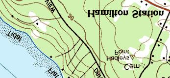
ME DOT Route 3. File No.: City and State: Bar Harbor, ME
|
|
|
- Corey Lynch
- 5 years ago
- Views:
Transcription
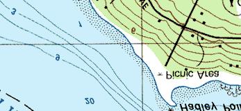
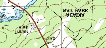
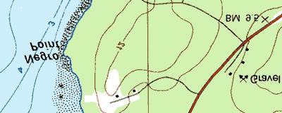
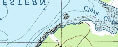
1 ME DOT Route 3 File No.: City and State: Bar Harbor, ME General Impacts: 0.28 acre tidal emergent 0.77 acre non-tidal forested 0.15 acre non-tidal emergent 0.51 acre non-tidal scrub-shrub Functions and Values Lost: (From EA/SOF) Floodflow Alteration Water Quality Maintenance Wildlife Habitat Fish Habitat Production Export Shoreline Stabilization Visual Quality/Aesthetics Recreation Year(s) Mitigation Constructed: May 1998 Size and Type of Mitigation as Proposed: 17 acres preserved 0.4 acre tidal emergent Proposed Functions and Values of Mitigation: (from database) Aesthetics Floodflow Alteration Nutrient Removal Production Export Recreation Shore Stabilization Sediment Retention Wildlife Habitat Mitigation Special Condition(s): 3. The permittee shall implement a mitigation plan to compensate for the project s impact to 1.7 acres of wetlands. The preliminary details of this plan are described in the document entitled Preliminary Wetland Mitigation Plan Route 3 Bar Harbor, Maine, MDOT PIN , dated January This plan, targeting water quality maintenance, floodflow alteration, and wildlife habitat functions, involves the restoration/creation of approximately 0.4 acre of salt marsh, the preservation of
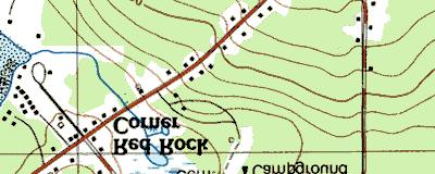
2 approximately 1.3 acres of tidal and freshwater wetland; and the preservation of approximately 16 acres of freshwater wetlands. 4. In accordance with the schedule contained in the mitigation plan and before construction at the mitigation sites, the permittee shall provide the Corps with a final mitigation plan. This plan is subject to review and approval by the Corps. The plan shall include but not be limited to narratives and final construction plans providing information on wetland species planting locations and densities, predicted ground and surface water levels, rational for hydrologic predictions, and existing/proposed soil conditions. The plan shall also include monitoring and reporting schedules, remediation plans, groundwater monitoring plans, inspection schedules, photographic records, and wildlife species observations. 5. In accordance with the schedule in the mitigation plan, plantings which have died or appear to be in poor health shall be replaced according to the remediation plan or any recommendations that have been approved in writing by the Corps of Engineers. Other remedial actions coordinated with the Corps shall occur at the first environmentally appropriate time. If any specimens of Phragmites sp. or Purple Loosestrife (Lythrum salicaia) appear in the Jones Marsh site during the monitoring period within areas disturbed by the construction activities, the permittee shall inform the Corps of Engineers. In coordination with the Corps, the permittee shall develop a plan and submit it to the Corps to eradicate those species from the affected areas. 6. The mitigation sites described in condition 3 above shall be protected in perpetuity from future development following construction. Remediation and monitoring efforts by the permittee shall be authorized in the Jones Marsh site; however, no other filling, clearing, or other disturbance is authorized. The mitigation areas shall be protected by covenants and restrictions. The permittee shall provide documentary evidence sufficient to verify placement of the covenants and restrictions. This evidence shall be provided to the Corps within ninety (90) days of acquisition in the case of the Fresh Meadow Marsh site and within ninety (90) days of construction completion in the case of the Jones Marsh and Northeast Creek sites. Remarks: None Directions: Take I-95 north to Bangor, Maine. Then take exit 45A, I-395 east. Take exit 6A, US-1A east towards Ellsworth. In Ellworth, US-1A ends at Route 1. Go east a short distance to Route 3 towards Bar Harbor. Follow Route 3 through Trenton and cross the bridge onto Mount Desert Island. Site is on the right side of the road about a mile from the bridge.
3 Street Atlas USA DeLorme. Street Atlas USA MN (18.0 W) TN Scale 1 : 14, ft m 1" = 1240 ft

 1997,")

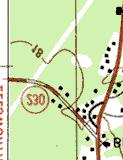
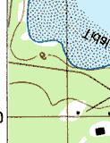
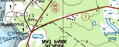
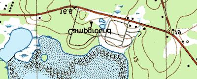


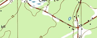
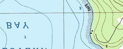
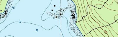
4 ME DOT, Route 3 Copyright (C) 1997, Maptech, Inc.
5 MITIGATION SITE FIELD DATA FORM Site Name: MEDOT Route 3 File No City/Town: Bar Harbor State: ME Waterbody: tidal Monitor(s): Ruth Ladd, Keith Wright Date: Was site constructed? yes Is site wetland? yes Size of proposed wetland: 0.4 acre Actual size of wetland: about the same Landscape position: tidal Lat/Long Points: N W Saved GPS Waypoint name: RT3 GPS Tracking Log Name: N/A Perimeter: TBD Surrounding land use: Tidal marsh, highway Is wetland function compromised by surrounding land use? The highway may contribute pollutants while deterring wildlife use. Plants: Atriplex patula Glaux maritima Juncus balticus Juncus gerardii Limonium carolinianum Plantago maritima Poaceae sp. Potentilla anserina Salicornia sp. Scirpus robustus? Solidago sempervirens Spartina alterniflora Spartina cynosuroides Spartina patens Suaeda sp. Triglochin maritimum Plant health: Good Invasive species: None observed. Wildlife use: Crab holes and small fish were observed. Page 1 of 2
6 Soils Data: Soils data not collected at this site. Sketch approximate mitigation site, noting areas and types of wetlands, waters, other features, landscape position, landmarks, etc., and data and photo point(s) See file. Overall Description of site: This site is a tidal marsh adjacent to Route 3, easily identified by the large snag sticking up in the middle and powerlines off in the distance stretching across a natural salt marsh. The site has a 95% cover of a Juncus sp. and 5% Spartina alterniflora. The principle functions of this site are soil stabilization and nutrient export. The soils for this site were saturated and/or inundated during low tide. Hydrology is fed by a tidal ditch. Comments, problems, recommendations: Crown vetch has taken over the enhancement plantings associated with this site. A bare patch 8 x 30 feet exists where plantings did not survive. Page 2 of 2
7
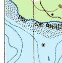
8 ME DOT Route ~0.3 ac yes no no N W tidal wetland and road 10 feet Ladd 8/12/02 EEM 75% no low (tidal) 1 (?) tidal marsh source of sediment and toxicants (road) water flow is diffuse detritus development, tidal flushing occurs sediment stabilization with generally dense herbaceous vegetation associated with large tidal system easily viewed from road with backdrop of large expanse of forested upland. and wetland and large salt marsh none known


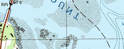
9 MEDOT Route 3 Bar Harbor, ME 8/12/02 Looking southeast, south, and southwest from the road towards the eastern end of the site. Site extends approximately to the dark spot in the upper center of the photo. Looking southeast, south, and southwest from the road towards the western end of the site. Creek is in the foreground. Looking northwest and north from the south side of the site.


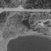
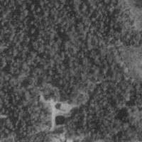


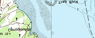
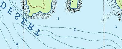
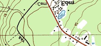
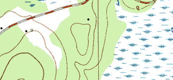
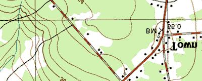
10 3 km SW of Eden, Maine, United States 14 May 1996 Image courtesy of the U.S. Geological Survey 2002 Microsoft Corporation. All rights reserved.
Caler Cove Lobster Company
 File No.: 199800920 City and State: Addison, ME Caler Cove Lobster Company General Impacts: 0.17 acre tidal emergent Functions and Values Lost: Production Export Nutrient Exchange Sediment Filtration Fishery
Syfeld Keene Associates
 Syfeld Keene Associates File No.: 198100675 City and State: Keene, NH General Impacts: 9.8 acres PSS/PFO/PEM (permit states most of 13 acre site ) Functions and Values Lost: Floodflow alteration (only
Polpis Bike Path. General Impacts: 1.47 acres forested, marsh, shrub swamp
 Polpis Bike Path File No.: 199201570 City and State: Nantucket, MA General Impacts: 1.47 acres forested, marsh, shrub swamp Functions and Values Lost: (from EA/SOF) Floodflow Alteration Groundwater Discharge
Southern Auto Sales, Inc.
 Southern Auto Sales, Inc. File No.: 199700775 City and State: East Windsor, CT General Impacts: 3.8 acres forested Functions and Values Lost: (From EA/SOF) Wildlife Habitat Year(s) Mitigation Constructed:
Hunts Point Landing, Bronx, New York
 Hunts Point Landing, Bronx, New York Sustainable Shorelines in an Urban Environment John Roebig, PhD. HDR Engineering, Inc. John.Roebig@hdrinc.com Promoting Resilient Shorelines along the Hudson River
Woolley and Lee Properties Choctawhatchee Bay, Walton County. SAJ IP-AWP, issued 3/3/08
 LIVE OAK PENINSULA MITIGATION FIRST ANNUAL MONITORING REPORT Woolley and Lee Properties Choctawhatchee Bay, Walton County SAJ-2007-1175 IP-AWP, issued 3/3/08 Impact: US 331 (US 98 to Choctawhatchee Bay)
Planning for Staten. Habitat Restoration and Green Infrastructure. Island s North Shore
 Habitat Restoration and Green Infrastructure Planning for Staten Island s North Shore Community Board 1 March 1, 2018 NYC Parks Forestry, Horticulture, and Natural Resources Funded by the NYS Department
Wisconsin Dept. of Transportation November 2017
 Wisconsin Dept. of Transportation November 2017 Jennifer Gibson WisDOT Environmental Coordinator Mike Helmrick WisDOT Environmental Coordinator Background on compensatory wetland mitigation Site purpose
Information for File # JTF
 Information for File # 2013-04665-JTF Applicant Corps Contact Enbridge Energy, Limited Partnership Josh Fitzpatrick Address 1554 Highway 2, Suite 2, Two Harbors, MN 55616 E-Mail joshua.t.fitzpatrick@usace.army.mil
Karen A. Duhring Marine Advisory Scientist Center for Coastal Resources Management Virginia Institute of Marine Science College of William & Mary
 Karen A. Duhring Marine Advisory Scientist Center for Coastal Resources Management Virginia Institute of Marine Science College of William & Mary March 20, 2009 Low-Impact Shoreline Stabilization Cumulative
ENBRIDGE GAS DISTRIBUTION INC. Proposed Relocation for Ninth Line, Markham and Whitchurch-Stouffville. Environmental Screening Report
 Page 1 of 18 ENBRIDGE GAS DISTRIBUTION INC. Proposed Relocation for Ninth Line, Markham and Whitchurch-Stouffville Environmental Screening Report July 2011 Page 2 of 18 Table of Contents 1.0 INTRODUCTION
Tentatively Selected Plan within Harlem River, East River and Western Long Island Sound Planning Region. First Level Costs. Federal Non-Federal Total
 HARLEM RIVER, EAST RIVER AND WESTERN LONG ISLAND SOUND PLANNING REGION Flushing Bay and Creek Ecosystem Restoration Source Feasibility Study Background Study Resolution (1994), Reconnaissance Report (1996),
Information for File MMJ Main Stem Bassett Creek Restoration Project
 Information for File 2013-03866-MMJ Main Stem Bassett Creek Restoration Project Applicant: Minneapolis Park and Recreation Board (MPRB) Corps Contact: Melissa Jenny Address: Corps of Engineers, St. Paul
Triangle Land Conservancy Conservation Area Monitoring Report Carolina North
 Triangle Land Conservancy Conservation Area Monitoring Report Carolina North Property Name: Bolin Creek West Conservation Area Date of visit: April 11, 2018 County: Orange Property Type: Restrictive Covenants
Triangle Land Conservancy Conservation Area Monitoring Report Carolina North
 Triangle Land Conservancy Conservation Area Monitoring Report Carolina North Property Name: Bolin Creek West Conservation Area Date of visit: 2.18.13, 2.18.13, 3.13.13, and 6.10.13 County: Orange Property
MITIGATION MANAGEMENT AND MONITORING PLAN BAYFRONT PARK WETLAND RESTORATION MILL VALLEY, CA
 MITIGATION MANAGEMENT AND MONITORING PLAN BAYFRONT PARK WETLAND RESTORATION MILL VALLEY, CA PREPARED FOR: THE CITY OF MILL VALLEY PARKS AND RECREATION DEPARTMENT 180 CAMINO ALTO AVENUE MILL VALLEY, CA
PURPOSE: The purpose is to provide commercial facilities in the Vancouver and Clark County vicinity.
 US Army Corps of Engineers Seattle District Joint Public Notice Application for a Department of the Army Permit and a Washington Department of Ecology Water Quality Certification and/or Coastal Zone Management
Stormwater Standards. Clackamas County Service District No. 1. Planting Guide for Buffers
 Stormwater Standards Clackamas County Service District No. 1 APPENDIX B Planting Guide for Buffers Table of Contents Appendix B - Planting Guide for Buffers... Page B.1 General... 1 B.1.1 Introduction...
319 Grant: Baker Creek & Centenary Creek Restoration Initiative
 319 Grant: Baker Creek & Centenary Creek Restoration Initiative Objectives: Overview of Watershed Characteristics: Discussion of Project Tasks: Discussion of Watershed Management Plan: Presented by: Erich
April 11, 2016 Park Board Chair and Commissioners General Manager Vancouver Board of Parks and Recreation New Brighton Salt Marsh - Preferred Concept
 TO: FROM: SUBJECT: April 11, 2016 Park Board Chair and Commissioners General Manager Vancouver Board of Parks and Recreation New Brighton Salt Marsh - Preferred Concept RECOMMENDATION A. THAT the Vancouver
North Carolina Coastal Federation
 North Carolina Coastal Federation Erosion Control: Non-Structural Alternatives A Shorefront Property Owner s Guide Shoreline erosion and landward migration of marshes are natural processes, and are important
Information for File MVP MMJ; CSAH 10 Reconstruction (Waconia and Watertown Townships)
") Information for File MVP-2014-03830-MMJ; Reconstruction (Waconia and Watertown Townships) Applicant: Carver County Corps Contact: Melissa Jenny Address: 180 Fifth Street East, Suite 700, St. Paul, MN 55101
Information for File MVP-2014-03830-MMJ; Reconstruction (Waconia and Watertown Townships) Applicant: Carver County Corps Contact: Melissa Jenny Address: 180 Fifth Street East, Suite 700, St. Paul, MN 55101
I-494 Rehabilitation Project SP (I-394 to Fish Lake Interchange) June 2014 Section 4(f) De Minimis Determination
 June 2014 Section 4(f) De Minimis Determination") I-494 Rehabilitation Project SP 2785-330 (I-394 to Fish Lake Interchange) June 2014 Section 4(f) De Minimis Determination State Project Number 2785-330 Federal Project No. NHPP-I494 (002) Trunk Highway:
I-494 Rehabilitation Project SP 2785-330 (I-394 to Fish Lake Interchange) June 2014 Section 4(f) De Minimis Determination State Project Number 2785-330 Federal Project No. NHPP-I494 (002) Trunk Highway:
Basic Information: Vernal Pool Systems
 Basic Information: Assessment Area Name: Project Name: Assessment Area ID #: Project ID #: Assessment Team Members for This AA Date: AA Location: Latitude: Longitude: Datum: Wetland Category: Natural Constructed
17 Jul 2002 PUBLIC NOTICE
 17 Jul 2002 Regulatory Branch PUBLIC NOTICE ------------- 1. Pursuant to Code of Federal Regulations 33 CFR 325.2(a)(8), the Chicago District issued permits or other approvals, withdrawals, appeals or
INTER-AGENCY COORDINATION MEETING
 Virginia Department of Transportation INTER-AGENCY COORDINATION MEETING Joint Permit Application DEQ COE VMRC I. VDOT PROJECT INFORMATION PERMIT #: PRE-APP#: Route: VDOT Project Number: City/County: Contract
Triangle Land Conservancy Conservation Area Monitoring Report Carolina North
 Triangle Land Conservancy Conservation Area Monitoring Report Carolina North Property Name: Bolin Creek West Conservation Area Date of first visit: 3.12.14 County: Orange Date of second visit: 6.5.14 Property
7.0 SOCIAL, ECONOMIC, AND ENVIRONMENTAL ISSUES
 7.0 SOCIAL, ECONOMIC, AND ENVIRONMENTAL ISSUES The following list of social, economic, and environmental issues have been identified based on a preliminary inventory of resources in the project area, an
 CRC-VR-15-04 RELEVANT STATUTES OR RULES ATTACHMENT A 15A NCAC 07H.0205 COASTAL WETLANDS (a) Description. Coastal wetlands are defined as any salt marsh or other marsh subject to regular or occasional flooding
MEMORANDUM OF BOG TURTLE HABITAT INVESTIGATION
 MEMORANDUM OF BOG TURTLE HABITAT INVESTIGATION 410-728-2900 Fax: 410-728-3160 www.rkk.com To: From: CC: U.S. Fish and Wildlife Service, Pennsylvania Fish and Boat Commission Jennifer A Ottenberg Miller,
NOTICE OF PREPARATION
 NOTICE OF PREPARATION DATE: January 6, 2016 TO: LEAD AGENCY: Responsible Agencies, Organizations, and Interested Parties Contact: Tyler Barrington, Principal Planner Planning Department Community Development
March 31, PENNDOT District Geerdes Road King of Prussia, PA Attn: Mr. Lawrence J. Link, P.E. Dear Mr. Link:
 March 31, 2002 PENNDOT District 6-0 7000 Geerdes Road King of Prussia, PA 17406 Attn: Mr. Lawrence J. Link, P.E. Re: S.R. 4005 and 4007, Sections 15P & 15B Germantown Avenue Reconstruction Project Letter
Biodiversity Conservation
 Biodiversity Conservation and Site Plan Review Biodiversity conservation principles Threats to biodiversity Location of development Reviewing site plans Lunch Reviewing site plans (continued) LEED and
VIRGINIA BEACH TRANSIT EXTENSION STUDY
 Dra Environmental Impact Statement VIRGINIA BEACH TRANSIT EXTENSION STUDY Appendix M Iden fica on Technical Report February 2015 Cover image: courtesy of the City of Virginia Beach February 2015 TABLE
DRAFT MAP AMENDMENT FLU 04-4
 DRAFT MAP AMENDMENT FLU 04-4 SW 24 TH AVENUE ROADWAY CORRIDOR The University of Florida participates with the Metropolitan Transportation Planning Organization (MTPO) in its responsibilities for the continuing,
ELIGIBILITY CRITERIA CHECKLIST OPEN SPACE CLASSIFICATION
 THURSTON COUNTY DEVELOPMENT SERVICES OPEN SPACE TAX PROGRAM ELIGIBILITY CRITERIA CHECKLIST OPEN SPACE CLASSIFICATION Use this checklist to help you determine whether your property is eligible for open
Restoring Water Ecosystems in NYC Parks
 Restoring Water Ecosystems in NYC Parks Hooked on our Waters Con October 19, 2013 - CUNY Graduate Center Marit Larson NYC Parks Landscape and ecosystem focus Watershed Streams Freshwater wetlands Tidal
HAZARD MITIGATION GOALS AND OBJECTIVES
 SEWRPC Community Assistance Planning Report No. 282, 2nd Edition CITY OF MILWAUKEE ALL HAZARDS MITIGATION PLAN UPDATE Chapter IV HAZARD MITIGATION GOALS AND OBJECTIVES [NOTE: Throughout this plan update
TOWNSHIP OF LOGAN SOIL & FILL IMPORTATION AND PLACEMENT APPLICATION SUBMITTAL CHECKLIST
 TOWNSHIP OF LOGAN SOIL & FILL IMPORTATION AND PLACEMENT APPLICATION SUBMITTAL CHECKLIST Applications: 5 copies of application - Applicant will reproduce the copies at his/her costs. The Township Clerk
Is a Riparian Restoration Still Viable After 100-year Storm Events Alter the Original Design?
 Is a Riparian Restoration Still Viable After 100-year Storm Events Alter the Original Design? Sarah Spear Cooke, Ph.D. Seattle, Washington Presentation Outline Introduction The site pre-restoration Restoration
Information for File # ARC
 Information for File # 2016-02630-ARC Applicant Corps Contact Will Bomier-Carlton County Transportation Department Andrew R Chambers Address 600 South Lake Avenue, Suite 211, Duluth, MN 55802 E-Mail Andrew.R.Chambers@usace.army.mil
5.0 Storm Water Landscape Guidance Introduction
 5.0 Storm Water Landscape Guidance Introduction Landscaping is a critical element to improve both the function and appearance of storm water management practices. Integrated storm water landscapes can
Information for File #MVP DAS
 Information for File #MVP201702209DAS Applicant: HyVee, Inc. Corps Contact: David Studenski Address: 1114 South Oak Street, La Crescent, Minnesota 559471560 EMail: david.a.studenski@usace.army.mil Phone:
Towne Park Estates Subdivision Phase II
 Towne Park Estates Subdivision Phase II ENVIRONMENTAL NARRATIVE October 21, 2014 Submitted to: Submitted by: Horner Environmental Professionals, Inc. 4252 Hay Road Lutz, Florida 33559 HEP TOWNE PARK ESTATES
Study Area Map. Wasatch Hollow Open Space Restoration, Use, & Management Plan. Legend. Harrison Ave East. Roosevelt East.
 Harrison Ave Roosevelt Emerson «4 «5 Rosecrest 1900 East «3 1800 East Wasatch Hollow Open Space Restoration, Use, & Management Plan Study Area Map Legend «2 «1 Potential Access Location Emigration Creek
STREAM BUFFERS
 88-415 STREAM BUFFERS 88-415-01 PURPOSE In the Kansas City region and throughout the nation, vegetated stream buffers have been clearly shown to protect stream stability and related infrastructure, improve
Information for File # ARC
 Information for File # 2017-03115-ARC Applicant Consultant Corps Contact Bob Manzoline St. Louis and Lake Counties Regional Rail Authority Natalie White Short Elliot Hendrickson (SEH) Inc. Andrew R Chambers
City of Surrey Ecosystem Management Study. Integration of ecological processes with land use
 City of Surrey Ecosystem Management Study Integration of ecological processes with land use Natural areas in Surrey are changing as the City grows and evolves. Many important natural areas remain or may
1/21/2014. Definitions vary widely Legal vs. functional Not always obvious. Wetlands are legally protected by Clean Water Act (1972)
") What is a Wetland? Freshwater Wetlands of Gulf Coast Plains Definitions vary widely Legal vs. functional Not always obvious What is a Wetland? Wetlands are legally protected by Clean Water Act (1972) Corps
What is a Wetland? Freshwater Wetlands of Gulf Coast Plains Definitions vary widely Legal vs. functional Not always obvious What is a Wetland? Wetlands are legally protected by Clean Water Act (1972) Corps
Old Mill Community Association Bioretention Facility
 Project Overview This project will install a bioretention facility in a community recreation area owned by the Old Mill Community Association, Inc. Drainage from the area is currently unmanaged and has
New Brighton Park Shoreline Habitat Restoration Project
 Vancouver Board of Parks and Recreation and Port Metro Vancouver New Brighton Park Shoreline Habitat Restoration Project Conceptual Design Public Consultation August 26 September 9, 2015 Discussion Paper
Information for File # MMJ; Methodist Hospital Flood Storage Mitigation and Wetland Enhancement Project
 Information for File # 2016-01223-MMJ; Methodist Hospital Flood Storage Mitigation and Wetland Enhancement Project Applicant: Park Nicollet, Attn: Robert Riesselman Corps Contact: Melissa Jenny Address:
-MENDOCINO COUNTY COASTAL ELEMENT-
 APPENDIX 8 -- CALIFORNIA COASTAL COMMISSION STATEWIDE INTERPRETIVE GUIDELINES (5-5-81) APPENDIX D. TECHNICAL CRITERIA FOR IDENTIFYING AND MAPPING WETLANDS AND OTHER WET ENVIRONMENTALLY SENSITIVE HABITAT
Jack Creek Park Capital Improvement Project
 Jack Creek Park Capital Improvement Project Public Information Meeting October 2, 2017 Consultants & Designers, Inc. Integrating Engineering and Environment 7455 New Ridge Road, Suite T Phone: (410) 694-9401
O l so n M e morial Highway, S t e , G o l d e n V a l l e y, MN Delano Laketown Homes Concept Plan
 N O R T H W E S T A S S O C I A T E D C O N S U L T A N T S, I N C. 4 1 5 0 O l so n M e morial Highway, S t e. 3 2 0, G o l d e n V a l l e y, MN 5 5 4 2 2 T e l e p h o n e : 7 6 3. 9 5 7. 1 1 0 0 W
Be Water Wise Rainwater Conservation
 Be Water Wise Rainwater Conservation Rain barrel Workshop May 19 th - White Marsh Township Michael A. Zeock- White Marsh Township Chris Gowen- McNeil CSP Laura Whalen- Partnership for DE Estuary Delaware
PUBLIC NOTICE. us Anny Corps CENAE-R-A FILE NO. NAE
 CENAE-R-A FILE NO. NAE-2007-02926 PUBLIC NOTICE us Anny Corps of Engineers s. New England District 696 Virginia Road Concord, MA 01742-2751 Comment Period Begins: January 15, 2019 Comment Period Ends:
Envision Sustainable Infrastructure
 Envision Sustainable Infrastructure Marshview Park Allyson Monsour, PE, ENV SP, LEED Green Associate Marshview Park MARSHVIEW HAMPTON ROADS 1 Marshview Park Marshview History 2 Marshview Zoning Marshview
JOINT PUBLIC NOTICE. 26 June United States Army Corps of Engineers State of Louisiana
 JOINT PUBLIC NOTICE 26 June 2017 United States Army Corps of Engineers State of Louisiana New Orleans District Department of Environmental Quality Regulatory Branch Office of Environmental Services 7400
Wisconsin NRCS Direct Volume Method Bank Recession Rate Categorizations
 2 Executive Summary The City of Ramsey contracted the Anoka Conservation District to complete an inventory of riverbank condition along the entire 5.8 miles of City that border the Mississippi River. The
City of Surrey Ecosystem Management Study. Integration of ecological processes with land use
 City of Surrey Ecosystem Management Study Integration of ecological processes with land use Natural areas in Surrey are changing as the City grows and evolves. Many important natural areas remain or may
Storm Water Quality and Shoreline Restoration Improvements - Grant Funding Request City of Mound Carlson Park Bolton & Menk Project No.
 September 15, 2016 Brett Eidem Cost Share Grant Administrator Minnehaha Creek Watershed District 15320 Minnetonka Boulevard Minnetonka, MN 55345 RE: Storm Water Quality and Shoreline Restoration Improvements
Local Planning to Advance Implementation of Living Shorelines at Municipal Properties
 Local Planning to Advance Implementation of Living Shorelines at Municipal Properties SALEM LIVING SHORELINE PROJECT CZM Green Infrastructure for Coastal Resilience Grant COLLINS COVE LIVING SHORELINE
We d like to thank you for attending this Wekiva Parkway Section 8 Preliminary Design Update hosted by the Florida Department of Transportation.
 We d like to thank you for attending this Wekiva Parkway Section 8 Preliminary Design Update hosted by the Florida Department of Transportation. We will provide you information on the overall project and
Commercial Launch Site Addendum to Wetland Mitigation Plan. Revision 2. April 25, SpaceX Proprietary
 Commercial Launch Site Addendum to Wetland Mitigation Plan Revision 2 April 25, 2017 SpaceX Proprietary Contents 1.0 Project Information... 1 1.1 Background... 1 2.0 Compensatory Mitigation... 2 2.1 Goals
Kevin M. Rampe, President -- Lower Manhattan Development Corporation
 For Internal Use Only: Date Received: WRP no. DOS no. NEW YORK CITY WATERFRONT REVITALIZATION PROGRAM Consistency Assessment Form Proposed actions that are subject to CEQR, ULURP or other local, state
Planning for Staten. Habitat Restoration and Green Infrastructure. Island s North Shore
 Habitat Restoration and Green Infrastructure Planning for Staten Island s North Shore Walker Park December 7, 2017 NYC Parks Forestry, Horticulture, and Natural Resources Funded by the NYS Department of
Riverview Road Fort Washington, MD. 163 Waterfront Street, Suite #450 National Harbor, MD (301)
") Riverview Road Fort Washington, MD 163 Waterfront Street, Suite #450 National Harbor, MD 20745 (301) 750-7040 www.fleurdelisllc.com 1 Prepared by Monique Anderson Walker Principal +1 301-750-7040 Monique@FleurDeLisLLC.com
Riverview Road Fort Washington, MD 163 Waterfront Street, Suite #450 National Harbor, MD 20745 (301) 750-7040 www.fleurdelisllc.com 1 Prepared by Monique Anderson Walker Principal +1 301-750-7040 Monique@FleurDeLisLLC.com
PLANT LIST FOR SHORELINE MANAGEMENT
 SHORELINE EVALUATION PROGRAM PLANT LIST FOR SHORELINE MANAGEMENT Following is a list of native s recommended for shoreline management. This list is not comprehensive. Rather, it lists s that are known
Section 1 TABLE OF CONTENTS
 Section 1 TABLE OF CONTENTS... [M]ineral fertilizer is essential to feed around half of the world s population, and will be fundamental to ensure global food security through the 21 st century. 2013 U.N.
Information for File # ARC
 Information for File # 2015-02781-ARC Applicant Corps Contact Enbridge Energy, Limited Partnership Andrew R Chambers Address 600 South Lake Avenue, Suite 211, Duluth, MN 55802 E-Mail Andrew.R.Chambers@usace.army.mil
Key elements : Filter Strips must be designed within parameters required by the Fort Wayne s Development Standards/Criteria Manual.
 4.4. Filter Strips Filter Strips are densely vegetated lands that treat sheet flow storm water from adjacent pervious and impervious areas. They function by slowing runoff, trapping sediment and pollutants,
Riggs Brook Mitigation Site, Augusta
 MAINE DEPARTMENT OF TRANSPORTATION 2006 POST-CONSTRUCTION MONITORING REPORT: Riggs Brook Mitigation Site, Augusta (MDOT PIN 556.47) Year 3 of 5 Compensation for Augusta Third Bridge Project, Augusta (MDOT
Peninsular Florida Landscape Conservation Cooperative. Marine and Estuarine Priority Resources and Conservation Targets
 Peninsular Florida Landscape Conservation Cooperative Marine and Estuarine Priority Resources and Conservation Targets Why are we here today? Workshop Goals: Develop a list of potential conservation targets
Wetlands Board Hearing Procedures
 Wetlands Board Hearing Procedures The Virginia Beach Wetlands Public Hearing is held at 10:00am in the Council Chamber of the City Hall Building, Municipal Center. A staff briefing is held at 8:30am a.m.
Rule D Wetland and Creek Buffers
 Rule D Wetland and Creek Buffers 1 Policy It is the policy of the Board of Managers to ensure the preservation of the natural resources, recreational, habitat, water treatment and water storage functions
STORMWATER GREEN INFRASTRUCTURE AND PLANNING/ZONING BOARDS
 STORMWATER GREEN INFRASTRUCTURE AND PLANNING/ZONING BOARDS Source: Center for Watershed Protection, 2007 Southern Tier Central Regional Planning & Development Board Chemung County Stormwater Team OUTLINE
NORTH DISTRICT. Description
 VI plan and major recommendations district plans north disrict NORTH DISTRICT Description The North District comprises approximately 105 acres and is bounded by two important bio-habitats and corridors
GREEN SHEET ENVIRONMENTAL COMMITMENTS FOR THE IOWA HIGHWAY 100 EXTENSION
 County: Linn County, IA GREEN SHEET Location: IA 100, from its terminus at Edgewood Rd. to US 30 southwest of Cedar Rapids Route: IA 100 Extension Project No.: NHS-100-1(36) 19-57 OLE Project Managers:
A Landowner s Guide to Creating Woodland Pools for Amphibians and Other Wildlife
 Cornell Department of Natural Resources Conservation Education Program Fact Sheet Kristi L. Sullivan and Stephen J. Morreale A Landowner s Guide to Creating Woodland Pools for Amphibians and Other Wildlife
Section 3 Non-Structural BMPs
 3.1 Stream Buffers A stream buffer or stream setback is a designated area around a stream, lake, or wetland left in a natural, densely vegetated state so as to protect the receiving water quality and provide
SECTION 1 SITE DESCRIPTIONS
 SECTION 1 SITE DESCRIPTIONS 1.0 Introduction A resolution ofthe U.S. House ofrepresentatives Committee on Transportation and Infrastructure, dated April 15, 1999, identified environmental restoration within
peruviana (L.) HaraH & Ludwigia
 HaraH & Ludwigia") Managing Ludwigia peruviana (L.) HaraH & Ludwigia longifolia (DC) HaraH infestations in NSW: Progress and Prospects Dr. Nimal Chandrasena GHD Pty Ltd OUTLINE 1. The Invaders in Sydney and NSW, Australia
Managing Ludwigia peruviana (L.) HaraH & Ludwigia longifolia (DC) HaraH infestations in NSW: Progress and Prospects Dr. Nimal Chandrasena GHD Pty Ltd OUTLINE 1. The Invaders in Sydney and NSW, Australia
Blue/Green Infrastructure Study Accomack County, VA
 Blue/Green Infrastructure Study Accomack County, VA Draft Asset Maps March 8-9, 2010 Green Infrastructure Center, Inc. 2 Overview What is Green and Blue Infrastructure Project Timeline & Tasks Literature
APPROVED JURISDICTIONAL DETERMINATION FORM U.S. Army Corps of Engineers
 APPROVED JURISDICTIONAL DETERMINATION FORM U.S. Army Corps of Engineers This form should be completed by following the instructions provided in Section IV of the JD Form Instructional Guidebook. SECTION
Natural Shorelines. for Inland Lakes. A Landowner s Guide to using. to STABLIZE SHORELINES, Michigan s inland lakeshore.
 Natural Shorelines for Inland Lakes A Landowner s Guide to using NATURAL MATERIALS to STABLIZE SHORELINES, IMPROVE WATER QUALITY and ENHANCE WILDLIFE HABITAT along Michigan s inland lakeshore. Natural
Sherman Pass Project Post-Fire Treatment Scenery Report Barbara Jackson, Landscape Architect, 3/30/2016
 Sherman Pass Project Post-Fire Treatment Scenery Report Barbara Jackson, Landscape Architect, 3/30/2016 Introduction This report updates the 2015 Sherman Pass Project Scenery Report based on changes in
6Natural. Environment Development Permit Guidelines
 6Natural Bylaw 2600-2016, being "Official Community Plan Bylaw, 2016" Schedule "A" CITY OF ABBOTSFORD OFFICIAL COMMUNITY PLAN Environment Development Permit Guidelines Part V - 6-1 Area Subdivision or
Restoring Soil Ecology and Native Plant Communities in an Altered Salt Pond Ecotone
 Restoring Soil Ecology and Native Plant Communities in an Altered Salt Pond Ecotone Dylan Chapple Save The Bay/UC Berkeley dylanchapple@berkeley.edu 10/24/2012 Overview Eden Landing Ecological Reserve
Green Design Principles
 Green Design Principles restoration planting Ecosystem restoration, including preserving and enhancing existing vegetation and where feasible, introducing new vegetative communities, benefits the stream
ALTERNATIVE SHORELINE MANAGEMENT IN COASTAL MISSISSIPPI
 ALTERNATIVE SHORELINE MANAGEMENT IN COASTAL MISSISSIPPI Project supported via financial assistance provided by the Coastal Zone Management Act of 1972, as amended, administered by the Office of the Ocean
A. General Information
 Important: When filling out forms on the computer, use only the tab key to move your cursor - do not use the return key. Massachusetts Department of Environmental Protection A. General Information 1. Project
Wetland Types. Grade Level: Basic. Duration: 30 minutes. Setting: Classroom
 Wetland Types Adapted from: An original Creek Connections activity created by Cassandra Hamilton. Creek Connections, Box E, Allegheny College, Meadville, PA 16335 http://creekconnections.allegheny.edu
SITE SUMMARY REPORT Arlington Dump NONCD Yadkin County
 SITE SUMMARY REPORT Arlington Dump NONCD 0000644 Yadkin County Hurricane Recovery Act of 2005 State of North Carolina State Contract N06009S Schnabel Project No. 06210002.15 July 31, 2009 Prepared for:
Surrey Ecosystem Management Study
 Surrey Ecosystem Management Study Green Infrastructure Network Opportunities Public Open House & Information Session June 24 th, 2010 EMS Process Ecological Inventory Ecological Assessment Management Policy
Stormwater Management/Bioswale Design. A Forest Preserve District of Cook County/Illinois Tollway Cooperative Solution
 Stormwater Management/Bioswale Design A Forest Preserve District of Cook County/Illinois Tollway Cooperative Solution Today s Challenge: Implement Stormwater BMPs for linear projects, i.e. roads and streets
Northern Branch Corridor SDEIS March 2017
 Northern Branch Corridor SDEIS March 2017 15. 15.1. Chapter Overview 15.1.1. Introduction This chapter discusses changes to the Preferred Alternative resulting in the potential for project improvements
Boeckman Road Extension
 Boeckman Road Extension Providing Safe Passage for Wildlife and Maintaining Habitat Connectivity By Kerry Rappold, City of Wilsonville Leslie Bliss-Ketchum, Portland State University October 20, 2008 Presentation
CONSERVATION ELEMENT GOALS, OBJECTIVES, AND POLICIES
 CONSERVATION ELEMENT GOALS, OBJECTIVES, AND POLICIES Goal 4 To conserve, manage, appropriately use and protect the natural resources of the City ensuring continued resource availability and environmental
Information for File # SEK
 Information for File # Applicant: Dane County Corps Contact: Simone Kolb Address: 20711 Watertown Rd., Suite F, Waukesha, WI, 53186 E-Mail: simone.e.kolb@usace.army.mil Phone: 262-717-9539 Primary County: