Design and Construction Report
|
|
|
- Tiffany Mills
- 5 years ago
- Views:
Transcription


1 Design and Construction Report Detailed Design and Class Environmental Assessment Highway 401 Bridge Improvements City of Cambridge and City of Kitchener, Region of Waterloo Prepared for: Ministry of Transportation West Region G.W.P (Sub-Component of G.W.P ) July 2013
2 DESIGN AND CONSTRUCTION REPORT Highway 401 Bridge Improvements City of Cambridge and City of Kitchener, Region of Waterloo G.W.P (Sub-Component of G.W.P ) Prepared By: Tisha Doucette, B.Sc. (Hons.) Ecological Services Manager Delcan Corporation Teresa Fediw, P. Eng., PMP Project Engineer Delcan Corporation Reviewed by: Henry Huotari, P. Eng. Project Manager Delcan Corporation
3 THE PUBLIC RECORD Copies of this document have been sent to the following office of the Ministry of the Environment to be placed on the public record: Ministry of the Environment West Central Region 12 th Floor 119 King Street West Hamilton, Ontario L8P 4Y7 Copies of this document have also been sent to the following locations to be placed on the public record for review during regular business hours: Ministry of Transportation West Region First Floor - Main Lobby 659 Exeter Road London, Ontario Regional Municipality of Waterloo Office of the Clerk 150 Frederick Street, 2 nd Floor Kitchener, Ontario Cambridge City Hall Office of the Clerk 50 Dickson Street Cambridge, Ontario Preston Library 435 King Street East Cambridge, Ontario Kitchener City Hall Office of the Clerk 200 King Street West Kitchener, Ontario Ce document hautement spécialisé n est disponsible qu en anglais en vertue du règlement 411/97, qui en exempte l application de la Loi sur les services en français. Pour de l aide en français, veuillez communiquer avec le ministère des Transports, bureau des services en français au: ou
4
5 TABLE OF CONTENTS 1.0 Overview Introduction Summary Description of the Undertaking Purpose of this Report Consultation Process Study Notification External Agencies and Municipalities Stakeholders First Nations and Métis Engagement Public Information Centre Preparation and Release of the Design and Construction Report (DCR) Detailed Description of the Recommended Design Major Design Features Replacement of Fountain Street Bridge Replacement of Speedsville Road Bridge Rehabilitation of Highway 8 Eastbound on-ramp Bridge Guiderail and Roadside Safety Measure Upgrades Entrance Modifications Local Roads Detour Route Traffic Signals Construction Staging Utilities Property Environmental Issues and Commitments Aquatic Environment Water Quality and Erosion and Sediment Control Groundwater Resources Terrestrial Environment Wildlife and Wildlife Habitat Nesting Birds Vegetation and Vegetation Communities Social / Cultural Environment Recreational Resources Pedestrian Trails, Parks Archaeology and Cultural Resources Property Acquisition Management of Excess Materials Land use and Agricultural Resources Highway and Construction Noise / Vibration Air Quality Temporary Disruption of Traffic and Property Access Summary of Environmental Effects, Proposed Mitigation and Commitments to Further Work Monitoring References... 29
6 LIST OF FIGURES Figure 1 Study Limits Figure 2 Overview of Class EA Process for Group B Projects Figure 3 Proposed Fountain Street bridge cross-section Figure 4 - Proposed Speedsville Road bridge cross-section Figure 5 Proposed Highway west-to-east ramp bridge cross-section Figure 6 Local roads detour during nightly closures of Highway 401 Figure 7 Local roads detour during Speedsville Road bridge closure Figure 8 Local roads detour during Fountain Street bridge closure Figure 9 Alternate route during rehabilitation of the Highway 8 ramp bridge LIST OF TABLES Table 1 Study Schedule and Consultation Activities Table 2 Summary of Environmental Effects, Proposed Mitigation and Commitments to Further Work LIST OF APPENDICES Appendix A Ontario Government Notices Appendix B Agency and Public Correspondence Appendix C PIC Display Material Appendix D First Nations and Métis Engagement Appendix E General Arrangement Drawings
7 Design and Construction Report (DCR) Highway 401 Bridge Improvements G.W.P (sub-component of ) 1.0 Overview 1.1 Introduction A Highway 401 Planning and Preliminary Design Study was completed for Highway 401 from 0.5 km west of Regional Road 8 to 0.5 km east of Regional Road 24 / Hespeler Road. This study, MTO GWP , was initiated in A Transportation Environmental Study Report (TESR) was prepared to document the preliminary design study and was placed on the public record in June This document provided information on: the existing conditions of the study area; potential environmental effects of the proposed improvements; and the environmental assessment process that was followed leading to the selection of the preferred preliminary design alternatives. The study received environmental clearance to proceed with Detailed Design in October Short-term and mid to long-term improvements (beyond 2013) were identified in the TESR including: the replacement of the Speedsville Road structure; replacement of the Fountain Street (Regional Road 17) structure; and the rehabilitation of the Highway 8 West-to East ramp bridge. These improvements, including the Class EA process, are being documented in this report. Other improvements identified in the TESR include: widening Highway 401 from 6 to 10 lanes, plus speed change lanes; realigning / reconstructing interchange ramps at Highway 8 and at Regional Road 24 / Hespeler Road; rehabilitating/widening of railway overpasses; and various highway improvements such as high mast lighting, overhead signs and electronic message signs. In addition to these improvements identified in the TESR, the outside shoulders will be designed to allow bus by-pass when Highway 401 is congested. The Speed River bridges will also be replaced. These improvements are future work and will be addressed during a separate Class EA process and documented in a separate report. This report will be made available for public review. In the summer of 2010, the MTO retained Delcan Corporation to undertake the Detailed Design and Class Environmental Assessment for the Highway 401 Bridge Improvements, City of Cambridge and City of Kitchener, Region of Waterloo (GWP a subcomponent of GWP ). This Design and Construction Report (DCR) has been prepared in compliance with the requirements of the Class Environmental Assessment (EA) for Provincial Transportation Facilities (MTO 2000), which is an approved planning document under the Environmental Assessment Act. The goal of all projects and activities covered by the Class EA document is to provide a safe and effective transportation system while avoiding or minimizing negative environmental effects (MTO 2000). MTO s Class EA process is principle-based, meaning that the Class EA describes what must be achieved rather than identifying how it should be accomplished. Readers interested in more information regarding the principle-based approach of the Class EA process are encouraged to refer to the Class Environmental Assessment for Provincial Page 1 of 29
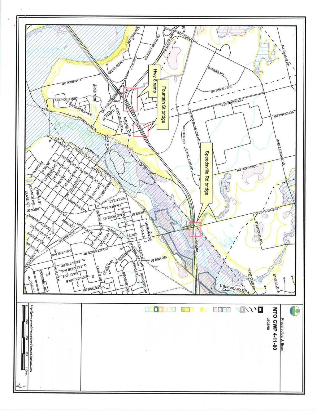
8 Design and Construction Report (DCR) Highway 401 Bridge Improvements G.W.P (sub-component of ) Transportation Facilities (MTO 2000) document, which can be viewed on MTO s website under the publications heading. This DCR documents the environmental assessment, detailed design, environmental mitigation and related construction methods and staging for the Highway 401 Bridge Improvements. The locations of the bridge improvements are shown in Figure 1. Additional background information for this project is contained in MTO s study file as well as the following supporting documents: Highway 401 Planning and Preliminary Design Study, Transportation and Environmental Study Report (URS, June 2006) Highway 401 Preliminary Design Report (URS, May 2010) Stage 1 Archaeological Resource Assessment (Archaeological Services Inc., December 2004) Stage 2 Archaeological Assessment (Archaeological Services Inc., June 2006) Drainage and Hydrology Report (URS, 2005, revised Sept. 2011) Highway 401 Bridge Improvements - Bird Nesting Assessment (Delcan, October 2011) Bridge Condition Survey Report: Highway 8 Eastbound Ramp Highway 401 Underpass, Site No (Golder, January 2012) Pavement Design Report Speedsville Road (Golder, January 2013) Pavement Design Report Fountain Street (Golder, January 2013) Foundation Investigation and Design Report Regional Road 17 / Fountain Street Underpass Site (Golder, February 2013) Foundation Investigation and Design Report Speedsville Road Underpass, Site (Golder, February 2013) Foundation Investigation and Design Report New Underground Utility (Golder, February 2013) Structural Design Report Site , Fountain Street Underpass Highway Structure Replacement (Delcan, April 2013) Structural Design Report Site , Highway 8 W-E Ramp Underpass Highway 401 Structure Replacement (Delcan, April 2013) Page 2 of 29
9 Design and Construction Report (DCR) Highway 401 Bridge Improvements G.W.P (sub-component of ) Structural Design Report Site , Speedsville Road Underpass Highway 401 Structure Replacement (Delcan, April 2013) Figure 1: Map showing the locations of the Speedsville Road and Fountain Street bridge replacements and the Highway 8 ramp bridge rehabilitation. Page 3 of 29
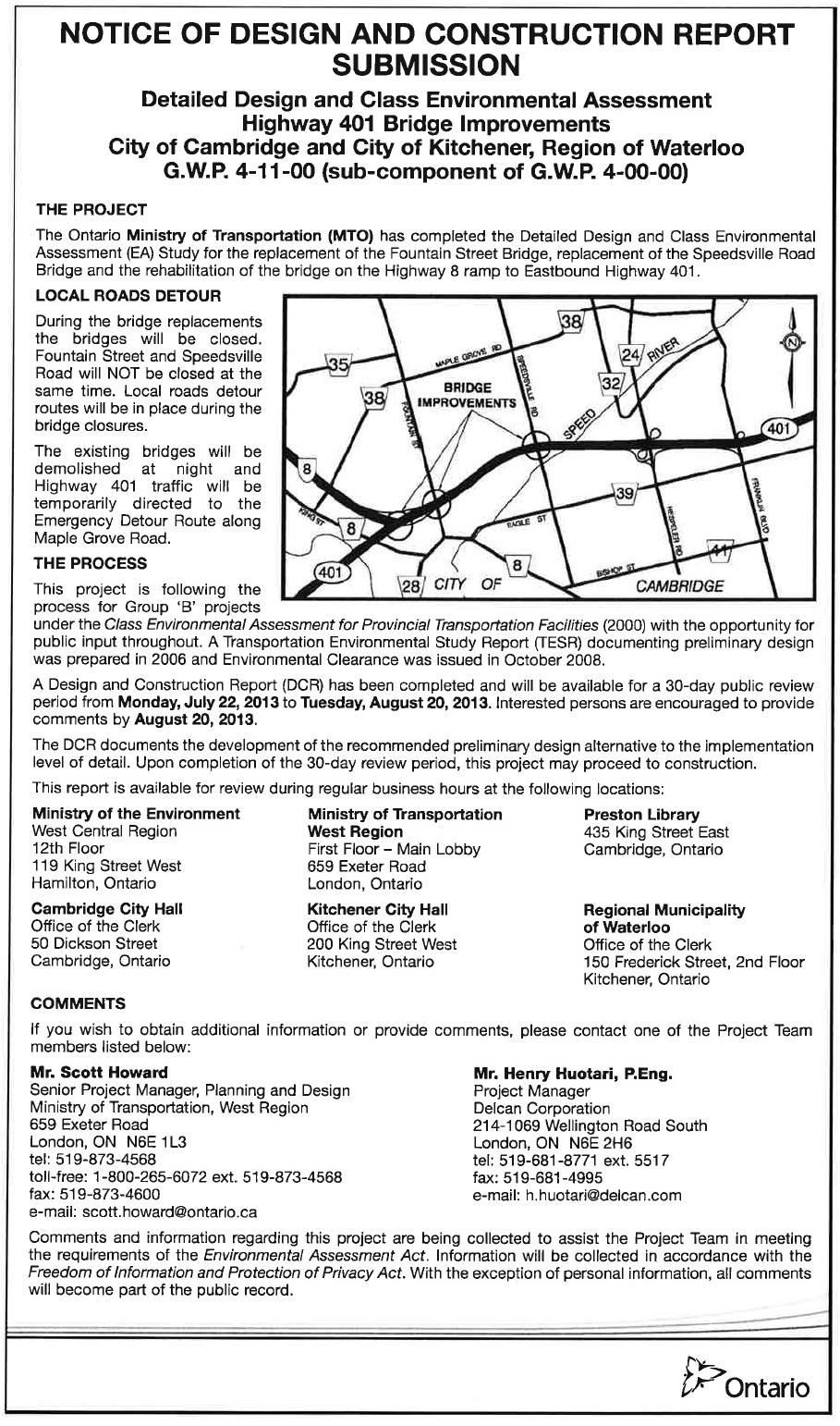
10 Design and Construction Report (DCR) Highway 401 Bridge Improvements G.W.P (sub-component of ) 1.2 Summary Description of the Undertaking The Highway 401 Bridge improvements include: Replacement of the Fountain Street bridge; Replacement of the Speedsville Road bridge; Rehabilitation of the Highway 8 ramp bridge to Eastbound Highway 401; and Extension of the Highway 401 Westbound off ramp to Highway 8 Westbound. Appropriate environmental protection and mitigation measures will be incorporated into the contract package to address potential environmental impacts described in this report. 1.3 Purpose of this Report This report documents the development of the detailed design of two bridge replacements and one bridge rehabilitation to the implementation level of detail and provides contract-specific design and construction staging information. The DCR also documents the following: Consultation with external agencies and the public during detailed design; First Nations and Métis engagement; Environmental issues, mitigation measures and commitments; Details on construction staging and local roads detour routes; and Compliance monitoring procedures during construction. The DCR will be placed on the public record on July 22, 2013 for a 30-day review period. At this time the public is encouraged to review this document and provide comments by August 20, The DCR is not eligible for Part II Order (bump-up) requests, in accordance with the Class EA. Upon completion of the 30-day review period, this project may proceed to construction. This project is classified as a Group "B" project. Group "B" projects are categorized as major improvements to existing facilities. The Class EA process for Group "B" projects is presented in Figure 2. Page 4 of 29

")
11 Figure 2: Diagram showing an overview of the Class Environmental Assessment (Class EA) Process.
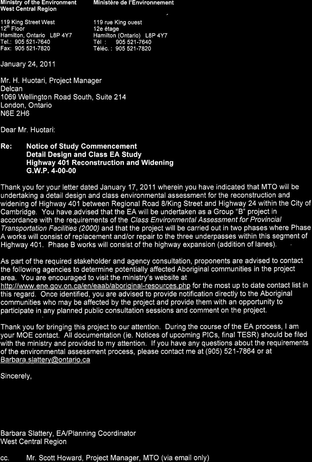
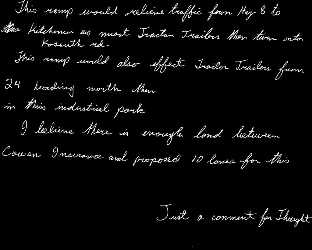
12 Design and Construction Report (DCR) Highway 401 Bridge Improvements G.W.P (sub-component of ) 2.0 Consultation Process In accordance with the Class EA process, external agencies, First Nations and Métis, stakeholders and the public were notified of the project by way of letters, and newspaper advertisements. All notification materials identified the key project team members including their contact information, and interested persons were encouraged to provide comments and concerns to the study team. Throughout the study, all interested parties that contacted the study team were added to the project mailing list. This list was maintained throughout both the preliminary and detail design phases of the study. The consultation plan was carried out in compliance with the requirements of a Group B Class EA project. The key components of the consultation plan included: Notices in local newspapers (study commencement, notice of Public Information Centre, Design and Construction Report Submission); Consultation with external agencies, municipalities, and directly impacted property owners; First Nations and Métis engagement; Public Information Center (PIC); and Release of the Design and Construction Report (DCR) for review. Copies of all newspaper notices are included in Appendix A. Agency and public correspondence is included in Appendix B. All PIC display material including the PIC bulletin is included in Appendix C. 2.1 Study Notification Communication with external agencies, First Nations and Métis, stakeholders and the general public has been continuous throughout the study. Table 2 summarizes the public notifications, the dates of the notice placement and the local and First Nation newspapers in which the notices were published. Page 6 of 29
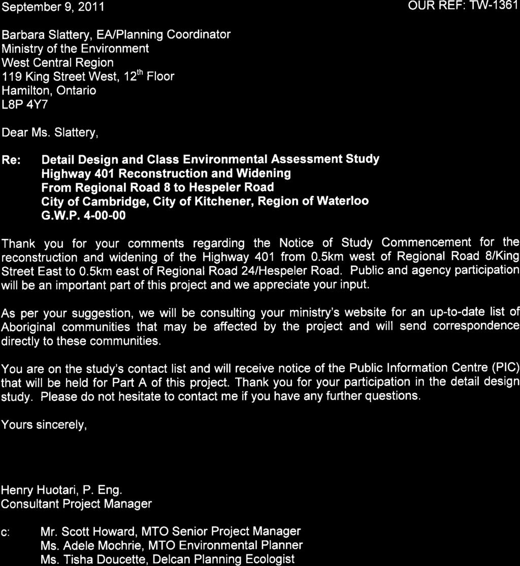
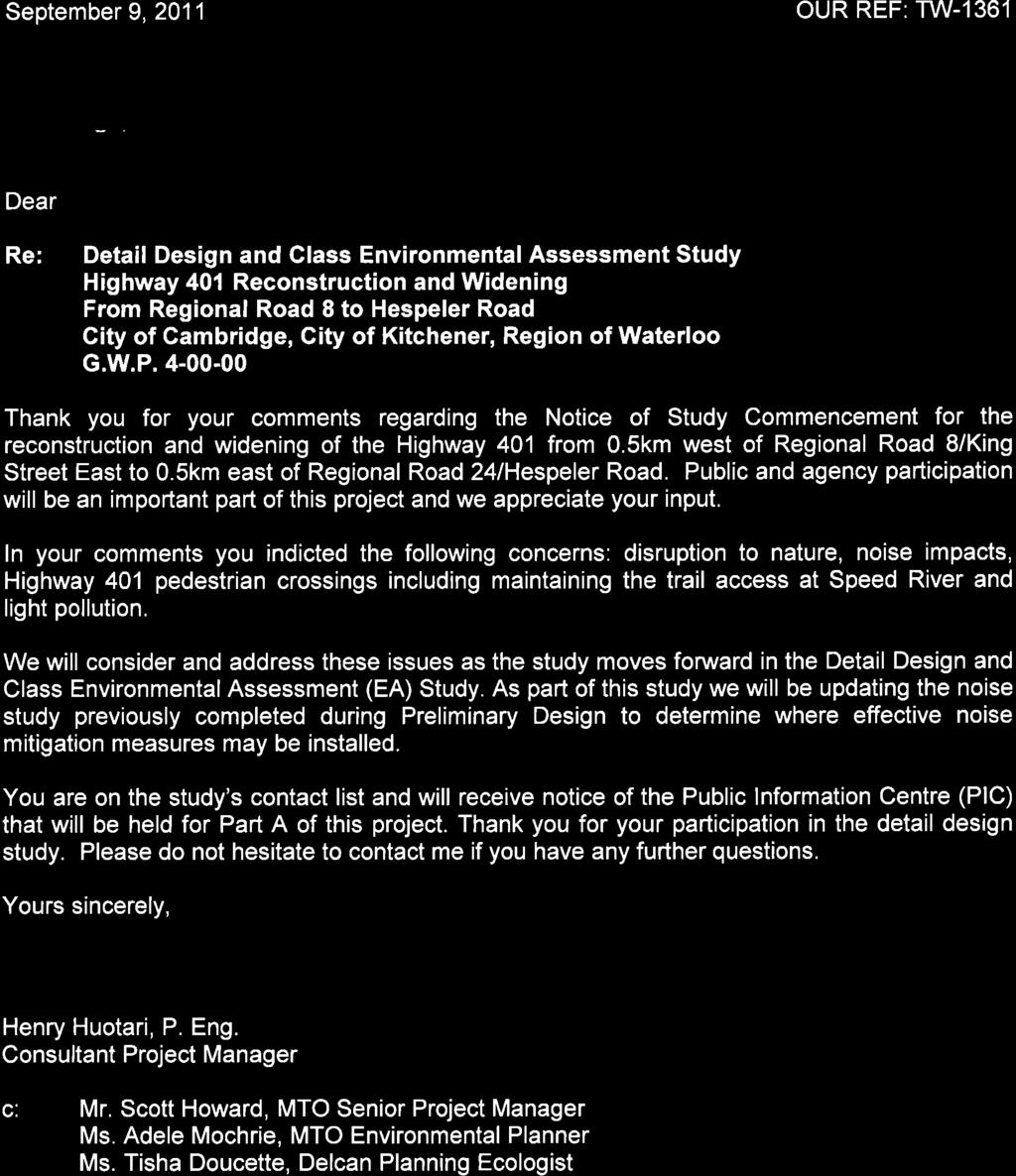
13 Design and Construction Report (DCR) Highway 401 Bridge Improvements G.W.P (sub-component of ) TABLE 1 - STUDY SCHEDULE AND CONSULTATION ACTIVITIES TASK / MILESTONE STUDY COMMENCEMENT Notice of Commencement of Detailed Design Initial Contact Letter SCHEDULE / MILESTONE DATE Placed in the Kitchener-Waterloo Record on January 22 nd and 26 th, 2011, and in the Cambridge Times on January 19 th and 25 th, Placed in the Tekawennake News and the Turtle Island News on January 19 th and 26 th, Delivered by hand to local residents on January 17 th, Issued to MPPs on January 12 th, 2011, and to external agencies/stakeholders on January 17 th, Issued to First Nations and Métis and on (January 17, 2011). Delivered by hand to local residents on January 17 th, PUBLIC INFORMATION CENTRE (PIC) Placed in The Waterloo Region Record on Saturday, May 4, 2013 and Wednesday, May 8, 2013; in the Cambridge Times on Tuesday, May 7, Notice of PIC 2013 and Friday, May 10, 2013; and in the Turtle Island News and Tekawennake News on Wednesday, May 1, 2013 and Wednesday, May 8, Issued to external agencies/stakeholders/first PIC Notification Letter Nations and Métis with Notice of PIC on May 1, Held May 16, 2013 at the Four Points Sheraton, PIC Cambridge Ontario. DESIGN AND CONSTRUCTION REPORT (DCR) SUBMISSION Submission of Final DCR July 22, 2010 Notice of Study Completion / DCR Submission Final Contact Letter 2.2 External Agencies and Municipalities Placed in the Waterloo Region Record on July 17, and July 20, and in the Cambridge Times on July 16 and July 19, 2013, and the Tekawennake News and the Turtle Island News on July 10 and July 17, Issued to external agencies, First Nations and Métis, stakeholders with submission of the DCR Communication with external agencies and municipalities was continuous throughout the design study. On March 13, 2012, MTO and Delcan met with the City of Cambridge and Region of Waterloo staff to discuss traffic issues and the designated local road detour routes. Page 7 of 29
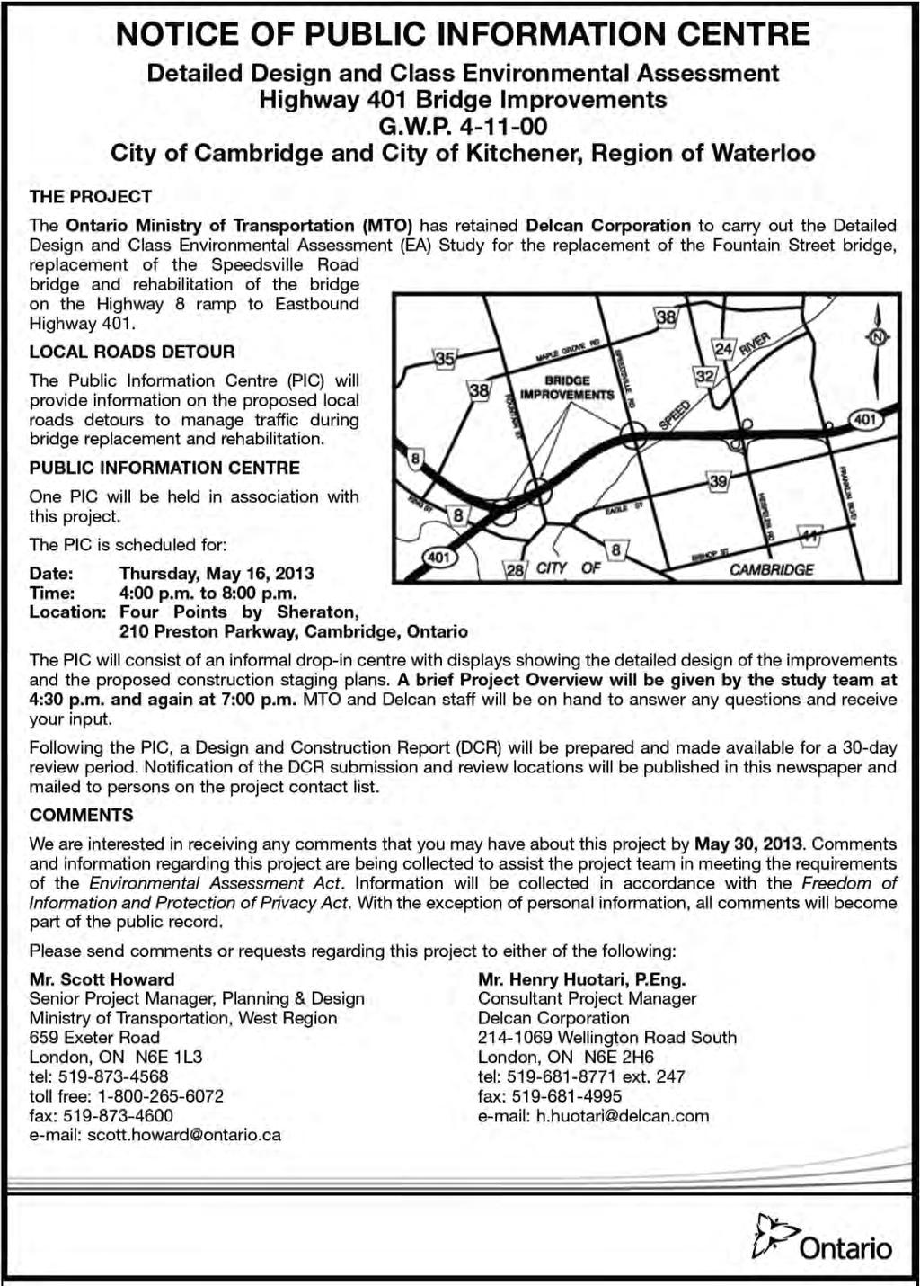
14 Design and Construction Report (DCR) Highway 401 Bridge Improvements G.W.P (sub-component of ) On December 5, 2012, Delcan, MTO and the City of Cambridge met to discuss the design of the Fountain Street and Speedsville Road bridges, impacts to the sideroads and future municipal works. Throughout the detailed design, the project team has had various meetings with utility companies to coordinate utility relocations, including: Bell, Cambridge North Dumfries Hydro, Cambridge Water / Sewer, Union Gas. Grand River Transit has also been contacted to notify of the bridge closures and proposed local road detours. On May 1, 2013, agencies, First Nations and Métis, and stakeholders were invited to attend the PIC one hour prior to the PIC being open to the public. This earlier session was intended to provide an opportunity for these groups to speak with study team members and express concerns and comments about the presented technically preferred detail design. At the PIC, the City of Cambridge provided feedback on the proposed detour. This feedback has led to the restriction of heavy trucks from using Speedsville Road, which currently prohibits truck traffic. Trucks will be diverted to Hespeler Road. On July 8, 2013, Delcan and MTO made a presentation to the City of Cambridge council to provide information and details on the project. 2.3 Stakeholders On April 18, 2013, MTO and Delcan teleconferenced with Toyota to discuss the project and its potential impacts to operations. 2.4 First Nations and Métis Engagement First Nations and Métis engagement has remained an important component of the consultation process for this study. Project notices were mailed to the Six Nations of the Grand River, Mississaugas of the New Credit First Nation, Haudenosaunee Chiefs Confederacy Council and the MNO Grand River Métis Council. First Nations and Métis communities were contacted directly by MTO at project milestones. A First Nation monitor was invited to the Stage 2 Archaeological Assessments for this project, however, a monitor was not available for this assessment as the program was under transition. All correspondence related to First Nation and Métis engagement is located in Appendix D. Study Commencement and PIC notices were published in two (2) First Nation newspapers: the Tekawennake News and Turtle Island News (Table 1). 2.5 Public Information Centre On May 16, 2013, study team members were available for information and discussion of project issues at a Public Information Centre (PIC). The display boards outlined the project limits, provided an overview of improvements and the class environmental assessment process. The display boards also provided a description of the Page 8 of 29
15 Design and Construction Report (DCR) Highway 401 Bridge Improvements G.W.P (sub-component of ) improvements, construction staging and local roads detours as well as environmental considerations including potential environmental mitigation measures. Members of the public, external agencies, First Nations and Métis, stakeholders, and interest groups were invited to the PIC and were requested to provide comments and identify their concerns in writing. A total of 51 people signed the PIC attendance register including local residents, business owners, and agency and municipal representatives. The key issues expressed during detail design include the following: Access During Construction: The majority of the comments received were related to access being severed during construction at Fountain Street Bridge. o Attendees were concerned about pedestrian and cyclist traffic not being able to use Fountain Street Bridge to get to and from work. The detour route outlined is too long and without sidewalks for pedestrian traffic. o It was also noted that accessing the cemetery on the north side of Highway 401 for pedestrian traffic will be difficult if not impossible. o Residents within the neighborhood of Marmel Court and Kitchener Road noted that if an accident occurs on Fountain north of King Street during the Fountain Street bridge replacement, they would be unable to leave or enter their residence for possibly several hours. o Residents within the Royal Oak neighbourhood had a similar concern; their experience is that with current traffic levels at key times during the day, they are essentially land-locked. There is also a concern that quick access to a hospital may not be possible in the event of an emergency. During construction and the closure of either bridge, traffic volumes will be intensified, exacerbating the issue. MTO response: The closure of these bridges during their replacement will be an inconvenience to the surrounding community. The project team has been examining measures to be implemented to expedite construction to minimize the overall duration of the project. Local Roads Detour Routes: There was some concern expressed regarding the local roads detour routes during the closure of both the Fountain Street Bridge and Speedsville Road Bridge. The concern is that traffic during peak times is already congested; re-routing traffic during the closure of Fountain Street bridge and Speedsville Road bridge will only exacerbate the problem. MTO response: The project team has been and will continue to work closely with the municipalities to manage traffic, optimize traffic signal timings and implement a communications plan in order to reduce impacts to the movement of traffic through the area. Lack of sidewalk or bike lane on approaches of Speedsville Road Bridge: Comments were received that were concerned that although the Speedsville Road Page 9 of 29
16 Design and Construction Report (DCR) Highway 401 Bridge Improvements G.W.P (sub-component of ) Bridge replacement will include paved shared-use shoulders, the road approaching the bridge does not. MTO response: The sidewalks and wider shared-use shoulders will extend approximately 250 metres north and south of both the Speedsville Road bridges and Fountain Street bridges. Beyond this distance the responsibility for installation of sidewalks and wider shoulders would be up to the municipality. Widening Roads throughout City of Cambridge: Comments were received from attendees that thought roads such as Maple Grove Road and Fountain Street should be widened to four lanes. MTO response: This is a provincial project, widening roads throughout the City of Cambridge is not within MTO s jurisdiction. The City of Cambridge and Region of Waterloo Official Plan and Transportation Master Plans have identified the need for future widening of Speedsville Road but not for Fountain Street, and these are municipal responsibilities. 2.6 Preparation and Release of the Design and Construction Report (DCR) Upon completion of the study, the DCR will be made available for public review. At this time, external agencies, First Nations and Métis, stakeholders and the public will have 30 days to review the document and provide comments. A Notice of DCR Submission will be published in two local newspapers on two separate days as well as in two local First Nation papers (Table 2). Page 10 of 29
17 Design and Construction Report (DCR) Highway 401 Bridge Improvements G.W.P (sub-component of ) 3.0 Detailed Description of the Recommended Design The TESR completed for Highway 401 from 0.5 km west of Regional Road 8 to 0.5 km east of Regional Road 24 / Hespeler Road resulted in the identification of a number of improvements necessary to address the short, medium and long-term (20 year) needs of Highway 401 in the specified project limits. Some of the improvements identified include: replacement of the Fountain Street Bridge and Speedsville Road Bridge and rehabilitation of the Highway 8 Eastbound on-ramp bridge. 3.1 Major Design Features Replacement of Fountain Street Bridge The Fountain Street bridge, constructed in 1960, is a concrete tee-beam bridge. It was screened according to the Ontario Heritage Bridge Guidelines but was not identified as having provincial heritage significance. The Fountain Street bridge has reached the end of its service live and requires replacement. The bridge will be replaced on the existing horizontal alignment. This structure will be demolished and replaced with a 113.8m four span, 1600 NU precast concrete girder bridge with fully integral abutments. The new bridge will have sidewalks on both sides of the bridge and paved shared-use shoulders. The general arrangement drawing of the Fountain Street bridge is included in Appendix E. Additional sidewalk and wider shared-use shoulders, beyond existing conditions or Ministry standards, will be paid for by the municipality (Region of Waterloo). The removal of the existing bridge will occur overnight with Highway 401 traffic temporarily directed to the Emergency Detour Route on Maple Grove Road. Figure 3: Proposed Fountain Street bridge cross-section Page 11 of 29
18 Design and Construction Report (DCR) Highway 401 Bridge Improvements G.W.P (sub-component of ) Replacement of Speedsville Road Bridge The Speedsville Road Bridge is a continuous deck slab bridge built in It was screened according to the Ontario Heritage Bridge Guidelines but was not identified as having provincial heritage significance. This structure will be demolished and replaced with an 84m, 1500 steel box girder bridge with fully integral abutments. The new bridge will have a sidewalk on the west side and paved shared-use shoulders. The general arrangement drawing of the Speedsville Road bridge is included in Appendix E. Additional sidewalk and wider shared-use shoulders, beyond the existing conditions or Ministry standards, on the Speedsville Road bridge will be paid for by the municipality (City of Cambridge). The removal of the existing bridge will occur overnight with Highway 401 traffic diverted to the designated Emergency Detour Route on Maple Grove Road. Figure 4: Proposed Speedsville Road bridge cross-section Rehabilitation of Highway 8 Eastbound on-ramp Bridge The Highway 8 ramp underpass is a post-tensioned deck slab type structure built in It was screened according to the Ontario Heritage Bridge Guidelines but was not identified as having provincial heritage significance. Required works at this location include: patching, waterproofing and paving; replacement of barriers; replacement of expansion joints; and installation of a new de- Page 12 of 29
19 Design and Construction Report (DCR) Highway 401 Bridge Improvements G.W.P (sub-component of ) icing system. The general arrangement drawing of the Highway 8 ramp bridge is included in Appendix E. Figure 5: Proposed Highway 8 West-to-East ramp bridge cross-section Guiderail and Roadside Safety Measure Upgrades The guiderail will be replaced on Fountain Street and Speedsville Road as part of the bridge replacements. Guiderail will be upgraded on Highway 401 where it is impacted by construction activities. The extension of the westbound off-ramp from Highway 401 to Highway 8 westbound will improve the length of storage for traffic queuing Entrance Modifications Modifications to eight entrances will be necessary as a result of the vertical grade revision to both Fountain Street and Speedsville Road Local Roads Detour Route Fountain Street and Speedsville Road traffic will be diverted to local roads during the replacement of each bridge. A detour along local roads is required to complete the bridge replacements and grade revisions of the roadway. Speedsville Road and Fountain Street bridges will not be closed at the same time. The existing bridges will be demolished during night time hours (one night per bridge). New bridge girders will be placed during night time hours (up to three nights per bridge). During this night-time work, Highway 401 traffic will be temporarily directed to the Emergency Detour Route along Maple Grove Road (Figure 6). Page 13 of 29
20 Design and Construction Report (DCR) Highway 401 Bridge Improvements G.W.P (sub-component of ) Figure 6: Emergency Detour Route along Maple Grove Road during Highway 401 nightly closures. It is expected that the replacement of the Speedsville Road Bridge and rehabilitation of the Highway 8 ramp to Eastbound Highway 401 bridge will be completed in Year 1 of construction. Page 14 of 29
 During the Speedsville Road bridge replacement, the bridge will be closed. Traffic will be diverted to a local roads detour (Figure 7).")
21 Design and Construction Report (DCR) Highway 401 Bridge Improvements G.W.P (sub-component of ) During the Speedsville Road bridge replacement, the bridge will be closed. Traffic will be diverted to a local roads detour (Figure 7). Figure 7: Local roads detour route during the closure of Speedsville Road bridge. Page 15 of 29
22 Design and Construction Report (DCR) Highway 401 Bridge Improvements G.W.P (sub-component of ) During the Fountain Street bridge replacement, the bridge will be closed. Traffic will be diverted to a local roads detour (Figure 8). Figure 8: Local roads detour route during the closure of Fountain Street bridge. The duration of construction for each bridge is expected to be 8 months, and during this time, the bridge will be closed. Local access for residences and emergency service providers will be maintained. Page 16 of 29
23 Design and Construction Report (DCR) Highway 401 Bridge Improvements G.W.P (sub-component of ) During the rehabilitation of the Highway 8 ramp bridge, one lane of traffic will be maintained. Two full closures at night will be required for paving operations. The overall duration of construction will be 8 10 weeks, during this time an alternate route will be designated (Figure 9). Figure 9: Alternate route during rehabilitation of the Highway 8 ramp bridge. Page 17 of 29
24 Design and Construction Report (DCR) Highway 401 Bridge Improvements G.W.P (sub-component of ) Traffic Signals Temporary traffic signals will be installed at the King Street / Shantz Hill Road interchange for the N-E ramp movement to facilitate the expected increase in traffic due to lane reductions on Highway 8 during the bridge rehabilitation. As seen in Figure 9, an alternate route will be provided from Highway 8 along King Street to Highway 401. The temporary traffic signals are intended to stop northbound vehicles to provide sufficient gaps for southbound left turns Construction Staging Highway 401 traffic will be temporarily directed to the Emergency Detour Route on Maple Grove Road during structure demolition and placement of new bridge girders. Construction will be staged over two years so both bridges / roads will not be closed at the same time. During the Fountain Street and Speedsville Road bridge construction, local road detours will be implemented. One lane of traffic will be maintained on-site during the Highway 8 bridge rehabilitation. An alternate route along King Street / Shantz Hill Road will be provided Utilities Bell Canada owns a duct structure fixed to the side of the Fountain Street bridge as well as buried and aerial lines along Fountain Street and Speedsville Road. Conflicts will be resolved prior to construction with the exception of two manhole structures on Fountain Street. The MTO contractor will hire a Bell approved sub-contractor to raise the manholes to match the new road grade. Cambridge North Dumfries Hydro has power lines that cross Highway 401 at both Fountain Street and Speedville Road. Relocations will take place prior to highway construction. Rogers has cable on joint use hydro poles, which will be relocated in advance of construction. Union Gas has underground crossings of Highway 401 at both Fountain Street and Speedsville Road. Relocations will take place prior to highway construction. The City of Cambridge owns a watermain fixed to the side of the Fountain Street bridge. The watermain will be relocated under Highway 401 prior to construction. They are also taking the opportunity to upsize an existing sanitary sewer crossing under Highway 401 at Fountain Street. Several watermain valve/swab chambers within the pavement of Fountain Street will be reconstructed to meet the new road grade as part of the MTO contract. Page 18 of 29
25 Design and Construction Report (DCR) Highway 401 Bridge Improvements G.W.P (sub-component of ) Property Property is required along Fountain Street, Speedsville Road and along portions of Highway 401 to accommodate the higher fill slopes approaching the new bridges. Page 19 of 29
26 Design and Construction Report (DCR) Highway 401 Bridge Improvements G.W.P (sub-component of ) 4.0 Environmental Issues and Commitments The following descriptions summarize the existing conditions of the study area, the potential impacts associated with the bridge improvements the resultant design modifications to avoid or reduce environmental impacts, and the mitigation measures to be included in the construction contract. 4.1 Aquatic Environment Aquatic Habitat and Fisheries Resources There are two main watercourses within the project limits that have the potential to be impacted by the proposed work, West Creek and the Speed River. While no direct inwater work is required at these watercourses for the bridge improvements, construction will be occurring in proximity to the West Creek. West Creek is a permanent, warm water stream which flows parallel to Speedsville Road and west of the Speedsville Road structure, from north to south into the Speed River. There are no barriers to fish movement between West Creek and the Speed River. The Speed River is a permanent, warm water river that provides habitat for many fish and freshwater mussel species. Speedsville Road crosses over the Speed River south of the structure, with road surface work ending just before the Speed River Bridge. There are several construction related activities which have the potential to impact the adjacent aquatic resources. These activities include: vegetation removal, grading, structure removal and construction, and use of industrial equipment. Any activity that has the potential to release sediment (i.e. vegetation removal, grading) could negatively affect the nearby fish and fish habitat if the sediment is permitted to enter the watercourses. In extreme cases this could result in the harmful alteration, disruption or destruction (HADD) of fish habitat as defined in the Fisheries Act. HADD includes any changes that prevent the physical, biological or chemical attributes of fish habitat from providing food, reproduction, cover and movement corridors, or any change in fish habitat that reduces its capacity to support one or more life processes of fish (DFO 1998). The risk or potential of a project resulting in a HADD is based on negative residual effects. Negative residual effects are determined after the incorporation of mitigation measures. Mitigation measures will be included in the Contract to reduce or eliminate the negative potential impacts of the construction works associated with this project on the aquatic habitat and fisheries resources. These measures include the restriction of any in-water work or access in West Creek or the Speed River. Access routes and staging areas will be placed away from the Speed River floodplain and West Creek banks, and away from the other drainage features leading to these watercourses. Sediment and erosion controls will be placed around the work area, in the vicinity of the noted watercourses, in order to prevent the input of construction-related deleterious substances (i.e. sediment, concrete dust/debris). Equipment maintenance and fuelling and any Page 20 of 29
27 Design and Construction Report (DCR) Highway 401 Bridge Improvements G.W.P (sub-component of ) stockpiling of excess materials will take place a minimum of 30m from the noted watercourses. An Environmental Monitor shall be on site during all activities in and around water features to ensure that environmental protection measures are properly installed, functioning effectively, and are maintained in good repair Water Quality and Erosion and Sediment Control The proposed works include the demolition of two existing bridges. The approaching roadway will need to be raised slightly to tie into the elevation of the new bridges. Activities such as paving; saw cutting concrete; and grading of exposed earth and granular materials will be required. Construction activities will therefore have the potential to adversely affect water quality through increased sediment loads in run-off water from precipitation. Construction activities may also result in increased dust from disturbed soils, and emissions from the operation of heavy equipment. Standard sediment control measures such as silt fencing, fibre filtration tubes, and rock flow checks will be implemented to minimize sediment entry and transport through ditches. Storm sewer outlets have been situated to be able to provide sediment retaining check dams and/or vegetation assisting with sediment filtration prior to outletting to the roadside ditches (Fountain Street bridge) and West Creek (Speedsville Road bridge). Erosion control will be accomplished via temporary and/or permanent cover applied to exposed soils, and limitations on the length of time soil surfaces may be exposed Groundwater Resources Information gathered during preliminary design indicates that, within the project limits, groundwater occurs in the overburden deposits and discharges to the Speed River. The thickness of the soil overburden is generally between 15 m to 25 m in thickness. Dewatering is not anticipated to be necessary for this project. In addition, no deep excavations are required. Therefore, adverse impacts to the quantity of groundwater are not anticipated. Best management practices will be employed during refueling to minimize the potential for spills. A spills response and mitigation plan shall also be prepared by the Contractor and implemented, if required, to further reduce the risk of potential groundwater or surface water contamination. 4.2 Terrestrial Environment Wildlife and Wildlife Habitat The Speed River Provincially Significant Wetland (PSW), located just east of the Speedsville Road structure, is associated with significant wildlife habitat features and/or functions (including colonial bird nesting, and waterfowl stopover and nesting) and habitat or potential habitat of several Species at Risk. The replacement of the Speedsville Road bridge will affect only a small area of the wetland (150 m 2 ), which Page 21 of 29
28 Design and Construction Report (DCR) Highway 401 Bridge Improvements G.W.P (sub-component of ) consists solely of cattail marsh. This area, specifically, is thought to provide some bird nesting habitat but is not, of itself, significant wildlife habitat. The majority of the area around the three structures, outside of the Speed River Wetland, is typical of roadsides and disturbed spaces in Southern Ontario, and was observed to provide some habitat for common wildlife (e.g., Eastern Cottontail, Meadow Vole). The majority of wildlife species associated with areas such as highway corridors are those that have a higher tolerance for disturbances. It is expected that these species will be tolerant of or will easily relocate away from the increased noise and disturbance resulting from construction. However, it is possible that individual animals may remain in the work area and become at risk of injury or mortality due to equipment and vehicles. The works associated with the Highway 401 bridge improvements will result in the removal and/or disturbance of vegetation, which will result in the loss of some additional wildlife habitat. This is of particular concern in association with the Speed River Wetland. However, the areas of removal associated with these improvements are minimal. Silt fence will be installed at the Speedsville Road structure and will act as a barrier to any wildlife that may attempt to enter the work site from the wetland, and thereby help protect wildlife from injury or mortality due to encounters with construction equipment. If any wildlife is found within the work areas at any time during construction, however, it shall be allowed to leave without harassment or harm Nesting Birds The three (3) structures were reviewed for nesting birds in fall of None of the three were determined to have supported nesting birds in the past or to have the potential for bird nesting in future. Unmown grasses, shrubs and other vegetation adjacent to the structures, however, could provide nesting habitat to some common bird species. Cedar Waxwing and Song Sparrow are examples of species that were observed to be using shrubs and trees in the highway ROW as nesting or shelter habitat; Red-winged Blackbirds commonly use long grasses and cattails in ditches as nest sites. The removal of vegetation adjacent to the bridges during the nesting season could result in the disturbance of nesting birds or mortality of the birds or their young. Excessive noise associated with construction could also cause disturbance to nesting birds; however, given the location adjacent to a busy highway the area already experiences a high level of noise. A short-term, minor increase in noise is not likely to significantly impact birds in the study area. The Regulations of the Migratory Birds Convention Act (1994) prohibit the destruction or disturbance of active bird nests. Mitigation measures will therefore focus on Page 22 of 29
29 Design and Construction Report (DCR) Highway 401 Bridge Improvements G.W.P (sub-component of ) avoidance: vegetation removal will take place outside of the typical bird nesting season (April 1 st to July 31 st or whenever active nests are present) or, if that timing is not possible, then areas slated for vegetation removal will be thoroughly checked for bird nests prior to any activity. If active bird nests (i.e., nests containing eggs or young) are found in the work area at any time, then work in the vicinity will stop until such time as the young birds have fledged or the nest is otherwise abandoned Vegetation and Vegetation Communities The Speed River PSW is located immediately east of the Speedsville Road structure; adjacent to the right-of-way (ROW) at this structure; the wetland consists of a cattail marsh community. Outside of that wetland area, vegetation in the vicinity of the three bridges consists mainly of common roadside grasses and forbs with some scattered shrubs and trees. The observed species were frequently non-native in Ontario and are highly tolerant of disturbed conditions. As a result of vertical grade revisions at the Speedsville bridge, roadway embankments will occupy a slightly wider span. Therefore, a small area of the Speed River PSW (150 m 2 ), consisting of cattail marsh, along the existing toe-of-slope will be permanently removed. Construction activities such as grading and the creation of access routes for vehicles and equipment will result in the removal of additional roadside vegetation. The plants noted in these areas are not of great ecological significance but do perform several functions in the landscape including erosion control, slope/soil stabilization, filtering of runoff, and some wildlife habitat. The vegetated areas also provide aesthetic benefits to the highway corridor. Following construction, areas of exposed soil where vegetation is removed will be restored with seed and cover. Access through the cattail marsh shall be minimized, and identified as an Environmentally Sensitive Area (ESA) which prohibits entry or use of the area. Protective fencing will be installed around any trees or groups of shrubs that are to be retained in or adjacent to the study area, to protect these features from damage. Necessary vegetation removal will be done with care to prevent incidental damage to surrounding vegetation. Where possible, existing healthy trees and shrubs will be retained on the site. 4.3 Social / Cultural Environment Recreational Resources Pedestrian Trails, Parks The Mill Run Trail runs along the Speed River from the Sheffiled Street trailhead under Highway 401 to Riverside Park connecting Hespeler to Preston. The trail will not be impacted by the proposed bridge improvements. However, the Speedsville Road Bridge will be closed during construction impeding pedestrian traffic north of Highway 401 Page 23 of 29
30 Design and Construction Report (DCR) Highway 401 Bridge Improvements G.W.P (sub-component of ) from accessing the trail on the south side of Highway 401. However, the trail will still be accessible using other routes Archaeology and Cultural Resources Stage 1 and 2 Archaeological Assessments were completed in the study area as part of the preliminary design phase. The Stage 1 assessment was conducted to identify the potential for pre-contact and historic archaeological resources in the study area. The assessment determined that there was the potential for pre-contact archaeological resources, based on the proximity to water, and also the potential for 19 th century Euro-Canadian historic archaeological sites due to the development of roads and railways through the course of the 19 th and 20 th centuries. The Stage 1 assessment recommended that all lands within the existing disturbed right-of-way should be considered clear of any archaeological concern. Additional lands beyond the disturbed ROW were addressed in the Stage 2 assessment. Most of the areas assessed did not exhibit any archaeological site potential due to disturbance, slope and/or inadequate drainage. Those areas which did exhibit archaeological site potential were assessed and no archaeological material was encountered. However, some areas that were considered to have archaeological potential could not be assessed at that time due to lack of site access permission. Further Stage 2 archaeological field assessments were completed during detailed design. Field investigations indicate that the areas are clear of archaeological material. A report documenting these findings will be submitted to the Ministry of Tourism, Culture and Sport for acceptance into the Ontario Public Register of Archaeological Reports. During construction there is the potential to uncover archaeological resources that have not been identified during the archaeological assessment. Should undocumented or deeply-buried archaeological materials be discovered during excavation, construction will cease and the Ministry of Tourism, Culture and Sport will be notified immediately. In the event that human remains are encountered during construction, construction will cease and the proponent should immediately contact both the Ministry of Tourism, Culture and Sport, and the Registrar or Deputy Registrar of the Cemeteries Regulation Unit of the Ministry of Consumer and Business Services Property Acquisition Several small areas of property located outside of the current right-of-way will be affected by the proposed works, and are required for the re-grading to occur near the Fountain Street and Speedsville Road bridges Management of Excess Materials A soil sampling program and the development of an Excess Materials Management Plan were completed during detailed design to investigate the potential for the presence of excess materials generated during construction which may require management. Page 24 of 29
31 Design and Construction Report (DCR) Highway 401 Bridge Improvements G.W.P (sub-component of ) Various types of materials (e.g. asphalt, concrete, soil, natural wood, pressure treated wood, metal etc.) will be generated during construction and have the potential to impact the surrounding environment. In order to mitigate the potential impacts, all excess material will be managed in accordance with the Ontario Provincial Standards Specification (OPSS) 180 General Specification for the Management of Excess Material Land use and Agricultural Resources Within the project limits, the area includes a mix of residential, industrial, commercial and natural land uses. As stated previously, several small areas of property located outside of the current right-of-way will be affected by the proposed works, specifically the re-grading to occur near the Fountain Street and Speedsville bridges. The proposed bridge replacements and bridge rehabilitation do not impact any agricultural property within the project limits Highway and Construction Noise / Vibration The study area is presently subject to a certain level of noise created by vehicles travelling on Highway 401. During construction, it can be expected that a slight temporary elevation in noise and vibration will occur due to the presence of construction equipment and construction activities. Construction noise effects will be temporary. To reduce construction noise effects standard mitigation measures have been included in the construction contract. The Contractor will be required to maintain construction equipment and noise muffling devices in proper working order, operating equipment only as required (no excessive idling). There are two noise by-laws that regulate construction noise within the project limits. Within the municipal boundaries of the City of Cambridge, the MTO is exempt from by-law restrictions for projects on the Highway 401. As such, a noise by-law exemption is not required for night work on the Fountain Street bridge or Speedsville Road bridge. However, night work is limited to the demolition of the bridges and placement of new bridge girders. The MTO is pursuing a noise by-law exemption, from the City of Kitchener, to undertake construction outside of the 7:00 a.m. to 7:00 p.m. hours on the Highway 8 West-to-east ramp bridge. Night work at this location may include final paving, expansion joint placement and testing, placement and removal of formwork / falsework Air Quality Construction activities may also result in increased dust from disturbed soils, and emissions from the operation of heavy equipment. Dust suppressants will be utilized to Page 25 of 29
32 Design and Construction Report (DCR) Highway 401 Bridge Improvements G.W.P (sub-component of ) mitigate dust created by concrete work and vehicles travelling on a granular and exposed earthen surfaces. Vehicle and equipment emissions will be reduced with preventative maintenance on all equipment. Vehicle idling will be kept to a minimum Temporary Disruption of Traffic and Property Access A detour along local roads is required during the removal and replacement of both the Speedsville Road and Fountain Street bridges. Highway 401 traffic will be maintained during construction, but will be temporarily directed to the Emergency Detour Route along Maple Grove Road during night time demolition. Both bridges will be replaced on the existing alignment and on a slightly higher grade therefore maintaining traffic (both vehicular and pedestrian) across the bridges during replacement is not feasible. The Speedsville Road bridge and Fountain Street bridge will not be replaced at the same time. It is expected that replacement of the Speedsville Road bridge and the rehabilitation of the Highway 8 ramp to Eastbound Highway 401 will be completed in Year 1 of construction. The Speedsville Road bridge will be closed for up to 8 months. The Fountain Street bridge will be replaced in Year 2 of construction, it is expected that the bridge will be closed for 8 months. It is understood that these closures will be disruptive to both vehicular and pedestrian traffic; therefore methods that will accelerate construction and reduce impacts to the surrounding community will be pursued. Several entrances along Fountain Street and Speedsville Road will be affected by the increase in bridge elevation. These entrances will be regraded to match the revised roadway grade. The local roads detour routes were identified based on their suitability of roadway alignment, adjacent land use, shoulder width, and pavement condition. In addition, two separate routes were identified for each bridge closure in order to split the traffic flows and reduce impacts to any one route. Temporary traffic signals will be installed at the intersection of Shantz Hill Road (King Street) and the eastbound Highway 401 ramp terminal during the rehabilitation of the Highway 8 ramp bridge. This will provide motorists with an alternate route from Highway 8 to Highway 401 eastbound. Local access to properties will be maintained throughout construction, and driveways will be adjusted to accommodate the new grade of the highway following project completion. Page 26 of 29
33 Design and Construction Report (DCR) Highway 401 Bridge Improvements G.W.P (sub-component of ) 5.0 Summary of Environmental Effects, Proposed Mitigation and Commitments to Further Work Table 2 summarizes the proposed mitigation measures and MTO commitments made to address issues and concerns identified during the detailed design. Page 27 of 29
34 Table 2 - Summary of Environmental Concerns and Commitments I.D. # Issues / Concerns / Potential Effects Concerned Agencies Mitigation / Protection / Monitoring 1.0 Fish and Fish Habitat Protection of Fish and Fish habitat 2.0 Erosion Control To minimize the potential for erosion and sedimentation of exposed soils. 3.0 Surface Water To prevent surface water contamination 4.0 Groundwater Impacts to groundwater resources 5.0 Terrestrial Ecosystems Vegetation protection and restoration MNR MOE GRCA MTO MNR GRCA MTO MOE MNR MTO MNR GRCA MOE MTO MNR GRCA CEAA MTO No in-water work or construction access permitted within West Creek or Speed River. Apply temporary and/or permanent cover to exposed soils and limit the length of time soil surfaces may be exposed. Placement of sediment and erosion control measures around work areas to prevent construction related deleterious materials from entering any water features. Equipment maintenance and refuelling will not take place within 30 metres of West Creek or Speed River. Stockpiling of excess materials shall be stabilized and not within 30 metres of West Creek or Speed River. Apply temporary and/or permanent cover to exposed soils, and limit the length of time soil surfaces may be exposed. In order to mitigate the transport of sediment along ditch lines, surface drainage pathways, as well as exposed soils adjacent to sensitive areas, environmental protection measures (such as fibre filtration tubes, rock flow checks, and silt fence barriers) will be utilized. Any dewatering operations will be directed onto a vegetated area at least 30 metres away from West Creek or Speed River. Discharge points for dewatering activities (if required) shall be suitable so as not to create additional erosion or sediment related impacts. All mobile equipment refuelling will take place no closer than 30 metres from any watercourses in order to prevent water contamination due to accidental fuel spills. For non-mobile equipment, refuelling should be carried out in a controlled manner so as to prevent fuel spillage, and drip pans should be located under the equipment at all times. The Contractor shall have a spills action plan and spill containment equipment on-site to address any spills which may occur during work. The Contractor will take all necessary precautions to prevent the accumulation of litter and construction debris within wetlands and wetted roadside channels. Dewatering is not anticipated to be necessary for this project. In addition, no deep excavations are required. Therefore adverse impacts to groundwater are not expected. Silt fence barriers will be installed to protect adjacent wetlands from run-off from disturbed areas. Minimize vegetation removal where possible. Access through the cattail marsh shall be minimized, and identified as an Environmentally Sensitive Area (ESA) which prohibits entry or use of the area. Vegetation clearing shall be completed outside of the nesting season (i.e., typically before April 1 or after August 15) or else a nest check survey conducted by a qualified Avian Specialist will be needed no more than 48 hours prior to vegetation removal. If active nests are discovered in the work area at any time, construction work shall cease in the vicinity and the Contract Administrator shall be notified. Protective fencing will be installed around any trees or groups of shrubs that are to be retained in or adjacent to the project area, to protect these features from damage. Any wildlife that enters the work area will be allowed to leave without harm or harassment. Areas of exposed soil where vegetation is removed will be restored with seed and cover.
35 I.D. # Issues / Concerns / Potential Effects Concerned Agencies Mitigation / Protection / Monitoring 6.0 Recreational Resources Pedestrian Trails, Parks Surrounding Community The Mill Run Trail will not be impacted by the proposed bridge improvements. However, during the closure of the Speedsville Road bridge, pedestrian traffic north of Highway 401 will not be able to cross Highway 401 via Speedsville Road bridge. The trail will still be accessible using other routes. 7.0 Archaeological Resources MTCS MTO 8.0 Management of Excess Material / Contaminated Material 9.0 Highway and Construction Noise / Vibration Construction related noise MOE MTO Surrounding Community CEAC City of Cambridge City of Kitchener MTO 10.0 Air Quality MOE MTO Surrounding Community 11.0 Temporary Disruption of Traffic and Property Access Surrounding Community City of Cambridge Region of Waterloo City of Kitchener MTO A Stage 1 and Stage 2 Archaeological Assessment has been undertaken for the project area. Stage 2 field work has recently been completed. A Stage 2 report will be submitted to MTCS for acceptance into the Ontario Provincial Register of Archaeological Reports. All excess material will be managed in accordance with the OPSS 180 General Specification for the Management of Excess Material. Maintain equipment in good working order, particularly mufflers. Minimize night work. A noise by-law exemption is not required for the Speedsville Road or Fountain Street bridges within the City of Cambridge. A noise by-law exemption is required for night work on the Highway 8 ramp bridge within the City of Kitchener. Application of dust control measures (e.g.calcium chloride, water) will be utilized to control dust created during construction. Vehicle and equipment idling will be kept to a minimum. Access for emergency services will be maintained at all times. Highway 401 traffic will be maintained during construction. Demolition of bridges will be completed during night time hours to reduce impacts to high volume traffic on Highway 401. Local road detour routes will be designated during closures of the Fountain Street and Speedsville Road bridges. An alternate route will be identified during the Highway 8 ramp bridge rehabilitation. Temporary traffic signals will be installed at the King Street / Shantz hill Road interchange to facilitate traffic movements. Entrances impacted along Fountain Street and Speedsville Road will be regraded to match the revised roadway grade. Access will be maintained at all times. Accelerated construction methods will be pursued in order to reduce impacts to the surrounding community.
36 Design and Construction Report (DCR) Highway 401 Bridge Improvements G.W.P (sub-component of ) 6.0 Monitoring Upon commencement of the construction phase for these improvements, the Ministry of Transportation may retain an engineering consulting firm or use in-house resources to provide Contract Administration services for the duration of the construction period. The Contract Administration role includes monitoring the contractor s activities on a day to day basis to ensure all Ministry specifications are adhered to. The inspection and monitoring shall be as per the Construction Administration and Inspection Task Manual (CAIT 2010). An environmental diary will be maintained that outlines the Contractor s daily activities related to the environment such as grading, placement of environmental protection measures, placement of seed and cover, landscaping and maintenance of these measures and their effectiveness as well as any changes that were made to improve their effectiveness. Page 28 of 29
37 Design and Construction Report (DCR) Highway 401 Bridge Improvements G.W.P (sub-component of ) 7.0 References Archaeological Services Inc Stage 1 Archaeological Resource Assessment. Archaeological Services Inc Stage 2 Archaeological Assessment. Golder Associates Bridge Condition Survey, Highway 8 Eastbound Ramp - Highway 401 Underpass. Golder Associates. 2012a. Foundation Investigation and Design Report - Regional Road 17 Underpass. Golder Associates. 2012b. Foundation Investigation and Design Report - Speedsville Road Underpass. Golder Associates. 2012c. Review of Road Surfacing Options for Enhancing Traffic Noise Mitigation. Ministry of Transportation Ontario (MTO) Environmental Reference for Contract Preparation. Ministry of Transportation Ontario (MTO) Environmental Reference for Highway Design. Ministry of Transportation Ontario (MTO) Class Environmental Assessment for Provincial Transportation Facilities. SS Wilson Associates Noise Impact Study. URS Canada Inc Drainage and Hydrology Report, Highway 401 from 0.5 km West of Regional Road 8 to 0.5 km East of Regional Road 24 (revised Sept. 2011). URS Canada Inc Highway 401 Planning and Preliminary Design Study, Transportation and Environmental Study Report. URS Canada Inc Preliminary Design Report, Highway 401. Page 29 of 29
38 APPENDIX A Ontario Government Notices

39
40

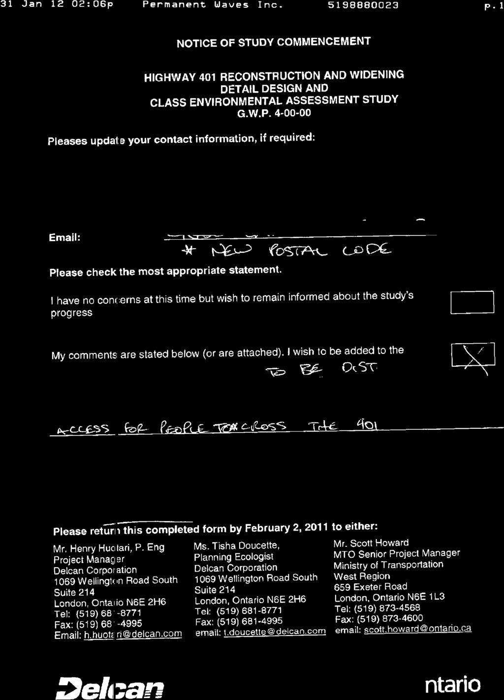
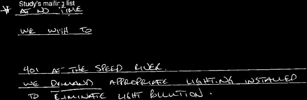
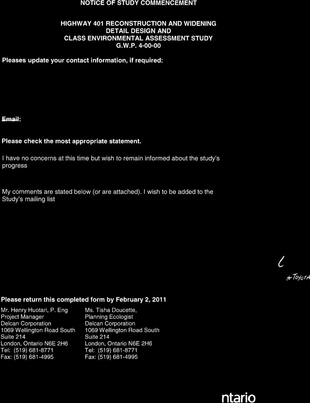
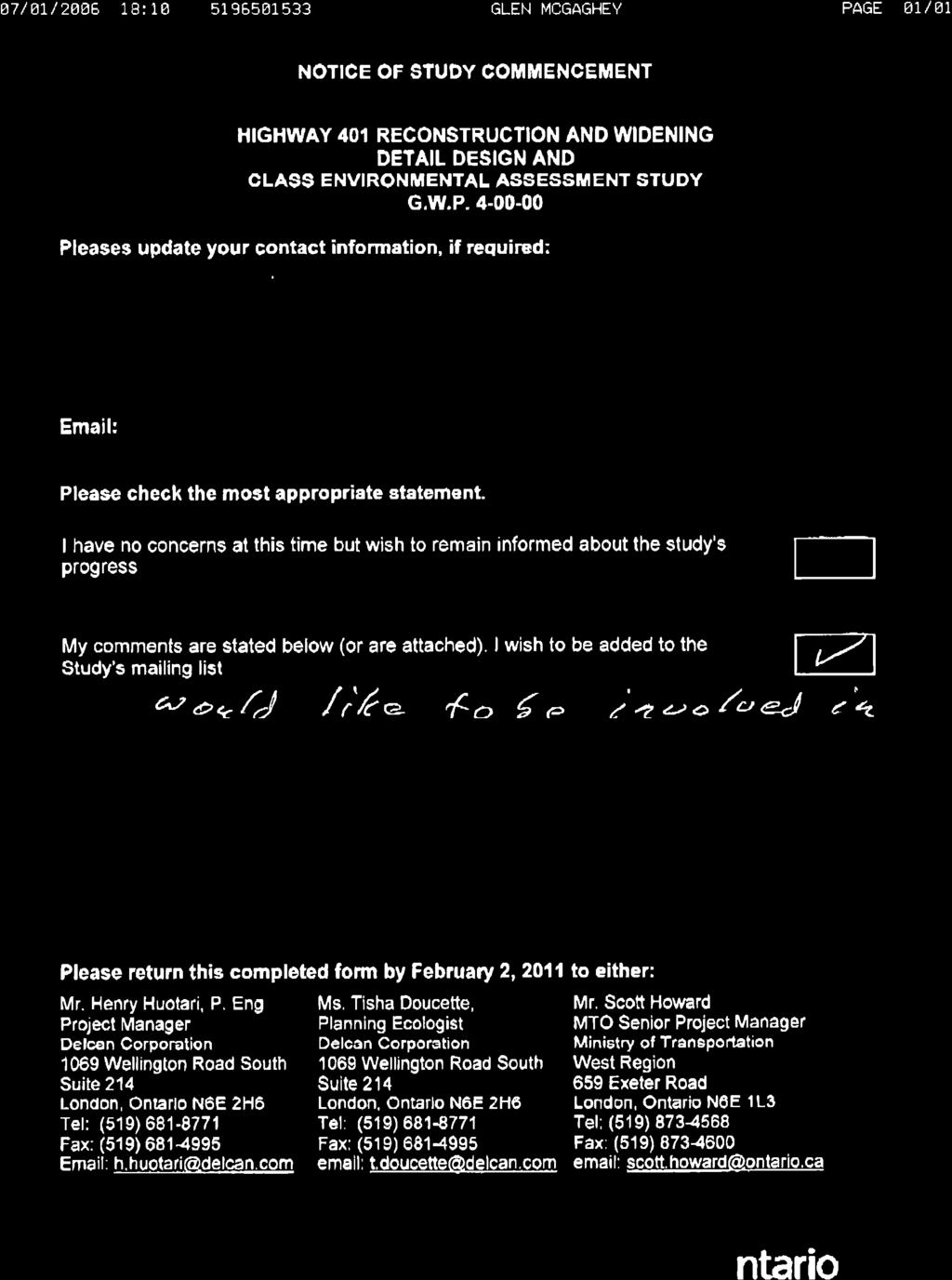
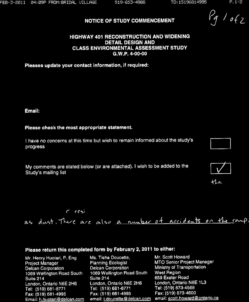
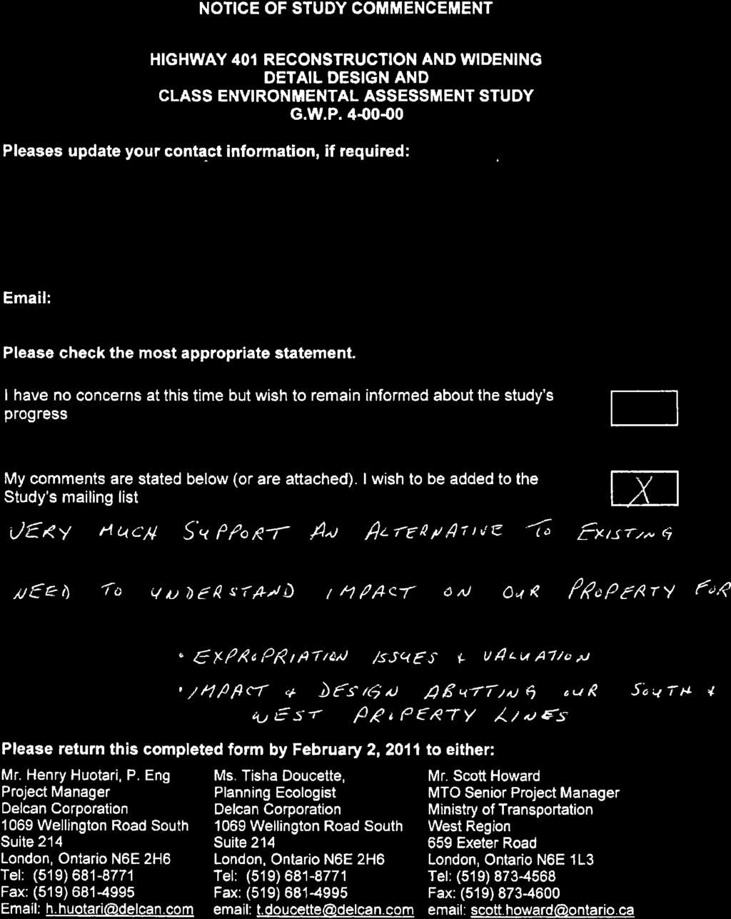
41 The Project NOTICE OF STUDY COMMENCEMENT MINISTRY OF TRANSPORTATION Detail Design and Class Environmental Assessment Study Highway 401 Widening, G.W.P The Ministry of Transportation, Ontario (MTO) has retained Delcan Corporation to carry out a Detail Design and Class Environmental Assessment (EA) Study for the reconstruction and widening of 5.5 kilometres of Highway 401 from 0.5 km west of Regional Road 8/King Street easterly to 0.5 km east of Regional Road 24/Hespeler Road. This project will be designed in two parts (Part A and Part B). Part A of the study will address bridge replacement and rehabilitation needs and Part B of the study will address the widening of Highway 401. Part A involves: Replacement and potential realignment of the Fountain Street underpass; Replacement of the Speedsville Road underpass; and Rehabilitation of the Highway 8 ramp underpass. Part B involves: Widening Highway 401 from 6 to 10 lanes, plus speed change lanes and bus bypass shoulders; Realignment/reconstruction of interchange ramps at Highway 8 and at Regional Road 24/Hespeler Road; Rehabilitation and widening of structures at Speed River and railway overpasses; and Various highway improvements such as high mast lighting, overhead signs and electronic message signs. THE PROCESS This study is being carried out in accordance with the Class Environmental Assessment for Provincial Transportation Facilities (2000) as a Group B project. Public consultation is an important part of the study. One Public Information Centre (PIC) will be held for Part A of this study. A PIC will also be held for Part B of this study at a later date. The first PIC is scheduled in The PICs provide an opportunity for the public to review and comment on the detail design. In September 2008 the Transportation Environmental Study Report (TESR) for this project received Environmental clearance. However, a TESR Addendum may be required to document two design options that were not identified during the 2008 preliminary design; including the rehabilitation of the Highway 8 ramp underpass, and the potential realignment of the Fountain Street bridge to the west of the existing alignment. Upon completion of the Detail Design and Class EA Study, a Design and Construction Report (DCR) will be made available for a 30-day public review period. This document is not eligible for a bump-up (Part II Order) in accordance with the Class EA. Notification of the DCR and TESR Addendum submissions and review locations will be published in this newspaper. Comments We are interested in receiving any comments that you may have about this project. Comments and information regarding this project are being collected to assist the project team in meeting the requirements of the Environmental Assessment Act. Information will be collected in accordance with the Freedom of Information and Protection of Privacy Act. With the exception of personal information, all comments will become part of the public record. Please send comments or requests regarding this project to any of the following: Mr. Henry Huotari, P. Eng. Ms. Tisha Doucette Mr. Scott Howard Consultant Project Manager Planning Ecologist Senior Project Manager Delcan Corporation Delcan Corporation Planning & Design Wellington Road South Wellington Road South Ministry of Transportation, West Region London, ON N6E 2H6 London, ON N6E 2H6 659 Exeter Road tel: ext. 247 tel: ext. 242 London, ON N6E 1L3 fax: fax: tel: h.huotari@delcan.com t.doucette@delcan.com fax: toll free: scott.howard@ontario.ca Ministry of Transportation Notice Of Study Commencement Cambridge Times PN-0023-DEL 4C (6.812) x 136 lines Jan 14th, 2011
42 STUDY COMMENCEMENT CORRESPONDENCE
43

44
45
46
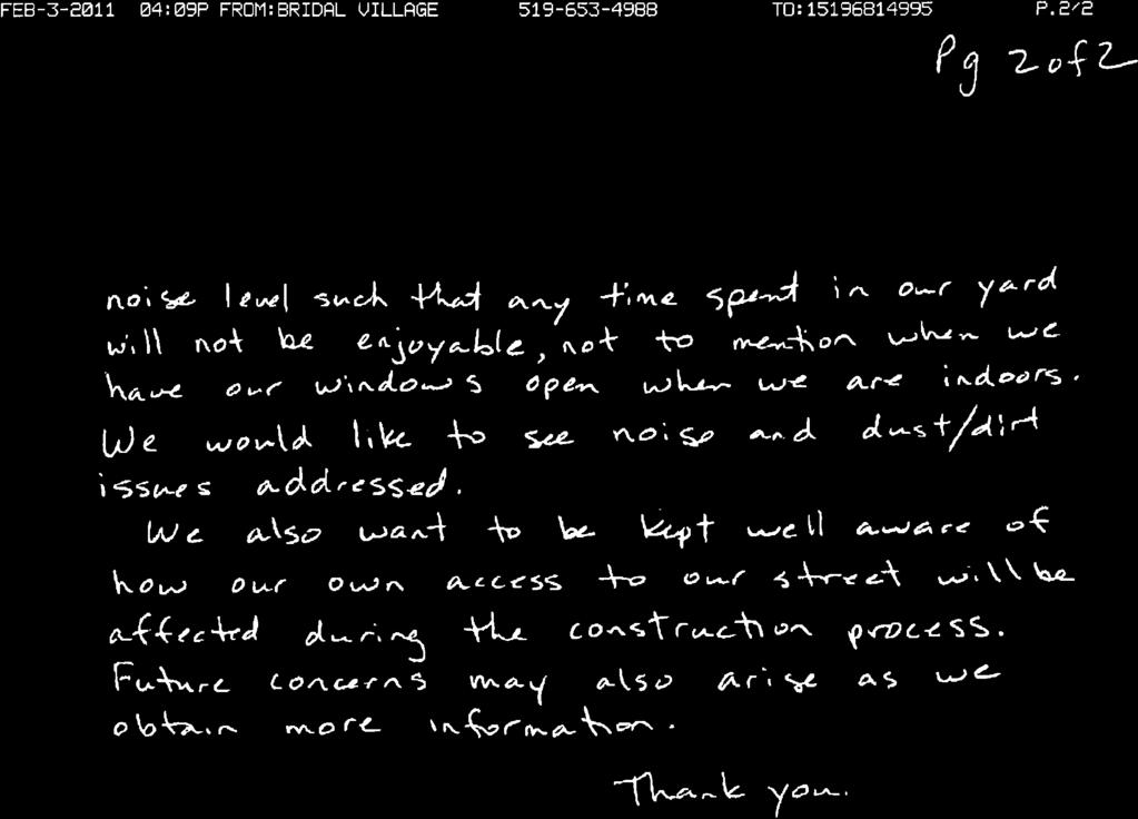
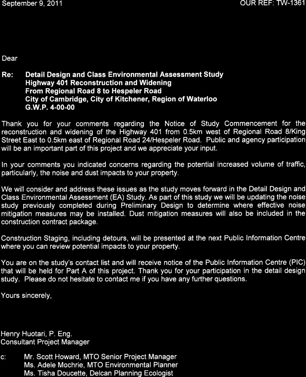
47 1069 Wellington Road South, Suite 214, London, ON N6E 2H6 Tel: Fax: January 17, 2011 OUR REF: TW-1361 Agency Address Dear Mr. / Ms.: Re: Notice of Study Commencement Detail Design and Class Environmental Assessment Study Highway 401 Reconstruction and Widening G.W.P The Ministry of Transportation, Ontario (MTO) has retained Delcan Corporation to carry out a Detail Design Study and Class Environmental Assessment (EA) Study for the reconstruction and widening of Highway 401 from 0.5km west of Regional Road 8 / King Street East to 0.5km east of Regional Road 24 / Hespeler Road. This Highway 401 project will be completed in two parts (Part A and Part B) and as two separate construction contracts, which will allow for better management of traffic staging and reduce impacts to the travelling public. This letter and enclosed notice is to serve as notification of the commencement of Part A of the study. Part A includes the complete structural design for the replacement of the Regional Road 17 / Fountain Street underpass and the Speedsville Road underpass as well as the rehabilitation of the Highway 8 ramp underpass. The design of the Highway 401 expansion to ten (10) lanes (Part B of the study) will also be initiated to facilitate the design of the structure replacements. The purpose of this letter is to introduce the Detail Design and Class Environmental Assessment Study, to request your participation, and to obtain available background information related to the study area. Information that would be of interest includes descriptions of existing conditions or sensitivities within the study area and issues or concerns that your office may have and any approval requirements or authorizations that may be necessary. All comments and information will be collected in accordance with the Freedom of Information and Protection of Privacy Act. With the exception of personal information, all comments will become part of the public record. If you wish to remain on the study mailing list please forward the enclosed questionnaire to any of the study team listed on the enclosed notice. We respectfully request a response by February 2, Yours sincerely, Henry Huotari, P. Eng.,
48 Page 2 Consultant Project Manager c. Mr. Scott Howard, MTO Senior Project Manager Ms. Adele Mochrie, MTO Environmental Planner Ms. Tisha Doucette, Consultant Planning Ecologist Encl.
49 1069 Wellington Road South, Suite 214, London, ON N6E 2H6 Tel: Fax: January 17, 2011 OUR REF: TW-1361 Hand Delivered Dear Mr. / Ms.: Re: Notice of Study Commencement Detail Design and Class Environmental Assessment Study Highway 401 Reconstruction and Widening G.W.P The Ministry of Transportation, Ontario (MTO) has retained Delcan Corporation to carry out a Detail Design and Class Environmental Assessment (EA) Study for the reconstruction and widening of Highway 401 from 0.5km west of Regional Road 8 / King Street East to 0.5km east of Regional Road 24 / Hespeler Road. This Highway 401 project will be completed in two parts (Part A and Part B) and as two separate construction contracts, which will allow for better management of traffic staging and reduce impacts to the travelling public. This letter and enclosed notice is to serve as notification of the commencement of Part A of the study. Part A includes the complete structural design for the replacement of the Regional Road 17 / Fountain Street underpass and the Speedsville Road underpass, as well as the rehabilitation of the Highway 8 ramp underpass. The design of the Highway 401 expansion to ten (10) lanes (Part B of the study) will also be initiated to facilitate the design of the structure replacements. The purpose of this letter is to introduce the Detail Design and Class Environmental Assessment Study, to request your participation, and to obtain available background information related to the study area. Information that would be of interest includes descriptions of existing conditions or sensitivities within the study area and issues or concerns that you may have. All comments and information will be collected in accordance with the Freedom of Information and Protection of Privacy Act. With the exception of personal information, all comments will become part of the public record. If you wish to remain on the study mailing list please forward the enclosed comment sheet to any of the study team listed on the enclosed notice. We respectfully request a response by February 2, Yours sincerely, Henry Huotari, P. Eng., Consultant Project Manager c. Mr. Scott Howard, MTO Senior Project Manager Ms. Adele Mochrie, MTO Environmental Planner Ms. Tisha Doucette, Consultant Planning Ecologist Encl.
50
51
52
53

54
55
56

57
58
59 1069 Wellington Road South, Suite 214, London, ON N6E 2H6 Tel: Fax: January 17, 2011 OUR REF: TW-1361 Resident / Business on Fountain Street (hand delivered) Dear Mr. / Ms.: Re: Notice of Study Commencement Detailed Design and Class Environmental Assessment Study Highway 401 Reconstruction and Widening G.W.P The Ministry of Transportation, Ontario (MTO) has retained Delcan Corporation to carry out a Detail Design and Class Environmental Assessment (EA) Study for the reconstruction and widening of Highway 401 from 0.5km west of Regional Road 8 / King Street East to 0.5km east of Regional Road 24 / Hespeler Road. This Highway 401 project will be completed in two parts (Part A and Part B) and as two separate construction contracts, which will allow for better management of traffic staging and reduce impacts to the travelling public and surrounding residents. This letter and enclosed notice is to serve as notification of the commencement of Part A of the study. Part A of this study includes reviewing an alternative for the replacement and potential realignment of the Fountain Street bridge to the west of the existing alignment. The alignment shift would allow for the existing bridge to remain open while the new bridge is being built. During the preliminary design it was proposed to replace the bridge in its existing location and to detour traffic on local roads. The study team would look at mitigation measures such as providing a vegetative buffer by way of landscaping to offset the alignment shift to the west. The purpose of this letter is to introduce the Detail Design and Class Environmental Assessment study, to request your participation, and to obtain available background information related to the study area. Information that would be of interest includes descriptions of existing conditions or sensitivities within the study area and specifically any issues or concerns that you may have with regard to the potential realignment of the Fountain Street bridge. All comments and information will be collected in accordance with the Freedom of Information and Protection of Privacy Act. With the exception of personal information, all comments will become part of the public record. If you wish to remain on the study mailing list please forward the enclosed comment sheet to any of the study team listed on the enclosed notice. We respectfully request a response by February 2, 2011 Yours sincerely, Henry Huotari, P. Eng., Consultant Project Manager c. Mr. Scott Howard, MTO Senior Project Manager Ms. Adele Mochrie, MTO Environmental Planner Ms. Tisha Doucette, Consultant Planning Ecologist Encl.
60
61


62

63
64
65

66

67

68
69
70

71
72
73
74
75
76

77
78
79

80


81
82
83
84


85

86

87
88
89

90

91

92
93

94
95
96

97
98
99
100
101
102
103
104

105
106
107
108
109
110 PUBLIC INFORMATION CENTRE CORRESPONDENCE
111
112


113

114
115 1069 Wellington Road South, Suite 214, London, ON N6E 2H6 Tel: Fax: May 1, 2013 OUR REF: TW-1361 Agency Address Dear Mr. / Ms. Re: Notice of Public Information Centre Detailed Design and Class Environmental Assessment Highway 401, Bridge Improvements MTO G.W.P The Ministry of Transportation, Ontario (MTO) has retained Delcan Corporation to undertake the Detailed Design and Class Environmental Assessment (EA) for the replacement of the Fountain Street bridge, replacement of the Speedsville Road bridge, and rehabilitation of the Highway 8 ramp bridge to Eastbound Highway 401. These bridges have reached the end of their service life and replacement and rehabilitation are required. Bridge replacements have been designed such that future widening of the Highway 401 will be accommodated. You are invited to attend the Public Information Centre (PIC) that is being held for this project. The purpose of the PIC is to present and discuss the detailed design of the improvements and the proposed construction staging plans. Representatives from external agencies and municipal staff are invited to attend an agency session prior to the PIC from 3:00 to 4:00 p.m. on Thursday, May 16, 2013 at Four Points by Sheraton, 210 Preston Parkway, Cambridge, ON. If you are unable to attend the pre-pic session, the public session will be held between 4:00 and 8:00 p.m. A brief overview of the project will be given by the study team at 4:30 p.m. and again at 7:00 p.m. If you require further information or have any questions / comments, please feel free to contact any of the study team listed on the enclosed notice. Yours sincerely, Henry Huotari Delcan Project Manager c. Mr. Scott Howard, MTO Project Manager Ms. Kirstie Houston, MTO Environmental Planner Ms. Tisha Doucette, Planning Ecologist, Delcan Corporation Encl.
116
117
118
119
120
121 1069 Wellington Road South, Suite 214, London, ONN6E 2H6 Tel: Fax: July 8, 2013 OUR REF: TW-1361 Ruth Westerveld Cambridge Environmental Advisory Committee (CEAC) Vice Chairperson 50 Dickson Street P.O. Box 669 Cambridge, Ontario Dear Ms. Westerveld, Re: Highway 401 Bridge Improvements Detailed Design and Class Environmental Assessment City of Cambridge and City of Kitchener, Region of Waterloo MTO G.W.P (sub-component of GWP ) Thank you for submitting your comments for the Highway 401 Bridge Improvements project. Agency, stakeholder and public participation is always an important part of any project and we appreciate your input. In your letter you noted three outstanding concerns: potential footprint impacts to the surrounding natural environment, potential impacts to the Speed River PSW located southeast of the Speedsville Road bridgeas a result of diverted stormwater drainage, and potential noise impacts as a result of bridge demolition and reconstruction during night-time periods. As a result of vertical grade revisions at the Speedsville bridge, roadway embankments will occupy a slightly wider span. Therefore, a small area of 150 m 2 of cattail marsh, along the existing toe-of-slope will be permanently removed. Mitigation measures, such as, minimizing access through the marsh, seeding areas of exposed soil within specified timing windows, and sediment and erosion control measures will be implemented during construction. With regard to storm water outlets, all existing storm water outlets will be maintained in their existing configuration. The reinstated storm sewer outlets will be situated such that there is sufficient space to allow for sediment retaining check dams and/or a vegetated strip to assist with sediment filtration, prior to outletting to nearby West Creek. And lastly, with regard to potential noise impacts during construction, the Fountain Street bridge and the Speedsville Road bridge will be demolished during night-time hours to minimize disruption to the 125,000 vehicles using Highway 401. It is expected that one night per bridge will be required for demolition. Up to three nights per bridge will be required to erect new bridge girders. Periodic nightly closures of the Highway 8 eastbound on-ramp bridge will be required to undertake specific operations. Conducting these operations at night is preferred since Highway 401 traffic volumes tend to be lower. During construction it can be expected that a slight temporary elevation in noise and vibration will occur. However, these construction noise effects
122 Page 2 will be temporary. The construction contract will include standard noise mitigation measures such as maintaining construction equipment and noise muffling devices in good working order and operating equipment only as required (no excessive idling). A Design and Construction Report (DCR) has been completed and will be available for a 30-day public review period from Monday, July 22 to Tuesday, August 20, Interested persons are encouraged to provide comments by August 20, The DCR documents the development of the recommended preliminary design alternative to the implementation level of detail. Upon completion of the 30-day review period, this project may proceed to construction. This report is available for review during regular business hours at the following locations: Ministry of the Environment West Central Region 12 th Floor 119 King Street West Hamilton, Ontario L8P 4Y7 Ministry of Transportation, West Region First Floor - Main Lobby 659 Exeter Road London, Ontario Cambridge City Hall Office of the Clerk 50 Dickson Street Cambridge, Ontario Regional Municipality of Waterloo Regional Offices 150 Frederick Street, 1 st Floor Kitchener, Ontario Kitchener City Hall Office of the Clerk 200 King Street West Kitchener, Ontario Preston Library 435 King Street East Cambridge, Ontario Yours sincerely, Henry Huotari, P. Eng. DelcanProject Manager c: Mr. Scott Howard, MTO Project Manager Ms. Kirstie Houston, MTO Environmental Planner Ms. April Souwand, CEAC Ms. Tisha Doucette, Planning Ecologist, Delcan Corporation
123
124
125
126 1069 Wellington Road South, Suite 214, London, ONN6E 2H6 Tel: Fax: July 8, 2013 OUR REF: TW-1361 Grand River Conservation Authority 400 Clyde Road P.O. Box 729 Cambridge, ON N1R 5W6 Attn: Mr. John Brum, Re: Highway 401 Bridge Improvements Detailed Design and Class Environmental Assessment City of Cambridge and City of Kitchener, Region of Waterloo MTO G.W.P (sub-component of GWP ) Thank you for submitting your comments for the Highway 401 Bridge Improvements project. Local agency participation is an important part of any project and we appreciate your input. In your comments, and ensuing phone conversation on June 21, 2013, you suggested that a permit from the GRCA, pursuant to the Ontario Regulation 150/06, could be acquired prior to project commencement to ensure environmental features within the project area are protected.however, given that the location of the project is within the existing MTO right-of-way, a permit is not required. One of the concerns you had outlined was the proximity of the Speedsville Road bridge to the Provincially Significant Speed River Wetland Complex. The total area of wetland impacted by the proposed bridge improvements, as a result of the increase in vertical alignment of the new bridge, is 150 m 2. The following environmental mitigation measures have been included in the construction contract: minimize construction access by identifying the area as an Environmentally Sensitive Area (ESA), which prohibits entry or use of the area; implementation of protective fencing to protect adjacent trees and shrubs from any damage; and standard sediment control measures (e.g. silt fencing, fibre filtration tubes, and rock flow checks) will be implemented to minimize sediment entry and transport through ditches and also act as a barrier to prevent any wildlife from entering the work area. In addition, an Environmental Monitoring Specialist will be required to monitor sediment and erosion control measures at a minimum bi-weekly during construction to confirm compliance with these stipulated environmental protection measures (e.g., sediment and erosion controls, tree protection measures, noise and dust controls), and recommend additional measures as required.
127 Page 2 In your comments you also suggested that we contact the MNR Guelph District Office with regard to fisheries and species at risk data in the Speed River near the Speedsville Road bridge.while no direct in-water work is required at these watercourses for the bridge improvements, construction will be occurring near West Creek, a tributary of the Speed River. Mitigation measures mentioned above will be implemented to prevent deleterious run-off from entering roadside ditches and this watercourse. A Design and Construction Report (DCR) has been prepared documenting the detailed design, environmental mitigation measures and related construction methods/staging for this project. This document will be made available for a 30-day review period from July 22, 2013 to August 20, The enclosed Notice of Design and Construction Report Submission provides details of the study process, the project, and the locations where the DCR is available for public review. Interested persons are encouraged to review the DCR and provide comments by Tuesday, August 20, If you wish to comment or have any questions regarding the study please contact either the undersigned or one of the project team members named in the enclosed notice. Yours sincerely, Henry Huotari, P. Eng. DelcanProject Manager c: Mr. Scott Howard, MTO Project Manager Ms. Kirstie Houston, MTO Environmental Planner Ms. Tisha Doucette, Planning Ecologist, Delcan Corporation
128
129
130 Ministry of Tourism, Culture and Sport Culture Services Unit Programs and Services Branch 401 Bay Street, Suite 1700 Toronto ON M7A 0A7 Tel Fax: Ministère du Tourisme, de la Culture et du Sport Unité des services culturels Direction des programmes et des services 401, rue Bay, Bureau 1700 Toronto ON M7A 0A7 Tél. : Téléc. : May 10, 2013 ( ONLY) Henry Huotari, P.Eng Delcan Corporation Wellington Road South London, ON N6E 2H6 E: h.huotari@delcan.com RE: Detailed Design and Class Environmental Assessment Highway 401 Bridge Improvements G.W.P City of Cambridge and City of Kitchener, Region of Waterloo MTCS file no. 30EA073 Dear Henry Huotari: Thank you for providing the Ministry of Tourism, Culture and Sport (MTCS) with the Notice of Public Information Centre for your project. For this undertaking, it is the mandate of MTCS, under the Ontario Heritage Act (OHA), to conserve, protect and preserve Ontario s cultural heritage, including: Archaeological resources; Built heritage resources, including bridges and monuments; and, Cultural heritage landscapes. Under the EA process, a determination of the project s potential impact on these cultural heritage resources is required. Please advise MTCS whether archaeological and/or heritage impact assessments will be completed for your EA project, and forward them to MTCS, before issuing a Notice of Completion. Archaeological Resources Screening your EA project with the attached MTCS Criteria for Evaluating Archaeological Potential determines whether it may impact archaeological resources. MTCS archaeological sites data are available at archaeologysites@ontario.ca. If your EA project area exhibits archaeological potential, then an archaeological assessment (AA) by an OHA licensed archaeologist is recommended and the AA report forwarded to MTCS for review. Built Heritage and Cultural Heritage Landscapes The MTCS Screening for Impacts to Built Heritage and Cultural Heritage Landscapes checklist attached determines whether your EA project may impact these cultural heritage resources: the clerks for the cities of Cambridge and Kitchener, and Region of Waterloo, can provide information on property listed or designated under the Ontario Heritage Act. The Municipal Engineers Association also provides screening criteria for bridges with a checklist and background material online. If your EA project may impact known or potential cultural heritage resources, MTCS recommends that a Heritage Impact Assessment (HIA) be prepared by a qualified consultant. The MTCS Info Sheet #5: Heritage Impact Assessments and Conservation Plans outlines the scope of HIAs. Please send completed HIAs to MTCS and the local municipality for review, and make it available to local heritage organizations with an interest.
131 Environmental Assessment Reporting HIA and AA reports and their recommendations are part of the EA project. Determinations that no cultural heritage resources are impacted and no technical studies are warranted should be documented and summarized as part of the EA process, and included in the final Environmental Study report. MTCS is in no way liable if the information in the completed checklists is found to be inaccurate or incomplete. Thank-you for circulating MTCS on this project: please continue to do so through the EA process, and contact me for any questions or clarification. Sincerely, Joseph Muller Heritage Planner Copied to: Scott Howard, Project Manager, MTO Disclaimer: The Ministry of Tourism, Culture and Sport reserves the right to review projects for their potential to impact archaeological, built heritage and cultural heritage landscape resources, and recommend that archaeological and/or heritage impact assessments be undertake. Please notify MTCS if archaeological resources are impacted by EA project work. All activities impacting archaeological resources must cease immediately, and a licensed archaeologist is required to carry out a determination of their nature and significance. If human remains are encountered, all activities must cease immediately and the local police be contacted as well as the Cemeteries Regulation Unit of the Ministry of Consumer Services must be contacted. In situations where human remains are associated with archaeological resources, MTCS should also be notified to ensure that the site is not subject to unlicensed alterations which would be a contravention of the Ontario Heritage Act.
132
133

134
135
136
137
138 1069 Wellington Road South, Suite 214, London, ON N6E 2H6 Tel: Fax: May 1, 2013 OUR REF: TW-1361 Public Address Dear Mr. / Ms. Re: Notice of Public Information Centre Detailed Design and Class Environmental Assessment Highway 401, Bridge Improvements MTO G.W.P The Ministry of Transportation, Ontario (MTO) has retained Delcan Corporation to undertake a Detailed Design and Class Environmental Assessment (EA) for the replacement of the Fountain Street bridge, replacement of the Speedsville Road bridge, and rehabilitation of the Highway 8 ramp bridge to Eastbound Highway 401. These bridges have reached the end of their service life and replacement and rehabilitation are required. Bridge replacements have been designed such that future widening of the Highway 401 will be accommodated. You are invited to attend the Public Information Centre (PIC) that is being held for this project. The purpose of the PIC is to present and discuss the detailed design of the improvements and the proposed construction staging plans. You are encouraged to attend the Public Information Centre (PIC) that will be held between 4:00 p.m. and 8:00 p.m. on Thursday, May 16, 2013 at Four Points by Sheraton, 210 Preston Parkway, Cambridge, ON. A brief overview of the project will be given by the study team at 4:30 p.m. and again at 7:00 p.m. MTO and Delcan staff will be on hand to answer any questions and receive your input. If you are unable to attend and would like further information regarding the study or would like to provide comments regarding the study, please contact either the undersigned or one of the Project Managers named in the enclosed notice. Yours sincerely, Henry Huotari Delcan Project Manager c. Mr. Scott Howard, MTO Project Manager Ms. Kirstie Houston, MTO Environmental Planner Ms. Tisha Doucette, Planning Ecologist, Delcan Corporation Encl.
139
140
141
142 1069 Wellington Road South, Suite 214, London, ON N6E 2H6 Tel: Fax: June 17, 2013 OUR REF: TW-1361 Dear, Re: Highway 401, Cambridge: Two Bridge Replacements and One Bridge Rehabilitation Detailed Design and Class Environmental Assessment City of Cambridge and City of Kitchener, Region of Waterloo MTO G.W.P (sub-project of ) Thank you for submitting your comments for the Highway 401 Bridge Improvements project. Public participation is always an important part of any project and we appreciate your input. In your comments you expressed your concern regarding current traffic levels and the management of traffic during construction, citing the high traffic volumes during the morning and evening work commutes. We understand that detouring traffic during the bridge improvement work will be a disruption to the travelling public and surrounding community. Therefore, measures have been included in the design to expedite the construction process and thereby minimize the overall duration of the project. We have and will continue to work closely with the municipalities to manage traffic, optimize traffic signal timings and implement a communications plan to reduce potential traffic issues. With regard to your comments noting that the plans for the replacement of Speedsville Road and Fountain Street bridges do not include widening to four lanes; the City of Cambridge and Region of Waterloo Official Plan and Transportation Master Plans have identified the need for future widening of Speedsville Road, but not for Fountain Street. By way of communications with the City and Region, the Speedsville Road bridge will include preparation work for future bridge widening. Since there are currently no plans for Fountain Street to be widened, no such preparation work has been included in this current contract. You also indicated concern that other area road work should be completed by the region prior to the bridge work outlined for this project. You had specifically cited the completion of the fourlane widening of Maple Grove Road all the way to Highway 24 to help support the extra traffic during the bridge construction. Although this road network is outside of the MTO jurisdiction, it is our understanding, that the City of Cambridge and Region of Waterloo do not currently have plans to widen Maple Grove Road. Lastly, you indicated concern regarding current public safety on both Speedsville Road and Fountain Street bridges and the need for a bike lane or sidewalk on both bridges and the
143 Page 2 existing bridge ramps and roads. The proposed plans include sidewalks for both bridges (both sides for Fountain Street and west side for Speedsville Road), as well as wide shared-use paved shoulders that could accommodate bike traffic. The sidewalks and wider shoulders will extend approximately 250 meters north and south of each bridge, within the jurisdiction of MTO. The Design and Construction Report (DCR), documenting the detailed design, is in the process of being prepared. You will be notified of the DCR completion and viewing locations by mail. In the meantime, if you have any further comments with regard to this study, please feel free to contact the undersigned. Yours sincerely, Henry Huotari, P. Eng. Delcan Project Manager c: Mr. Scott Howard, MTO Project Manager Ms. Kirstie Houston, MTO Environmental Planner Ms. Tisha Doucette, Planning Ecologist, Delcan Corporation
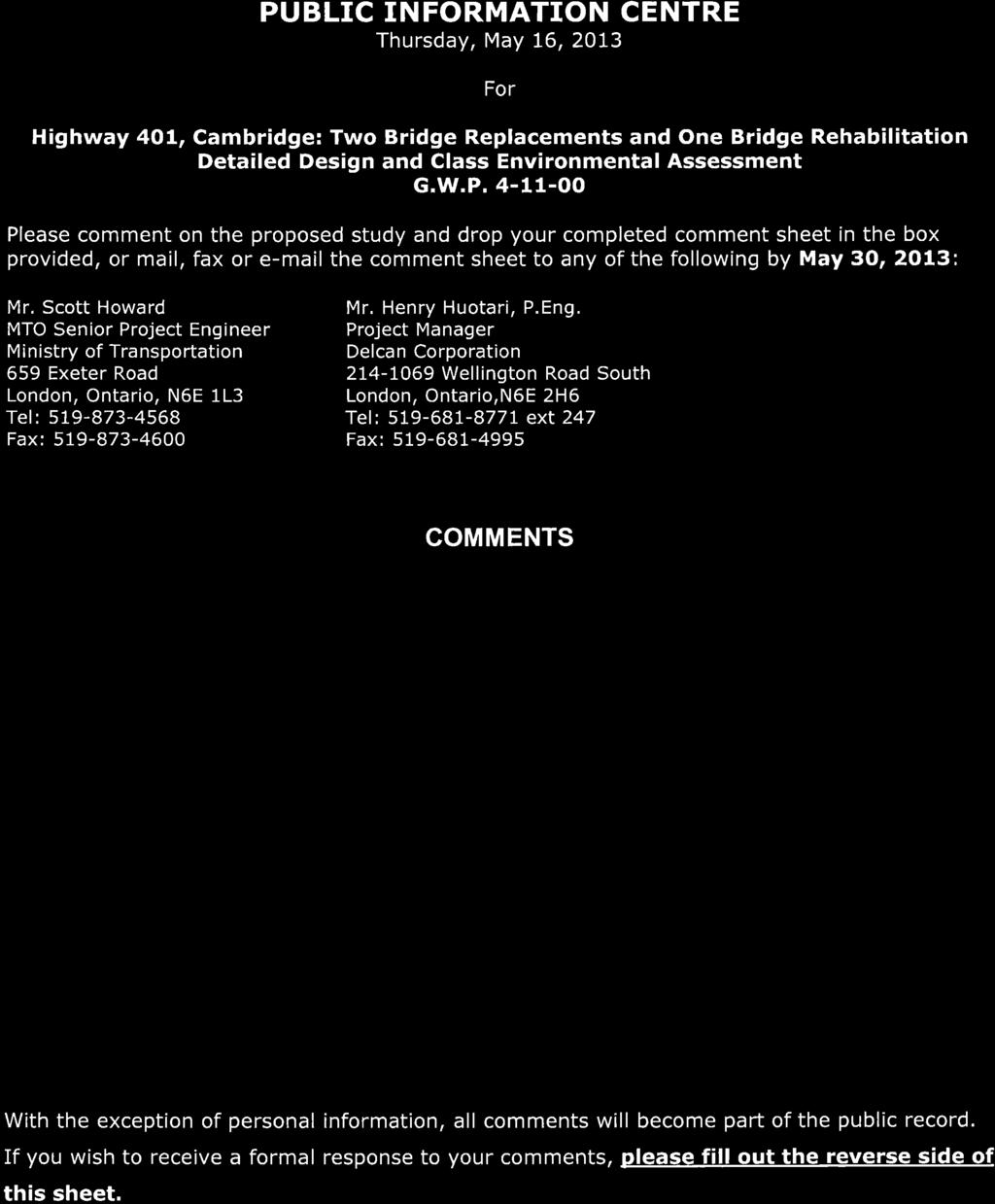

144
145
146 1069 Wellington Road South, Suite 214, London, ON N6E 2H6 Tel: Fax: June 17, 2013 OUR REF: TW-1361 Dear, Re: Highway 401, Cambridge: Two Bridge Replacements and One Bridge Rehabilitation Detailed Design and Class Environmental Assessment City of Cambridge and City of Kitchener, Region of Waterloo MTO G.W.P (sub-project of ) Thank you for submitting your comments for the Highway 401 Bridge Improvements project. Public participation is always an important part of any project and we appreciate your input. In your comments you suggested that Highway 7 to Guelph needs improvement and that Highway 6 from Highway 7 to Highway 401 should be upgraded. The Ministry is proceeding with separate studies of these corridors. For more information regarding other MTO highway projects please refer to the Southern Highways Program section of the Ontario Ministry of Transportation website ( In your comments you also noted concern with traffic management during construction and you had provided potential routes that would connect the present Highway 7 and Bingeman Centre Drive to the Kingsway Expressway. With respect to detour routes, the shortest, most convenient route around the closure will be signed while locals that are more familiar with the area can typically find other routes. Also note, the project team has been and will continue to work closely with the municipalities to manage traffic, optimize traffic signal timings and implement a communications plan. The Design and Construction Report (DCR), documenting the detailed design, is in the process of being prepared. You will be notified of the DCR completion and viewing locations by mail. In the meantime, if you have any further comments with regard to this study, please feel free to contact the undersigned. Yours sincerely,
147 Page 2 Henry Huotari, P. Eng. Delcan Project Manager c: Mr. Scott Howard, MTO Project Manager Ms. Kirstie Houston, MTO Environmental Planner Ms. Tisha Doucette, Planning Ecologist, Delcan Corporation
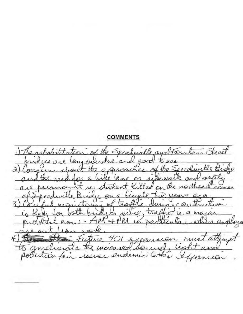
148
149
150 1069 Wellington Road South, Suite 214, London, ON N6E 2H6 Tel: Fax: June 17, 2013 OUR REF: TW-1361 Dear, Re: Highway 401, Cambridge: Two Bridge Replacements and One Bridge Rehabilitation Detailed Design and Class Environmental Assessment City of Cambridge and City of Kitchener, Region of Waterloo MTO G.W.P (sub-project of ) Thank you for submitting your comments for the Highway 401 Bridge Improvements project. Public participation is always an important part of any project and we appreciate your input. In your comments you indicated concern with regard to public safety and the need for a bike lane or sidewalk at the Speedsville Road bridge. The proposed replacement plans include sidewalks for both bridges (both sides for Fountain Street and west side for Speedsville Road), as well as shared-use paved shoulders that could accommodate bike traffic. The sidewalks and wider shoulders extend approximately 250 metres north and south of each bridge, within the jurisdiction of MTO. You also identified traffic management concerns during construction, citing the high traffic volume during the morning and evening work commutes. We appreciate your concern and are including measures in the design to expedite the construction process so to minimize the overall duration of the project. We are also working closely with the municipalities to manage traffic, optimize traffic signal timings and implement a communications plan. Lastly, you noted your concern with respect to increased noise, light and pollution issues associated with the future Highway 401 expansion. Please note that a separate Environmental Assessment (EA) process will be conducted for the future Highway 401 widening project. Through the EA process, information will be presented including proposed measures to mitigate these concerns. The Design and Construction Report (DCR), documenting the detailed design, is in the process of being prepared. You will be notified of the DCR completion and viewing locations by mail. In the meantime, if you have any further comments with regard to this study, please feel free to contact the undersigned.
151 Page 2 Yours sincerely, Henry Huotari, P. Eng. Delcan Project Manager c: Mr. Scott Howard, MTO Project Manager Ms. Kirstie Houston, MTO Environmental Planner Ms. Tisha Doucette, Planning Ecologist, Delcan Corporation
152 COMMENTS REGARDING THE TWO BRIDGE REPLACEMENTS AND ONE BRIDGE REHABILITATION We attended the public information meeting held May 16, 2013 as we reside in the Kitchener Road neighbourhood. I do not believe that the proposed schedule of closures and detours is appropriate for a number of reasons. In looking at any proposal of street or bridge closure, one must keep in mind that the neighbourhood located off Fountain Street is very isolated in that the only way in or out is off Fountain Street. At one time in the last few years, there was road work on Fountain so the road to the north was closed. Then there was an accident at the corner of Fountain and King, a not uncommon occurrence, and the south exit was closed. The neighbourhood had no way in or out for a number of hours during the police investigation. Further, Fountain Street is already a road in crisis. There are so many vehicles using the road during rush hour that it is common for the traffic to be backed up to the north as far as the cemetery. Trying to come home by using Shantz Hill to Fountain is just as crowded. Further, if one is coming from King Street, one can be lined up all the way to Westminster. In my experience, it is one of the most difficult neighbourhoods to access. Any closures resulting in detours of all of that traffic are clearly going to create a very difficult problem given the current frailties of the traffic movement. There are a number of other issues: The city of Cambridge is currently reviewing issues impacting Riverside Park located on King Street. It is my understanding that one of the considerations is closing the King Street entrance to vehicular traffic, both in and out. Should this happen, one less option is available to traffic seeking an alternate route. The area immediately north of the 401 on Fountain is also part of the city of Cambridge and is home to a significant industrial area. Fountain Street is the access point for not only vehicular traffic but also bicycle and foot traffic of the employees. There is no sidewalk for pedestrian traffic on Shantz Hill going under the 401 or on Maple Grove even if a pedestrian could be expected to negotiate that extensive detour. 1
153 The importance of access to this area north of the 401 for employment purposes by the people of Cambridge is recognized even by the Region in the provision of bus service on Fountain Street from the Preston area during work times. Also located on Fountain north of the 401 are several of the city s cemeteries. Every day there are people by car and on foot attending burials or visiting their loved ones. This area also serves as a major green space for walking for the neighbourhood, especially for those who have difficulty negotiating the steep hill leading down Fountain to King Street and Riverside Park. It is critical that the planners revisit the issue of not providing foot and bike access across the 401 at Fountain during construction. While there is a special pedestrian bridge over the 401 located in the Blair area, it only provides access to the west side of the Grand River and is not helpful. To expect people to go on foot by way of Shantz, King, Sportsworld and Maplegrove is not appropriate: it is too long and without the sidewalks to make it safe. It should also be noted that the bridge at Speedsville Road provides access to those people of Cambridge north of the 401 to all their services including pedestrian and bike access to the trail located south of the 401. Further, many people use that trail to get to work north of the 401 by bike from the Hespeler area of the city. The plan appears to have ignored in many respects the existing traffic problems of the area and completely disregarded the importance of maintaining foot and bike access in the Region. We expressed these concerns (some of which without the plans cannot now be pinpointed) and asked questions of the staff in attendance but were not provided with much feedback. We hope that you will reconsider your options although expect little given the uninformed people sent to the public meeting. We did not come away with the impression that public opinion was genuinely being sought. May 30,
154 3

155 1069 Wellington Road South, Suite 214, London, ON N6E 2H6 Tel: Fax: June 17, 2013 OUR REF: TW-1361 Attn:, Re: Highway 401, Cambridge: Two Bridge Replacements and One Bridge Rehabilitation Detailed Design and Class Environmental Assessment City of Cambridge and City of Kitchener, Region of Waterloo MTO G.W.P (sub-project of ) Thank you for submitting your comments for the Highway 401 Bridge Improvements project. Public participation is always an important part of any project and we appreciate your input. In your comments you expressed concern regarding the schedule of closures and detours, with an emphasis on the Fountain Street closure. You suggested that Fountain Street is currently a road in crisis, especially during rush hour traffic, and that we had not addressed the existing traffic problems in the project area. It should be noted that this is a provincial project; therefore addressing traffic issues beyond the provincial highway network is not within the jurisdiction of MTO. However, we do appreciate your concern regarding the temporary disruption of traffic during the implementation of the proposed local roads detour. Therefore, we are and will continue to work closely with the municipalities to manage traffic, optimize traffic signal timings and implement a communications plan. In addition, measures have been included in the design to expedite the construction process so as to minimize the overall duration of the project. Your letter also noted that a potential closure of King Street, by the City of Cambridge, may limit alternate routes during bridge construction for this project. Thank you for this information, as previously stated, we will continue to work with the City of Cambridge in order to maintain communications regarding roadwork that may impact the movement of local traffic. In your letter you also expressed your concern regarding pedestrian access across Highway 401 by way of the Fountain Street bridge and Speedsville Road bridge. We understand that the temporary closure of these bridges during construction will be disruptive and inconvenient to both pedestrian and vehicular traffic as well as the surrounding community. Measures to expedite construction have been implemented in the contract, construction has been staged, and detours have been selected with consideration for reducing these impacts. We are also coordinating with Grand River Transit for the re-routing of bus services in the area.
156 Page 2 We regret to hear that you felt the public opinion was not genuinely sought at the Public Information Centre. However, we assure you that our aim for this project is to implement a sustainable and efficient work plan for the bridge replacements and to minimize, as much as possible, any disturbances to the surrounding community. The Design and Construction Report (DCR), documenting the detailed design, is in the process of being prepared. You will be notified of the DCR completion and viewing locations by mail. In the meantime, if you have any further comments with regard to this study, please feel free to contact the undersigned. Yours sincerely, Henry Huotari, P. Eng. Delcan Project Manager c: Mr. Scott Howard, MTO Project Manager Ms. Kirstie Houston, MTO Environmental Planner Ms. Tisha Doucette, Planning Ecologist, Delcan Corporation
157 DESIGN AND CONSTRUCTION REPORT SUBMISSION CORRESPONDENCE
158 1069 Wellington Road South, Suite 214, London, ON N6E 2H6 Tel: Fax: July 3, 2013 OUR REF: TW-1361 Mr. Rob Leone, MPP Cambridge Constituency Office Cambridge Riding 498 Eagle Street North Cambridge, Ontario N3H 1C2 Dear Mr. Leone: Re: Notice of Design and Construction Report Submission Detailed Design and Class Environmental Assessment Highway 401 Bridge Improvements City of Cambridge and City of Kitchener, Region of Waterloo MTO G.W.P (sub-component of GWP ) The Ministry of Transportation, Ontario (MTO) retained Delcan Corporation to carry out the Detailed Design and Class Environmental Assessment (EA) for the replacement of the Fountain Street Bridge, replacement of the Speedsville Road Bridge, and the rehabilitation of the bridge on the Highway 8 ramp to Eastbound Highway 401. A Design and Construction Report (DCR) has been prepared documenting the detailed design, environmental mitigation measures and related construction methods/staging for this project. This document will be made available for a 30-day review period from July 22, 2013 to August 20, The enclosed Notice of Design and Construction Report Submission provides details of the study process, the project, and the locations where the DCR is available for public review. The notice will appear in The Waterloo Region Record on Wednesday, July 17 and Saturday July 20, 2013; in the Cambridge Times on Tuesday, July 16 and Friday, July 19, 2013; and in the Turtle Island News and Tekawennake News on Wednesday, July 10 and Wednesday July 17, If you require further information or have any questions / comments, please feel free to contact any of the study team listed on the enclosed notice. Yours sincerely, Henry Huotari Delcan Project Manager c. Mr. Scott Howard, MTO Project Manager Ms. Kirstie Houston, MTO Environmental Planner Ms. Tisha Doucette, Planning Ecologist, Delcan Corporation Enclosed
159 1069 Wellington Road South, Suite 214, London, ON N6E 2H6 Tel: Fax: July 3, 2013 OUR REF: TW-1361 Mr. Michael Harris, MPP Kitchener Conestoga Constituency Office Kitchener Conestoga Unit King Street East Kitchener, Ontario N2P 2E9 Dear Mr. Harris: Re: Notice of Design and Construction Report Submission Detailed Design and Class Environmental Assessment Highway 401 Bridge Improvements City of Cambridge and City of Kitchener, Region of Waterloo MTO G.W.P (sub-component of GWP ) The Ministry of Transportation, Ontario (MTO) retained Delcan Corporation to carry out the Detailed Design and Class Environmental Assessment (EA) for the replacement of the Fountain Street Bridge, replacement of the Speedsville Road Bridge, and the rehabilitation of the bridge on the Highway 8 ramp to Eastbound Highway 401. A Design and Construction Report (DCR) has been prepared documenting the detailed design, environmental mitigation measures and related construction methods/staging for this project. This document will be made available for a 30-day review period from July 22, 2013 to August 20, The enclosed Notice of Design and Construction Report Submission provides details of the study process, the project, and the locations where the DCR is available for public review. The notice will appear in The Waterloo Region Record on Wednesday, July 17 and Saturday July 20, 2013; in the Cambridge Times on Tuesday, July 16 and Friday, July 19, 2013; and in the Turtle Island News and Tekawennake News on Wednesday, July 10 and Wednesday July 17, If you require further information or have any questions / comments, please feel free to contact any of the study team listed on the enclosed notice. Yours sincerely, Henry Huotari Delcan Project Manager c. Mr. Scott Howard, MTO Project Manager Ms. Kirstie Houston, MTO Environmental Planner Ms. Tisha Doucette, Planning Ecologist, Delcan Corporation Enclosed
160 1069 Wellington Road South, Suite 214, London, ON N6E 2H6 Tel: Fax: July 8, 2013 OUR REF: TW-1361 Address Dear Mr / Ms. Re: Notice of Design and Construction Report Submission Detailed Design and Class Environmental Assessment Highway 401 Bridge Improvements City of Cambridge and City of Kitchener, Region of Waterloo MTO G.W.P (Sub-component of GWP ) The Ministry of Transportation, Ontario (MTO) retained Delcan Corporation to carry out the Detailed Design and Class Environmental Assessment (EA) for the replacement of the Fountain Street Bridge, replacement of the Speedsville Road Bridge, and the rehabilitation of the bridge on the Highway 8 ramp to Eastbound Highway 401. A Design and Construction Report (DCR) has been prepared documenting the detailed design, environmental mitigation measures and related construction methods/staging for this project. This document will be made available for a 30-day review period from July 22, 2013 to August 20, The enclosed Notice of Design and Construction Report Submission provides details of the study process, the project, and the locations where the DCR is available for public review. Interested persons are encouraged to review the DCR and provide comments by Tuesday, August 20, If you wish to comment or have any questions regarding the study please contact either the undersigned or one of the project team members named in the enclosed notice. Yours sincerely, Henry Huotari, P. Eng. Delcan Project Manager c. Mr. Scott Howard, MTO Project Manager Ms. Kirstie Houston, MTO Environmental Planner Ms. Tisha Doucette, Planning Ecologist, Delcan Corporation Enclosed
161 APPENDIX C Public Information Centre Display Material


162 WELCOME PUBLIC INFORMATION CENTRE Highway 401, Cambridge: Two Bridge Replacements and One Bridge Rehabilitation Detailed Design and Class Environmental Assessment Thursday, May 16, :00 p.m. to 8:00 p.m. Project Overview Presentations 4:30 p.m. and 7:00 p.m. Location: Four Points by Sheraton 210 Preston Parkway Cambridge, ON

163 HIGHWAY 401, CAMBRIDGE TWO BRIDGE REPLACEMENTS AND ONE BRIDGE REHABILITATION This PIC will present and discuss the detailed design of the Highway 401 Bridge Improvements and construction staging plans. Please review the information and display boards presented and discuss any aspects of the project with the Study Team members in attendance. Comment forms are provided for your convenience and may be completed here or returned by May 30, Comments and information regarding this study are being collected to assist the study team in meeting the requirements of the Environmental Assessment Act. Information will be collected in accordance with the Freedom of Information and Protection of Privacy Act. This material will be maintained on file for use during the study and may be included in study documentation. With the exception of personal information, all comments will become part of the public record. You are encouraged to contact the study team if you have any questions or concerns regarding the above information.


164 OVERVIEW OF IMPROVEMENTS The Speedsville Road bridge and Fountain Street bridge have reached the end of their service life and require replacement. Both of these bridges will be replaced with provisions for future widening of Highway 401. The Highway 8 Eastbound on-ramp bridge is showing signs of deterioration and requires rehabilitation. Existing Speedsville Bridge Existing Fountain Street Bridge Existing Highway 8 Eastbound on-ramp Bridge
165 CLASS ENVIRONMENTAL ASSESSMENT The Detailed Design is being carried out in accordance with the requirements of the Class Environmental Assessment for Provincial Transportation Facilities (MTO 2000). The Class Environmental Assessment (Class EA) process ensures: All relevant engineering and environmental factors are considered in the planning and design process. Public and agency input is integrated into the process. The Class EA categorizes the Highway 401 Bridge Improvements as a Group B project a major improvement to an existing transportation facility. During Detailed Design, the EA process involves: Continuing public and agency consultation and the identification of impacts and environmental protection / mitigation measures Documenting the Detailed Design and Class EA process in a Design and Construction Report (DCR).


166 *A separate EA process will be conducted for the future Highway 401 widening project

167 REPLACEMENT OF THE SPEEDSVILLE ROAD BRIDGE The bridge type is a steel girder bridge. The project team is reviewing construction methods that will accelerate construction and reduce impacts to the surrounding community. The Speedsville Road bridge is expected to be closed for 8 months. The new bridge will have a sidewalk on the west side of the bridge and 2.0 metre wide paved shared-use shoulders. Proposed Speedsville Road Bridge Cross Section Aesthetic Drawing of the Proposed Speedsville Road Bridge
168 SPEEDSVILLE ROAD BRIDGE LOCAL ROADS DETOUR YEAR 1 Speedsville Road Bridge replacement will take place in Year 1 of construction. The duration of construction is expected to be 8 months, at this time, the bridge will be closed.

169 REPLACEMENT OF FOUNTAIN STREET BRIDGE The bridge type is a concrete girder bridge. The project team is reviewing construction methods that will accelerate construction and reduce impacts to the surrounding community. Fountain Street bridge will be closed for up to 8 months. There will be no pedestrian access during construction. The new bridge will have sidewalks on both sides of the bridge and 2.0 metre wide paved shared-use shoulders. Proposed Fountain Street Bridge Cross Section Aesthetic Drawing of the Proposed Fountain Street Bridge
170 FOUNTAIN STREET BRIDGE LOCAL ROADS DETOUR YEAR 2 Fountain Street Bridge replacement will take place in Year 2 of construction. The duration of construction is expected to be 8 months, at this time, the bridge will be closed.

171 REHABILITATION OF THE HIGHWAY 8 RAMP BRIDGE Highway 8 West-to-East Ramp carries 2 lanes of Highway 8 eastbound traffic onto Highway 401 eastbound. Bridge rehabilitation is required to avoid further deterioration and preserve the integrity of the bridge. The outside barrier walls, expansion joints and de-icing system will be replaced. There will be two nightly closures for final paving operations. Highway 8 West-to-East Ramp Bridge New Cross Section Aesthetic Drawing of the Proposed West to-east Ramp Bridge
. Highway 401 traffic will be diverted to a designated Emergency Detour Route along Maple Grove Road.")
172 OVERVIEW OF CONSTRUCTION STAGING FOR BRIDGE REPLACEMENTS The existing bridges will be demolished during night time hours (one night per bridge). New bridge girders will be placed during night time hours (up to three nights per bridge). Highway 401 traffic will be diverted to a designated Emergency Detour Route along Maple Grove Road. Fountain Street and Speedsville Road traffic will be detoured to local roads. Fountain Street and Speedsville Road will NOT be closed at the same time.

173 ALTERNATE ROUTE HIGHWAY 8 RAMP BRIDGE REHABILITATION Highway 8 Ramp Bridge Rehabilitation: YEAR 1 Replace outside barrier walls; Patch, waterproof, re-pave deck; Upgrade de-icing system; and Replace expansion joints. Construction Staging: Maintain one lane of traffic on bridge at all times. Two full closures at night for paving operations. Provide alternate route. Overall duration of construction will be 8 10 weeks.


 structures is dominated by urban")


174 EXISTING ENVIRONMENTAL CONDITIONS An assessment of the surrounding natural, social and economic environment was completed for the Highway 401 Bridge Improvements Detailed Design. Highlights of the assessment are identified below. Mitigation measures to avoid and/or reduce impacts to the environment will be included in contract documents. Natural Environment The area surrounding the three (3) structures is dominated by urban development. East of the Speedsville Road Underpass, there is a cattail marsh, which is associated with the Speed River Provincially Significant Wetland Complex. Photos - Cattail Marsh on east side of Speedsville Road Archaeology Further field investigations are required and are currently underway. The findings will be documented in a report and submitted to the Ministry of Tourism, Culture and Sport for review and acceptance. West Creek north of Highway 401


175 ENVIRONMENTAL MITIGATION MEASURES Natural Environment. Restoration of disturbed areas as soon as possible to reduce the potential of sedimentation. Implementation of effective erosion and sediment control measures to avoid release of sediment into nearby water features. Socio-economic Environment Implementation of accelerated construction techniques to reduce the duration of construction and impacts to businesses, industries and the travelling public. Demolition of Speedsville Road Bridge and Fountain Street Bridge will not be completed at the same time to reduce impacts to the travelling public.
176 NEXT STEPS Information and comments received from external agencies, municipalities and the public will be reviewed and incorporated into the detailed design, where appropriate. Following this PIC, a Design and Construction Report (DCR) will be prepared documenting the Detailed Design in accordance with the Class EA Study, and made available for a 30-day public review period. DCR review locations will be advertised in local newspapers and those on the study mailing list will be notified. The Highway 401 Bridge Improvements project is listed in the ministry s Southern Highways Program: ( ) for construction start between 2014 to If you have any questions or comments regarding this study, please contact one of the following: YOUR INPUT IS IMPORTANT Scott Howard, Senior Project Manager Ministry of Transportation, West Region 659 Exeter Road London, Ontario, N6E 1L3 Tel: Fax: Toll Free: scott.howard@ontario.ca Henry Huotari, P. Eng. Consultant Project Manager Delcan Corporation Wellington Road South. London, Ontario, N6E 2H6 Tel: ext 5517 Fax: h.huotari@delcan.com Comments would be appreciated by May 30, Thank you for your participation in this study.
177 HIGHWAY 401 RECONSTRUCTION AND WIDENING - FUTURE WORK A PIC will be held for the Reconstruction and Widening of Highway 401, from 0.5 km west of Regional Road 8 / King Street easterly to 0.5 km east of Regional Road 24 / Hespeler Road (date to be determined). Future work will include the Detailed Design of the following: Widening Highway 401 from 6 to 10 lanes, plus speed change lanes and bus bypass shoulders; Realignment / reconstruction of interchange ramps at Highway 8 and at Regional Road 24 / Hespeler Road: Replacement of the Speed River bridges, and rehabilitation/widening of railway overpasses; and Various highway improvements such as high mast lighting, overhead signs and electronic message signs. Pavement design analysis considering noise reduction pavement types and lighting pole locations will be presented at the PIC for Highway 401 Reconstruction and Widening a future project.


178 OVERVIEW Public Information Centre Highway 401, Cambridge: Two Bridge Replacements and One Bridge Rehabilitation Detailed Design and Class Environmental Assessment (MTO G.W.P ) Date: Thursday May 16, 2013 Location: Four Points Sheraton, 210 Preston Parkway, Cambridge ON The project will involve the replacement of the Speedsville Road Bridge and Fountain Street Bridge as both bridges are near the end of their service life. The project will also rehabilitate the Highway 8 Eastbound on-ramp bridge as it shows signs of deterioration. All three bridges are located near Highway 401 in Cambridge (see figure 1). The two bridge replacements will be constructed with provisions for future widening of Highway 401. Figure 2- Local Roads Detour during closure of Speedsville Road Bridge Figure 1-Key map: Bridge improvement locations CLASS ENVIRONMENTAL ASSESSMENT The Detailed Design is being carried out in accordance with the requirements of the Class Environmental Assessment (Class EA) for Provincial Transportation Facilities (MTO 2000). The Class EA process ensures: All relevant engineering and environmental factors are considered in planning / design process Agency and public input is integrated into process The bridge improvements are categorized as a Group B project - a major improvement to an existing transportation facility, and as such involves: Continuing agency and public consultation and identification of environmental protection / mitigation measures. Documenting the Detailed Design and Class EA process in a Design and Construction Report (DCR). FOUNTAIN STREET BRIDGE REPLACEMENT The new bridge at Fountain Street will be a concrete girder bridge. The project team is reviewing construction methods to accelerate construction and reduce impacts to the surrounding community. The bridge replacement is expected to take place in Year 2 of construction and the duration of construction is expected to be 8 months, at which time the bridge will be closed with no pedestrian access. The new bridge will have sidewalks on both sides and 2.0 metre wide paved shared-use shoulders. Fountain Street traffic will be detoured through local roads (see Figure 3). SPEEDSVILLE ROAD BRIDGE REPLACEMENT The new bridge at Speedsville Road will be a steel box girder bridge. The project team is reviewing construction methods to accelerate construction and reduce impacts to the surrounding community. The bridge replacement is expected to take place in Year 1 of construction and the duration of construction is expected to be 8 months, at which time the bridge will be closed. The new bridge will have a sidewalk on the west side of the bridge and 2.0 metre wide shared-use shoulders. Speedsville Road traffic will be detoured through local roads (see Figure 2). Figure 3- Local Roads Detour during closure of Fountain Street Bridge
179 HIGHWAY 8 RAMP BRIDGE REHABILITATION Highway 8 West-to-East Ramp carries two lanes of traffic onto Highway 401 eastbound. To avoid further deterioration and preserve the integrity of the bridge; the outside barrier walls, expansion joints, and de-icing system will be replaced and the deck will be patched, waterproofed, and re-paved. One lane of traffic will be maintained at all times with only two full closures at night for paving operations, with a pre-determined alternate route (see Figure 4). Overall duration of construction will be 8-10 weeks. NEXT STEPS Information and comments received from external agencies, municipalities and the public will be reviewed and incorporated into the detailed design, where appropriate. Following this PIC, a Design and Construction Report (DCR) will be prepared documenting the Detailed Design in accordance with the Class EA Study, and made available for a 30-day public review period. DCR review locations will be advertised in local newspapers and those on the study mailing list will be notified. The Highway 401 Bridge Improvements project is listed in the ministry s Southern Highways Program: ( ) for construction start between 2014 and Please fill out a comment sheet to provide us with your input. Comments would be appreciated by May 30, Questions or Comments? Scott Howard, Senior Project Manager Ministry of Transportation West Region Tel: Fax: Toll free: scott.howard@ontario.ca Henry Huotari, P. Eng., Delcan Project Manager Delcan Corporation Tel : Fax: h.huotari@delcan.com Figure 4- Alternate route during closure of the Highway 8 EB ramp Bridge during paving operations. HIGHWWAY 401 NIGHTLY CLOSURES The existing bridges will be demolished at night (one night per bridge) and new bridge girders will be placed at night (up to three nights per bridge). Highway 401 traffic will be diverted to the Emergency Detour Route along Maple Grove Road (see Figure 5). FUTURE WORK Future work will include the Detailed Design of the following: Widening Highway 401 from 6 to 10 lanes, plus speed change lanes and bus bypass shoulders; Realignment / reconstruction of interchange ramps at Highway 8 and at Regional Road 24 / Hespeler Road: Replacement of the Speed River bridges, and rehabilitation/widening of railway overpasses; and Various highway improvements such as high mast lighting and overhead signs. Figure 5- Local roads detour route during bridge demolition.
180 PUBLIC INFORMATION CENTRE Thursday, May 16, 2013 For Highway 401, Cambridge: Two Bridge Replacements and One Bridge Rehabilitation Detailed Design and Class Environmental Assessment G.W.P Please comment on the proposed study and drop your completed comment sheet in the box provided, or mail, fax or the comment sheet to any of the following by May 30, 2013: Mr. Scott Howard MTO Senior Project Engineer Ministry of Transportation 659 Exeter Road London, Ontario, N6E 1L3 Tel: Fax: Mr. Henry Huotari, P.Eng. Project Manager Delcan Corporation Wellington Road South London, Ontario,N6E 2H6 Tel: ext 247 Fax: Ms. Tisha Doucette Planning Ecologist Delcan Corporation Wellington Road South London, ON N6E 2H6 Tel: , ext. 242 Fax: COMMENTS With the exception of personal information, all comments will become part of the public record. If you wish to receive a formal response to your comments, please fill out the reverse side of this sheet.

181 Please fill out this portion of the form if you wish to receive a formal response to your comments. Name: Address: Telephone: Thank you for your participation!
182 APPENDIX D First Nations and Métis Engagement
183

184
185


186
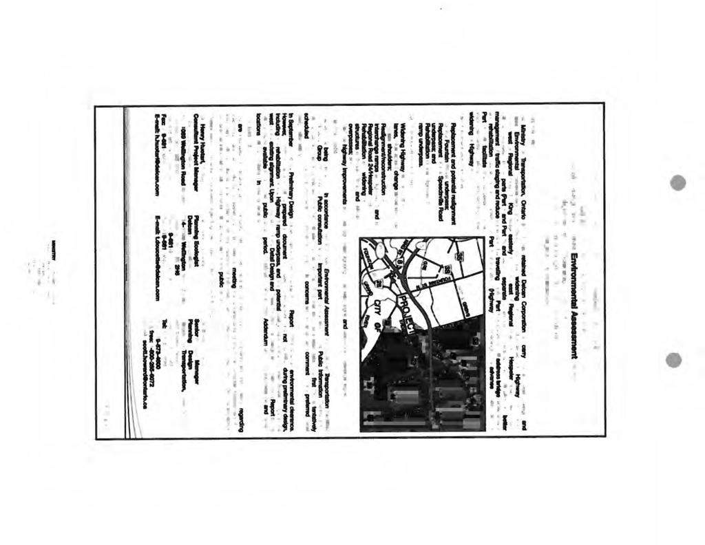


187

188


189

190

191


192


193


194
195
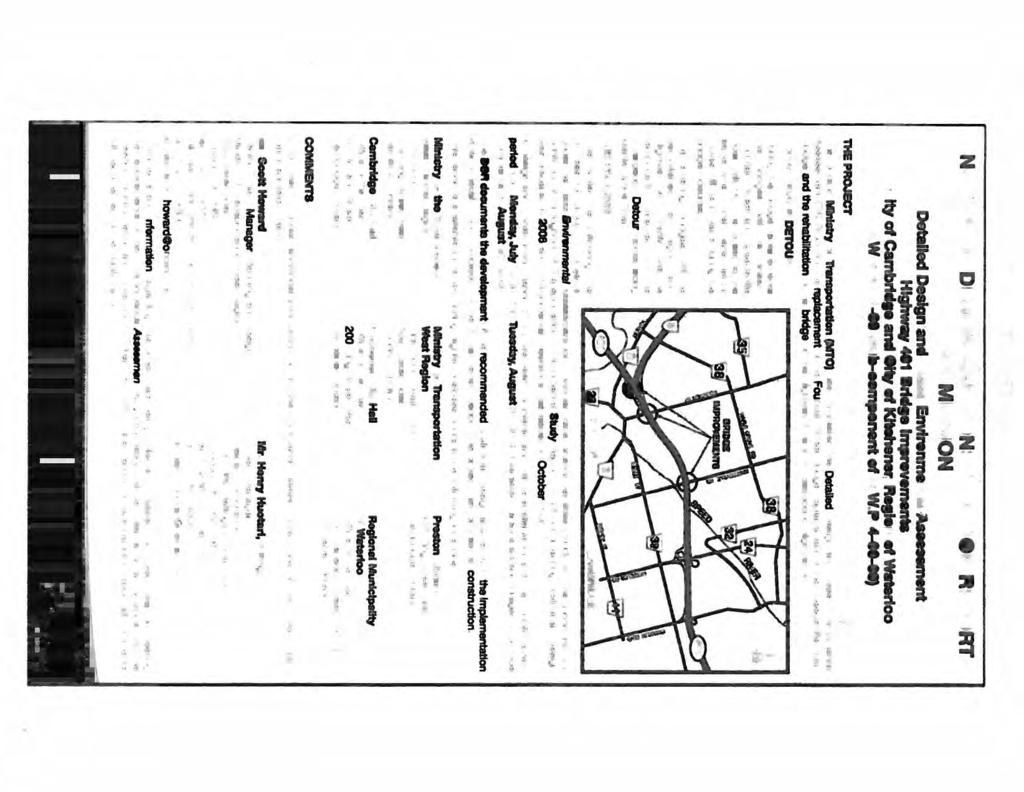


196
ONLINE PUBLIC INFORMATION CENTRE
 ONLINE PUBLIC INFORMATION CENTRE County Road 17 Bridge Replacements Detail Design and Environmental Assessment GWP 4203-15-00 The Ministry of Transportation Ontario (MTO) has retained CH2M Hill and Dillon
II PREVIOUS REPORTS PERTINENT TO THIS MATTER II
 ~ ~~ ~~~ ~ ~~ ~ ~~~~ ~ ~~ ~~ ~~~~ ~ Agenda Item # Page # TO: FROM: -..-.-I- 3UBJCL I CHAIR AND MEMBERS ENVIRONMENT AND TRANSPORTATION COMMITTEE MEETING ON OCTOBER 17,2005 DAVID A. LECKIE, P. ENG DIRECTOR
Second Line West Pedestrian/Cyclist Crossing of Highway 401 Class EA. Second Line West Pedestrian/Cyclist Crossing of Highway 401 Class EA
 1 1 Purpose of Public Information Centre #2 To provide interested and/or potentially affected stakeholders with an opportunity to participate in the planning and decision-making process for this Municipal
TRANSPORTATION COMMITTEE
 TRANSPORTATION COMMITTEE CITY OF OTTAWA Ministry of Transportation Detailed Design Assignment G.W.P.# 4058-01-00 Highway 417 (Ottawa Queensway) Widening & Rehabilitation from Maitland Avenue to Island
ENBRIDGE GAS DISTRIBUTION INC. Proposed Relocation for Ninth Line, Markham and Whitchurch-Stouffville. Environmental Screening Report
 Page 1 of 18 ENBRIDGE GAS DISTRIBUTION INC. Proposed Relocation for Ninth Line, Markham and Whitchurch-Stouffville Environmental Screening Report July 2011 Page 2 of 18 Table of Contents 1.0 INTRODUCTION
Public Information Centre. Welcome
 Transportation Improvements from the Beaver Creek Bridge to the Entrance of Santa s Village District of Muskoka Municipal Class Environmental Assessment Welcome Please sign in Take a comment sheet Staff
Victoria Bridge Municipal Class EA Civic Works Committee
 Municipal Class EA John Pucchio, P. Eng., Project Manager June 19 2018 Introduction Existing Conditions Municipal Class EA Proposed Bridge Proposed Road Reconstruction Proposed Improvements Construction
Better Cycling. The City will update the cycling master plan (London ON Bikes) based on the approved BRT network.
 based on the approved BRT network.") Better Cycling Dedicated bike facilities will be constructed along BRT corridors where space is available. Nearby bike routes will also be upgraded to ensure a complete network is available for cyclists.
Better Cycling Dedicated bike facilities will be constructed along BRT corridors where space is available. Nearby bike routes will also be upgraded to ensure a complete network is available for cyclists.
WELCOME! 8 8:30 6: TH STREET IMPROVEMENTS. Open House. Presentation & Q&A
 WELCOME! 168 TH STREET IMPROVEMENTS 6:30 Open House 7 8 Presentation & Q&A 8 8:30 Open House WELCOME Todd Pfitzer City of Omaha Engineer Bob Stubbe City of Omaha Public Works Director Jon Meyer Project
The purpose of tonight s PIC is to:
 The purpose of tonight s PIC is to: Provide an overview of the work completed to date and a summary of the Class EA process being followed; Provide a summary of public input received so far, including
WELCOME TO OPEN HOUSE TWO November 28, 2018
 Langstaff Road Weston Road to Highway 7 Class Environmental Assessment Study WELCOME TO OPEN HOUSE TWO November 28, 2018 Please sign in and join our mailing list Study Overview York Region is conducting
Heritage Road Improvements from Steeles Avenue to Rivermont Road
 The Corporation of the City of Brampton Heritage Road Improvements from Steeles Avenue to Rivermont Road Class Environmental Assessment Study (Schedule C) September 19, 2013 The Corporation of the City
Mavis Road Class Environmental Assessment
 Mavis Road Class Environmental Assessment Public Information Centre #2 Wednesday November 9, 2016 6:00 to 8:00 p.m. Please sign in and complete a comment sheet Review the displays on your own or join in
FANSHAWE PARK ROAD/RICHMOND STREET INTERSECTION IMPROVEMENTS. PUBLIC INFORMATION CENTRE 2 June 16, 2016
 FANSHAWE PARK ROAD/RICHMOND STREET INTERSECTION IMPROVEMENTS Municipal Class Environmental Assessment PUBLIC INFORMATION CENTRE 2 June 16, 2016 ACCESSIBILITY Under the Accessibility Standards 2015 for
GEOMETRIC IMPROVEMENTS AND WATERMAIN LOOPING MUNICIPAL CLASS ENVIRONMENTAL ASSESSMENT
 GEOMETRIC IMPROVEMENTS AND WATERMAIN LOOPING MUNICIPAL CLASS ENVIRONMENTAL ASSESSMENT Veterans Way (previously Powerline Road) and Klondike Park Road Wasaga Beach Welcome Please sign in Take a comment
GLEN ROAD PEDESTRIAN BRIDGE ENVIRONMENTAL ASSESSMENT STUDY PUBLIC INFORMATION CENTRE #2 OCTOBER 24, 2017
 GLEN ROAD PEDESTRIAN BRIDGE ENVIRONMENTAL ASSESSMENT STUDY PUBLIC INFORMATION CENTRE #2 OCTOBER 24, 2017 Glen Road Pedestrian Bridge Class Environmental Assessment 1 WELCOME! Welcome to the second Public
WELCOME TO PUBLIC INFORMATION CENTRE #2. Please Sign In
 WELCOME TO PUBLIC INFORMATION CENTRE #2 Replacement of Oxtongue Lake Narrows Bridge & Oxtongue River Bridge, Highway 60 (G.W.P. 93-89-00 & G.W.P. 5550-04-00) Class Environmental Assessment (Group B) Please
WELCOME TO THE PUBLIC INFORMATION CENTRE. Please Sign In
 WELCOME TO THE PUBLIC INFORMATION CENTRE Replacement of Oxtongue Lake Narrows Bridge & Oxtongue River Bridge, Highway 60 (G.W.P. 93-89-00 & G.W.P. 5550-04-00) Class Environmental Assessment (Group B) Please
City of Cornwall Municipal Class Environmental Assessment. Proposed Improvement and Extension of Lemay Street
 Welcome City of Cornwall Municipal Class Environmental Assessment Proposed Improvement and Extension of Lemay Street Redevelopment and Design of the Municipal Works Yard Public Information Centre #1 Thursday,
Bostwick Road. Municipal Class Environmental Assessment. October 13, City of London. Bostwick Road Municipal Class Environmental Assessment
 Bostwick Road Municipal Class Environmental Assessment October 13, 2016 Welcome! Welcome to the first Public Information Centre for the Bostwick Road Municipal Class Environmental Assessment. Representatives
Public Information Centre #1
 and Highway 401 Interchange Improvements WELCOME Public Information Centre #1 Veterans Memorial Parkway Extension and Highway 401 Interchange Improvements Study May 23, 2012 4 p.m. to 7 p.m. Brief Overview
Commissioners Road West Realignment Environmental Assessment
 City of London Commissioners Road West Realignment Environmental Assessment Public Information Centre No. 1 March 30, 2017 Welcome to the Public Information Centre This first Public Information Centre
Vaughan Metropolitan Centre (VMC) Black Creek Renewal CLASS ENVIRONMENTAL ASSESSMENT
 Black Creek Renewal CLASS ENVIRONMENTAL ASSESSMENT") PUBLIC INFORMATION CENTRE Vaughan Metropolitan Centre (VMC) Black Creek Renewal Wednesday, May 10, 2017 6:00 p.m. to 8:00 p.m. Add photo Project Management, Environmental Assessment, Stormwater Management
PUBLIC INFORMATION CENTRE Vaughan Metropolitan Centre (VMC) Black Creek Renewal Wednesday, May 10, 2017 6:00 p.m. to 8:00 p.m. Add photo Project Management, Environmental Assessment, Stormwater Management
St. Clair Avenue West Area Transportation Master Plan
 1 (Between Keele Street and Old Weston Road) Public Information Centre 1 December 2, 2015 2 Welcome Welcome to the first Public Information Centre for the St. Clair Avenue West Area. The panels will present
Declarations of Pecuniary Interest under the Municipal Conflict Of Interest Act
 Regional Municipality of Waterloo Heritage Planning Advisory Committee Minutes February 8, 2018 5:00 PM Regional Administrative Headquarters, Room 110 150 Frederick Street, Kitchener Present were: Councilor
Highway 427 Industrial Secondary Plan Area 47 Schedule C Class Environmental Assessment For Arterial Roadways
 Welcome to Pubic Information Centre #1 Highway 427 Industrial Secondary Plan Area 47 Schedule C Class Environmental Assessment For Arterial Roadways Welcome to Open House # 1 Tonight, we invite you to.
Municipal Class EA Study Public Information Centre No. 1 December 13, :00 pm 7:00 pm. Please sign in so we can keep you updated on this study
 Reconstruction of Regional Road 45 (Creek Road) Between Regional Road 27 (River Road) and Regional Road 63 (Canborough Road) in the Township of Wainfleet Municipal Class EA Study Public Information Centre
Bostwick Road. Municipal Class Environmental Assessment. Public Information Centre #2 June 14, City of London
 Bostwick Road Municipal Class Environmental Assessment Public Information Centre #2 June 14, 2017 Welcome! Welcome to the 2 nd Public Information Centre for the. Representatives from the and the consulting
Meeting Purpose: Date and Time: Location: Attendance: Handouts:
 Meeting Purpose: Date and Time: Location: Attendance: Handouts: PA Turnpike / I-95 Interchange Project Design Advisory Committee (DAC)/Public Officials Meeting #8 April 12, 2012 at 1:30 p.m. Project Office,
Burloak Drive Grade Separation
 Burloak Drive Grade Separation Transit Project Assessment Process Public Meeting #1 March 30, 2017 GO Lakeshore West Service Plan Weekday Rush Hour 15-minute, two-way service between Aldershot* and Union
Station Street/Haig Road Extension Environmental Assessment (EA)Study. Welcome
Study. Welcome") Station Street/Haig Road Extension Environmental Assessment (EA)Study Welcome Welcome to this Public Information Centre (PIC) meeting. Please record your attendance and obtain a comment sheet at the registration
Station Street/Haig Road Extension Environmental Assessment (EA)Study Welcome Welcome to this Public Information Centre (PIC) meeting. Please record your attendance and obtain a comment sheet at the registration
TOWN OF WHITBY REPORT RECOMMENDATION REPORT
 TOWN OF WHITBY REPORT RECOMMENDATION REPORT REPORT TO: Council REPORT NO: PL 95-09 DATE OF MEETING: October 13, 2009 PREPARED BY: Planning/Public Works Joint Report FILE NO(S): N/A LOCATION: N/A REPORT
Commissioners Road West Realignment Environmental Assessment
 City of London Commissioners Road West Realignment Environmental Assessment Public Information Centre No. 2 November 29, 2017 Welcome to the Public Information Centre This 2 nd Public Information Centre
Red Hill Valley Project More Than A Road October 16, 2006
 Red Hill Valley Project Presented By: More Than A Road October 16, 2006 September, 2007 Gerry Davis, C.M.A., Senior Director, Capital Planning and Implementation Division Public Works Department City of
Meeting Agenda. City of Guelph. River Systems Advisory Committee. Agenda Items. Item 1, 2 and 3. Item 4 Ward to Downtown Pedestrian Bridge
 Meeting Agenda City of Guelph River Systems Advisory Committee September 19, 2018 City Hall, Meeting Room B From 4:00 to 6:00 p.m. Meeting Chair: Mariette Pushkar Agenda Items Welcome to all Item 1, 2
7.0 SOCIAL, ECONOMIC, AND ENVIRONMENTAL ISSUES
 7.0 SOCIAL, ECONOMIC, AND ENVIRONMENTAL ISSUES The following list of social, economic, and environmental issues have been identified based on a preliminary inventory of resources in the project area, an
SECTION 4(f) DE MINIMIS DOCUMENTATION
 DE MINIMIS DOCUMENTATION") SECTION 4(f) DE MINIMIS DOCUMENTATION Illinois Route 60/83 IL 176 to the intersection of IL 60 (Townline Road) Lake County P-91-084-07 Mundelein Park and Recreation District Project Limit SECTION 4(f)
SECTION 4(f) DE MINIMIS DOCUMENTATION Illinois Route 60/83 IL 176 to the intersection of IL 60 (Townline Road) Lake County P-91-084-07 Mundelein Park and Recreation District Project Limit SECTION 4(f)
Blackfriars Bridge Municipal Class Environmental Assessment. Public Information Centre #1 November 19 th, 2014
 Blackfriars Bridge Municipal Class Environmental Assessment Public Information Centre #1 November 19 th, 2014 Why are you here tonight? To determine the future requirements of the river crossing at Blackfriars
Fall 2017 Construction Update
 Fall 2017 Construction Update Ward 4 Southeast Engineering Department Riverwalk Red Multi-Use Trail Bridge Rehabilitation The Riverwalk Red Multi Use Trail Bridge was awarded to Cramer and Associates,
Adelaide Street / Canadian Pacific Railway (CPR) Grade Separation Class Environmental Assessment. Public Information Centre 3
 Grade Separation Class Environmental Assessment. Public Information Centre 3") 1 Adelaide Street / Canadian Pacific Railway (CPR) Grade Separation Study Process and Purpose of PIC 3 2 Study Commencement February 2016 Phase 1: Problem and Opportunity Identify problems and opportunities
1 Adelaide Street / Canadian Pacific Railway (CPR) Grade Separation Study Process and Purpose of PIC 3 2 Study Commencement February 2016 Phase 1: Problem and Opportunity Identify problems and opportunities
Ministry of Transportation
 Ministry of Transportation Highway 401/Mavis Road Interchange and New Ramps at the Highway 401/410/403 Interchange Detail Design Design and Construction Report G.W.P. 2152-01-00 and 2150-01-00 HIGHWAY
City of Toronto. Emery Village Transportation Master Plan
 City of Toronto Emery Village Transportation Master Plan May 2009 Emery Village Transportation Master Plan Toronto, ON May 2009 Consulting Inc. 100 York Blvd., Suite 300 Richmond Hill, ON L4B 1J8 Tel:
Public Information Centre
 Public Information Centre Sunnidale Road Highway 400 Transmission i Watermain Crossing January 31, 2012 Sir Robert Barrie Room, 2 nd Floor, City Hall 4:00 pm to 7:00 pm As part of the Environmental Assessment
Welcome. Mill Creek Ravine Pedestrian Bridges Rehabilitation. Public Information Session #1. Thursday, October 27, :00 8:00 p.m.
 Welcome Mill Creek Ravine Pedestrian Bridges Rehabilitation Public Information Session #1 Thursday, October 27, 2016 5:00 8:00 p.m. Tonight you can: Learn about the rehabilitation of 5 pedestrian bridges
HUNTSVILLE PHYSICAL SERVICES DEPARTMENT
 HUNTSVILLE PHYSICAL SERVICES DEPARTMENT URBAN DEVELOPMENT SITE PLAN CONTROL DRAWING DESIGN GUIDE April, 2000 (Revised June, 2003) TABLE OF CONTENTS Part A. General Information Page 1 Part B. Site Servicing
Rt. 29 Solutions Project Delivery Advisory Panel. January 7, 2016
 Rt. 29 Solutions Project Delivery Advisory Panel January 7, 2016 Agenda item 1: Introductions Project Delivery Advisory Panel Technical Team 2 Agenda item 2: Interaction and Feedback Live Streaming Dec
Purpose of Open House #3
 Public Meeting #3 May 9, 2009 MVVA Team Purpose of Open House #3 The main purpose of this Open House is to present and seek input on the: Evaluation of transportation and infrastructure design alternatives
Public Meeting #3 May 9, 2009 MVVA Team
 Public Meeting #3 May 9, 2009 MVVA Team Welcome to the third Public Meeting for the Lower Don Lands Municipal Class Environmental Assessment (EA) Infrastructure Master Plan and Keating Channel Precinct
COUNCIL ATTACHMENT 2 HIGHWAY 7 CORRIDOR AND VAUGHAN NORTH-SOUTH LINK
 COUNCIL ATTACHMENT 2 HIGHWAY 7 CORRIDOR AND VAUGHAN NORTH-SOUTH LINK Welcome! The purpose today is to: Present the Study Background; Describe Alignment Alternatives Analyzed; Present the Evaluation of
Northeast Anthony Henday Drive Manning Freeway to Whitemud Drive Welcome to this Construction Information Session
 Manning Freeway to Whitemud Drive Welcome to this Construction Information Session Purpose To inform interested residents and businesses about the plans accommodation. Background: The Government of Alberta
Municipal Heritage Bridges Cultural, Heritage and Archaeological Resources Assessment Checklist Revised April 11, 2014
 Municipal Heritage Bridges Cultural, Heritage and Archaeological Assessment Checklist Revised April 11, 2014 This checklist was prepared in March 2013 by the Municipal Engineers Association to assist with
Highway 417 Expansion East
 Highway 417 Expansion East Nicholas Street to Ottawa Road 174 GWP 4091-07-00 & GWP 4320-06-00 Outline Project Overview Highway 417 Widening Bridge Rapid Replacements Traffic & Incident Management Project
Welcome. Date: Thursday March 2, 2017 Time: 6:30 p.m. 9:00 p.m. Location: Woodview School Gym, 69 Flatt Road, Burlington Presentation Time: 7:00 p.m.
 Welcome Public Information Centre No.2 City of Burlington, City of Hamilton, Region of Halton Waterdown Road Widening Detailed Design Craven Avenue to Mountain Brow Road Date: Thursday March 2, 2017 Time:
Rapid Transit Implementation Working Group September 14, 2017
 Rapid Transit Implementation Working Group September 14, 2017 BACKGROUND Council approved the Rapid Transit Master Plan and Updated Business Case on July 25, 2017. Approval of the RTMP confirmed the BRT
Strachan Ave. Overpass Community Design Update. October 26, 2010 Stephen Lipkus Executive Director Georgetown South Project GO Transit
 Strachan Ave. Overpass Community Design Update October 26, 2010 Stephen Lipkus Executive Director Georgetown South Project GO Transit Welcome Program Overview 6:30 8:30 p.m.: Storyboard Review Project
I-494 Rehabilitation Project SP (I-394 to Fish Lake Interchange) June 2014 Section 4(f) De Minimis Determination
 June 2014 Section 4(f) De Minimis Determination") I-494 Rehabilitation Project SP 2785-330 (I-394 to Fish Lake Interchange) June 2014 Section 4(f) De Minimis Determination State Project Number 2785-330 Federal Project No. NHPP-I494 (002) Trunk Highway:
I-494 Rehabilitation Project SP 2785-330 (I-394 to Fish Lake Interchange) June 2014 Section 4(f) De Minimis Determination State Project Number 2785-330 Federal Project No. NHPP-I494 (002) Trunk Highway:
Lower Don River West Remedial Flood Protection Project TABLE OF CONTENTS. Page. Executive Summary
 TABLE OF CONTENTS Page Executive Summary 1.0 INTRODUCTION...1-1 1.1 Purpose of the Undertaking...1-1 1.2 Study Area Description...1-1 1.3 Description of the Undertaking...1-1 1.4 Rationale for the Undertaking...1-2
Public Meeting. US Highway 14 (6TH Street) from Main Ave to Medary Ave Urban Reconstruction Project Brookings, SD P-PH 0014(179)419 PCN 027B
 from Main Ave to Medary Ave Urban Reconstruction Project Brookings, SD P-PH 0014(179)419 PCN 027B") Public Meeting US Highway 14 (6TH Street) from Main Ave to Medary Ave Urban Reconstruction Project Brookings, SD P-PH 0014(179)419 PCN 027B Mark Leiferman Chief Road Design Engineer April 28, 2014 Why
Public Meeting US Highway 14 (6TH Street) from Main Ave to Medary Ave Urban Reconstruction Project Brookings, SD P-PH 0014(179)419 PCN 027B Mark Leiferman Chief Road Design Engineer April 28, 2014 Why
Bridge Type Assessment and Evaluation
 16M-01410-01 (3216026) Glen Road Pedestrian Bridge EA Study Bridge Type Assessment and Evaluation Factor Group/Criteria Alternative 1: Steel girder with two inclined steel legs Alternative 2: Steel girder
Portage Parkway Environmental Assessment Public Information Centre No. 1
 City of Vaughan Portage Parkway Environmental Assessment Public Information Centre No. 1 November 25, 2015 Welcome to the Public Information Centre This first Public Information Centre (PIC) introduces
Don Mills Crossing Study and Celestica Lands Development Application Community Meeting, Open House, and Breakout Discussions
 Consultation Summary Don Mills Crossing Study and Celestica Lands Development Application Community Meeting, Open House, and Breakout Discussions This report is not intended to provide a verbatim transcript
WELCOME TO OPEN HOUSE # 3
 Bayview Avenue Class Environmental Assessment Study Steeles Avenue to Elgin Mills Road WELCOME TO OPEN HOUSE # 3 Please sign in and join our mailing list Why Are We Here Tonight? Study Process and Purpose
Elevated Water Storage Facility and Pumping Station Municipal Class EA for Pressure District 7: PIC # 1 Summary
 Memorandum DATE: March 14, 2018 TO: FROM: CC: OUR REF.#: SUBJECT: Winston Wang, M.A.Sc., P.Eng Project Manager, City of Hamilton Jennifer Whittard, B.E.S., PMP Shelley Kuan, Jessica Mollo WM16-0435 Elevated
Toronto Complete Streets Guidelines
 Toronto Complete Streets Guidelines 108 110 7.1 Green Infrastructure Design Principles 112 7.2 Context-Sensitive Green Streets 114 7.3 Key Green Street Elements Green infrastructure refers to natural and
The MSII reports for the bridge indicate that the Annual Average Daily Traffic at the bridge is 100. The road can be considered a low volume road.
 Page 1 1 INTRODUCTION 1.1 Background The Bronk Road Bridge is located on Bronk Road about 0.2 km north of Thrasher Road and spans Parks Creek, a tributary of the Moira River. Bronk Road is the road allowance
BACKGROUND INFORMATION DOCUMENT
 BACKGROUND INFORMATION DOCUMENT PROPOSED UPGRADING OF THE N2 NATIONAL ROAD FROM KRAAIBOSCH TO DIE VLEIE BASIC ENVIRONMENTAL IMPACT ASSESSMENT The South African National Roads Agency Society Limited (SANRAL)
Update. What is the Osborne Bridge Rehabilitation project all about and how is it being planned? Neighbourhood Advisory Committee (NAC)
") Update JANUARY 2010 Neighbourhood Advisory Committee (NAC) ARTS AND CULTURE Gas Station Theatre BUSINESS Osborne Village BIZ Downtown BIZ COMMERCIAL PROPERTY OWNER Great-West Life COMMUNITY ORGANIZATIONS
Update JANUARY 2010 Neighbourhood Advisory Committee (NAC) ARTS AND CULTURE Gas Station Theatre BUSINESS Osborne Village BIZ Downtown BIZ COMMERCIAL PROPERTY OWNER Great-West Life COMMUNITY ORGANIZATIONS
2007 TAC SUSTAINABLE URBAN TRANSPORTATION AWARD SUBMISSION. Bridge Over Highway 401 for Pedestrians and Cyclists in Waterloo Region
 2007 TAC SUSTAINABLE URBAN TRANSPORTATION AWARD SUBMISSION Bridge Over Highway 401 for Pedestrians and Cyclists in Waterloo Region Project Partners: City of Cambridge City of Kitchener Region of Waterloo
Clay Street Bridge Replacement Project
 Clay Street Bridge Replacement Project Frequently Asked Questions (FAQs) No. 2 April 4, 2018 The project is located in downtown Placerville on Clay Street between US Highway 50 and Main Street and Cedar
Services Department F May 28, 2007
 Report To: Development Services Committee Item: Date of Report: From: DS-07-144 May 23, 2007 Commissioner, Development File: Date of Meeting: Services Department F-7000-0013 May 28, 2007 Subject: Gibb
Project Status. Construction is underway for Phase 3. Overall Project Area and Schedule. Schedule of Current Construction Phases.
 I-95 Avenue Interchange Project Status Construction is underway for Phase 3. Overall Project Area and Schedule Phase 0: Completed 2010 Section GR0: Completed in Fallin 2010 Phase 2: Completed Section GR2:
PUBLIC HEARING. Thursday, December 14, 2017 FDOT Urban Office 2198 Edison Avenue Jacksonville, FL 32204
 DISTRICT TWO PUBLIC HEARING I 10 (SR 8) from I 295 to I 95 Project Development & Environment Study Duval County, Florida Financial Project Number 213326 2 22 01 Efficient Transportation Decision Making
WILLIAM STREET STORM SEWER OUTFALL. PUBLIC INFORMATION CENTRE March 23, 2017
 WILLIAM STREET STORM SEWER OUTFALL Municipal Class Environmental Assessment PUBLIC INFORMATION CENTRE March 23, 2017 ACCESSIBILITY Under the Accessibility Standards 2015 for Customer Service Regulation
FY STATEWIDE TRANSPORTATION IMPROVEMENT PROGRAM New Jersey Department of Transportation Projects
 ROUTE/ Project ID No. TIP No. Burlington County Computerized Signal Control, IV D9911 D9911 This ITS project will be a traffic responsive signal system, consisting of 24 intersections--9 on CR 607, 4 on
Welcome to the Public Consultation Exhibition
 Welcome to the Public Consultation Exhibition Today is your opportunity to: Speak to the team Learn more about the project Leave feedback on the plans The Secretary of State for Transport has recognised
SUMMARY ASSESSMENT MATRIX
 ASSESSMENT MATRIX Legend: Least Preferred Most Preferred Natural Environment Terrestrial Ecosystems Avoids regulated SAR habitat. Avoids regulated SAR habitat. Avoids creating a new crossing of the features.
GREEN SHEET ENVIRONMENTAL COMMITMENTS FOR THE IOWA HIGHWAY 100 EXTENSION
 County: Linn County, IA GREEN SHEET Location: IA 100, from its terminus at Edgewood Rd. to US 30 southwest of Cedar Rapids Route: IA 100 Extension Project No.: NHS-100-1(36) 19-57 OLE Project Managers:
Bexar County Public Works Department Flood Control Program
 Bexar County Public Works Department Flood Control Program Bulverde Rd. at Mud Creek Trib. A (SC-27) February 23 rd, 2016 Agenda Introductions Bexar County Flood Control (Engineering and PR) Office of
Decision Notice. Proposed Action
 Decision Notice Paving Weld County Road 105 USDA Forest Service Arapaho and Roosevelt National Forest and Pawnee National Grassland Pawnee National Grassland Ranger District Weld County, Colorado November
Presentation Overview
 DETROIT RIVER INTERNATIONAL CROSSING STUDY Presentation to Windsor Rotary Club October 23, 2006 1 Presentation Overview 1. Overview 2. Progress Update Technical Work Program Environmental Work Program
NEWSLETTER #03 BEAUDESERT ROAD LOGAN MOTORWAY
 NEWSLETTER #03 MT. LINDESAY HIGHWAY Feedback shapes design changes Thank you to the more than 600 stakeholders and community members that provided feedback on the Logan Enhancement Project initial concept
Telecommunication Facility Policy
 Telecommunication Facility Policy September 26, 2016 Table of Contents SECTION 1 Purpose of the Policy SECTION 2 Principles SECTION 3 Designated Municipal Official SECTION 4 Design and Landscaping SECTION
Focus Group First Meeting Belfountain Community Centre Tuesday June 29, :00 p.m. to 9:00 p.m.
 Focus Group First Meeting Belfountain Community Centre 7:00 p.m. to 9:00 p.m. Mississauga Road/Old Main Street and Bush Street, from Olde Base Line Road to Winston Churchill Boulevard Environmental Assessment
Ashbridges Bay Erosion and Sediment Control Project
 Ashbridges Bay Erosion and Sediment Control Project Project Brief Overview Toronto and Region Conservation Authority, in partnership with the City of Toronto, intends to carry out remedial erosion control
MUNICIPALITY OF NORTH GRENVILLE. PROPOSED WATERFRONT TRAILS AND PEDESTRIAN BRIDGE ON THE SOUTH BRANCH OF THE RIDEAU RIVER Kemptville, Ontario
 MUNICIPALITY OF NORTH GRENVILLE PROPOSED WATERFRONT TRAILS AND PEDESTRIAN BRIDGE ON THE SOUTH BRANCH OF THE RIDEAU RIVER Kemptville, Ontario MUNICIPAL CLASS ENVIRONMENTAL ASSESSMENT, SCHEDULE B Project
Request for an Exception to the Napa County Road and Street Standards
 F Request for an Exception to the Napa County Road and Street Standards Shed Creek Winery Use Permit P16-327 and Use Permit Exception to the Conservation Regulations P17-178 Planning Commission Hearing
Recreational Pathway Crossing of Richmond Street Municipal Class Environmental Assessment. Public Information Centre #2 April 22, 2015
 Recreational Pathway Crossing of Richmond Street Municipal Class Environmental Assessment Public Information Centre #2 April 22, 2015 1. Study Process PHASE 1 PHASE 2 PHASE 3 PHASE 1 : Problem/Opportunity
The Illinois Department of Transportation and Lake County Division of Transportation. Route 173, including the Millburn Bypass
 The Illinois Department of Transportation and Lake County Division of Transportation welcome you to this Public Hearing for U.S. Route 45 from Illinois Route 132 to Illinois Route 173, including the Millburn
Ashbridges Bay TTC Maintenance and Storage Facility
 Ashbridges Bay TTC Maintenance and Storage Facility September 8, 2010 Presented to Government Review Team 1 Presentation Overview Overview of the Project Status of Transit Project Assessment Process Potential
APPENDIX F: EXTERNAL APPROVALS
 1.0 RESPONSIBILITIES When the City is constructing the Park or Open Space Development lands (OPTION I), after the subdivision construction process is completed by the Developer, Open Space Development
(blank page) WestConnex New M Roads and Maritime Services Environmental impact statement
 WestConnex New M Roads and Maritime Services Environmental impact statement") (blank page) WestConnex New M5 5-42 (blank page) WestConnex New M5 5-44 5.5 Tunnels 5.5.1 Main alignment tunnels The main alignment tunnels would be about nine kilometres long, with the western tunnel
(blank page) WestConnex New M5 5-42 (blank page) WestConnex New M5 5-44 5.5 Tunnels 5.5.1 Main alignment tunnels The main alignment tunnels would be about nine kilometres long, with the western tunnel
St. Laurent Transit Improvements Innes / Industrial to Smyth. Public Information Session December 2, 2015
 St. Laurent Transit Improvements Innes / Industrial to Smyth Public Information Session December 2, 2015 Agenda Introduction Project Background Preliminary Design Widening for transit lanes Roadway resurfacing
Stage 2 ION: Light Rail Transit (LRT) from Kitchener to Cambridge
 from Kitchener to Cambridge") Stage 2 ION: Light Rail Transit (LRT) from Kitchener to Cambridge Public Consultation Centre No. 3 Cambridge City Hall, November 21, 2 8 p.m. Preston Memorial Auditorium, November 28, 4 8 p.m. Public Information
Stage 2 ION: Light Rail Transit (LRT) from Kitchener to Cambridge Public Consultation Centre No. 3 Cambridge City Hall, November 21, 2 8 p.m. Preston Memorial Auditorium, November 28, 4 8 p.m. Public Information
Baby Point Wastewater Pumping Station Forcemain Class Environmental Assessment Study
 Baby Point Wastewater Pumping Station Forcemain Class Environmental Assessment Study Public Drop-in Event 1 Thursday, October 12, 2017 6:00 p.m. to 8:00 p.m. Humbercrest United Church Welcome Welcome to
PROJECT SHOWING MINUTES
 PROJECT SHOWING MINUTES North Lynn Street Esplanade Improvements Project No. 0029-000-859, C501, B605 UPC No. 109813 November 1, 2017 10:00 a.m. 1911 North Ft. Myer Drive, LL-10, Arlington, VA Overview
ROAD CONSTRUCTION. 36 June 2014 ROADS&BRIDGES
 ROAD CONSTRUCTION 36 June 2014 ROADS&BRIDGES Young is full of life Recent expansion completes continuous, multilane arterial By Donald Hammack, P.E. Contributing Author The Florida Department of Transportation
Leaside to Main Infrastructure Refurbishment Project
 N6667_Leaside to Main Panels Feb 2016_Clarington Panels 16-02-01 3:22 PM Page 1 Leaside to Main Infrastructure Refurbishment Project Strengthening the transmission system in your neighbourhood N6667_Leaside
Rapid Transit Implementation Working Group
 Rapid Transit Implementation Working Group October 12, 2017 1 Agenda 1. Consultation Update 2. Technical Work Update 3. LTC Rapid Transit Integration 4. Next Steps 2 Consultation Update 3 Consultation
PennDOT. single spann lanes and 3- mayy need to be to accommodate. any bridge. addition to III. Date: CRP 07/27/2015 CRP.
 (10/27/14) PennDOT Section 106 Field Assessments and Finding Combined Early tification/finding? Yes Concurrence required or requested: Yes MPMS: 51507 ER# (if consultation with PHMC required) ): County:
I-66 EASTBOUND WIDENING INSIDE THE BELTWAY PARDON OUR DUST MEETING
 I-66 EASTBOUND WIDENING INSIDE THE BELTWAY From the Dulles Connector Road (Route 267) to Fairfax Drive (Route 237) PARDON OUR DUST MEETING Bill Cuttler, PE (VDOT District Construction Engineer, Northern