SECTION 4 INDIVIDUAL PARKS SURVEY AND ENHANCEMENT RECOMMENDATIONS. Section 4 pg. 24
|
|
|
- Valentine Garrett
- 5 years ago
- Views:
Transcription
1 SECTION 4 INDIVIDUAL PARKS SURVEY AND ENHANCEMENT RECOMMENDATIONS Section 4 pg. 24
2 This section describes the existing features of each park within the Community Park District, and makes suggestions on enhancements that may provide additional benefits or increase potential usage. Preceding the Park analysis are general comments that can be applied across the District as a whole, and should be considered with each renovation or development considered in the Master Plan. upon findings of this report and follow up meetings with public and staff. However, as funding is crucially tight and it may be a period of years before every park is addressed, it is not recommended to undertake all Park Master Plans for every park at this time. Public opinion, recreation trends, and populations may change quickly, rendering a Master Plan out of date and out of touch with actual needs. As in all comprehensive plans, it is recommended that for each park a Park Master Plan should be created by a competent park planner, based GENERAL RECOMMENDATIONS 1. The majority of the parks are in good condition, and are maintained well. However; many amenities and equipment are nearing or are past their useful life cycle. 2. All parks should continue to be studied for potential improvements with amendments to the master plan as needed prior to renovation. It is important that the Community Park District continue utilizing a public process that encourages and solicits neighborhood participation in the park design process. 3. While there are no large tracts of lands available in La Grange Park that would accommodate a sport park, the Community Park District should consider a trend that groups athletic fields where parking and sports related amenities are available. If possible, neighborhood parks should not have competitive athletic fields. These areas should be designed for pickup play and practices only. 4. The Park District should consider additional methods of providing park policing and observation, including: Neighborhood watch programs More Police presence Bicycle Patrols, etc. Park patrol program Security Cameras 5. Industry standards should be followed during park development to ensure that items are installed properly. For example, benches with concrete footings should be installed below frost depth and at a proper, level height of for the seat. 6. The Park Maintenance Staff should continue to check for vandalism and markings on all surfaces of play equipment and park amenities. Tagging should continue to be removed immediately to prevent additional damage 7. The practice of painting a fence black or replacing fencing with black vinyl should continue. 8. Park Signs should be installed in a consistent manner. They should be of the same style and be consistently located at the entrances to the park. This will help prevent a proliferation of park signs being scattered throughout the parks. Regulatory signs should include only those rules that are deemed to allow the most enjoyment of a park by the most people. Signs should be: a. Cost effective b. Uniform c. Be installed at the park entrance(s). Section 4 pg. 25
3 9. All new and current park developments must meet the Americans with Disabilities Act (ADA) requirements. Phase 1 recommendations of the ADA Review from 2011 should be implemented as soon as possible. Phase 2 and 3 recommendations should be should be completed during park renovation. Major considerations include: a. Bench Locations and placement b. Transitions into playgrounds from accessible routes c. Playground surfacing and maintenance d. Providing accessible routes a minimum of 5 wide to all components of a park, and from public walks and parking areas 10. Playground renovations should standardize playground surfacing throughout the district; wood fiber or stable rubber products are recommended. 11. Trash cans should be installed on concrete pads bases to simplify mowing and locked to posts to prevent vandalism and tipping 12. Outdated landscaping reflects negatively to passer-by traffic and to the casual park user. The Community Park District should begin a program of adding perennials and landscape enhancements to parks that can be maintained in a cost effective manner. 13. Berms should be added to landscape design to add screening and visual interest to parks as they are renovated. When possible utilize earth fill for land contouring to save dollars on hauling fees. 14. Place all asphalt paths on a seal coating program at least every 5 year, or as needed. Bundling all jobs offers good scale of economy. 15. Turf quality use for athletic in many parks has been pointed out as low quality. Turf repair, possibly including regrading and recontouring schemes should be addressed for each park 16. To prevent residents from feeling slighted, the quality of all facilities should be similar across the District, and budgets should be allocated across the district in an even manner. As stated in public meetings, the Community Park District does a good job maintaining its facilities in a uniform fashion. 17. Specific user count surveys should be made of several sports offerings, including tennis, skateboarding, and basketball. Meetings showed less tennis use than expected, and may not require as many courts. This may allow repurposing some of the existing courts for other hard surface play. In some cases, a court may be removed entirely to provide more open space for a completely new activity. 18. The Community Park District should continue its annual tree planting programs to help replace existing trees as they decline from age and urban conditions. The Community Park District should continue to promote its Memorial Tree program. Workshops and special events that feature environmental education could be conducted to promote public appreciation of trees and their value to the environment. It is noted that many ash trees are being preserved through expensive treatment. These treatments should be evaluated against tree condition to determine worth. 19. The current program to update topographic and boundary surveys for all parks should be completed. Section 4 pg. 26
4 FACILITY MATRIX CLASS ACTIVE PASSIVE MISC. ACREAGE (M- Mini Park, N - Neighborhood, C - Community, SP - School Park, A - Athletic Complex, S - School) Concessions Golf Course Football Field & Con. Baseball Field Softball Diamond Soccer Field Playground Equip. Tot Lot Rec. Bldg. & Gym Basketball Court (half) Basketball Court (full) PARK SITES 1 Beach-Oak Park N Beach & Oak 2 Hanesworth Park C mi Y 5 26th & Barnsdale 3 Memorial Park C mi 1 1 Y 7 Woodlawn & LaGrange Rd 4 Robinhood Park N th & Robinhood 5 Stone / Monroe Park N Stone & Monroe 6 Yena Park C,N th & Harrison FACILITIES 20 Administration Office C n/a Hanesworth Park 21 Rec Center C n/a Hanesworth Park 22 Amphitheatre C n/a Memorial Park 23 Rec Building C n/a Memorial Park TOTALS FOREST PRESERVE 20 Cook County X X X 500 Tennis Court Volleyball Ice Skating Fishing Picnic Area Walking path In-Line Skate Rink Picnic Shelter Perm. Washrooms Outdoor Pool Section 4 pg. 27


5 BEACH-OAK PLACEMENT AND SURROUNDINGS This small park serves a ½ mile radius Single Family Homes; north, south & east Multiple apartment complexes are nearby Indiana Harbor Railroad to west HISTORY This.6 acre, L-shaped Park was purchased by the Community Park District in Of historical significance, the property was once owned by the Chicago and West Towns Electric Railway. The property is the location of a bend from west to south before the final run from Cermak and 46th Avenue to La Grange. The track served as a trolley commuter service. EXISTING FEATURES / SUMMARY Asphalt and concrete pathways thru park and around playground Separate Age play areas tot area with train Entire park last renovated in 1995 Sand area - diggers are missing Integrated well into landscape with trees and native boulders Basketball Court set behind adjacent house Wood benches Trash Receptacles Hexagon shelter with shingle roof IMMEDIATE CONCERNS Playground equipment at end of useful life Playground not accessible Walls provide hiding areas and visual barriers Portable restroom located in main site line into park Park is small for uses requested by local residents Basketball area has become a hang-out; too far removed from sight lines and use areas Outdoor Recreation Master Plan Section 4 pg. 28


6 RECOMMENDED ENHANCEMENTS Make priority improvements off of 2011 ADA report. Examine need for Portable Restroom Relocate entry path for better access Redesign playground with motion or other interactive play. Create a Train spotting tower and interpretive area on the history of the Electric railway Potential to incorporate a small spray area Stain shelter / replace roof with colorful steel to prevent abuse Remove some / all of concrete walls and restore site lines Add drain and re-grade turf areas Add new bike rack properly sized for park Redesign/repurpose basketball to reduce competitive play; use vandal resistant basketball goals Replace benches Add color and lower scale landscaping to improve sight lines Look at potential to add additional land single family homes to either side (Oak Street is to north that would add another 66 feet to the park, however a private driveway accesses the stub road Outdoor Recreation Master Plan Section 4 pg. 29

7 Outdoor Recreation Master Plan Section 4 pg. 30

8 Outdoor Recreation Master Plan Section 4 pg. 31


9 ROBINHOOD PLACEMENT AND SURROUNDINGS Single family homes on the east and west sides. Two-30 home condominium complexes are adjacent on the park s southeast and southwest corner. 31st Street is a 4-lane, major arterial roadway that runs across the park s southern boundary. 30th Street runs across the north boundary. Homes are separated from the park with landscaping and a four foot chain link fence. Head-in parking is provided on the north end of the park. Park patrons have also utilized the St. Michaels Lutheran Church parking lot, located across 31st street from the park. HISTORY The park consists of approximately 3 acres and was pieced together in two parts. The north half was acquired in 1945 and was the first land acquired by the newly formed Community Park District. Four lots were donated by the developer and three lots were purchased with money left over from the local civil defense fund. In 1964 the south half consisting of ten lots were purchased from the La Grange Lumber Company. EXISTING FEATURES / SUMMARY Tot Lot and Youth playgrounds at end of useful life 24 x 16 Wood Picnic shelter Picnic tables 8 Asphalt Path runs N/S thru center of park Good turf Two small baseball fields Parking Lot 25 cars 2 tennis courts (last resurfaced in 1991) Outdoor Recreation Master Plan Section 4 pg. 32


10 IMMEDIATE CONCERNS Not ADA accessible Shelter roof and fascia in poor condition Dangerous road crossing at 31 st Street No creative play elements; beyond useful life Water Fountain by tennis is old and worn Portable restroom located in main site line into park RECOMMENDED ENHANCEMENTS Make priority improvements off of 2011 ADA report. Add a perimeter path to provide access to many amenities. Many amenities past a useful life Investigate additional access points at dead end alleys on east and west. Add ornamental plantings for beautification and curb appeal. Enhance parking lot / fence with plantings Enhance pathways, use shade to advantage for sitting areas Replace or eliminate drinking fountain Improve drainage on south ballfield Create a bocce ball and / or horseshoes area near tennis courts Replace roof decking on shelter Examine need for Portable Restroom Convert one tennis court to Skate Spot, basketball, or other recreational use. Outdoor Recreation Master Plan Section 4 pg. 33
11 Outdoor Recreation Master Plan Section 4 pg. 34

12 Outdoor Recreation Master Plan Section 4 pg. 35

 is a four-lane highway that runs along the west boundary of the park.")

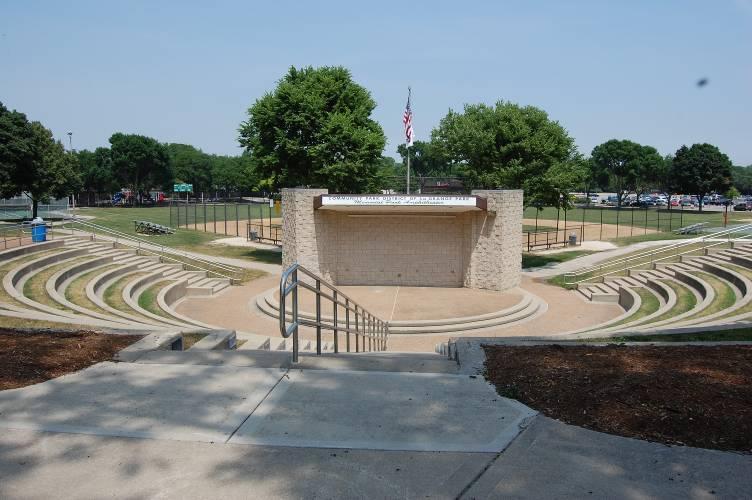
13 MEMORIAL PLACEMENT AND SURROUNDINGS The park is the most visible and heavily used park in the park system. It is the site of several special events during the year including a popular 10-week Music Under the Stars program. Its visibility is enhanced by its close proximity to the Village Market shopping mall to the south, Jewel Foods and a PNC Bank to the east and the La Grange Park Library off the park s northwest corner. La Grange Road (Route 45) is a four-lane highway that runs along the west boundary of the park. Oak Avenue to the north, Sherwood Avenue to the east are two lane roadways and carry moderately heavy traffic going to and from shopping. HISTORY This seven acre parcel was pieced together from 1949 to 1951starting with a four lot donation from the Village of La Grange Park. The first major development took place in 1953 with the construction of two tennis courts, a small amphitheater, a playground, a one story fieldhouse, two baseball fields and a parking lot. Two additional tennis courts and lighting for all four courts were added in In 1980 the southeast corner of the exiting park was acquired though donation by the owner. In 1986 the north baseball field was removed when an addition to the playground and gazebo were constructed. Two sand volleyball courts, additional play equipment and a new enlarged amphitheater were completed in The existing internally lighted marquee sign along La Grange Road was installed in The baseball infield was renovated in The north two tennis courts, which had been converted to inline hockey in 1994 was restriped in 2011 to become a multipurpose play court. The lighted court becomes a two sheet ice rink in the winter months. Outdoor Recreation Master Plan Section 4 pg. 36
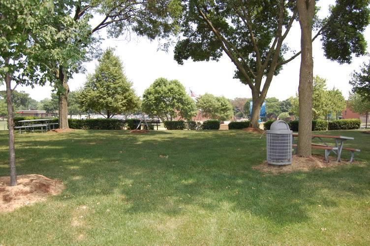
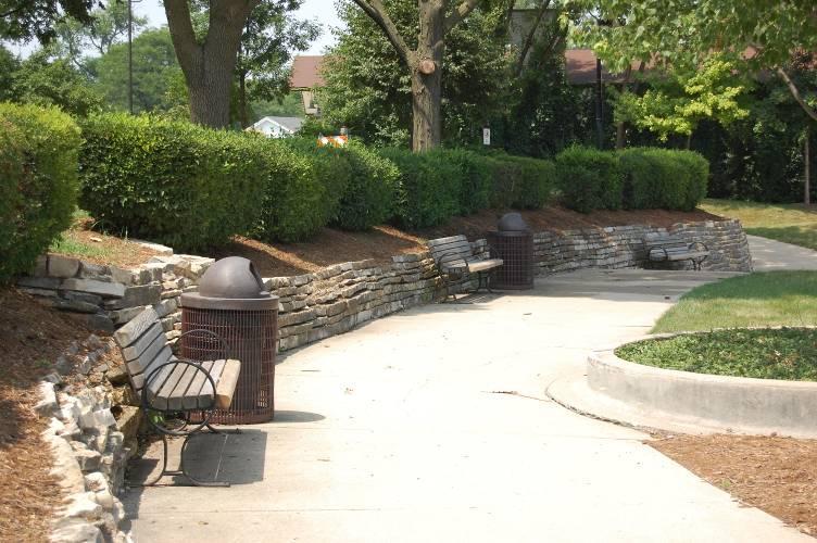
14 EXISTING FEATURES / SUMMARY A steep hill to the west slopes down to the tennis courts and causes a drainage problem. The field house, built in 1953, was the first Community Park District Recreation Center. It contains a 20x20 main room, restrooms, and storage. The building does not comply with ADA standards and has structural issues. In recent years the building has been used as a warming house in the winter and a storage building for day camps in the summer. The large playground, the multiuse play court and gazebo at the north end of the park are attractive to family uses. The park is supported by a 24 car, off road parking lot. The parking lot also serves as a convenient drop-off & pick-up point during the day camp season. Four foot high black vinyl fencing surrounds the playground, which restricts circulation between some of the park s amenities. The corner of the park closest to Sherwood and Oak Avenues is landscaped with mature trees, berms and a park sign. A concrete game table is located in this area but has no hard surface access. An approximately ½ acre area located along La Grange Road contains several memorial trees and mature hard wood trees. The area is a prominent feature of the park for travelers along La Grange Road and has a great potential to become a Community Park District signature. The trees and an interior shrub line serves as a sound buffer between La Grange Road and the Amphitheatre during performances. The aforementioned shrub line obstructs the view to the amphitheater but if removed, another provision for traffic noise must be found. An internally lighted marque sign along La Grange Road has become a very popular place for Community Park District and other local announcements. The amphitheater, in addition to Community Park District events, is also rented occasionally for church, theatre and other. local group events. Its semicircular seating with grass steps is a signature of the Community Park District but creates a high maintenance area. The concrete has developed some cracking over time. Lights intended to illuminate the steps no longer work due to faulty wiring. The wiring conduit has collapsed preventing the wires from being pulled and replaced. The amphitheater building provides an adequately sized stage with ample electric power and three rooms for storage. It does not provide indoor restrooms or changing rooms. The two sand volleyball courts and opposing goal basketball court were constructed in 1988 and remain in good condition. The design; however, allows sand to migrate onto adjacent hard surfaces causing a slip hazard unless frequently maintained. The sidewalk running along the play court s sound side creates a fall hazard. The 90 baseline infield was reconditioned in 2010 and is the only major league size field in the park system. It is used as a practice field by Nazareth Academy in the spring and by the La Grange Park Little League during summer months. The infield is in excellent condition; however the outfield is uneven in places. There is no homerun fence. The outfield doubles use for soccer field administered by AYSO. Seasonal special events also use the large outfield. The asphalt interior and perimeter paths appear to work well; however, they require attention per ADA standards. The path coming into the park from Woodlawn was widened with stone chips to accommodate vehicles coming to and from the amphitheater. The Village Market parking lots are heavily utilized by park patrons, especially during special events. The Jewel Foods parking lot is also used during large special events. There is no formal agreement for parking lot use but to date the owners have allowed the use without question. Section 4 pg. 37


15 IMMEDIATE CONCERNS Make priority improvements off of 2011 ADA report. Add a perimeter path to provide access to many amenities. Many amenities past a useful life Gazebo is close to the north parking lot Underutilized areas include the Fieldhouse along Oak Avenue and the area behind Phillips Flowers. There is an opportunity to create a positive signature for the Community Park District, particularly along La Grange Road and at the intersection of Oak and Sherwood Avenues. There are safety issues around the sand volleyball court. There is some cracking in the concrete amphitheater seating area. RECOMMENDED ENHANCEMENTS Replace the field house with a multi-purpose family picnic shelter and washroom facility. Construct a Splash Pad for community use. Renovate playground. Arrange walks and provide electric service in the southwest corner to allow for community and family events. Provide better parking lot separation from play areas and gazebo. Re-design volleyball / basketball area to make a 'sports core', and eliminate some site maintenance issues Add seating, clear sight lines, and make infra-structure repairs to amphitheater seating areas Make priority improvements off of 2011 ADA report. Create better defined entry points to the park with landscaping. Install new community park information sign. Outdoor Recreation Master Plan Section 4 pg. 38

16 Outdoor Recreation Master Plan Section 4 pg. 39

17 Outdoor Recreation Master Plan Section 4 pg. 40

18 Outdoor Recreation Master Plan Section 4 pg. 41

19 Outdoor Recreation Master Plan Section 4 pg. 42

20 Outdoor Recreation Master Plan Section 4 pg. 43


21 STONE-MONROE PLACEMENT AND SURROUNDINGS Stone-Monroe is surrounded by detached single-family homes and is bounded by Waiola, Monroe and Stone Avenues. Two residential properties are adjacent to the south boundary. This is the only Park District property west of La Grange Road HISTORY The 2.5 acre park was purchased in most part in 1952 with the remaining piece purchased in Improvements to the existing facilities took place in 1966, 1976, 1988 & EXISTING FEATURES / SUMMARY Two small ballfields used for T-ball, last renovated in Baseball fields utilize dome style backstops installed in 1991 to protect nearby homes. Two tennis courts received a carpeted playing surface in Playground last renovated in 2002, offers two age group areas. Park Benches are dated and poorly located. IMMEDIATE CONCERNS Benches not accessible Playground not accessible Rainwater drainage needed at southwest corner Only one entry to tennis courts Ball fields need better seating and move away from roadways. Should have better curb appeal at Monroe and Waiola. Outdoor Recreation Master Plan Section 4 pg. 44


22 RECOMMENDED ENHANCEMENTS Make priority improvements off of 2011 ADA report. Examine need for portable restroom Consider replacing two baseball fields with one larger baseball field. Add landscaping and shade Consider replacing one tennis court with other recreational features. Replace tennis court carpet with a new one Replace sections of south boundary fence. Consider usefulness of walkway south of tennis courts Improve drainage for ball fields. Outdoor Recreation Master Plan Section 4 pg. 45

23 Outdoor Recreation Master Plan Section 4 pg. 46


24 WILLIAM G. YENA PLACEMENT AND SURROUNDINGS Single family homes across two lane residential streets are located east, west and north of the park. Brook-Park School is across a two lane street to the south. St. Louise School is immediately south of Brook-Park School. HISTORY Originally this five-acre park was called Northeast Park, due to its location in the park system. All twenty-four lots comprising the park were purchased in In 1991, it was renamed the William G. Yena Park in recognition of Mr. Yena s leadership in establishing the first Community Park District recreation programs. EXISTING FEATURES / SUMMARY Newer playground ages 2-5 and 5-12 have pea gravel surface Three ½ court basketball courts One Sand volleyball court Two sod infield baseball fields Full sized soccer field crosses baseball outfields Park is used heavily by neighboring schools. There is limited street parking with a 16 car head in parking lot on south side of park One 24 x 16 shelter One 12 x12 shelter near school age playground Two tennis courts with older 10 fence Interior asphalt pathways with good connections Drinking fountain at end of life span Bike rack Mature trees and good turf Outdoor Recreation Master Plan Section 4 pg. 47


25 IMMEDIATE CONCERNS Benches not accessible Examine need for portable restroom Tennis court and basketball court surface is worn Strom water drain issues at north end of park Water fountain in need of frequent repair Southeast and northwest corners are unattractive Bicycle rack is not used Safety concerns for dropping off and picking up children RECOMMENDED ENHANCEMENTS Make priority improvements off of 2011 ADA report. Consider removing some of the fencing that cordons off the park. Communicate with School District to determine need Examine perimeter pathway as a combined sidewalk and access to park amenities. Replace pea gravel safety surface Resurface tennis and basketball courts Re-purpose 1 basketball court to a Skate Spot for teen users Re-configure sitting area in southeast section Re-landscape southeast section Re-consider need for water fountains Re-Roof large shelter Re-landscape at 29th and Harrison Consider re-purposing sand volleyball court Outdoor Recreation Master Plan Section 4 pg. 48

26 Outdoor Recreation Master Plan Section 4 pg. 49


27 HANESWORTH PLACEMENT AND SURROUNDINGS Located in an industrial area, bordered by manufacturing / truck yards to north and south Apartments to west and then single family homes The Indiana Belt Harbor Railway is a two rail railroad that borders the east boundary. The Village Field Club facility is ½ block away. HISTORY This five acre parcel was named for a past Community Park District President who led the effort to acquire the property in 1978 with assistance from a Federal Conservation grant. The property had been a vacant lot used for sports by local residents. EXISTING FEATURES / SUMMARY A 10,000 sf community center with 96 parking stalls is located at the south end of the park. Many recreation programs use the park, including SEASPAR Two high quality baseball fields Small parking lot at northwest; Community Center overflow parking is allowed by adjacent manufacturing areas 1,500 sf concession stand building with washrooms and storage Scorers boxes for both fields; storage on northeast field Northeast field is exclusively used by La Grange Park Little League. Perimeter asphalt pathway 8 wide. 2 pathway along Barnsdale Ave Perimeter benches, not on path Newer playground area used by Park District preschool program. Has a surrounding 4 fence. Solitary swing area near concessions and railroad Outdoor Recreation Master Plan Section 4 pg. 50


28 IMMEDIATE CONCERNS Path along Barnsdale too narrow and unsafe Washrooms kept locked for vandalism reasons; portable restroom placed at fields RECOMMENDED ENHANCEMENTS Make priority improvements off of 2011 ADA report. Widen pathway along Barnsdale Road Find alternative use for gymnasium pad east of Recreation Center, e.g. special events, multiuse play court, splash pad, miniature golf Replace concession building with family sized shelter and better washroom solution; use time locks on doors Create entry portals at community center parking entry and at NW parking lot Monitor availability of properties to north and south for acquisition (currently strong businesses) Add landscape enhancements color and sitting boulders to help create a sense of place Outdoor Recreation Master Plan Section 4 pg. 51

29 Outdoor Recreation Master Plan Section 4 pg. 52
ANCHORAGE PARK REPORT CARD Assessing A Park s Appearance, Function, & Condition
 ANCHORAGE PARK REPORT CARD Assessing A Park s Appearance, Function, & Condition Park Name: Is Your Park an A or an F? Your Name: Contact Information Optional: Date: General Instructions: Phone: Email:
Memo Preliminary. City of Miamisburg Parks Site Reconnaissance
 Memo Preliminary To: From: Ms. Rebecca Benna Woolpert, Inc. Date: Subject: City of Miamisburg Parks Site Reconnaissance The consultant team toured the existing Miamisburg Parks to assess current levels
1. Parks & Recreation Neighborhood Parks Community Parks Special Use Sites 2. Open Space 3. Trails
 Appendix A: Park Classifications The intent of parks and recreation classifications is to aid in making acquisition and design decisions for park sites, facilities and the organization of recreation space
Burrus Old Mill Park
 Burrus Old Mill Park Park Location: 112 NW Woods Chapel Rd. Park Land Established: 1969 Park Size: 14 acres Developed Acres: 14 acres Undeveloped Acres: 0 acres Park Type: Neighborhood Park Amenities:
Wilbur Young Park. Park Land Established: Developed Acres: 15 acres Undeveloped Acres: 25 acres
 Wilbur Young Park Park Location: 1100 SE Adams Dairy Parkway Park Land Established: 1987 Park Size: 40 acres Developed Acres: 15 acres Undeveloped Acres: 25 acres Park Type: Community Park Amenities: Shelter
Benedict Fountain Park Meeting Notes Wednesday, February 15, 2012
 Benedict Fountain Park Meeting Notes Wednesday, February 15, 2012 ALTERNATIVE #1 Like the big open lawn space in alternative 1. Like cohesiveness of sidewalk walk and play areas shown on alternative 1
29 Bella Fontaine Park
 29 Bella Fontaine Park 9565 Bellefontaine Road St. Louis County Parks Master Plan Planning Zone 2 Visit Date: July 2016 Page 1 129 Bella Fontaine Park 9565 Bellefontaine Road St. Louis County Parks Master
Master Plan Presentation August 12, 2015
 Master Plan Presentation August 12, 2015 A vision for tomorrow... May, 13 2015 prepared for: prepared by: SITE LOCATION SITE NTS SITE ANALYSIS +/- 17.8 Ac. RESIDENTIAL HOMES 1 2 RAIL ROAD (SAFETY CONCERNS)
Blue Springs Park. Park Land Established: Developed Acres: 12 acres Undeveloped Acres: 2 acres
 Blue Springs Park Park Location: 2204 SW South Ave. Park Land Established: 1975 Park Size: 14 acres Developed Acres: 12 acres Undeveloped Acres: 2 acres Park Type: Neighborhood Park Amenities: Softball
Recreation Facility Evaluation - Conclusions
 2015 Parks Report Upon initial assessment of the Village parks it was evident that the inventory of the Village s park land, athletic fields, recreational facilities, playgrounds, trails, etc., was substantial,
Long Branch-Wayne Local Park Renovation Project
 Montgomery Parks Long Branch-Wayne Local Park Renovation Project Community Meeting #2 September 20, 2016 Oak View Elementary School 7:00-9:00 PM Welcome / Team Introductions M-NCPPC (Montgomery Parks)
PART TWO: PROJECT SPECIFIC DESIGN GUIDELINES
 PART TWO: PROJECT SPECIFIC DESIGN GUIDELINES 2.1.0 GENERAL REQUIREMENTS: 1. Approved warm season turf varieties shall be used for LMD/CFD, commercial, industrial, and public landscape areas. The use of
TA B L E O F C ON T EN T S
 TA B L E O F C ON T EN T S Introduction 1 Site Analysis 2 EXISTING TREE ANALYSIS 3 Community Outreach 5 PUBLIC WORK SHOP #1 GENERAL PUBLIC 6 PUBLIC WORKSHOP #2 4 TH OF JULY CELEBRATION 9 PUBLIC WORKSHOP
FY Capital Improvement Program Parks and Landscaping. 8 - Summary
 PARK PROJECTS FY 211-215 Capital Improvement Program Description FY 21 FY 211 FY 212 FY 213 FY 214 FY 215 1 Restroom Bldgs (Replace or Construct)-Jefferson, McDonald, 5,774,623 4,669,623 1,15, Allendale,
a) Inventory of all existing privately-owned, state-owned, or local governmentowned recreational facilities and open spaces within the context area
 Inventory of all existing privately-owned, state-owned, or local governmentowned recreational facilities and open spaces within the context area") 8.0 RECREATION AND OPEN SPACE ELEMENT (1) DATA REQUIREMENTS a) Inventory of all existing privately-owned, state-owned, or local governmentowned recreational facilities and open spaces within the context
8.0 RECREATION AND OPEN SPACE ELEMENT (1) DATA REQUIREMENTS a) Inventory of all existing privately-owned, state-owned, or local governmentowned recreational facilities and open spaces within the context
Appendix A. Park Land Definitions
 Appendix A Park Land Definitions Mini Park May serve specific function for any and all ages, depending on need of the user area. Size range 1-5 acres with optimum size being 3 acres. Service area is sub-neighborhood
PARKS & RECREATION SUBCOMMITTEE. Oct. 1, 2015
 PARKS & RECREATION SUBCOMMITTEE Oct. 1, 2015 1999 Bond - $22,000,000 Land Acquisition Allen Station Phase II Neighborhood Parks PREVIOUS BOND ELECTIONS 1999 & 2007 2002 Bond - $4,000,000 Allen Senior Recreation
REQUEST FOR COUNCIL ACTION
 REQUEST FOR COUNCIL ACTION Date: 04/15/13 Item No.: 10.b Department Approval City Manager Approval 1 2 3 4 5 6 7 8 9 10 11 12 13 14 15 16 17 18 19 20 21 22 23 24 25 26 27 28 29 30 31 32 33 34 35 Item Description:
Courthouse Planning Area
 Courthouse Planning Area Current Reality The Courthouse Planning Area is the characterized by expansive suburbanscale residential areas as well as the community resource planned area of athletic, educational,
Rotary Park / Railroad Lake
 Rotary Park / Railroad Lake Park Location: 600 NW Vesper St. Park Land Established: 1975 Park Size: 12 acres Developed Acres: 12 acres Undeveloped Acres: 0 acres Park Type: Community Park Amenities: 2
Charles P. Johnson and Associates. Annapolis Landscape Architects
 Charles P. Johnson and Associates Annapolis Landscape Architects AGENDA Introduction Project Limits and Scope Site Analysis Opportunities & Constraints Program Goals Image Boards Design Alternatives Pros
A cknovvledgements. Table of Contents. Project Introduction...1
 Pashek Asscx::iates MARCH2007 A cknovvledgements Pashek Associates would like to thank Jackson Township and the Jackson Township Recreation Board for their valuable contributions, support, and input during
FY Capital Improvement Program Parks and Landscaping - Park Projects
 PARK PROJECTS FY 219-223 Capital Improvement Program FY 218 FY 219 FY 22 FY 221 FY 222 FY 223 1 2 3 4 5 6 7 8 9 1 11 12 13 14 15 16 17 Robinson Park - Recreation Center Renovation Project (7843) Desiderio
Park Types and Attributes
 02 APPENDIX B APPENDIX B s and s 194 APPENDIX B 04 Size Level of Service Any privately owned park, of any size, is a neighborhood park Primary Service Area - 1/2 mile or within 15 minutes walking distance
PARTF Scoring System for Grants
 PARTF Scoring System for Grants The members of the N.C. Parks and Recreation Authority use the PARTF scoring system as one of several tools to select grant recipients. Please provide all of the information
City of Bonney Lake Allan Yorke Park. MASTER PLAN SUMMARY REPORT June 30, 2016
 City of Bonney Lake Allan Yorke Park MASTER PLAN SUMMARY REPORT June 30, 2016 TABLE OF CONTENTS INTRODUCTION PUBLIC INVOLVEMENT PROCESS MASTER PLAN North Park Central Park South Park East Park Field Development
Outdoor Recreation Facilities Inventory
 Outdoor Recreation Facilities Inventory Allouez Neighborhood Parks: East Lawn Park (4.90 acres) is located in the northeastern corner of Allouez near Boyd Street. This site contains: Baseball diamond with
Parks, and Recreation & Cultural Arts Master Plan Update
 Parks, and Recreation & Cultural Arts Master Plan Update Community Profile Public Input Summary: Staff Interviews conducted April 14 and 15, 2014 Citizens Workshop - conducted April 15 th and 24 th, May
Bullhead City Rotary Park Plan Update
 Bullhead City Rotary Park Plan Update PLANNERS/LANDSCAPE ARCHITECTS: RBF Consulting 16605 N 28 th Avenue Suite 100 Phoenix, Arizona 85053-7550 (602) 467-2200 CIVIL ENGINEER: RBF Consulting 16605 N. 28
Special Revenue Funds
 Special Revenue Funds Special Revenue Funds account for the proceeds of specific revenue sources (other than special assessments for major capital projects) that are legally restricted to expenditures
PARK M A I N T E N A N C E REPORT CARD
 PARK M A I N T E N A N C E REPORT CARD Park Name: Date: General Instructions: Your Name: Phone: Contact Information Optional: Email: SAMPLE The Report Card consists of six specific park areas to be graded.
Draft Master Plan for Franklin Park
 Draft Master Plan for Franklin Park Metro Parks Tacoma with SiteWorkshop November 2009 I. overview & background Process & History Master Plan Process The Master Plan is based on a community involvement
Y Sports Complex PROGRAMMING Capitol Improvement Plan. Anticipated/Suggested Improvements. Sedgwick County Park: Sports Complex:
 PROJECT OVERVIEW Location: East of Ridge Road, between 21 st Street and 13 th Street, not including SCZ In conjunction with The Sedgwick County Park Facilities Observation Report Compilation of improvements
Appendix E Section 4(f) Evaluation
 Evaluation") Appendix E Section 4(f) Evaluation Appendix E Draft Section 4(f) Evaluation E.1 Introduction This appendix addresses a federal regulation known as Section 4(f), which protects parks, recreation areas,
Appendix E Section 4(f) Evaluation Appendix E Draft Section 4(f) Evaluation E.1 Introduction This appendix addresses a federal regulation known as Section 4(f), which protects parks, recreation areas,
Neighborhood Districts
 NEIGHBORHOOD DISTRICTS SEVEN MAIN DISTRICTS Neighborhood Districts While the Development Plan provides a broad-scale overview of the neighborhood, this section focuses on uses and relationships at the
Moreno Valley College: Conceptual Master Planning - Site Analysis Lasselle Street, Moreno Valley, CA 92551
 Master Plan Architect School Name Moreno Valley College District Riverside Community College District Architecture and Urban Design 5898 Blackwelder Street Ground Floor Culver City, CA 90232 T: 310.559.5720
SOUTHEAST SPORTS COMPLEX MASTER PLAN
 REPORT TO SOUTHGATE NEIGHBORHOOD COUNCIL APRIL 13, 2016 Visioning Process April 30: Stakeholder Meeting with Sports Groups May 5: Stakeholder Meeting with Southgate Land Use Committee May 13: SNC Meeting
(SCHOOL DISTRICT NAME) MAINTENANCE/MANAGEMENT SPECIFICATIONS FOR ATHLETIC FIELDS AND OUTDOOR FACILITIES (SUGGESTED TEMPLATE)
 MAINTENANCE/MANAGEMENT SPECIFICATIONS FOR ATHLETIC FIELDS AND OUTDOOR FACILITIES (SUGGESTED TEMPLATE)") (SCHOOL DISTRICT NAME) MAINTENANCE/MANAGEMENT SPECIFICATIONS FOR ATHLETIC FIELDS AND OUTDOOR FACILITIES (SUGGESTED TEMPLATE) I. ATHLETIC FACILITIES: PROFESSIONAL FIELDS A. Turf 1. Mow baseball outfield
(SCHOOL DISTRICT NAME) MAINTENANCE/MANAGEMENT SPECIFICATIONS FOR ATHLETIC FIELDS AND OUTDOOR FACILITIES (SUGGESTED TEMPLATE) I. ATHLETIC FACILITIES: PROFESSIONAL FIELDS A. Turf 1. Mow baseball outfield
Ward Park. Park Land Established: Developed Acres: 9 acres Undeveloped Acres: 4 acres
 Ward Park Park Location: 1000 SW 22 nd St Park Land Established: 1979-80 Park Size: 13 acres Developed Acres: 9 acres Undeveloped Acres: 4 acres Park Type: Neighborhood Park Amenities: 2 Shelters, tennis
A 2012 Clean and Safe Neighborhood Parks Bond Project. Katy Tang, District Supervisor. Jasmine Kaw, Landscape Architect Will Kwan, Architect
 West Sunset Park A 2012 Clean and Safe Neighborhood Parks Bond Project Community Meeting #2 November 20, 2013 Katy Tang, District Supervisor Dan Mauer, Project Manager Jasmine Kaw, Landscape Architect
Woods Chapel Park. Park Amenities: Playground, basketball court, single table shelter, small pond and multi-use trail.
 Woods Chapel Park Park Location: 3925 NW Dogwood Park Land Established: 1979 Park Size: 10 acres Developed Acres: 6 acres Undeveloped Acres: 4 acres Park Type: Neighborhood Park Amenities: Playground,
Little Neck Planning Area
 Little Neck Planning Area Current Reality The Little Neck Planning Area is characterized by established residential neighborhoods, Town Center and Pembroke. The Eastern and Western Branches of the Lynnhaven
January 11, New benches installed. Paving of parking lot adjacent to piers and the canoe put-in. Near complete with clean up remaining.
 Project Updates January 11, 2018 CENTERVILLE CHESAPEAKE ARBORETUM BELLS MILL CITY CREEKWOOD SOUTH DEEP CREEK LOCK WORK TO BE PERFORMED/UPDATES Improvements to the parking lot include installation of a
PARK DATA THEMES SUMMARY:
 area and identified key themes that should be addressed in the upcoming design process. The following is a compilation of the themes identified (organized by park). Not every park was addressed in this
Chapter 6. Overall Vision RECOMMENDATIONS. More Trail and Trail. Connections. Equal Access to Park. Facilities and Programs. Water Access.
 Overall Vision More Trail and Trail Connections Equal Access to Park Facilities and Programs Water Access Environment Variety Chapter 6 RECOMMENDATIONS Chapter 6 The following recommendations for park,
APPENDIX D: PARKS AND RECREATION ACTION PLAN
 APPENDIX D: PARKS AND RECREATION ACTION PLAN Goals The following goals are specific to the development, maintenance, and operation of the existing parks in the Township, as well as the acquisition and
RECREATION AND OPEN SPACE ELEMENT
 RECREATION AND OPEN SPACE ELEMENT Last amended August 19, 2008 Table of Contents Objective Page 5.1 Park system defined... 5-1 5.2 Access to parks and recreational facilities... 5-2 5.3 Recreation and
Southeast Quadrant Plan
 Southeast Quadrant Plan Southeast Quadrant Distinctive Features Land Use The Southeast Quadrant includes all the area within the planning area that is east of Interstate 5 and south of State Route 44.
OPPORTUNITIES AND CONSTRAINTS - OXBOW PARK ENTRANCE AND PUT-IN
 OPPORTUNITIES AT OXBOW EXISTING WETLANDS Site is undeveloped and we can design a park that works well from the start. SAND BEACH Potential to eliminate invasive species. DEBRIS (CONCRETE, OLD CARS) VEGETATION
Section 3 INVENTORY OF RECREATION LAND AND FACILITIES
 Photo of Juan Bautista de Anza Park Section 3 INVENTORY OF RECREATION LAND AND FACILITIES Summary of Findings Park Definitions Summary of Recreation Facilities Other Recreation Facilities Nearby Recreation
100 Dix Drive Conceptual Master Plan. Wyatt Thompson, PLA, ASLA, Assistant Director Lindsay Stucki, Intern Park Planner
 100 Dix Drive Conceptual Master Plan Wyatt Thompson, PLA, ASLA, Assistant Director Lindsay Stucki, Intern Park Planner Final Draft Prepared August 2018 Introduction On September 20, 2016, the City of Manhattan
3.2 P - Park District
 3.2 P - Intent - The P: s are established to promote and maintain the development of recreational opportunities within the. The development of new parks or the major expansion of existing parks within
Master Plan Workshop October 25, 2007 Charlotte Mecklenburg Government Center
 Master Plan Workshop October 25, 2007 Charlotte Mecklenburg Government Center Land Discussion 1. What are the most important land related issues we need to address? Protect natural areas Passive walking
Great Neck Planning Area
 Great Neck Planning Area Current Reality The Great Neck Planning area is characterized primarily by large lot/lowdensity residential development with the majority of recreational opportunity existing as
Littleton Fields Master Plan
 Town of Littleton Littleton Fields Master Plan September 25, 2017 Gale Associates, Inc. John M. Perry, P.E. Jeffrey F. Georges, MRLA About Gale Agenda Introduction and Purpose Background Investigation
SOUTH PARK. Construction of a Portion of South Park at Fresh Kills Park, Staten Island
 SOUTH PARK Construction of a Portion of South Park at Fresh Kills Park, Staten Island FRESHKILLS PARK FIRST PHASE OF SOUTH PARK FRESHKILLS PARK CONTEXT SOUTH PARK EXISTING CONDITIONS PROJECT OPPORTUNITIES
Athletic Facilities Needs Assessment
 PARKS AND RECREATION DEPARTMENT Athletic Facilities Needs Assessment Fiscal Year 2014 PROPOSED Needs Assessment Index 1. Andrew s Fields located at Margate Middle School pg. 2 2. Firefighters Park pg.
Chapter 3: Existing Parks & Facilities
 Parks & Recreation Master Plan Update Chapter 3: Existing Parks & Facilities Town of Yucca Valley 3.0 EXISTING PARKS AND FACILITIES 3.1 Introduction This Chapter provides a description of the Town s existing
Barrie Park Site Master Plan
 Barrie Park Site Master Plan Community Meeting Number 4 May 13th, 2015 Barrie Park Site Master Plan: Process A Blue Print for the Future Already taken place: Site walkthrough, Focus Groups, 3 Community
MASTER PLAN IMPLEMENTATION COSTS. Appendix A
 Appendix A MASTER PLAN IMPLEMENTATION COSTS Town of Bradford West Gwillimbury HENDERSON COMMUNITY PARK MASTER PLAN IMPLEMENTATION COSTS Draft Order of Magnitude Costing Revised 5/27/2014 ITEM DESCRIPTION
CHAPPLES PARK MASTER PLAN
 CHAPPLES PARK MASTER PLAN Presentation of Preliminary Development Options Public Open House #2 Wednesday November 2 nd, 2016 TONIGHT S AGENDA 1. Welcome & Introductions 2. Presentation by Sierra Planning
Proposed Park Master Plan: The Master Plan has been revised to incorporate suggestions received in response to the Park Survey:
 March 31, 2010 SUBJECT: Morningcrest Park Master Plan Dear Resident, I would like to thank you for your comments on the Morningcrest Park that was mailed out and posted online on the City website in February,
Northeast Quadrant Plan
 Northeast Quadrant Plan Northeast Quadrant Distinctive Features Land Use The Northeast Quadrant includes all the area within the planning area that is east of Interstate 5 and to the north of State Route
APPENDIX D2: PARKS AND TRAILS
 APPENDIX D2: PARKS AND TRAILS Cultivate Hopkins Comprehensive Plan 8/15/18 DRAFT Cultivate Hopkins Appendix D2 1 Existing Conditions Local Parks and Trails Figure D2.1 shows the existing park and trail
CHAPTER 9: Parks, Recreation, and Open Space Element
 CHAPTER 9: Parks, Recreation, and Open Space Element INTRODUCTION: The Parks, Recreation, and Open Space Element is a comprehensive representation of the City s vision and goals for the future of the park,
More than 30 adults and 19 children were involved in these community workshops.
 Linwood Workshops held at Household of Faith Deliverance Church 3.29.08 and 4.05.08 What is a Design Workshop? We use the term workshop (often called charrette among design professionals) to describe a
VISION PLAN PRESENTATION - SEPTEMBER 28, 2013
 AREAS OF IMPROVEMENT E A POOL HOUSE POOL DECK B B MAIN BUILDING UPPER PLAZAS A D F G C MAJOR BLEACHERS DUGOUTS FIELD MAIN COURTYARD D REGGIE PARK C E SPORT COURT ADA RAMP H F G H TENNIS COURTS KITCHENETTE
North Oakville East Parks Facilities Distribution Plan. November, 2009
 North Oakville East November, 2009 POLICY CONTEXT 1) Purpose a) The purpose of this document is to be a guide for the location, configuration, design and development of the parks system for the North Oakville
City of Naples Parks Master Plan
 Parks Master Plan Draft Master Plan Presentation January 19, 2015 Presentation Outline Overview Needs Assessment Recap Response to Needs Implementation Strategy Questions, Discussion 2 OVERVIEW Project
EDGEMONT - JOHN LAURIE PARK
 EDGEMONT - JOHN LAURIE PARK EDGEMONT Connections to Trails Sidewalks run adjacent to site and throughout entire community. A pedestrian overpass (over John Laurie Blvd) links the site to Dalhousie Community.
Clarendon Park Framework Plan. Chicago Park District Department of Planning & Development June 7, 2008
 Clarendon Park Framework Plan Chicago Park District Department of Planning & Development June 7, 2008 1 Table of Contents Framework Plan Purpose.3 Radius Map one mile.4 Aerial Map...5 Existing Park Layout.6
Provide and maintain sufficient public parks, recreation facilities, and open space to meet the recreational needs of County residents and visitors.
 (ROS) Goal Provide and maintain sufficient public parks, recreation facilities, and open space to meet the recreational needs of County residents and visitors. OBJECTIVE ROS.01 The County shall acquire,
(ALL TIMES LISTED ARE APPROXIMATE AND SUBJECT TO CHANGE. )
") AGENDA TANGENT CITY COUNCIL AND PLANNING COMMISSION JOINT PUBLIC HEARING Wednesday March 16, 2011 PARK COMMISSION SESSION 7:00 p.m.. Bass Estate 32166 Old Oak Drive, Tangent, OR 97389 (ALL TIMES LISTED
AGENDA TANGENT CITY COUNCIL AND PLANNING COMMISSION JOINT PUBLIC HEARING Wednesday March 16, 2011 PARK COMMISSION SESSION 7:00 p.m.. Bass Estate 32166 Old Oak Drive, Tangent, OR 97389 (ALL TIMES LISTED
BOARD OF TRUSTEE MEMORANDUM
 1 15 17 2 12 14 19 18 13 11 3 10 6 16 5 4 9 8 7 BOARD OF TRUSTEE MEMORANDUM TO: HONORABLE MAYOR & BOARD MEMBERS FROM: JANET ALUISE, COMMUNITY DEVELOPMENT DIRECTOR DATE: OCTOBER 2, 2012 RE: MASTERPLANNING
Design Considerations
 Essential to the development of a successful Master Plan for the Park Complex is input from the community that the park will serve. The community outreach component of the planning process included numerous
STAFF RECOMMENDATION: Adopt the Parks and Recreation Master Plan 2013, or take other action as deemed appropriate.
 Regular 7. CITY COUNCIL AGENDA Meeting Date: 12/02/2013 TITLE: Parks and Recreation Master Plan 2013 Adoption Proposal - Dwight Curtis Responsible Staff: Dwight Curtis Backup Material: Backup material
ARTICLE IV: DEVELOPMENT STANDARDS 404 MASTER PLANNING
 IV 13 404 MASTER PLANNING Master Planning through the Site Analysis (Master Planning Site Analysis) or Planned Development (Master Planning Planned Development) is provided to encourage development which
REVISED DRAFT. Malone Memorial Recreational Park and West Street Park Facilities Enhancement Master Plan. Village of Malone, New York.
 West Street Park Salmon River REVISED DRAFT Malone Memorial Recreational Park and West Street Park Facilities Enhancement Master Plan Village of Malone, New York Revised Draft Date: February 24, 2014 DOS
Canal Winchester Parks Master Plan. Public Meeting 2 Thursday, February 2 6:30pm
 Canal Winchester Parks Master Plan Public Meeting 2 Thursday, February 2 6:30pm Meeting Agenda 1. Project overview 2. Project schedule 3. Public input results Survey Public Meeting #1 Stakeholder Interviews
Errol Heights Park and Community Garden Frequently Asked Questions March 22, 2018
 Errol Heights Park and Community Garden Frequently Asked Questions March 22, 2018 Question 1: What improvements are planned for Errol Heights Park? How will the community be engaged in the process to shape
Public Recreation Spaces. Brian E. Saelens, Lawrence D. Frank, Christopher Auffrey, Lauren Elise Leary,
 Environmental Assessment of Public Recreation Spaces Preliminary i Data for ALRConference Brian E. Saelens, Lawrence D. Frank, Christopher Auffrey, Lauren Elise Leary, Robert C. Whitaker, Hillary Burdette
November 21, Planning Commission Charter Township of Lyon Grand River Ave. New Hudson, MI 48165
 Planning Commission Charter Township of Lyon 58000 Grand River Ave. New Hudson, MI 48165 Subject: AP-18-68; 11 Mile and Milford Road Park, Site Plan Review #1 Based on site plan dated 11/12/18 Location:
PARK PLANS OPERATIONS AND MAINTENANCE EAST OF THE RIVER PARK MASTER PL AN
 INTRODUCTION PLANNING PROCESS SERVICE AREA VISION PARK PLANS OPERATIONS AND MAINTENANCE IMPLEMENTATION 4 PARK PLANS EAST OF THE RIVER PARK MASTER PL AN 67 THIS PAGE WAS INTENTIONALLY LEFT BLANK NEIGHBORHOOD
City of Naples Parks Master Plan (Draft)
") City of Naples (Draft) CSAB April 12, 2016 OVERVIEW Presentation Outline Overview Needs Assessment Recap Response to Needs Implementation Strategy Questions, Discussion Preserving Naples: A vision plan
City of Naples (Draft) CSAB April 12, 2016 OVERVIEW Presentation Outline Overview Needs Assessment Recap Response to Needs Implementation Strategy Questions, Discussion Preserving Naples: A vision plan
Ohlone College Measure G Project Scope Revisions
 Scope Revisions Current Title Revised Title Current Scope Revised Scope 6101 Relocated Baseball Field Athletic Fields Create new sustainable baseball field with synthetic turf, bleacher seating and batting
GOALS AND OBJECTIVES. This section includes Goals and Objectives for the communities of:
 GOALS AND OBJECTIVES The Goals and Objectives provide the overriding ideas and thoughts regarding the planning, development and maintenance of parks and recreation facilities and recreational opportunities
Kempsville Planning Area
 Kempsville Planning Area Current Reality The Kempsville Planning Area is by far the most populated planning area in the City. The preservation of the 1,422 Stumpy Lake Natural Area, the largest City-owned
David Ache, representing Councilmember Hucker s office was present during the first portion of the meeting.
 Long Branch Wayne LP Renovation Project Community Meeting #1 March 8, 2016 Park Staff Present at Community Meeting #1 Lucas Bonney, Project Manager, Park Development Michael Ma, Park Development Tricia
I-70 Highway Cover Study MARCH 4, 2015 COMMUNITY WORKSHOP SUMMARY
 I-70 Highway Cover Study MARCH 4, 2015 COMMUNITY WORKSHOP SUMMARY MARCH 2015 COMMUNITY WORKSHOP CDOT and the City and County of Denver joined together to engage the community and gather ideas to explore
City of Talent Capital Improvements Plan
 City of Talent Capital Improvements Plan Report Prepared For: City of Talent Prepared by: Community Planning Workshop Community Service Center 1209 University of Oregon Eugene, OR 97403-1209 Email: cpw@uoregon.edu
6. RECREATION AND OPEN SPACE ELEMENT
 6. RECREATION AND OPEN SPACE Introduction This Recreation and Open Space Element includes Goals, Objectives and Policies (GOP) that apply to the main campus in Gainesville and the Lake Wauburg Recreation
Preci nct P l ans Figure 56 Campus Aerial Photo, 2008 CAL STATE EAST BAY, HAYWARD CAMPUS MASTER PLAN
 9 Precinct Plans This section contains a detailed discussion of the planning and design concepts for specific areas or precincts of the Cal State East Bay Hayward campus. The Precinct Plans pertain to
30% DRAFT GAINSBORO PARK IMPROVEMENT PROJECT THE CITY OF PLEASANT RIDGE CITY OF PLEASANT RIDGE, OAKLAND COUNTY, MICHIGAN
 LEGAL PROPERTY DESCRIPTION SEE NOTES SHEET FOR LEGAL PROPERTY DESCRIPTIONS THE CITY OF PLEASANT RIDGE GAINSBORO PARK IMPROVEMENT PROJECT CITY OF PLEASANT RIDGE, OAKLAND COUNTY, MICHIGAN 4444 Second Avenue
South East Sports Complex Phase I
 South East Sports Complex Phase I City of Spokane Design Review Board August 29, 2018 (Revised) Objectives 1. Early discussion and collaboration. 2. Provide framework / catalyst for future improvements
master plan hodge park
 KCMO Parks & Commissioners Recreation Board of Parks & Recreation Kansas City, Missouri Mark McHenry Director Heather Runkel Project Manager LAND3 Studio L.L.C. Bob G Bushyhead Principle Michael H Malyn
Revitalization of Durand Park. Durand Park Proposal June 2008
 Revitalization of Durand Park Durand Park Proposal June 2008 Background! " Property purchased in 1974! " Opened in September 1975, largely thanks to the work of the DNA! " Only park in the Durand: 12 000
MADISON MANOR PARK RENOVATIONS
 MADISON MANOR PARK RENOVATIONS COMMUNITY KICK-OFF MEETING MINUTES To: Wilfredo Calderon, Steven Torgerson (AMT), Tom Mitchler, Kevin Stalica, Vincent Verweij, Greg Anselene, Chris Willett, Peter Alchin,
Standards (R-3) Figure B-11: R-3 Residential Standards Exhibit
 Figure B-11: R-3 Residential Standards Exhibit") Avila Ranch Avila Ranch Specific Plan Development Standards High Medium Density - High Residential Density Residential Lot and Building Lot and Standards Building (R-3) Standards (R-3) EXAMPLES These sketches
Avila Ranch Avila Ranch Specific Plan Development Standards High Medium Density - High Residential Density Residential Lot and Building Lot and Standards Building (R-3) Standards (R-3) EXAMPLES These sketches
Las Colonias Park Master Plan
 2013 Las Colonias Park Master Plan City of Grand Junction June 2013 Introduction Las Colonias Park, a 101 acre parcel on the edge of the Colorado River south of downtown, was deeded to the City of Grand
Elm Fork Land Use. Trinity River Corridor Project Committee May 13, 2013
 Elm Fork Land Use Trinity River Corridor Project Committee May 13, 2013 Purpose Discuss Trinity River planned Land Use and Appropriate Compatible Uses, particularly with respect to the Elm Fork Area 2