Draft Downtown Waterfront Municipal Harbor Plan
|
|
|
- Gregory Marsh
- 5 years ago
- Views:
Transcription
1 7/20/2016

2 Draft Downtown Waterfront Municipal Harbor Plan
3 FRAMEWORK MHP BACKGROUND & GOALS AMPLIFICATIONS, SUBSTITUTE PROVISIONS, & OFFSETS CHAPTER 91 LONG-TERM LICENSE FEES PREPARING FOR CLIMATE CHANGE MHP CONSISTENCY

4 MHP BACKGROUND & GOALS
5
6
7
8
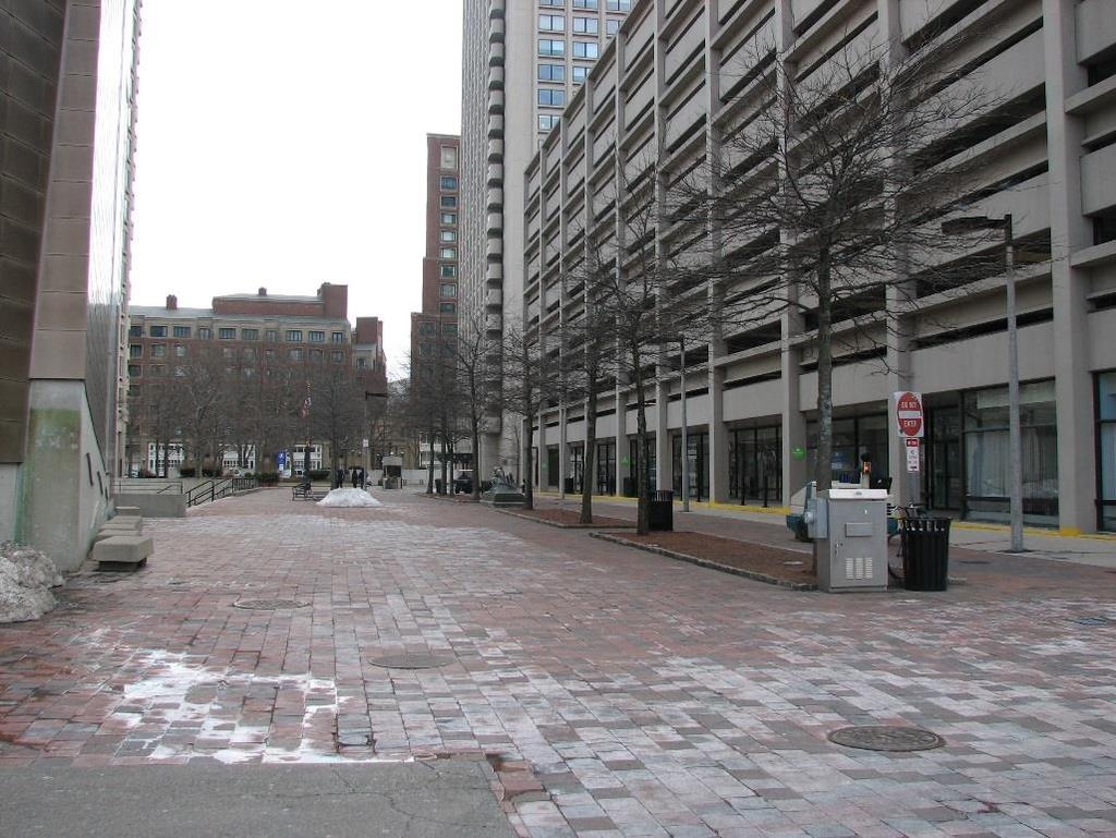
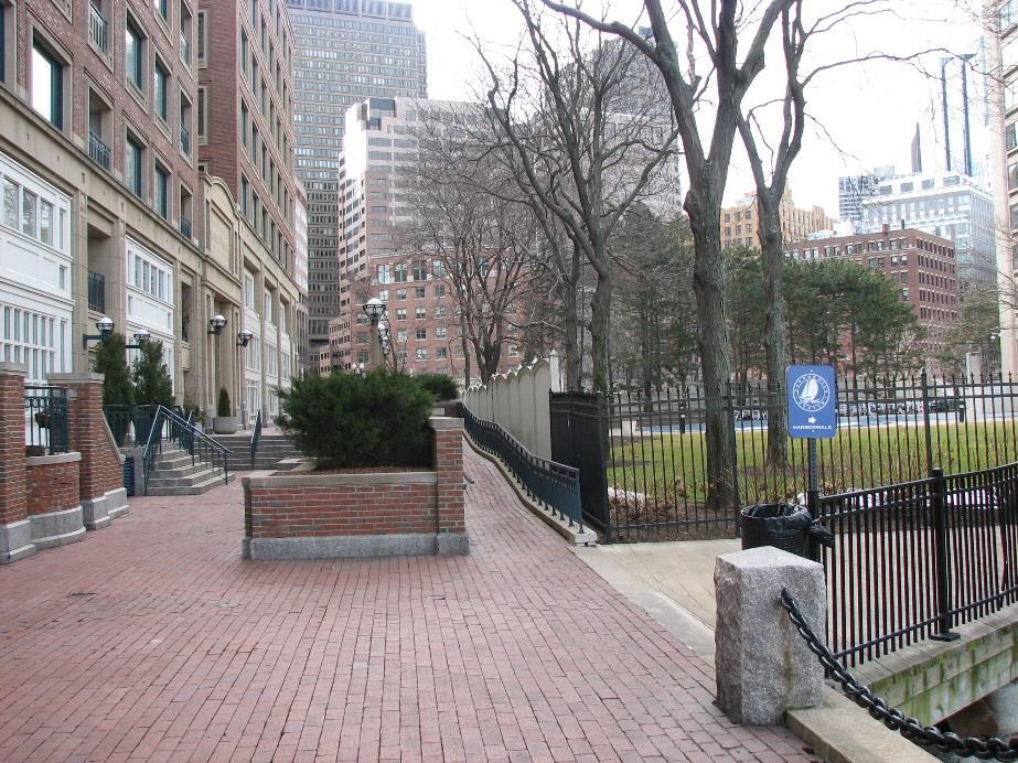
9 Water-dependent Uses
10 Planning Foundation
11

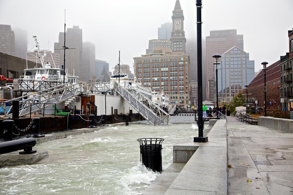
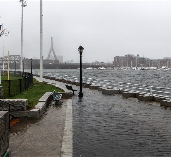
12 Sandy October 29, 2012

13
14
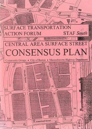
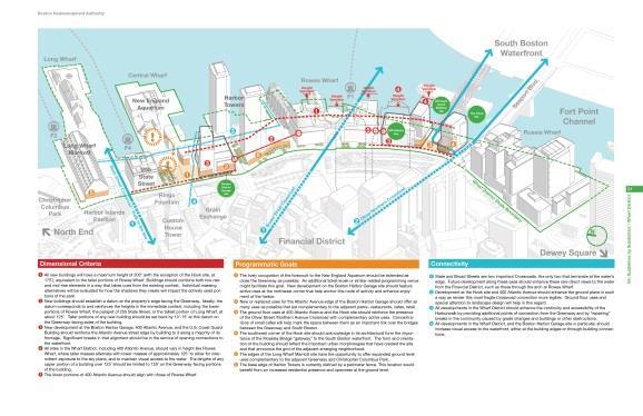
15 Notice to Proceed Goal #1: Continue to Develop the District as an Active, Mixed Use Area that is an Integral Part of Boston s Economy Goal #2: Promote Access to Boston Harbor, the Harbor Islands and Water Transportation Goal #3: Improve Waterfront Wayfinding and Open Space Connections. Goal #4: Enhance Open Space Resources and the Public Realm. Goal #5: Create a Climate Resilient Waterfront. Goal #6: Implement the Greenway District Planning Study Wharf District Guidelines.


16 Revisions Long and Central Wharves Touch the Water
17 AMPLIFICATIONS, SUBSTITUTE PROVISIONS, & OFFSETS

18 Downtown Waterfront: Long Wharf Marriott Proposed Expansion of the Marriott: Oct Revisions Existing Building Footprint ~64% lot coverage ~36% open space Revised Proposal Footprint ~80% lot coverage ~20% open space Improve linear walkway from the Rose Kennedy Greenway to Long Wharf Highlight Walkway. Use indoor / outdoor continuous paving treatment or other features to emphasize the N-S connection. Clearly defined interior passageway with some possible expansion of retail. Create new retail edge to define and enhance the HARBORWALK and access to ferries. Reduce footprint and reshape to prevent pedestrian bottlenecks & improve views Harbor Islands Gateway, ferry waiting room, and rest rooms Improve Atlantic Ave. facade with retail and architectural improvements Develop parking and traffic management plan for taxis, drop-off, queuing, etc., to better emphasize N- S connection and improve traffic flow Improve linear walkway from the Rose Kennedy Greenway to Long Wharf MHP to include BRA parking lot as open space, improvements to the end of Long Wharf, and other open space n space Reduce footprint and reshape to prevent pedestrian bottlenecks & improve views


19 Downtown Waterfront: Hook Lobster Site Hook Lobster Proposal: Building Footprint Ch. 91-compliant massing Proposed Hook Lobster Building Building footprint comparison with SF and % Total height of proposed building Height of highest occupiable floor Greenway Guidelines recommended height Zoning height Ch. 91 compliant massing height Lot Coverage: 50% Building Footprint: ~10,000 SF Total parcel size: 20,056 SF Lot Coverage: 67.3% Building Footprint: ~13,500 SF Total parcel size: 20,056 SF

20 2 Downtown Waterfront: Harbor Garage Site Chapter 91 Compliant Scenario 50% Building Coverage 50% Open Space Ch. 91 baseline 145


21 Downtown Waterfront: Harbor Garage Site Two Towers Oct. 23 Net New Shadow over Greenway Net New Shadow over Central Wharf and Long Wharf Net New Shadow over watersheet Streets and Sidewalks Christopher Columbus WaterfrontPark LongWharf Greenway Minimum 1 hour or more continuous shadow extent for 300 & 200 Towers Scenario Minimum 1 hour or more continuous shadow extent for 400 & 300 Towers Scenario Old Atlantic Ave CentralWharf Minimum 1 hour or more continuous shadow extent for 500 & 400 Towers Scenario Minimum 1 hour or more continuous shadow extent for 600 & 500 Towers Scenario Minimum 1 hour or more continuous shadow extent for Chapter-91 Compliant proposal Oct. 23 8:00 Oct. am 23 to 5:00pm 8:00 am to 5:00pm and Durand & Anastas Environmental Strategies for the Boston MHPAC Meeting March 2

22 Public Benefits Proposed projects also have inherent public realm benefits Long Wharf Marriott Hook Lobster Site Harbor Garage Site Hook redevelopment Revitalizes the property Reconnects the water s edge to the public realm Connects South Boston Waterfront and Fort Point to Downtown; advances the Crossroads Initiative Harbor Garage redevelopment Activates edges Removes wall of the garage Provides new open space and views to Harbor and NEAq Long Wharf Marriott Expansion Activates edges


23 District-wide Urban Design Issues Public Realm Prioritization: Estimates for Area-specific projects Northern Ave. Estimate: $ mil. BRA property Estimate: $ mil Old Atlantic Avenue Estimate: $ mil. Central Wharf Estimate: $2.6-7 mil. Chart House Parking Lot Estimate: $ mil. Long Wharf tabling and upgrades Estimate: $ mil.
24 CHAPTER 91 LONG-TERM LICENSE FEES
 Rose Kennedy Greenway")
 From 2009-2013, averaged annual costs were as")

25 Public Benefits Funds for programming and maintenance Public Space Maintenance Cost Programming Budget Channel Center Park (A Street) Rose Kennedy Greenway Harbor Islands $3.21 per SF -- $ per SF (based on 2014) From , averaged annual costs were as follows: $11.4 million in operations / maintenance costs $7.4 million in capital improvement $1.344 million in 2014 on public art direct program expenses $1.131 million in 2014 on contracted services --
26 Public Benefits Water Transportation Subsidies MHP precedent is to $2 per SF subsidy for water transportation for each SF above the baseline. Existing Water Transportation Subsidies (information provided by BHC) Routes Routes per day Operator MBTA Route F1 (Hingham to Rowes) MBTA Route F2 (Hingham to Long) MBTA Route F2H (Hull to Long) 2014 Ridership 2015 Ridership Fare (one way) 18 rt/day BHC/MBL 764, ,670 $ rt/day 10 rt/day BHC 295, ,443 $ 8.50 Subsidy (2015) $ 7,973,204 $ 3,516,929 Subsidy / Passenger (2015) $10.65 $10.98 MBTA Route F4 (CNY to Long) rt/day BHC 305, ,381 $ 3.25 Lynn Ferry Pilot Program May-Oct 3 rt/day Recent Ferry Boat costs Bids for 12-meter water taxis ranged from $860,000 to $1,160,000 each in 2015 $ 1,260,923 $4.31 BHC 13,136 15,230 $ 7.00 $ 703,923 $46.22 MBTA (Hingham & Hull to Georges) -- BHC 9,944 7,670 $ Long to Georges and Spectacle May-Oct 7 rt/day BHC 115, ,222 $ BHC Water Taxi On-demand BHC 74, ,728 $ Cultural Connector May-Sept 6 rt/day BHC $ 5.00 $ 99,883 $

27 PREPARING FOR CLIMATE CHANGE
28 MHP CONSISTENCY Consistency with State Coastal Policies Public Access Policy #1 Ensure that development (both water-dependent or nonwater-dependent) of coastal sites subject to state waterways regulation will promote general public use and enjoyment of the water s edge, to an extent commensurate with the Commonwealth s interests in flowed and filled tidelands under the Public Trust Doctrine. Ports and Harbors Policy #4 For development on tidelands and other coastal waterways, preserve and enhance the immediate waterfront for vessel-related activities that require sufficient space and suitable facilities along the water s edge for operational purposes.
29 Submittal of MHP to EEA Secretary Public Comment & consultation Final decision by EEA Secretary

30 Downtown Waterfront Next Meeting Wednesday, September 28, 3-5 pm
Agenda. Where we are in the MHP process/regulatory review MHP components Proposed MHP Next steps
 1 Agenda Where we are in the MHP process/regulatory review MHP components Proposed MHP Next steps for the Boston Redevelopment Authority MHPAC Meeting 2 Where we are in the MHP process The BRA and its
Downtown Waterfront Municipal Harbor Plan Advisory Committee
 Downtown Waterfront Municipal Harbor Plan Advisory Committee Waterfront Activation and Programming Subcommittee November 1, 2013 1 Our Process 1. Solicit Ideas and Public Input a. Through charrettes Charrette
2017 Downtown Waterfront District Municipal Harbor Plan & Public Realm Activation Plan Supplement - February 16, 2018
 Harbor Garage and New England Aquarium Throughout the Downtown Waterfront planning process and the state s consultation sessions protections and assurances for the New England Aquarium s ongoing operations
DOWNTOWN WATERFRONT DISTRICT MUNICIPAL HARBOR PLAN TABLE OF CONTENTS
 DOWNTOWN WATERFRONT DISTRICT MUNICIPAL HARBOR PLAN 1. SUMMARY TABLE OF CONTENTS 2. MHP BACKGROUND & GOALS 2.1. The Downtown Waterfront Planning Area Boundary & Parcels 2.2. Chapter 91 Jurisdiction 2.3.
DRAFT DOWNTOWN WATERFRONT DISTRICT MUNICIPAL HARBOR PLAN TABLE OF CONTENTS
 DRAFT 7-20-2016 DOWNTOWN WATERFRONT DISTRICT MUNICIPAL HARBOR PLAN 1. SUMMARY TABLE OF CONTENTS 2. MHP BACKGROUND & GOALS 2.1. The Downtown Waterfront Planning Area Boundary & Parcels 2.2. Chapter 91 Jurisdiction
Chelsea Creek Municipal Harbor Plan
 Chelsea Creek Municipal Harbor Plan Public Meeting #1 June 11th, 2018 1 Presentation outline I. Introduction: Why are we doing this plan? II. Evolution of Chelsea Creek III. State of Chelsea Creek IV.
Request for Proposals
 Request for Proposals Charlestown Navy Yard Infrastructure Assessment Engineering Services The Boston Redevelopment Authority ( BRA )/Economic Development Industrial Corporation ( EDIC ) is issuing a Request
Lynn Waterfront Master Plan
 Lynn Waterfront Master Plan Public Meeting #2 December 10th, 2018 1 Project Schedule Update September 26, 2018 December 10, 2018 Development of the Master Harbor Plan Amendment and Revised Waterfront Master
Downtown Waterfront District Municipal Harbor Plan & Public Realm Activation Plan
 March 2017 Downtown Waterfront District Municipal Harbor Plan & Public Realm Activation Plan Boston Redevelopment Authority (D/B/A Boston Planning & Development Agency) One City Hall Square Boston, MA
Subject: Intercontinental Hotel Boston (500 Atlantic Ave) Ch. 91 License # 9825
 Ch. 91 License # 9825") July 11, 2017 Ben Lynch, Waterways Program Chief Department of Environmental Protection One Winter Street Boston, Massachusetts 02108 Subject: Intercontinental Hotel Boston (500 Atlantic Ave) Ch. 91 License
July 11, 2017 Ben Lynch, Waterways Program Chief Department of Environmental Protection One Winter Street Boston, Massachusetts 02108 Subject: Intercontinental Hotel Boston (500 Atlantic Ave) Ch. 91 License
FORT POINT DOWNTOWN WATERFRONT MUNICIPAL HARBOR
 FORT POINT DOWNTOWN WATERFRONT MUNICIPAL HARBOR P L A N A MUNICIPAL HARBOR PLAN OF THE CITY OF BOSTON PHASE II SUPPLEMENT CITY OF BOSTON Thomas M. Menino Mayor Boston Redevelopment Authority Mark Maloney
PLAN ELEMENTS WORKSHOP. April 5, 2016
 PLAN ELEMENTS WORKSHOP April 5, 2016 needs more housing. But there is no one-size fits-all solution. Every neighborhood has its own character. In some places, density is not only appropriate it is badly
Hudson Group North America LLC
 Hudson Group North America LLC Mr. John Palmieri, Director Boston Redevelopment Authority One City Hall Square Boston, MA 02201 August 30, 2010 RE: 120 Kingston Street Development, Notice of Project Change
Boston Redevelopment Authority. Boston s s Planning and Economic Development Agency
 Boston Redevelopment Authority Boston s s Planning and Economic Development Agency What is the BRA? Established in 1957 by the City Council and MA Legislature to assume and expand the powers of the BHA
150 Seaport Boulevard BCDC Project Summary Booklet
 150 Seaport Boulevard BCDC Project Summary Booklet Submitted by Cronin Holdings LLC March 30, 2016 150 SEAPORT BOULEVARD PROJECT SUMMARY Project Proponent: Project Proponent: Architect: Landscape Architect:
Cohasset Municipal Harbor Plan Public Meeting #1. Harriman GEI Consultants FXM Associates May 31, 2018
 Public Meeting #1 Harriman GEI Consultants FXM Associates Agenda Welcome and Introductions Planning Study: Purpose and Process Municipal Harbor Planning 101 Existing Conditions Creating a Vision for the
LYNN WATERFRONT MHP Request for Notice to Proceed Proposed Planning Program
 LYNN WATERFRONT MHP Request for Notice to Proceed Proposed Planning Program Purpose and Need for the Municipal Harbor Plan A Municipal Harbor Plan (MHP) is a document which sets forth a municipality's
Somers Point Master Plan
 Somers Point Master Plan Progress Report and Public Meeting August 20, 2014 Master Plan Reexamination Municipal Land Use Law require that all municipalities reexamine their master plan every ten years.
Rose Kennedy Greenway Ramp Parcels Study
 Rose Kennedy Greenway Ramp Parcels Study Public Meeting #1 June 26, 2014 Consultants: HDR Utile, Inc. MassDOT & Boston Redevelopment Authority Rose Kennedy Greenway Ramps Parcels Study Public Meeting #1
Taming the Bus: Strategies for Urbanizing Suburban Transit. Seth Riseman, Utile, Inc. Architecture + Planning
 Taming the Bus: Strategies for Urbanizing Suburban Transit Seth Riseman, Utile, Inc. Architecture + Planning Taming the Bus Strategies for Urbanizing Suburban Transit Stations Seth Riseman http://utile.posterous.com
Pedestrian and Bike Bridge LOGO
 6.2.2 Pedestrian and Bike Bridge The proposed pedestrian and bike crossing re-envisions the existing bridge at Pismo Creek on Cypress Street. The bridge is currently underutilized by vehicular through
Forest Hills Improvement Initiative A Partnership for Building a Better Community. Use & Design Guidelines September 23, 2008
 Forest Hills Improvement Initiative A Partnership for Building a Better Community City of Boston Thomas M. Menino, Mayor Emerging Community Vision p. 2 Site Use & Design Guidelines p. 3 to 21 Arborway
José Campos Manager of Planning and Design Review SPUR San José Symposium October 12, 2018
 1 Transbay: Freeways to New Ways José Campos Manager of Planning and Design Review SPUR San José Symposium October 12, 2018 2 Transbay freeway land pre-1989 3 1989 Loma Prieta Earthquake 4 TRANSBAY c.
Draft Cary Community Plan Review Part 3: Shop, Engage, Serve, Special Area Plans, Other Updates. October 27, 2015 Police Department Training Room
 Draft Cary Community Plan Review Part 3: Shop, Engage, Serve, Special Area Plans, Other Updates Committee for the Future October 27, 2015 Police Department Training Room AGENDA 1. Welcome and Call to Order
AMENDED AND RESTATED DEVELOPMENT PLAN For PLANNED DEVELOPMENT AREA NO. 78. SEAPORT SQUARE PROJECT South Boston. Dated: November 16, 2017
 AMENDED AND RESTATED DEVELOPMENT PLAN For PLANNED DEVELOPMENT AREA NO. 78 SEAPORT SQUARE PROJECT South Boston Dated: November 16, 2017 I. Development Plan In accordance with Sections 3-1A and 80C-3 of
Planning Commission March 14, Presented by: City of Bellingham Port of Bellingham
 Planning Commission March 14, 2013 Presented by: City of Bellingham Port of Bellingham 1 Agenda Waterfront District Background Waterfront District Proposal Overview Sub-area Plan Development Regulations
DRAFT PLAN PRESENTATION
 DRAFT PLAN PRESENTATION 1.23.2018 AGENDA Process Project Schedule Results from Visioning Workshop Draft Plan Highlights Concept Plans Feedback Next Steps PROJECT SCHEDULE KICK-OFF WORKSHOP August 29 th
South Station Expansion Project. Appendix 4 (Part 2) - Land Use and Zoning Technical Report
 - Land Use and Zoning Technical Report") Project Appendix 4 (Part 2) - Land Use and Zoning Technical Report This Page Intentionally Left Blank Table of Contents List of Figures... iii List of Tables... iv 1. Introduction... 1 2. Summary of Findings...
Project Appendix 4 (Part 2) - Land Use and Zoning Technical Report This Page Intentionally Left Blank Table of Contents List of Figures... iii List of Tables... iv 1. Introduction... 1 2. Summary of Findings...
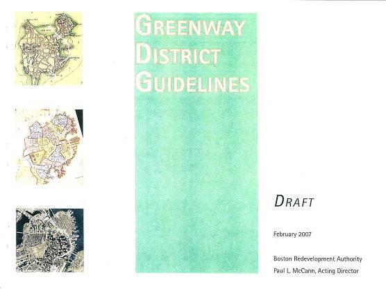
Greenway District Planning Study Use and Development Guidelines
 Greenway District Planning Study Use and Development Guidelines City of Boston Mayor Thomas M. Menino Boston Redevelopment Authority John F. Palmieri, Director August 2010 City of Boston Mayor Thomas M.
Nantasket Focused Area Study
 Nantasket Focused Area Study Community Development Plan Town of Hull, Massachusetts June 2004 Prepared for: The Hull Planning Board Prepared by: The Cecil Group, Inc. 31 St. James Avenue Boston, Massachusetts
DISCUSSION TOPIC: ST JOHNS RIVER & ITS TRIBUTARIES (BPII) 2030 COMPREHENSIVE PLAN POLICES AND REGULATORY FRAMEWORK
 2030 COMPREHENSIVE PLAN POLICES AND REGULATORY FRAMEWORK") DISCUSSION TOPIC: ST JOHNS RIVER & ITS TRIBUTARIES (BPII) 2030 COMPREHENSIVE PLAN POLICES AND REGULATORY FRAMEWORK St. John s River & Its Tributaries Issue Summary: The St. Johns River is an important
DISCUSSION TOPIC: ST JOHNS RIVER & ITS TRIBUTARIES (BPII) 2030 COMPREHENSIVE PLAN POLICES AND REGULATORY FRAMEWORK St. John s River & Its Tributaries Issue Summary: The St. Johns River is an important
EXECUTIVE SUMMARY AND URBAN DESIGN DOCUMENTATION
 EXECUTIVE SUMMARY AND URBAN DESIGN DOCUMENTATION Submitted to: Submitted by: Boston Civic Design Commission Kavanagh Advisory Group LLC 100 Conifer Hill Drive Suite 412 Danvers, MA 01923 Submitted on:
Stuart Street Planning Study Development Review Guidelines to supplement Back Bay Downtown IPOD (1987) October 15, Preface
 October 15, Preface") Stuart Street Planning Study Development Review Guidelines to supplement Back Bay Downtown IPOD (1987) October 15, 2015 Preface Background The Stuart Street Planning Study area, bound by St. James Avenue
Stuart Street Planning Study Development Review Guidelines to supplement Back Bay Downtown IPOD (1987) October 15, 2015 Preface Background The Stuart Street Planning Study area, bound by St. James Avenue
May 4, Via electronic mail
 Via electronic mail ben.lynch@state.ma.us Ben Lynch, Waterways Program Chief Department of Environmental Protection One Winter Street Boston, Massachusetts 02108 Re: DDRC Gateway LLC Ch. 91 License # 8530
North Downtown Specific Plan MEMORANDUM
 North Downtown Specific Plan MEMORANDUM MEETING DATE: November 13, 2017 TO: Members of the North Downtown Specific Plan Advisory Committee FROM: Jeanine Cavalli, Senior Planner SUBJECT: Materials for the
October 26,2006 CERTIFICATE OF THE SECRETARY OF ENVIRONMENTAL AFFAIRS ON THE ENVIRONMENTAL NOTIFICATION FORM
 - - Mil7 ROMNEY GOVERNOR KERRY HEALEY LIEUTENANT GOVERNOR Tel. (617) 626-1000 Fax. (617) 626-1 181 http://www.mass.govlenvir ROBERT W. GOLLEDGE, JR. SECRETARY October 26,2006 CERTIFICATE OF THE SECRETARY
Dealing with the Loss of Waterfront Land in South Florida: The Monroe County Marine Management Strategic Plan
 Dealing with the Loss of Waterfront Land in South Florida: The Monroe County Marine Management Strategic Plan presented by Lenore Alpert, Ph.D., Assistant Director of Research Center for Urban & Environmental
The principal elements of the NTC Strategic Vision plan are as follows.
 The proposed project would improve the NTC site plan, circulation, visitor amenities, and landscaping, and would include construction of two new stadiums to replace the existing Louis Armstrong Stadium
TOWN COUNCIL / PLANNING COMMISSION
 Workshop #3 TOWN COUNCIL / PLANNING COMMISSION January 20, 2011 Consultant Team In Attendance Tonight BMS Design Group Nevada City and San Francisco Michael Smiley, AICP, ASLA Partner-in-Charge Nancy L.
WELCOME and introduction
 1 WELCOME and introduction Mobility Hub Locations within Burlington STUDY OVERVIEW STUDY OBJECTIVES The City of Burlington is developing four Area Specific Plans, one for each of Burlington s Mobility
PORT OF SAN FRANCISCO
 PORT OF SAN FRANCISCO WATERFRONT LAND USE PLAN Prop H (1990) required a Waterfront Land Use Plan Port property in BCDC jurisdiction Define Acceptable Uses Hotels prohibited on piers Prioritize Maritime
PINE CURVE REZONING. Property does not meet criteria for open space preservation and is not a candidate for a park
 PINE CURVE REZONING BACKGROUND Purchased as two parcels in 2001 and 2002 Annexed and Zoned Greater Downtown District Historic Center September 25, 2002 and October 7, 2002 WHAT THE PROJECT IS AND IS NOT
Re: Alameda Point Update Review and Comment on SunCal s September 19, 2008 Development Concept
 Alameda Reuse and Redevelopment Authority Memorandum ITEM 10-A To: From: Honorable Chair and Members of the Alameda Reuse and Redevelopment Authority Debra Kurita Executive Director Date: November 5, 2008
The Master Plan Framework
 The Master Plan Framework The East Harbour Master Plan advances the development of 60 acres of former industrial lands east of the Don River. The Master Plan outlines a vision for a vibrant, transit-oriented
Johnson Street Bridge Public Realm Update
 Johnson Street Bridge Public Realm Update August 20, 2015 Background Johnson Street Bridge Replacement Project impacts a diverse range of stakeholders In addition to a new bridge, the project also includes
LOW DENSITY RESIDENTIAL
 LOW DENSITY RESIDENTIAL Corner lots with coach houses to increase diversity, provide unity to the streetscape and increase eyes on the street. Garages and ancillary units accessed via rear lanes. Parking
DESIGN WORKSHOP. November 17, 2015
 DESIGN WORKSHOP November 17, 2015 needs more housing. But there is no one-size fits-all solution. Every neighborhood has its own character. In some places, density is not only appropriate it is badly -
City of Meriden Harbor Brook Flood Control Project Overview
 City of Meriden Harbor Brook Flood Control Project Overview Updated August 2013 OVERVIEW The center of Meriden, including the HUB site is the low point of the town which is ringed by basalt ridges. Running
Hamilton Pier 7&8 Draft Urban Design Plan
 Hamilton Pier 7&8 Draft Urban Design Plan Public Open House October 29, 2015 Contents 1. Study Overview 2. Area Design Goals 3. Urban Structure 4. Public Realm 5. Urban Design Plan Options 6. Next Steps
Honorable Mayor and Members of the City Council. Submitted by: Eric Angstadt, Director, Planning and Development
 Office of the City Manager ACTION CALENDAR January 29, 2013 To: From: Honorable Mayor and Members of the City Council Christine Daniel, City Manager Submitted by: Eric Angstadt, Director, Planning and
This Review Is Divided Into Two Phases:
 Semiahmoo Town Centre Review The purpose of this review: To review the Semiahmoo Town Centre Concept Plan, originally approved in 1993, to ensure that this centre will continue to serve the needs of South
LEED-ND 101: Practical Strategies for Achieving Sustainability Goals. Travis Parker Lakewood Planning Director
 LEED-ND 101: Practical Strategies for Achieving Sustainability Goals Travis Parker Lakewood Planning Director Metro Vision Idea Exchange Oct 11, 2012 West Corridor Stations West Corridor Overview West
CRYSTAL CITY BLOCK PLAN # CCBP- G 1 DRAFT
 CRYSTAL CITY BLOCK PLAN # CCBP- G 1 DRAFT BLOCK G (Metro Market Square block) Long Range Planning Committee Meeting January 29, 2018 1 1. Introduction 2 1. LRPC Meeting Purpose Review of proposed Crystal
PORT ST. JOE WATERFRONT PARTNERSHIP WATERFRONT STRATEGIC PLAN. Land Design Innovations, Inc.
 Land Design Innovations, Inc. i TABLE OF CONTENTS A. INTRODUCTION..1 B. MASTER PLAN..2 1. Baywalk.. 2 2. St. Joseph s Landings.4 3. Trail Connectors and Improved Pedestrian Crosswalks.5 4. Regional Stormwater
Congress Street Bridge Lighting Project Community Meeting. April 6, 2017
 Congress Street Bridge Lighting Project Community Meeting April 6, 2017 CSBLP Community Meeting Agenda Introductions Context for Lighting Project Initial Concept Designs Open Discussion Image: Boston Planning
4/8/2015 Item #10D Page 1
 MEETING DATE: April 8, 2015 PREPARED BY: Christy Villa, Associate Civil Engineer DEPT. DIRECTOR: Glenn Pruim DEPARTMENT: Public Works CITY MANAGER: Larry Watt SUBJECT: NORTH COAST HIGHWAY 101 STREETSCAPE
Request for Proposals A Revised Master Plan for Waterfront Planning Area, City of Lynn
 Request for Proposals A Revised Master Plan for Waterfront Planning Area, City of Lynn In this Request for Proposals The City of Lynn, Massachusetts (the City) acting through the Economic Development Industrial
WALTER RAND TRANSPORTATION CENTER
 WALTER RAND TRANSPORTATION CENTER PLANNING AND DESIGN STUDY Public Meeting May 25, 2017 TONIGHT S AGENDA Introduction and Welcome Project Objectives The Study Area: WRTC and its Context Circulation Assessment
Waterfront West December 6, 2016
 1 Waterfront West December 6, 2016 Agenda 1. Development Team 2. Waterfront History As Our Guide. A Compelling Site Idea 4. Community Benefits 5. Zoning 6. Architectural Context 7. Project Renderings 8.
WATERFRONT PLACE CENTRAL MIXED USE REDEVELOPMENT PROJECT
 WATERFRONT PLACE CENTRAL MIXED USE REDEVELOPMENT PROJECT View Impact Analysis - Summary Narrative The view impact analysis conducted for the Waterfront Place Central mixed-use redevelopment project proposal
City of Los Angeles, Bureau of Engineering staff report - dated October 14, 2009 and the Hearing Examiner Report signed October 21, 2009.
 - the Rifkin Transportation Los Feliz Towers 4455 Los Feliz Boulevard Suite 1403 Planning Group E-mail allynrifkin@gmail.com Telephone and fax -- (323) 664-2805 Mobile phone - (323) 697-1594 February 3,
Prince George s County Economic Development Corporation David Iannucci President & CEO
 Prince George s County Economic Development Corporation David Iannucci President & CEO WBC REGIONAL ECONOMIC DEVELOPMENT FORUM THE FUTURE OF PRINCE GEORGE S COUNTY Wednesday, March 6, 2019 Why Prince George
Subject: 30 Otis Street, Evaluation of Shadow on Proposed 11th and Natoma Park
 Date: September 5, 2018 To: Recreation and Park Commission Capital Committee Through: Philip A. Ginsburg, General Manager Toks Ajike, Director, Capital & Planning Division From: Brian Stokle, Planner,
Construction Contract A47CN01: Wollaston Station Improvements and Quincy Center Garage Demolition. June 2017
 Construction Contract A47CN01: Wollaston Station Improvements and Quincy Center Garage Demolition June 2017 OVERVIEW Today s board action will provide for the construction of improvements to the Wollaston
Joint Study Session of the Sutter County. March 2, 2009
 Joint Study Session of the Sutter County Board of Supervisors and Planning Commission March 2, 2009 CURRENT APPLICATION General Plan Amendment Specific Plan Specific Plan Appendices Utility Plans Transit/AQ
The underlying goals of the study and resultant zoning recommendations are to:
 Stuart Street Planning Study Advisory Group Proposed Zoning Recommendations to replace Back Bay Downtown IPOD (1987) DRAFT OCT 20, 2009 Preface Background The Stuart Street Planning Study area, bound by
University of the District of Columbia Van Ness Campus Master Plan Community Open House 3. December 8, 2010
 University of the District of Columbia Van Ness Campus Master Plan Open House 3 December 8, 2010 Introductions Sequence of Work: Campus Master Plan BEGIN: INTRODUCE AND START WORK Project Initiation Team
Naomi Weiss, Executive Director, DBPA Jason Jeffries, Project Manager, City of Daytona Beach
 Naomi Weiss, Executive Director, DBPA Jason Jeffries, Project Manager, City of Daytona Beach Nottingham Plan 2002 Adopted Redevelopment Plan 2002 Riverfront Action Plan 2004 Downtown Vision Plan 2007
PLACEMAKING & MOBILITY WORKSHOP. January 27, 2016
 PLACEMAKING & MOBILITY WORKSHOP January 27, 2016 Boston needs more housing. But there is no one-size fitsall solution. Every neighborhood has its own character. In some places, density is not only appropriate
Charlestown Waterfront Assessment: Creating Connections
 Charlestown Waterfront Assessment: Creating Connections Marisa Arpels Luis Montoya Rodrigo Diaz Sabra Loewus Cyd McKenna Charlestown = 1.5 miles USS Constitution 3 miles Creating Connections Between Charlestown
KENDALL SQUARE INITIATIVE. Planned Unit Development Special Permit Application - SoMa September 8, 2015
 KENDALL SQUARE INITIATIVE Planned Unit Development Special Permit Application - SoMa September 8, 2015 GENERAL DEVELOPMENT GOALS Kendall Square PUD 2 PRE-ZONING PUBLIC ENGAGEMENT 2008-2009 2010-2012 2013
RFP DRAINAGE OUTFALL DESIGN AND PERMITTING. Mandatory Meeting for Proposers August 15, 2015
 RFP 2018-02 DRAINAGE OUTFALL DESIGN AND PERMITTING Mandatory Meeting for Proposers August 15, 2015 IMPORTANT DATES August 15 th, 2:00pm August 17 th, 5:00pm August 22 nd, 5:00pm September 5 th, 2:00pm
VICTORIA DOWNTOWN DEVELOPMENT PLANNING
 VICTORIA DOWNTOWN DEVELOPMENT PLANNING A Vision & Guide for the Future Downtown Victoria thrives as a center for the community, offering a great mix of entertainment, culture, business, and recreational
chapter DESIGN GUIDELINES NEW RIVER MASTER PLAN REPORT
 chapter DESIGN GUIDELINES NEW RIVER MASTER PLAN REPORT .76 DESIGN GUIDELINES An Overview design guidelines NEW RIVER MASTER PLAN Design Guidelines can transform the image of a city. Specific, design-based
12 th Street Connector Alignment Study VISIONING PUBLIC WORKSHOP - JUNE 25, :00PM TO 8:00PM
 12 th Street Connector Alignment Study VISIONING PUBLIC WORKSHOP - JUNE 25, 2018 6:00PM TO 8:00PM Goals for Today s Workshop Agenda: Project Introduction, Purpose, and Goals Existing Conditions Traffic
Attachment 1 TOWN OF NEW TECUMSETH. Manual for the Preparation of an Urban Design Report
 Attachment 1 TOWN OF NEW TECUMSETH Manual for the Preparation of an Urban Design Report July 2010 TABLE OF CONTENTS Background, Policy Framework and the Preparation of Urban Design Reports 1. Introduction
DRAW SEVEN PARK RENOVATION PROJECT SOMERVILLE, MASSACHUSETTS
 DRAW SEVEN PARK RENOVATION PROJECT SOMERVILLE, MASSACHUSETTS DCR Public Meeting Monday, February 5th 6:30pm-8:30pm East Somerville Community School 50 Cross Street, Somerville, MA, 02145 Commonwealth of
Grafton Street < N September 2, 2015
 Grafton Street < N September 2, 2015 Project Background, Site Inventory + Analysis Brunswick Street Duke Street Scotia Bank Centre Carmichael Street Argyle Street City Hall Grand Parade Barrington Street
Project Goal. RRRC Living Towns Planning Workshp. Town of Halifax Revitalization Project. Dynamic Planning & Management Duo: July 12, 2006
 Project Goal Town of Halifax Revitalization Project RRRC Living Towns Planning Workshp July 12, 2006 Town of Halifax Halifax County *** Revitalization Project Goal*** To create Economic Opportunity and
Notes from table discussions at the Metro North Regional Forum in Malden on April 30, 2014
 Notes from table discussions at the Metro North Regional Forum in Malden on April 30, 2014 These notes represent a summary of the themes, locations, and discussions that were discussed as part of the facilitated
Bethesda Downtown Plan
 Bethesda Downtown Plan Planning Board Update Connecticut Avenue Location Economic Sustainability Social Environmental Scope Coming Soon! Team Listening, Twitter Outreach We Are Here Engagement Challenge
TABLE OF CONTENTS 1.0 INTRODUCTION... 3
 TABLE OF CONTENTS 1.0 INTRODUCTION... 3 1.1. BACKGROUND... 3 1.2. THE PROPOSAL... 5 2.0 EXISTING POLICY FRAMEWORK... 5 2.1. PROVINCIAL POLICY STATEMENT (PPS)... 5 2.2. CITY OF LONDON OFFICIAL PLAN (OP)...
M i s s i o n B a y W a t e r f r o n t
 114 M i s s i o n B a y W a t e r f r o n t Character of the Area: The Mission Bay Waterfront extends from Pier 48 at China Basin Channel to 18th Street in the Central Basin. This area of the waterfront
The DCR Neponset River Trail Central Avenue to Mattapan Square
 The DCR Neponset River Trail Central Avenue to Mattapan Square Photo Public Meeting Tuesday, August 30, 2011 7:30 pm 9:00 pm Foley Senior Residences Dining Room 249 River Street, Mattapan DCR MISSION STATEMENT
KENDALL SQUARE INITIATIVE. Planned Unit Development Special Permit Application - SoMa September 8, 2015
 KENDALL SQUARE INITIATIVE Planned Unit Development Special Permit Application - SoMa September 8, 2015 GENERAL DEVELOPMENT GOALS Kendall Square PUD 2 PRE-ZONING PUBLIC ENGAGEMENT 2008-2009 2010-2012 2013
{Best Practices. Summary of Tools, Strategies and Best Practices from 11 Michigan Case Study Communities
 Case Studies Michigan Coastal Community Working Waterfronts { Summary of Tools, Strategies and from 11 Michigan Case Study Communities Table of Contents Zoning...2 Community and Stakeholder Collaboration
Complete Streets Master Plan for Downtown New Britain CRCOG Transportation Committee Meeting Monday, December 9, 2013
 CRCOG Transportation Committee Meeting Monday, December 9, 2013 Introduction Why the Project was Initiated About Downtown New Britain Master Plan Goals Master Plan Overview Master Plan Study Areas and
Port of Seattle Street Vacations Summary April, 2016
 Port of Seattle Street Vacations Summary April, 2016 Since the question of street vacations provided to the Port was raised at the April 19 Sustainability and Transportation Committee, the Port is providing
Potential Green Infrastructure Strategies May 6, 2015 Workshop
 Potential Green Infrastructure Strategies May 6, 2015 Workshop Background The City of Cortland is developing the Tioughnioga Urban Headwaters Green Infrastructure Action Plan with funding from the National
MARINA MARKET & WATERFRONT DEVELOPMENT STUDY PORT ARANSAS, TEXAS
 MARINA MARKET & WATERFRONT DEVELOPMENT STUDY PORT ARANSAS, TEXAS FEBRUARY 2015 PRESENTATION OUTLINE 1 2 3 4 5 6 7 REGIONAL POSITIONING SITE IMPRESSIONS PLANNING & DESIGN PRINCIPLES EXISTING IMPROVEMENTS
PORT OF SAN FRANCISCO WATERFRONT PLAN UPDATE: PART 3
 Waterfront Planning Timeline WHAT IS THE PORT? The Port of San Francisco manages 7½ miles of the San Francisco waterfront from Fisherman s Wharf in the north to Heron s Head Park in the south. Port properties
2.1 Location and Size
 2.0 Context 7 2.1 Location and Size The Saanich Penninsula The study area is centrally located within the Town boundaries on the east side of Highway 17, which runs through Sidney in a north-south direction.
Planning Commission Report
 Planning Commission Report To: From: Subject: Planning Commission Meeting: January 6, 2016 Agenda Item: 8-B Planning Commission David Martin, Planning & Community Development Director Introduction to the
BATHURST QUAY NEIGHBOURHOOD PLAN IMPLEMENTATION. Streetscape & Public Realm Improvement Plan - Canada Malting Silo Site and Eireann Quay
 BATHURST QUAY NEIGHBOURHOOD PLAN IMPLEMENTATION Streetscape & Public Realm Improvement Plan - Canada Malting Silo Site and Eireann Quay Bryan Bowen, Waterfront Secretariat November 25, 2017 Presentation
Plymouth Transportation & Visitor s Services Center May 6, 2014 Town of Plymouth Board of Selectmen Project Update - Schematic Design
 Plymouth Transportation & Visitor s Services Center May 6, 2014 Town of Plymouth Board of Selectmen Project Update - Schematic Design Overview PRIMARY PROJECT OBJECTIVES: Help address the downtown/waterfront
Presentation Item C Annotated Model Outline for a Framework for a Green Infrastructure Plan
 Date: August 17, 2016 To: From: Subject: Management Committee Dan Cloak, Consultant Presentation Item C Annotated Model Outline for a Framework for a Green Infrastructure Plan Recommendation: Receive the
preliminary master plan Cover Slide executive summary public presentation
 preliminary master plan public presentation executive summary Cover Slide {agenda} + Master Plan Process + Context and Overviews + Preliminary Concepts - Entry/Gateways - Core District - Streetscape +
Vision for East Cowes
 Vision for East Cowes A better East Cowes for now and the future The East Cowes Regeneration project is a major regeneration scheme on the Isle of Wight. It will create a vibrant community with a long-term
PUBLIC SPACE/AMENITY PROJECTS
 BUFFALO S LWRP 49 A1. Black Rock Canal Park Improvements Erie County Parks Black Rock Canal Park, Ontario and Niagara Street intersection PROJECT DESCRIPTION: Erie County s Black Rock Canal Park is 4.25
PLANNING ADVISORY BOARD AGENDA OCTOBER
 ! City of Langley PLANNING ADVISORY BOARD AGENDA OCTOBER 1, 2014 3-5pm LANGLEY CITY HALL - 112 2 nd Street, Langley WA 1) Call to Order and Roll Call 2) Approval of the Minutes September 10, 2014 3) Public