We are pleased to present Delwyn Spronk Farm ± Acres Elmer Township, Pipestone County
|
|
|
- Branden Ball
- 5 years ago
- Views:
Transcription


1 We are pleased to present Delwyn Spronk Farm ± Acres Elmer Township, Pipestone County SUBJECT PROPERTY This property to be sold by Sealed Bid Auction Owner: Delwyn & Julie Spronk Owner s Attorney: Kristen Haberman, Einhaus, Mattison, Carver & Haberman, P.A., Owatonna, MN Date & Time: Tuesday, September 25, 11 a.m. Location: Senior Citizens Center, 120 Maple St, Edgerton, MN Note: See Sealed Bid Information page in the back of this brochure for more details. Only registered bidders may attend. Must be registered prior to auction date. Listing Agent: Charles Wingert, ALC Office: LAND (5263) Toll Free: LAND (5263) Direct: Auctioneer # Charles@WingertRealty.com


2 State Highway Map Minneapolis SUBJECT PROPERTY Mankato

3 Pipestone County Minnesota SUBJECT PROPERTY

4 Elmer Township Pipestone County SUBJECT PROPERTY


5 United States Department of Agriculture Pipestone County, Minnesota FSA Aerial View Farm 4628 Tract Program Year Map Created May 11, T105 R45 Elmer NHEL PC/NW PC/NW NHEL t h A v e Feet Unless otherwise noted: Shares are 100% operator Crops are non-irrigated Corn = yellow for grain Soybeans = common soybeans for grain Wheat = HRS, HRW = Grain Sunflower = Oil, Non-Oil = Grain Oats and Barley = Spring for grain Rye = for grain Peas = process Alfalfa, Mixed Forage AGM, GMA, IGS = for forage Beans = Dry Edible NAG = for GZ Canola = Spring for seed PC/NW Common Land Unit Non_Cropland Cropland Tract Boundary PLSS ² Wetland Determination Identifiers &- Restricted Use Limited Restrictions Exempt from Conservation ") Compliance Provisions #* Tract Cropland Total: acres United States Department of Agriculture (USDA) Farm Service Agency (FSA) maps are for FSA Program administration only. This map does not represent a legal survey or reflect actual ownership; rather it depicts the information provided d from the producer and/or National Agricultural Imagery Program (NAIP) imagery. The producer accepts the data 'as is' and assumes all risks associated with its use. USDA-FSA assumes no responsibility for actual or consequential damage incurred as a result of any user's reliance on this data outside FSA Programs. Wetland identifiers do not represent the size, shape, or specific determination of the area. Refer to your original determination (CPA-026 and attached maps) for boundaries and determinations or contact USDA Natural Resources Conservation Service (NRCS). This map displays the 2017 NAIP Imagery. Survey Drawing SUBJECT PROPERTY
6 Property Information DESCRIPTION: ± Acres. N½ SE¼ Exc..91 ac Tr Desc as Comm at SE Cor of Sec; N Section 27, T105N-R45W (not to be used on legal documents) (Elmer Township, Pipestone County, Minnesota) TAX PID #: BUILDINGS: None REAL ESTATE TAXES: 2018 Ag Non Hmstd taxes = $2, Special Assessments = $0 FSA INFORMATION: Total acres = ± acres FSA Tillable acres = ± acres Corn base acres = ± acres Corn PLC Yield =145 ± bushels Soybean base acres = 7.66 ± acres Soybean PLC Yield = 48 ± bushels Farm Program Info - Enrolled into Agricultural Risk Coverage (ARC) County SOIL DESCRIPTION: Kranzburg, Brookings, Estelline, Hidewood, Badger, Buse, Vienna, Lamoure, La Prairie. See Soils Map. CPI: Crop Productivity Index = 87.5 TOPOGRAPHY: DRAINAGE: Level to rolling Private mains and laterals. See Tile Map. NRCS CLASSIFICATIONS ON TILLABLE ACRES: Exempt from conservation compliance provisions. NHEL - Non-Highly Erodible Land WINGERT REALTY & LAND SERVICES, INC. stipulates that they are representing the seller exclusively in this transaction. The information gathered for this brochure in its entirety is from sources deemed reliable, but cannot be guaranteed by Seller, Wingert Realty & Land Services, Inc., or its staff. Package is subject to prior sale, price change, correction or withdrawal. The buyer must make their own independent investigation of the property. The buyer is purchasing the property as is.
7 Tile Map This tile map is an approximation. Wingert Realty & Land Services, Inc. does not guarantee tile maps, footage, tile condition, location, size, grade or depth.

8 Soils Map
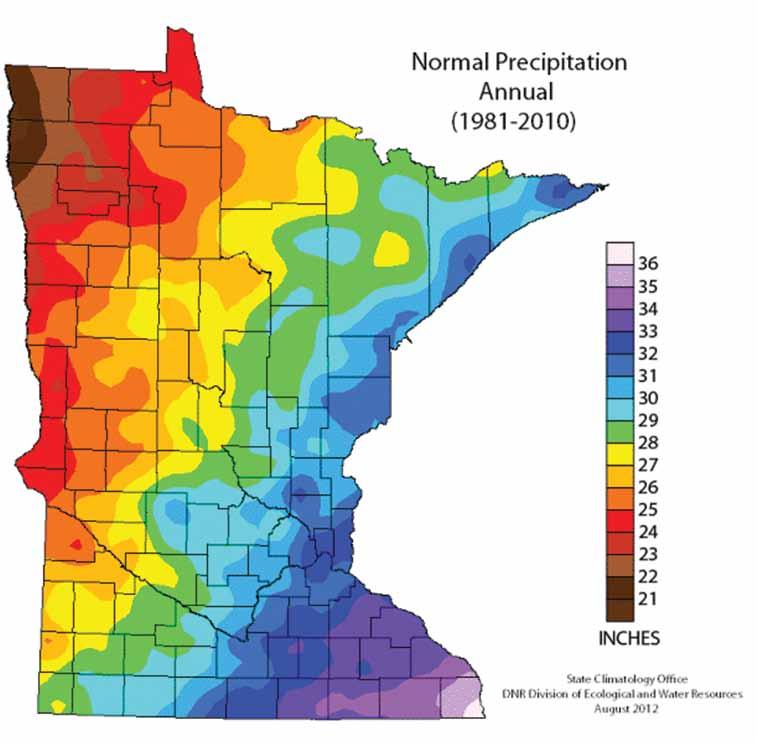
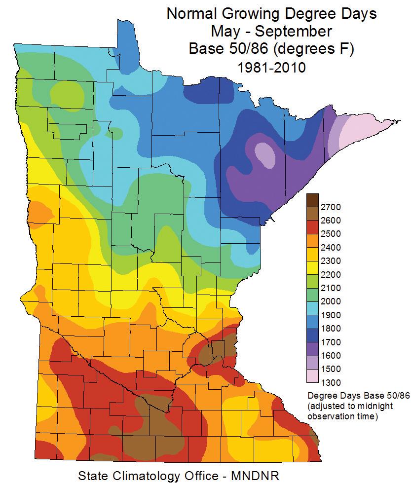
9 Soil Descriptions KRANZBURG SERIES - Soil # J90B The Kranzburg series consists of very deep, well drained soils formed in silty glacial drift and the underlying glacial till on uplands. Permeability is moderately slow. Slopes range from 0 to 9 percent. Mean annual precipitation is about 23 inches and mean annual temperature is 43 degrees F. TYPICAL PEDON: Kranzburg silty clay loam - on a plane, southfacing slope of 2 percent in a cultivated field. When described the soil was moist throughout. GEOGRAPHIC SETTING: Kranzburg soils are on glacial plains having gentle, smooth, and uniform slopes with surfaces plane or slightly convex. Slope gradients typically are less than 6 percent, but range from 0 to 9 percent. Kranzburg soils formed in 20 to 40 inches of silty glacial drift overlying loamy glacial till. Mean annual temperature ranges from 39 to 48 degrees F, and mean annual precipitation from 16 to 24 inches. Growing season is about 120 to 135 days; average growing season precipitation from 14 to 18 inches; and growing degree days are about 2600 to Elevation ranges from 1000 to 2130 feet. GEOGRAPHICALLY ASSOCIATED SOILS: These are the competing Poinsett soils and the Badger,Barnes, Brookings, Forman, Hidewood and McIntosh soils. The Poinsett soils are on the lower back slopes. Badger soils have fine textured control sections and are on toe slopes. The Barnes, Forman, and Vienna soils are on adjacent till plains and have more than 15 percent fine sand or coarser within depths of 20 inches. In addition, Forman soils have an argillic horizon. Brookings soils have more than 16 inches of mollic colors and are in swales and shallow drainageways. The somewhat poorly drained Hidewood soils have low chroma mottles within a depth of 40 inches and are on flats and depressed upland drains. McIntosh soils have a calcic horizon within 16 inches of the surface and are on foot slopes. DRAINAGE AND PERMEABILITY: Well drained. Surface runoff is low or medium. Permeability is moderately slow. BROOKINGS SERIES - Soil # J90B The Brookings series consists of very deep, well drained and moderately well drained soils formed in silty glacial till over loamy glacial till on foot slopes of till plains. Permeability is moderately slow. Slopes range from 0 to 6 percent. Mean annual precipitation is about 21 inches, and mean annual temperature is about 44 degrees F. TYPICAL PEDON: Brookings silty clay loam - on a plane slope of 1 percent in a cultivated field. When described the soil was moist throughout. GEOGRAPHIC SETTING: Brookings soils are on nearly level and gently sloping foot slopes of till plains. Surfaces are plane or concave, and slope gradients range from 0 to 6 percent. These soils formed in 20 to 40 inches of silty glacial till over calcareous loamy glacial till. Mean annual temperature ranges from 39 to 48 degrees F, and mean annual precipitation ranges from 16 to 24 inches. Growing season is about 120 to 140 days; average growing season precipitation ranges from 16 to 24 inches; and growing degree days are about 2500 to GEOGRAPHICALLY ASSOCIATED SOILS: These are the Badger, Hidewood, Kranzburg, Lismore, McIntosh, and Vienna soils. The somewhat poorly drained Badger soils have a fine textured particle size control section. The somewhat poorly drained Hidewood soils have gleyed horizons in the series control section. The Badger and Hidewood soils are in lower more depressed landscapes. Lismore soils have a fine-loamy control section and are on similar landscapes. McIntosh soils have a calcic horizon within 16 inches of the surface and are on similar landscapes. Kranzburg and Vienna soils have a mollic epipedon less than 16 inches thick and are on convex to plane slopes above the Brookings soils. DRAINAGE AND PERMEABILITY: Moderately well drained; surface runoff is low or medium; permeability is moderately slow till. It has a seasonal high water table at depths between 3 and 5 feet in the spring and fall of most years. Areas in swales receive run-in water from adjacent soils. ESTELLINE SERIES - Soil # J74A The Estelline series consists of deep, well drained soils formed in silty materials overlying sand and gravel on stream terraces and outwash plains. Permeability is moderate in the solum and very rapid in the sand and gravel. Slopes range from 0 to 9 percent. Mean annual precipitation is about 21 inches, and mean annual temperature is about 43 degrees F. TYPICAL PEDON: Estelline silt loam - in cultivation. GEOGRAPHIC SETTING: Estelline soils are on smooth stream terraces or outwash plains. Slopes are plane to convex and gradients are usually less than 3 percent but range from 0 to 9 percent. These soils formed in silty mantles overlying outwash sand and gravel. Mean annual temperature ranges from 43 to 48 degrees F, and the mean annual precipitation ranges from 20 to 24 inches. Growing season is about 120 to 130 days; average growing season precipitation from 15 to 18 inches; and growing degree days are about 2500 to GEOGRAPHICALLY ASSOCIATED SOILS: These are the competing Athelwold soils and the Fordville, Kranzburg, Poinsett, and Renshaw soils. Athelwold soils are in nearby swales and flats. Fordville and Renshaw soils contain more than 15 percent fine or coarser sand in all parts of the series control section and are on similar nearby landscapes. The Kranzburg and Poinsett soils do not have sand and gravel within a depth of 40 inches and are on higher nearby landscapes. DRAINAGE AND PERMEABILITY: Well drained. Runoff is medium to slow. Permeability is moderate in the solum and very rapid in the underlying sand and gravel.
10 Soil Descriptions HIDEWOOD SERIES - Soil # J93A The Hidewood series consists of deep, poorly drained, moderately and moderately slowly permeable soils on uplands. They formed in loess or in local alluvium derived from loess overlying loamy glacial till. Slope ranges from 0 to 2 percent. Mean annual precipitation is about 24 inches, and mean annual temperature is about 45 degrees F. TYPICAL PEDON: Hidewood silty clay loam with a slightly concave slope of 1 percent in a meadow. GEOGRAPHIC SETTING: These soils are on plane to slightly concave level or nearly level slopes mostly on ground moraines of the Coteau des Prairies. They formed in 20 to 40 inches of silty clay loam loess that is underlain by loam or clay loam glacial till. Mean annual temperature is about 40 to 45 degrees F, and mean annual precipitation is about 20 to 28 inches. GEOGRAPHICALLY ASSOCIATED SOILS: They are the Kranzburg, Brookings, Vienna, and Lismore soils. The Kranzburg and Vienna soils are well drained and are on higher lying more sloping parts of the landscape. The Brookings and Lismore soils are moderately well drained and are on only slightly higher lying nearly level and very gently sloping parts of the landscape. The Kranzburg and Brookings soils formed in materials similar to those of Hidewood soils. The Vienna and Lismore soils formed in a thinner loess mantle and in loam and clay loam materials. DRAINAGE AND PERMEABILITY: Poorly drained. Surface runoff is slow. Permeability is moderate or moderately slow. BADGER SERIES - Soil # J93A The Badger series consists of very deep, somewhat poorly drained soils formed in local alluvium over silty glacial till or other loamy glacial till in upland toeslopes. Permeability is slow. Slopes range from 0 to 2 percent. Mean annual precipitation is about 23 inches, and mean annual temperature is about 44 degrees F. TYPICAL PEDON: Badger silty clay loam, on a slightly concave slope of less than 1 percent in a cultivated field. When described the soil was moist throughout. GEOGRAPHIC SETTING: Badger soils are in nearly level swales, drainageways, and slight depressions on uplands toe slopes. Surfaces are plane or concave with slope gradients less than 2 percent. Badger soils formed in local alluvium over silty glacial till. Mean annual temperature ranges from 40 to 48 degrees F, and mean annual precipitation ranges from 18 to 24 inches. Average growing season is 120 to 130 days; average growing season precipitation is 16 to 18 inches; and average number of growing degree days is 2,500 to 2,800. GEOGRAPHICALLY ASSOCIATED SOILS: These are the competing Parnell soils and the Aastad, Barnes, Bearden, Forman, Hamerly, Oldham, Poinsett, Svea, Tonka, and Waubay soils. Parnell soils are on lower parts of the landscape. Aastad, Barnes, Poinsett, Svea, and Waubay soils do not have an argillic horizon and are on higher parts of the landscape. Forman soils have a thinner mollic epipedon and are on higher parts of the landscape. Bearden and Hamerly soils have a calcic horizon and are on slight rises above swales and depressions. Oldham soils are calcareous to the surface and are in depressions and basins of shallow lakes. Tonka soils have an albic horizon, are poorly drained, and are in closed depressions and basins. DRAINAGE AND PERMEABILITY: Somewhat poorly drained. Runoff is very low. Permeability is slow. A perched watertable is at a depth of 0 to 3 feet during the spring of most years. Flooding is frequent and brief. Badger soils usually are not saturated in the soil moisture control section for more than 30 consecutive days during the growing season. BUSE SERIES - Soil # J92C2 Complex The Buse series consists of very deep, well drained soils that formed in loamy glacial till on moraines. These soils have moderate and moderately slow permeability. They have slopes of 3 to 60 percent. Mean annual precipitation is about 22 inches. Mean annual air temperature is about 42 degrees F. TYPICAL PEDON: Buse loam with a convex slope of 5 percent on a glacial moraine in a cultivated field. GEOGRAPHIC SETTING: The Buse soils have slightly to strongly convex slopes in glacial moraines. Slope gradient ranges from 3 to 60 percent. The Buse soils formed in calcareous till of the Wisconsinan Age. Mean annual air temperature is about 36 to 45 degrees F. Mean annual precipitation is about 16 to 24 inches. Frost free days are 120 to 150 days. Elevation above sea level ranges from 1,000 to 1,600 feet. GEOGRAPHICALLY ASSOCIATED SOILS: These are the Aastad, Aazdahl, Barnes, Flom, Forman, Formdale, Hamerly, Langhei, Sioux, Svea, Vienna, and Waukon soils. Aastad and Svea soils have cambic horizons and thicker mollic epipedons. Barnes, Flom, Forman, Vienna and Waukon soils have Bw or Bt horizons, thicker sola and lack free calcium carbonate in the upper part of solum. Hamerly soils have calcic horizons and have lower chroma in the upper part of the C horizon. Langhei soils do not have a mollic epipedon. Sioux soils are coarse textured and excessively drained. DRAINAGE AND PERMEABILITY: Well drained. Surface runoff is moderately low on the lesser slopes and very high on steep slopes. Permeability is moderate or moderately slow. VIENNA SERIES - Soil # J92C2 Complex The Vienna series consists of very deep, well drained soils formed in silty and loamy loess and the underlying loamy glacial till on uplands. These soils have moderately slow permeability. Slopes range from 0 to 15 percent. Mean annual precipitation is about 21 inches, and mean annual temperature is about 43 degrees F.
11 Soil Descriptions TYPICAL PEDON: Vienna silty clay loam - on a nearly level part of an undulating landscape of less than 6 percent gradient. Soil was moist throughout when described. GEOGRAPHIC SETTING: Vienna soils are nearly level to hilly on uplands having plane and slightly convex surfaces. Slope gradients typically are less than 6 percent, but range from 0 to 15 percent. Vienna soils formed in silty and loamy loess calcareous loamy glacial till. Mean annual temperature ranges from 38 to 48 degrees F, and mean annual precipitation is 18 to 25 inches. Growing season is about 120 to 130 days; average growing season precipitation ranges from 15 to 19 inches; and growing degree days are about 2500 to GEOGRAPHICALLY ASSOCIATED SOILS: These are the competing Barnes soils and the Brookings, Buse, Forman, Hidewood, Kranzburg, Lismore, and Poinsett soils. The Barnes and Forman soils are on nearby till plains. Buse soils typically are on steeper landscapes and have carbonate at or near the surface. Forman soils have an argillic horizon. Brookings and Lismore soils have a mollic epipedon more than 16 inches thick and are in swales and shallow drainageways. The fine-silty Hidewood soils are poorly drained and are on lower parts of the landscapes. Kranzburg and Poinsett soils are fine-silty. Kranzburg and Poinsett soils are on similar landscapes. DRAINAGE AND PERMEABILITY: Well drained. Surface runoff is low to high. Permeability is moderately slow. LAMOURE SERIES - Soil # J80A The Lamoure series consists of very deep, somewhat poorly drained or poorly drained soils formed in silty alluvium on flood plains. Permeability is moderate or moderately slow. Slopes are less than 2 percent. Mean annual precipitation is about 22 inches, and mean annual air temperature is about 43 degrees F. TYPICAL PEDON: Lamoure silty clay loam - on a slope of 1 percent in a cultivated field. When described the soil was moist throughout. GEOGRAPHIC SETTING: The Lamoure soils are on nearly level bottoms of glacial outwash valleys and on flood plains of major streams and tributaries within glacial till plains. Slopes are less than 2 percent. They formed in silty alluvium. Mean annual air temperature ranges from 36 to 48 degrees F, and mean annual precipitation ranges from 16 to 24 inches. Growing season is about 120 to 135 days; average growing season precipitation from 14 to 20 inches; and growing degree days are about 2500 to GEOGRAPHICALLY ASSOCIATED SOILS: These are the competing Playmoor and Rauville soils and the Dovray, Forman, LaDelle, Lowe, Ludden, and Poinsett soils. Ludden and Playmoor soils are in similar landscapes. Ludden soils have a fine textured series control section. Rauville soils are in more depressed and sluggish drainageways. Dovray soils are deeper to carbonates, have a fine textured series control section, and are on similar landscapes. The well drained Forman soils have an argillic horizon and on adjacent uplands. The moderately well drained LaDelle soils do not have mottles within depths of 40 inches and are on slightly higher positions on the landscape. Lowe soils have a calcic horizon within 16 inches of the surface and have a fine-loamy series control section. They are on similar landscapes to the Lamoure soil. The well drained Poinsett soils have mollic epipedons less than 16 inches thick and are on adjacent uplands. DRAINAGE AND PERMEABILITY: Somewhat poorly drained or poorly drained. Surface runoff is low. Permeability is moderate or moderately slow. The water table is at depths of 0 to 2 feet, except during the growing season. Lamoure soils frequently flood from stream overflow. LA PRAIRIE SERIES - Soil # J80A The La Prairie series consists of very deep, moderately well drained, moderately permeable soil that formed in loamy alluvium. These soils are on terraces and bottom lands in stream valleys. Slope ranges from 0 to 6 percent. Mean annual air temperature is 42 degrees F, and mean annual precipitation is 19 inches TYPICAL PEDON: La Prairie silt loam - on a flat slope of less than 1 percent in a cultivated field. GEOGRAPHIC SETTING: La Prairie soils are on level to gently sloping terraces, bottom lands and in swales of intermittent streams. Slope ranges from 0 to 6 percent. The soils formed in alluvium. The mean annual air temperature ranges from 37 to 45 degrees F, and the mean annual precipitation from 15 to 23 inches. Most of the precipitation comes in the spring and summer. GEOGRAPHICALLY ASSOCIATED SOILS: These are the Aastad, Barnes, Cashel, Fairdale, Forman, Gardena, LaDelle, Lamoure, Ludden, Svea, Wahpeton and Walsh soils. Aastad, Barnes, Forman and Svea soils are on nearby till uplands and Gardena and Walsh soils are on nearby deltas, fans and lake plains. These soils have a regular decrease in organic matter content with depth. In addition, Barnes and Forman soils have mollic epipedons less than 16 inches in thickness and Gardena soils are coarse-silty. Cashel, Lamoure and Ludden soils are on nearby lower lying bottom lands. Cashel soils are somewhat poorly drained and have fine textures. Lamoure soils are poorly drained and are fine-silty. Ludden soils are poorly drained and have fine textures. Fairdale and LaDelle soils are on similar positions as La Prairie soils. Fairdale soils have fine stratification below the A horizon. LaDelle soils are fine-silty. Wahpeton soils are on higher lying levees and have fine textures. DRAINAGE AND PERMEABILITY: Moderately well drained. Runoff is negligible to low depending on slope. Permeability is moderate. The soils are flooded for short periods when streams overflow. A seasonal high water table is at depth of 3 to 5 feet at some time during the period of April through June.
12
13
14 SEALED BID AUCTION INSTRUCTIONS Sealed Bid Location and Time: Senior Citizens Center 120 Maple St, Edgerton, MN Tuesday, September 25, 11 a.m. Sealed Bid Instructions: 1. Only registered bidders may attend. Must be registered prior to auction date. All potential bidders shall deliver or mail a sealed bid, postmarked by September 19, 2018 to: Wingert Realty & Land Services, Inc., Attn: Charles Wingert 1160 Victory Drive So., Suite 6, Mankato, MN If you are unable to get postmarked bid in on time, call our office for other arrangements. 2. All bids must be accompanied by a $5,000 check for earnest money made out to Wingert Realty Trust Account. 3. The written bid shall state the total price for total deeded acres. 4. All persons submitting a written bid will be allowed to raise their bid after all bids have been opened. 5. The premises described herein will be sold in as is, where is condition 6. Seller shall pay the real estate taxes and special assessments due and payable in 2018, and receive 2018 income. 7. Purchaser shall pay the real estate taxes and special assessments due and payable in 2019 and beyond. 8. The successful bidder or bidders will enter into a Purchase Agreement and shall pay as earnest money 10% of the successful bid on the day of auction. 9. A 2% Buyer Premium will be added to the final bid price to arrive at the final contract price. 10. The entire balance of the purchase price, without interest, will be due and payable on Thursday, October 25, 2018 at which time marketable title shall be conveyed. Possession takes place after 2018 crop has been removed. 11. All checks will be returned to unsuccessful bidder. 12. The Sellers reserve the right to reject any and all bids and to waive any irregularities in the bidding. 13. Announcements made the day of the auction take precedence over written material. For additional information, contact: Wingert Realty & Land Services, Inc. Charles Wingert, ALC, Auctioneer # (800) 730-LAND (5263), LAND (5263) or Direct
15 REGISTRATION / BIDDING FORM Bid Submitting Instructions: Write in your total price for total deeded acres for each parcel you would like to bid on Write in your name, address, telephone number and address All bids must be accompanied by a $5,000 check (this check covers any and all parcels you wish to bid on) for earnest money made out to Wingert Realty Trust Account. Only registered bidders may attend. Must be registered prior to auction date. All potential buyers shall deliver or mail a sealed bid, postmarked by September 19, 2018 to: Wingert Realty & Land Services, Inc., Attn: Charles Wingert 1160 Victory Drive So., Suite 6, Mankato, MN If you are unable to get postmarked bid in on time, call our office for other arrangements. Refer to the Delwyn Spronk Farm brochure for further details concerning bidding procedures. Also available to print online: ACRES ± TOTAL BID AMOUNT (Nearest $1,000) $ NAME: ADDRESS: CITY / STATE / ZIP: CELL PHONE: ( ) /RESIDENTIAL ( ) ADDRESS:
 Broker Direct Line: 507-381-9790 Charles@WingertRealty.")
16 WINGERT REALTY & LAND SERVICES, INC. Serving Minnesota and Northern Iowa Mankato Office: Toll Free LAND (5263) Local LAND (5263) CHARLES WINGERT, ALC PAST NATIONAL PRESIDENT OF REALTORS LAND INSTITUTE (2013) Broker Direct Line: DARRELL HYLEN, ALC Real Estate Sales & Lease Negotiation Direct Line: Auctioneer # Auctioneer # DAVID HANSON Real Estate Sales Direct Line: David@WingertRealty.com Auctioneer # Redwood Falls Office: RICHARD HAUGE, ALC & ARA Real Estate Sales & Appraisals Direct Line: Rick@WingertRealty.com Auctioneer # ALL ARE LICENSED MN REALTORS THE LAND REPORT, the magazine of the American Landowner, has named Wingert Realty & Land Services, Inc. America s Best Brokerages and Top Auction Houses in the U.S.A.! 9/21
For Sale at $290,000.00
 We are pleased to present Stearns Property 77± Acres Forest Township, Rice County For Sale at $290,000.00 Listing Agent: Charles Wingert Office: 507-345-LAND (5263) Toll Free: 800-730-LAND (5263) Direct:
We are pleased to present
 We are pleased to present Zenk Farms 57 ± Acres Lowville Township, Murray County 80 ± Acres Lowville Township, Murray County 150 ± Acres Mason Township, Murray County 150.31 ± Acres Slayton Township, Murray
We are pleased to present Leonard Thorston Revocable Trust ± Acres Charleston Township, Redwood County
 We are pleased to present Leonard Thorston Revocable Trust 158.72 ± Acres Charleston Township, Redwood County PARCEL 1 PARCEL 2 This property to be sold by Sealed Bid Auction Owner: Leonard Thorston Family
Horner-McLaughlin Woods: Soil Types
 Horner-McLaughlin Woods: Soil Types Not present at HMW Adrian Muck Conover Loam 0-4% Slopes Houghton Muck Miami Loam 2-6% Slopes Miami Loam 6-12% Slopes Miami Loam 12-18% Slopes t 0 0.125 0.25 Miles Mary
LAND FOR SALE 82 ACRES M/L CEDAR COUNTY, IOWA LISTING # DOUGLAS R. YEGGE C: O:
 LAND FOR SALE LISTING #13968 82 ACRES M/L CEDAR COUNTY, IOWA DOUGLAS R. YEGGE C: 563-320-9900 O: 563-659-8185 Doug@PeoplesCompany.com ALAN MCNEIL C: 563-321-1125 O: 563-659-8185 Alan@PeoplesCompany.com
365.8 Acres +/- Brown County, KS February 28, 2019 at 10:30 am Community Building, 511 West Front Street, Fairview, KS
 Farmland Auction February 28, 2019 at 10:30 am Community Building, 511 West Front Street, Fairview, KS This excellent Brown County farm is just North of Fairview, KS and it will be selling in 3 tracts
2014 Iowa FFA Soil Judging CDE Exam
 2014 Iowa FFA Soil Judging CDE Exam 1. Landscape position is one aspect of evaluating the surface features of a certain tract of land. Identifying the correct landscape position will indicate: a. If the
IOWA FFA STATE SOILS CDE SATURDAY, OCTOBER 13, 2007 AMES, IOWA
 IOWA FFA STATE SOILS CDE SATURDAY, OCTOBER 13, 2007 AMES, IOWA 1. Moderately sloping has what percent slope: a. 9-14% b. 2-5% c. 5-9% d. over 14% 2. Which of the following horizons is the loose underlying
Auction Location Eagles Club 316 S. 2 nd Street, Aberdeen, SD
 Auction Location Eagles Club 316 S. 2 nd Street, Aberdeen, SD Welcome We would like to invite and welcome you to our public auction! This is an excellent opportunity to add Brown County cropland to your
2016 Iowa FFA Soils Evaluation CDE Exam
 2016 Iowa FFA Soils Evaluation CDE Exam 1. Which of the following is true regarding soil horizons? a. A horizon is darker in color and has more organic matter b. B horizon is darker in color and has more
Pits 1 & 3 Questions. 7. Subsurface: Texture (5 pts) A. Coarse B. Moderately course C. Medium D. Fine E. Very Fine
 A. Coarse B. Moderately course C. Medium D. Fine E. Very Fine") Minnesota Soils Scorecard Questions for Pits 1-4 Scantron # 105481 Use your soils scorecard to fill out the answers on your scantron Bubble in the front side of the sheet for Pit 1 (# 1-45) and Pit 2 (#51-95)
Minnesota Soils Scorecard Questions for Pits 1-4 Scantron # 105481 Use your soils scorecard to fill out the answers on your scantron Bubble in the front side of the sheet for Pit 1 (# 1-45) and Pit 2 (#51-95)
268 Acres m/l, Iowa County, IA. Offered in 2 Remaining Parcels. Parcel Ac. m/l Parcel 2-81 Ac. m/l Parcel 3-45 Ac. m/l - SOLD!
 LAND FOR SALE 268 Acres m/l, Iowa County, IA Offered in 2 Remaining Parcels Parcel 1-187 Ac. m/l Parcel 2-81 Ac. m/l Parcel 3-45 Ac. m/l - SOLD! Golden Grain Enterprises Good Iowa County Farms Located
FARMLAND AUCTION. FSA INFORMATION: Farmland: acres Cropland: acres Tillable: acres
 FARMLAND AUCTION January 22, 2019 at 10:30 am Keep an eye on BarnesRealty.com for possible blizzard date of 1/24/2019 Fisher Community Center, 201 E. Iowa St. Hiawatha, KS 66434 Here is a very productive
/- Acres Becker County, MN (see pgs 1-6) /- Acres Clay County, MN (see pgs 8-14) Pifer s Written Bid.
 /- Acres Clay County, MN (see pgs 8-14) Pifer s Written Bid.") 812.02 +/- Acres Becker County, MN (see pgs 1-6) 810.14 +/- Acres Clay County, MN (see pgs 8-14) Written Bid Land For Lease WRITTEN BIDS DUE BEFORE: Friday, December 8, 2017 5:00 p.m. OWNERS: Case Agricultural
812.02 +/- Acres Becker County, MN (see pgs 1-6) 810.14 +/- Acres Clay County, MN (see pgs 8-14) Written Bid Land For Lease WRITTEN BIDS DUE BEFORE: Friday, December 8, 2017 5:00 p.m. OWNERS: Case Agricultural
2017 Iowa FFA Soil Judging CDE Exam
 2017 Iowa FFA Soil Judging CDE Exam 1. Landscape positions vary in soil composition and makeup. What landscape position would be characterized by having strata and lenses of different textures in the profile:
Pifer s. 1, /- Acres Clay County, MN. Written Bid. Land For Lease. WRITTEN BIDS DUE BEFORE: Friday, January 19, :00 p.m.
 1,666.53 +/- Acres Clay County, MN Written Bid Land For Lease WRITTEN BIDS DUE BEFORE: Friday, January 19, 2018 5:00 p.m. OWNER: Hogetvedt Family Rev Trust STOCK PHOTO General Information Land Lease Auction
LAND AUCTION. Open House: Saturday, August 6th and Saturday, August 20th From 9:00 AM to 11:00 AM at 1220 C Avenue, Scranton, Iowa
 L-1005 LAND AUCTION 1,235+/- Acres, Carroll and Greene Counties, Iowa Friday, August 2, 201 10:00 AM at the Saint Joseph s Parish Center 501 North Locust Street Jefferson, Iowa Highlight Features: Over
Iowa FFA Soil Career Development Event 2008
 Iowa FFA Soil Career Development Event 2008 1. In Iowa, corn suitability ratings for soil mapping units specifies a. natural weather conditions b. surface and subsurface drainage installed where needed
131 ACRES M/L VAN BUREN COUNTY, IOWA LISTING #458 JIM KEDLEY. C: O:
 131 ACRES M/L VAN BUREN COUNTY, IOWA LISTING #458 JIM KEDLEY C: 563-212-5401 O: 563-659-8185 Jimkedley@totalrealtyco.com CWC Holdings LLC, 131 Acres M/L, Van Buren County, IA TOTAL ACRES: 131 MOL PRICE:
2018 Iowa FFA Soil Judging CDE Exam 1. Landscape positions characterizes the location of the soil on the landscape and identifies potential risks.
 2018 Iowa FFA Soil Judging CDE Exam 1. Landscape positions characterizes the location of the soil on the landscape and identifies potential risks. Which landscape position is considered the floodplain
80 ACRES M/L CEDAR COUNTY, IA LISTING #465 DOUGLAS R. YEGGE ALAN MCNEIL. C: O:
 80 ACRES M/L CEDAR COUNTY, IA LISTING #465 DOUGLAS R. YEGGE C: 563-320-9900 O: 563-659-8185 total@totalrealtyco.com ALAN MCNEIL C: 563-321-1125 O: 563-659-8185 alan@totalrealtyco.com Kroemer, 80 Acres
Farmland For Sale 3 Tracts /- acres Webster County, Iowa Section 31, T88N, R30W & Section 33, T88N, R29W
 Farmland For Sale 3 Tracts 316.02 +/- acres Webster County, Section 31, T88N, R30W & Section 33, T88N, R29W Contact Martin today! 309-242-7299 mthornton@hbtbank.com Martin G. Thornton, Broker 200 W. College
LAND FOR SALE 30 ACRES M/L FLOYD COUNTY, IOWA LISTING # DOUGLAS R. YEGGE C: O:
 LAND FOR SALE LISTING #13886 30 ACRES M/L FLOYD COUNTY, IOWA DOUGLAS R. YEGGE C: 563-320-9900 O: 563-659-8185 Doug@PeoplesCompany.com ALAN MCNEIL C: 563-321-1125 O: 563-659-8185 Alan@PeoplesCompany.com
 108 40' 29'' W Soil Map Mesa County Area, Colorado 108 36' 55'' W 39 10' 11'' N 39 6' 31'' N 4331700 4332500 4333300 4334100 4334900 4335700 4336500 4337300 4338100 701100 701900 702700 703500 704300 705100
Land Sales Specialists Setting the trend for how Real Estate is sold in the Midwest.
 Land Sales Specialists Setting the trend for how Real Estate is sold in the Midwest. www.barnesrealty.com 18156 Hwy 59 Mound City, MO 64470 (660) 442-3177 1711 Oregon Hiawatha, KS 66434 (785) 742-4580
Land Capability Classifications
 Land Capability Classifications Unit: Soil Science Problem Area: Basic Principles of Soil Science Student Learning Objectives. Instruction in this lesson should result in students achieving the following
Soil Horizons cont. Oa- highly decomposed Oi-undecomposed
 Soils Soil Basics Soil Horizons Soil Horizons cont. O Horizon: Or organic layer Organic layer of decomposing plant and animal tissue. Wooded upland areas have thin O horizons Wetlands may have thick O
2 Older farm homes on the land
 2 Older farm homes on the land LAND RANCHES EXCHANGES This ranch consists of 70 +/_ acres of level farmland. Prime 13700 POWERHOUSE RD POTTER VALLEY agricultural land at an attractive price. This property
TAXONOMIC CLASS: Loamy-skeletal, mixed, mesic Vitrandic Durochrepts
 ESRM311/SEFS507 Important Soil Series in Seattle Area ALDERWOOD SERIES The Alderwood series consists of moderately deep, moderately well drained soils formed in glacial till. Alderwood soils are on glacially
LAND FOR SALE 314 ACRES M/L BERG, WORTH COUNTY, IOWA LISTING # DOUGLAS R. YEGGE C: O:
 LAND FOR SALE LISTING #13870 314 ACRES M/L BERG, WORTH COUNTY, IOWA DOUGLAS R. YEGGE C: 563-320-9900 O: 563-659-8185 Doug@PeoplesCompany.com ALAN MCNEIL C: 563-321-1125 O: 563-659-8185 Alan@PeoplesCompany.com
Harding Real Estate Vacant Acres Thompson Rd., Woodstock, IL
 Harding Real Estate 325.31 Vacant Acres Thompson Rd., Woodstock, IL Randy Erwin, Broker Associate Natalie Torres, Broker Associate BHHS Starck Real Estate 1710 South Eastwood Dr. Woodstock, IL. 60098 Randy@RandyErwin.com
September 20, 2016 Soils Investigation for Agricultural Designation Windemere Place, Missoula County, Montana
 September 20, 201 Soils Investigation for Agricultural Designation Windemere Place, Missoula County, Montana The purpose of this report is to compare on-site soils of the proposed subdivision with the
STATE TAX COMMISSION OF MISSOURI ASSESSOR MANUAL
 STATE TAX COMMISSION OF MISSOURI ASSESSOR MANUAL CHAPTER: REVISION DATE: 10/1/2008 Page 1 of 18 7.3 The purpose of this section of the Assessor s Manual is to supplement the State Tax Commission s published
Custom Soil Resource Report for Kane County, Illinois
 United States Department of Agriculture Natural Resources Conservation Service A product of the National Cooperative Soil Survey, a joint effort of the United States Department of Agriculture and other
2012 FINAL SOILS AREA 2 Envirothon Questions Answer KEY
 2012 FINAL SOILS AREA 2 Envirothon Questions Answer KEY Questions 1-6 to be answered at the soil pit: 1. Soil scientists categorize soils by drainage classes. What is the drainage class of the soil at
Sam Houston Ranger District West/Central WUI Fuels Reduction Project Soil and Water Resources
 Soil and Water Resources The Sam Houston National Forest has identified specific wildland urban interface (WUI) areas within Compartments 33, 36, 37, 49, 57, and 66 that contain high fuel loadings. This
FARMLAND FOR SALE ± Acres 5 Tracts
 Now is your chance to acquire productive farmland in Greene County, Illinois. Greene County, IL FARMLAND FOR SALE 756.08± Acres 5 Tracts Highly productive riverbottom farms Heavily improved with tiling
1. Position (2 pts.) 2. Parent Material (2 pts.) 3. Slope Characteristics (2 pts.) 4. Surface Stoniness or Rockiness (2 pts.)
 2. Parent Material (2 pts.) 3. Slope Characteristics (2 pts.) 4. Surface Stoniness or Rockiness (2 pts.)") Maryland Envirothon SOILS Exam Guidance Information (revised 2017) Objective: To test students' knowledge and awareness of basic soil science and its application in wise land-use planning and therefore
Maryland Envirothon SOILS Exam Guidance Information (revised 2017) Objective: To test students' knowledge and awareness of basic soil science and its application in wise land-use planning and therefore
Annual lease of the tillable acreage for crops (soybeans and/or corn).
.") FOR SALE $895,000.00 11201 Hill Road, Woodsboro, Maryland 21798 Crop Farm with Subdivision Potential PRESENTING Location: 11201 Hill Road, Woodsboro, MD 132.2064 acre crop farm with extraordinary views,
FOR SALE $895,000.00 11201 Hill Road, Woodsboro, Maryland 21798 Crop Farm with Subdivision Potential PRESENTING Location: 11201 Hill Road, Woodsboro, MD 132.2064 acre crop farm with extraordinary views,
2011 Wisconsin Envirothon Soils and Land Use Exam
 2011 Wisconsin Envirothon Soils and Land Use Exam USE THE OCONTO COUNTY SOIL SURVEY TO ANSWER QUESTIONS 1-4 The Pensaukee River Wetland Complex is a mixture of state (Pensaukee Wildlife Area) and privately
Unit II Soil Management
 Unit II Soil Management Lesson 2: Using Soil Survey Manuals Soil survey manuals provide useful information for grassland management. Soil scientists evaluate the soil for chemical and physical properties,
DO YOU KNOW YOUR SOILS? (Rev. 10/11)
") DO YOU KNOW YOUR SOILS? (Rev. 10/11) Circle all the correct answers. 1. What is the layer normally present on the surface of the soil in cropped fields? a. O c. Ap e. B g. R b. A d. E f. C 2. Available
DO YOU KNOW YOUR SOILS? (Rev. 10/11) Circle all the correct answers. 1. What is the layer normally present on the surface of the soil in cropped fields? a. O c. Ap e. B g. R b. A d. E f. C 2. Available
Soil types of lake county
 Soil types of lake county Ad Adrian muck This deep, level, very poorly drained organic soil is in depressional areas on the lake plain. It is subject to frequent flooding. Slope is generally less than
Demoss Farm & Home 118 Acres, M/L W. 209th Ave. Pattonsburg, Mo 64670
 118 Acres, M/L 39436 W. 209th Ave. Pattonsburg, Mo 64670 PRICE: $400,000.00 LAND USE: FSA shows approx. 118.32 farmland acres, ml, of which there were 36.47 acres of effective cropland with the remainder
SUBSURFACE DRIP DISPERSAL OF EFFLUENT for LARGE SYSTEMS. Presented by: David Morgan and Rodney Ruskin
 SUBSURFACE DRIP DISPERSAL OF EFFLUENT for LARGE SYSTEMS Presented by: David Morgan and Rodney Ruskin Program Map Making Program Soil Parent material, Relief, Time. Organisms, Color, Texture, Depth, Profile
Using Land Capability Classifications
 Lesson C7 2 Using Land Capability Classifications Unit C. Plant and Soil Science Problem Area 7. Soil Erosion and Land Management Lesson 2. Using Land Capability Classifications New Mexico Content Standard:
Soil Colors, Texture & Structure
 Application Soil Colors, Texture & Structure Limiting conditions Soil color type/depth of system Bedrock type/depth of system Soil texture, structure, percolation rate size and type of system Sara Heger,
SOIL SEPARATES. Soil Evaluator Day 2, Presentation 3-3/27/2018. Soil Texture, Page 1 TITLE 5 SOIL EVALUATOR CERTIFICATION TRAINING SOIL TEXTURE
 Soil Evaluator Day 2, Presentation 3-3/27/18 TITLE 5 SOIL EVALUATOR CERTIFICATION TRAINING SOIL TEXTURE Prepared for: Commonwealth of Massachusetts Department of Environmental Protection By L.A. Spokas,
Soil & Site Evaluator - Need to Know
 Soil & Site Evaluator - Need to Know I. The professional will understand the factors of soil development and demonstrate their importance to site evaluations. A. Topography 1. Landscape description 2.
Topoclimate Southland Soil Technical Data Sheet No Waiau
 This Technical Data Sheet describes the typical average properties of the specified soil. It is essentially a summary of information obtained from one or more profiles of this soil that were examined and
STATEMENT OF PHYSICAL CHARACTERISTICS AND AGRICULTURAL LAND CLASSIFICATION WITTON PARK, COUNTY DURHAM PROPOSED QUARRY EXTENSION DECEMBER 1992

II We Fall-plow or Spring-plow
 II We Fall-plow or Spring-plow r,n Illinois? an JU L 11 R. S. SMITH, in Soil Physics and Soi' Survey., t lllii'vl\).. THE PROBLEM wl1'eth~ 0 f I-plow or to spring-plow IS an especially difficult one in
3. What are the five master horizons? Give distinguishing features of each. 5. List three means by which plant roots come into contact with nutrients.
 Study Questions Exam 1 1. What are the four general components of soil? 2. Define regolith and solum. 3. What are the five master horizons? Give distinguishing features of each. 4. What is meant by an
CHECKLIST BMPs for FIELD NURSERIES REGULATIONS, SITE SELECTION, WATER MANAGEMENT
 CHECKLIST BMPs for FIELD NURSERIES REGULATIONS, SITE SELECTION, WATER MANAGEMENT Regulations For information on the Wetlands Protection Act or the Water Management Act, contact the Massachusetts Department
Topoclimate Southland Soil Technical Data Sheet No. 8. Sobig
 This Technical Data Sheet describes the typical average properties of the specified soil. It is essentially a summary of information obtained from one or more profiles of this soil that were examined and
PHYSICAL CHAtlACTERISTICS REPORT FOR THE PROPOSED SAND AND GRAVEL SITE AT MANOR FARM, UFFINGTON
 PHYSICAL CHAtlACTERISTICS REPORT FOR THE PROPOSED SAND AND GRAVEL SITE AT MANOR FARM, UFFINGTON Introduction Following the" request for detailed information on the physical characteristics of soil at Manor
2016 Area 3 Envirothon Muskingum County Soils Test ANSWER KEY
 2016 Area 3 Envirothon Muskingum County Soils Test ANSWER KEY 1. The majority of the bedrock in Muskingum County is. a. sedimentary bedrock b. glacial bedrock c. igneous bedrock d. metamorphic bedrock
This definition is from the Soil Science Glossary (Soil Science Society of America).
.") What is Soil? This definition is from the Soil Science Glossary (Soil Science Society of America). soil - (i) The unconsolidated mineral or organic material on the immediate surface of the earth that serves
What is Soil? This definition is from the Soil Science Glossary (Soil Science Society of America). soil - (i) The unconsolidated mineral or organic material on the immediate surface of the earth that serves
Topoclimate Southland Soil Technical Data Sheet No. 11. Pukemutu
 This Technical Data Sheet describes the typical average properties of the specified soil. It is essentially a summary of information obtained from one or more profiles of this soil that were examined and
+/- 60 AC LAND FOR SALE HARLEY ROAD, ELBURN, IL 60119
 Land For Sale OFFERING SUMMARY Sale Price: $660,000 Price / Acre: $11,000 PROPERTY OVERVIEW +/- 60 acres available for purchase on the west side of Harley Road, South of Rt. 38. This site has Harley Road
Soil characteristics that influence nitrogen and water management
 Section C Soil characteristics that influence nitrogen and water management Soil characteristics vary across the landscape Soils vary from one field to another, and often within the same field. Soil differences
Section 1. Judging the soil pit (questions 1-4)
") CONNECTICUT ENVIROTHON 2009 SOILS QUESTIONS Please select the best response to the following questions. There are 25 questions; each question is worth 4 points. Section 1. Judging the soil pit (questions
CONNECTICUT ENVIROTHON 2009 SOILS QUESTIONS Please select the best response to the following questions. There are 25 questions; each question is worth 4 points. Section 1. Judging the soil pit (questions
Aerial Map. map center: 38 0' 55.53, ' S-4E Franklin County Illinois
 Aerial Map map center: 38 0' 55.53, -88 42' 58.78 0ft 594ft 1188ft 11/24/2016 Field borders provided by Farm Service Agency as of 5/21/2008. Soils data provided by University of at Champaign-Urbana. Topography
AY-362-W. INDIANA SOIL Evaluation Field Book. Don Franzmeier, Gary Steinhardt, Cathy Egler Purdue University Department of Agronomy
 AY-362-W INDIANA SOIL Evaluation Field Book Don Franzmeier, Gary Steinhardt, Cathy Egler Purdue University Department of Agronomy Table of Contents PREFACE 3 CHAPTER 1 Soil Formation, Soil Properties,
Custom Soil Resource Report for Craighead County, Arkansas
 United States Department of Agriculture Natural Resources Conservation Service A product of the National Cooperative Soil Survey, a joint effort of the United States Department of Agriculture and other
State: Kansas County: Sherman Location: S-037W Township: Union Acres: Date: 12/19/2011. Maps provided by:
 Soils Map State: Kansas County: Sherman Location: 007-009S-037W Township: Union Acres: 147.8 Date: 12/19/2011 Fsa borders provided by the Farm Service Agency as of May 23, 2008. Soils data provided by
173 ACRES - RILEY COUNTY, KS
 Buyers, Sellers & Land Connected PRICE: $690,000 ACRES: 173 COUNTY: RILEY STATE: KANSAS First Class Hunting with Outstanding Income Potential If you have ever dreamed of owning your very own piece of first
SOIL CHARACTERIZATION USING DIAGNOSTIC PROPERTIES
 SOIL CHARACTERIZATION USING DIAGNOSTIC PROPERTIES The following are the characters of the pedologically important properties used in categorizing soils: SOIL CHARACTERIZATION Soil Profile Description:
Custom Soil Resource Report for Ulster County, New York
 United States Department of Agriculture Natural Resources Conservation Service A product of the National Cooperative Soil Survey, a joint effort of the United States Department of Agriculture and other
Soil Survey of San Luis Obispo County, California Paso Robles Area
 United States Department of Agriculture Soil Conservation Service In cooperation with University of California Agricultural Experiment Station Soil Survey of San Luis Obispo County, California Paso Robles
Soil & Site Evaluator - Need to Know
 Soil & Site Evaluator - Need to Know I. The professional will understand the factors of soil development and demonstrate their importance to site evaluations. A. Topography 1. Landscape & landform description
AGRICULTURAL LAND CLASSIFICATION AND STATEMENT OF PHYSICAL CHARACTERISTICS
 AGRICULTURAL LAND CLASSIFICATION AND STATEMENT OF PHYSICAL CHARACTERISTICS DALE PIT FARM. HATFIELD VOODHOUSE PROPOSED EXTRACTION OF SAND AHD GRAVEL ADAS April 1989 Leeds Regional office File Ref: 2FCS
Loam: About 40% sand, 40% silt, 20% clay. Mixture of pore sizes to balance water retention and aeration. Considered the best soil for growing crops.
 Soil Characteristics Soil is formed from a combination of two Primary sources: Weathering of Parent Rock ( ) = material introduced by plants, animals, and decomposers Minor sources: Nutrients incorporated
Soil resources in upper Basho Valley.
 Soil resources in upper Basho Valley. Åge A. Nyborg, 2007 Norwegian Forest and Landscape Institute. Soil management challenges in Upper Basho Valley Low nutrient content, low organic matter content, deficient
Soil Science Society of America. What is Miami Soil? Where to dig Miami
 Miami Indiana State Soil Soil Science Society of America Introduction Many states have a designated state bird, flower, fish, tree, rock, etc. And, many states also have a state soil one that has significance
Rural Soils Career Development Event
 Rural Soils Career Development Event Effective August 1, 2014 Important Note: Please thoroughly read the Introduction and General Rules Section at the beginning of this handbook for complete rules and
Submittal Document II.I. USDA NRCS Soil Resources Report
 Submittal Document II.I. USDA NRCS Soil Resources Report United States Department of Agriculture Natural Resources Conservation Service A product of the National Cooperative Soil Survey, a joint effort
Ecological Sites. Topics of Discussion 2/28/2014. Ecological Site Classification. Ecological Site Key. Ecological Site Descriptions
 Ecological Sites Topics of Discussion Ecological Site Classification Ecological Site Key Ecological Site Descriptions Jon Siddoway Montana NRCS Helping People Help the Land An Ecological Site is defined
Custom Soil Resource Report for Franklin County, Washington
 United States Department of Agriculture Natural Resources Conservation Service A product of the National Cooperative Soil Survey, a joint effort of the United States Department of Agriculture and other
ASCE - Philadelphia. Soils & Stormwater Management. Matthew C. Hostrander, CPSS, SEO Soil Scientist. Gilmore & Associates, Inc.
 ASCE - Philadelphia Soils & Stormwater Management Matthew C. Hostrander, CPSS, SEO Soil Scientist Gilmore & Associates, Inc. Course Overview COURSE OUTLINE Soil Science Fundamentals Discuss United States
80 ACRES M/L BOONE COUNTY, IOWA LISTING # Pilot Mound, Iowa. I Avenue. 130th Street. Co Hwy P th Street
 Co Hwy P70 I Avenue 80 ACRES M/L BOONE COUNTY, IOWA CAPTION Pilot Mound, 130th Street 130th Street LISTING #12320 New Listing Price! $800,000 DESCRIPTION: High Quality Farm in Strong Farming Area and potential
SOIL SCIENTIST REPORT FOR THE CONNECTICUT PORTION OF THE CONNECTICUT EXPANSION PROJECT. Prepared for:
 SOIL SCIENTIST REPORT FOR THE CONNECTICUT PORTION OF THE CONNECTICUT EXPANSION PROJECT Prepared for: Tennessee Gas Pipeline Company, L.L.C. 1001 Louisiana Street Houston, Texas 77002 Prepared by: AECOM
Deuel County Dryland
 Deuel County Dryland Two parcels of dryland farm ground near Lewellen, NE Property Highlights List Price $852,474 $786,877 Location 12-15 miles south of Lewellen, Ne or the same distance from Big Springs,
CB1 Moderately undulating landscape with slight gilgai (few inches) formation: broad ridge tops and upper slopes of moderately shallow grey cracking
 formation: broad ridge tops and upper slopes of moderately shallow grey cracking") CB1 Moderately undulating landscape with slight gilgai (few inches) formation: broad ridge tops and upper slopes of moderately shallow grey cracking clays (Ug5.22 and Ug5.23). Associated are: (i) some
CB1 Moderately undulating landscape with slight gilgai (few inches) formation: broad ridge tops and upper slopes of moderately shallow grey cracking clays (Ug5.22 and Ug5.23). Associated are: (i) some
Topoclimate Southland Soil Technical Data Sheet No. 76. Mossburn
 This Technical Data Sheet describes the typical average properties of the specified soil. It is essentially a summary of information obtained from one or more profiles of this soil that were examined and
Erosion and Deposition & Land Use. Erosion & Deposition 2/18/2016. Soil Conservation Safeguarding soil from depletion and/or deterioration
 Soils & Land Use ESRM311- SEFS507 Erosion and Deposition & Land Use Redmond Ridge & Snoqualmie Valley Erosion & Deposition Definitions of erosion and deposition Examples of erosion and deposition Examples
Soil Interpretations Erosion and Sedimentation Control Planning and Design Workshop
 Soil Interpretations Erosion and Sedimentation Control Planning and Design Workshop Presented by Richard Brooks Presentation prepared by Kristin May Resource Soil Scientists USDA-Natural Resources Conservation
SOIL DATA: Avondale. in Allen, TX. This information was taken from NRCS web soil survey of Collin County, Texas.
 SOIL DATA: Avondale in Allen, TX This information was taken from NRCS web soil survey of Collin County, Texas. United States Department of Agriculture Soil Conservation Service in cooperation with Texas
Managing sprinkler irrigation systems
 Section L Managing sprinkler irrigation systems The circular irrigation pattern of the center pivot results is illustrated in Figure L-1. The system is a typical seven to eight span pivot with span widths
A GUIDE FOR LAND JUDGING IN MICHIGAN. D. L. Mokma, E. Dersch and D. Kesselring
 A GUIDE FOR LAND JUDGING IN MICHIGAN D. L. Mokma, E. Dersch and D. Kesselring Michigan State University in cooperation with the Michigan Chapter of the Soil and Water Conservation Society The study of
Topoclimate Southland Soil Technical Data Sheet No. 23. Waikiwi
 This Technical Data Sheet describes the typical average properties of the specified soil. It is essentially a summary of information obtained from one or more profiles of this soil that were examined and
Sacramento River Farmland Anderson, California
 AG-LAND INVESTMENT BROKERS 275 Sale Lane / P. O. Box 896 Red Bluff, CA 96080 530.529.4400 office / 530.527.5042 fax Sacramento River Farmland Anderson, California Property: 43 +/- acres of farmland with
Alternative Crop Suitability Methodology
 Alternative Crop Suitability Methodology The Alternative Agriculture in Missouri Hub on Community Commons includes model-based ratings of natural suitability for selected alternative crops. These ratings
Soils and the Environment. A Summary of RI Envirothon Study Materials Compiled by Sally Paul
 Soils and the Environment A Summary of RI Envirothon Study Materials Compiled by Sally Paul Why Soils Food and water resources Disposing of waste Support for human structures Growing timber and fibers
Team number Page 1 of Canon Envirothon Soils Station Test. Soils and Climate Change
 Team number Page 1 of 9 2006 Canon Envirothon Soils Station Test Soils and Climate Change There are many kinds of soil on the surface of the earth. The kind of soil that is present at a given location
AGRICULTURAL LAND CLASSIFICATION
 AGRICULTURAL LAND CLASSIFICATION GOOLE/HOOK LOCAL PLAN SITES SURVEYED FOR BOOTHFERRY BOROUGH COUNCIL'S INDUSTRIAL LAND SUITABILITY STUDY ADAS February 1991 Leeds Regional Office 2FCS 5205 CONTENTS 1. Introduction
Lecture 5: Introduction to Soil Classification; Soil Physical Properties
 Lecture 5: Introduction to Soil Classification; Soil Physical Properties Soil Classification Argillic Horizon Alfisols Moderately leached soils with a clay-rich B-horizon Typically found in forests Andisols
AGRICULTURAL LAND CLASSIFICATION AND SOIL PHYSICAL CHARACTERISTICS LAND NEAR SHIRE HILL FARM SAFFRON WALDEN ESSEX
 AGRICULTURAL LAND CLASSIFICATION AND SOIL PHYSICAL CHARACTERISTICS LAND NEAR SHIRE HILL FARM SAFFRON WALDEN ESSEX AGRICULTURAL LAND CLASSIFICATION (ALC) AND SOIL PHYSICAL CHARACTERISTICS LAND NEAR SHIRE
Parent Material & some of Seattle s soils
 Parent Material & some of Seattle s soils ESRM 311/SEFS 507 Week 3 SOILS = f(cl, r, o, p, t) Parent Materials 1) Sedentary a) residual (bedrock weathered in place) b) organic 2) Transported by a) gravity
LANDPKS TEACHING MANUAL
 LANDPKS TEACHING MANUAL IMPLICATIONS FOR LAND DEGRADATION and RESTORATION FOR THE LandPKS LandInfo MODULE Contents: A description of LandPKS application indicators Indicators and how they impact land degradation