/- Acres Becker County, MN (see pgs 1-6) /- Acres Clay County, MN (see pgs 8-14) Pifer s Written Bid.
|
|
|
- Muriel Bradford
- 5 years ago
- Views:
Transcription
 Written Bid Land For Lease WRITTEN BIDS DUE BEFORE: Friday,")
1 /- Acres Becker County, MN (see pgs 1-6) /- Acres Clay County, MN (see pgs 8-14) Written Bid Land For Lease WRITTEN BIDS DUE BEFORE: Friday, December 8, :00 p.m. OWNERS: Case Agricultural Properties, LP


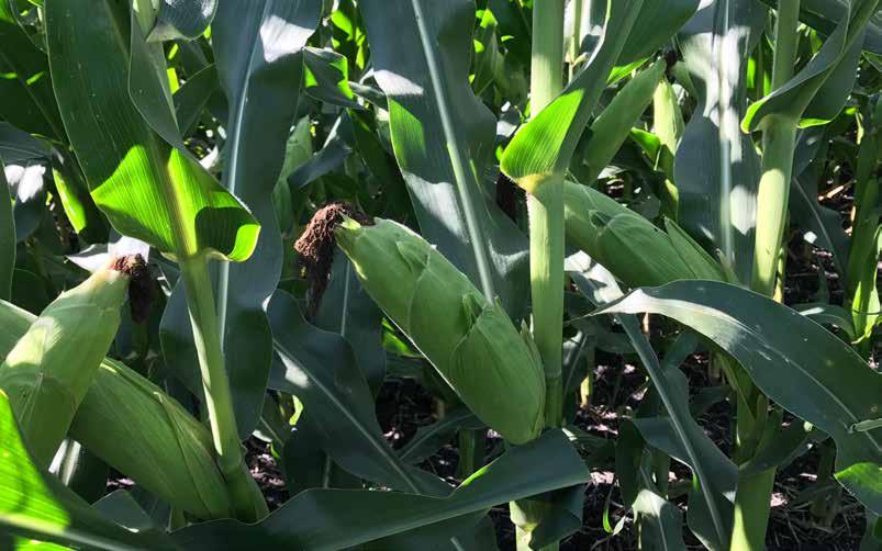
2 Becker County Land Information Auction Note: Land will be presented in 4 parcels and written bids will be accepted until 5:00 p.m. (CT) on Friday, December 8, Bidding will be based on Cropland Acres. Highest written bids will have an opportunity to orally raise their bid on Monday, December 11, 2017 at 10:00 a.m. (CT) by phone. Bidders may bid on one or more parcels or all parcels combined. This property features acres of cropland with Soil es between 80.5 to 89.4! Driving Directions Parcel 1: From Lake Park drive west on Hwy 10 for approximately 3 miles to the intersection of Hwy 10 and 120th Ave. From the intersection, continue north approximately 1.5 miles. This will place you at the center of the properties on the E1/2 of Section of 31 and the W1/2 of Section th St. 190th Ave. 4 Parcel 2: From Lake Park take Co Rd 9 northeast for approximately 2.5 miles to the intersection of Co Rd 9 and 240th St. This will place you at the SW corner of the property. Parcel 3: From Lake Park take Co Rd 9 northeast approximately 2 miles to the intersection of Co Rd 9 and 240th St. This will place you at the NW corner of the property. Parcel 4: From Lake Park take Co Rd 9 northeast approximately 4 miles to intersection of Co Rd 9 and 260th St. Proceed east 5 miles. This will place you at the center of the properties on the S1/2 of section 9 and the W1/2 of section th Ave Lake Park, MN th St. 230th St. Contact: Paul Butenhoff Cell: paulb@pifers.com th Ave S. - Moorhead, MN 56560


3 Legal: NE1/4SE1/4, SE1/4NE1/4 and S1/2NW1/4 Section and S1/2NW1/4 EX RWY & N1/2SW1/4 Less 9 AC Farmstead Section in Cuba Township, Becker County, MN Cropland Acres: /- Becker County Parcel 1 780B Audubon-Boyerlake complex, 1 to 6 percent slopes % IIe C2 Audubon-Boyerlake complex, 6 to 12 percent slopes, eroded % IIIe Foxlake silty clay loam % IIw B Audubon silty clay loam, 0 to 6 percent slopes % IIe C2 Barnes-Buse complex, 6 to 12 percent slopes, moderately eroded % IIIe Lakepark-Parnell, occasionally ponded, complex, 0 to 2 percent slopes % IIw D2 Audubon-Boyerlake complex, 12 to 20 percent slopes, eroded % IVe D2 Langhei-Barnes, moderately eroded, complex, 12 to 20 percent slopes % IVe Dovray silty clay % IIIw B Arvilla-Sandberg complex, 2 to 6 percent slopes % IVs Vallers clay loam, 0 to 2 percent slopes % IIw Osakis sandy loam % IIIs Quam, Cathro, and Urness soils, ponded % VIIIw 5 903B Hokans-Buse complex, 2 to 6 percent slopes % IIe Balaton-Hamerly complex, 1 to 4 percent slopes % IIs Quam silty clay loam, occasionally ponded, 0 to 1 percent slopes % IIIw Hamre muck % VIw Aazdahl clay loam, 1 to 4 percent slopes % Iw 100 Weighted Average Corn auctions@pifers.com


4 General Becker County Information Parcel 2 Legal: S1/2SW1/4, NE1/4SW1/4 and SE1/4NW1/4 Section in Cuba Township, Becker County, MN Cropland Acres: / Urness mucky silty clay loam, occasionally ponded, 0 to 1 percent slopes % IIIw Balaton-Hamerly complex, 1 to 4 percent slopes % IIs Vallers clay loam, 0 to 2 percent slopes % IIw B Formdale-Buse complex, 2 to 6 percent slopes % IIe C2 Formdale-Langhei complex, 6 to 12 percent slopes, % IIIe eroded 344 Quam silty clay loam, occasionally ponded, 0 to 1 percent slopes % IIIw 88 Corn Weighted Average th Ave S. - Moorhead, MN 56560


5 Legal: W1/2 LESS 20 AC SW1/4SW1/4 Section in Cuba Township, Becker County, MN Cropland Acres: /- Becker County Parcel C2 Formdale-Langhei complex, 6 to 12 percent slopes, eroded % IIIe B Formdale-Buse complex, 2 to 6 percent slopes % IIe Lakepark-Parnell, occasionally ponded, complex, 0 to 2 percent slopes % IIw Aazdahl clay loam, 1 to 4 percent slopes % Iw D2 Langhei-Formdale complex, 12 to 20 percent slopes, eroded % IVe Vallers clay loam, 0 to 2 percent slopes % IIw Urness mucky silty clay loam, occasionally ponded, 0 to 1 percent slopes % IIIw Quam silty clay loam, occasionally ponded, 0 to 1 percent slopes % IIIw Cathro muck, occasionally ponded, 0 to 1 percent slopes % VIw 5 Corn Weighted Average auctions@pifers.com


6 Becker County Parcel 4 Legal: S1/2SW1/4 LESS AC Section in Hamden Township, Becker County, MN and N1/2NW1/4 LESS 7.02 AC Section in Hamden Township, Becker County, MN Cropland Acres: /- TEAR/CUT HERE 171B Formdale clay loam, 2 to 5 percent slopes % IIe Aazdahl clay loam, 1 to 4 percent slopes % Iw Lamoure silty clay loam, occasionally flooded % IIw Rockwell loam % IIw C2 Formdale-Langhei complex, 6 to 12 percent slopes, eroded % IIIe B Formdale-Buse complex, 2 to 6 percent slopes % IIe Vallers clay loam, 0 to 2 percent slopes % IIw Lakepark-Parnell, occasionally ponded, complex, 0 to 2 percent slopes % IIw Wolverton fine sandy loam % IIs Wyndmere fine sandy loam % IIs B Egeland sandy loam, 2 to 6 percent slopes % IIIe Haslie muck % VIw Quam silty clay loam, occasionally ponded, 0 to 1 percent slopes % IIIw 88 Weighted Average th Ave S. - Moorhead, MN Corn
7 Land Lease Becker County Bidder Form PROSPECTIVE BIDDERS MUST READ THIS IMPORTANT INFORMATION! Bidding Procedure and Terms/Conditions Bidding Procedure: 1 - All written bids must be received before 5:00 p.m. on Friday, December 8, Written bid should be on an annual per acre basis. 3 - The top written bids will be invited to the Oral Bidding, and will have an opportunity to raise their bid at a time and place designated by Auction & Realty. Oral Bidding will be on Monday, December 11, 2017 at 10:00 a.m. (CT). 4 - Each Oral Bidder will have the opportunity to bid on each parcel individually as well as altogether (Overall). Each Oral Bidder must bid on at least one parcel individually to qualify for participation in the Overall bidding process. 5 - The winning bidder will (upon Landowner acceptance) receive a lease agreement and will be required to return a signed copy to on or before December 18, Bidders are bidding on a 2 year lease agreement. The agreement will begin on January 1, 2018 and terminate on December 31, The Landowner reserves the right to reject or accept any and all bids. 8 - All statements made the day of the Oral Bidding take precedence over all printed materials. Mail, or Fax this Bid Form to: Land Management ATTN: Case Agricultural Properties, LP Land Lease c/o Paul Butenhoff th Ave S. Moorhead, MN Fax: paulb@pifers.com Parcel Parcel 1: /- Acres Parcel 2: /- Acres Parcel 3: /- Acres Parcel 4: /- Acres $ Per Acre Name: Address: City: State: Zip Phone: I understand & agree to all the terms & conditions for this sale. Signature: auctions@pifers.com
 Written Bid Land For Lease WRITTEN BIDS DUE BEFORE: Friday, Decemb")
8 /- Acres Clay County, MN (see pgs 8-14) /- Acres Becker County, MN (see pgs 1-6) Written Bid Land For Lease WRITTEN BIDS DUE BEFORE: Friday, December 8, :00 p.m. OWNERS: Case Agricultural Properties, LP th Ave S. - Moorhead, MN 56560
 by phone.")


9 Clay County Land Information Auction Note: Land will be presented in 5 parcels and written bids will be accepted until 5:00 p.m. (CT) on Friday, December 8, Bidding will be based on Cropland Acres. Highest written bids will have an opportunity to orally raise their bid on Monday, December 11, 2017 at 1:00 p.m. (CT) by phone. Bidders may bid on one or more parcels or all parcels combined. This property features acres of cropland with Soil es between 73.4 to 89.7! Driving Directions Parcel 1: From Glyndon, MN drive west on Hwy 10 for approximately 3 miles, then take the Co Hwy 11 exit. Turn north onto 70th St. N which turns into Hwy 11 and drive 4 miles north to the intersection Co Hwy 11 and Co Rd 91. Turn east on to Co Rd 91 then proceed east 1.9 miles. This will place you at the SE corner of the property at the corner of Co Rd 91 and Co Rd 68. Parcel 2: From Glyndon drive east on Hwy 10 for approximately 3 miles to the intersection of Hwy 10 and Hwy 9. From the intersection, continue north 8 miles to intersection Hwy 9 and 100th Ave. N., then drive west 1 mile. This will place you at the NE corner of the property at the corner of 100th Ave. N and 130th St. N. Parcel 3: From Glyndon drive east on Hwy 10 for approximately 3 miles to the intersection of Hwy 10 and Hwy 9. From the intersection, continue north 2 miles to intersection of Hwy 9 and 28th Ave. N. This will place you at the SW corner of the property at the corner of Hwy 9 and 28th Ave. N. Parcel 4: From Glyndon drive east on Hwy 10 for approximately 3 miles to the intersection of Hwy 10 and Co Rd 9. Then from the intersection, continue north 6 miles to intersection of Hwy 9 and 80th Ave. N., then drive 1 mile east. This will place you at the SW corner of the property at the corner of Hwy 9 and 150th St. N. Parcel 5: From Glyndon drive east on Hwy 10 for approximately 3 miles to the intersection of Hwy 10 and Co Rd 9. From the intersection, continue south 2 miles to intersection of Hwy 9 and 28th Ave. S, then drive south for a ½ a mile. This will place you at the SE 1/4 corner of the property th St. N 1 100th Ave. N 68 90th Ave. N 80th Ave. N 91 28th Ave. N Glyndon, MN 130th St. N 10 28th Ave. S Contact: Paul Butenhoff Cell: paulb@pifers.com auctions@pifers.com


10 General Clay County Information Parcel 1 Legal: E1/2NE1/4 LESS DITCH & E1/2SE1/4 Section in Moland Township, Clay County, MN Cropland Acres: /- I377A Wheatville silt loam, 0 to 2 percent slopes % IIe 89 I634A Augsburg silt loam, 0 to 1 percent slopes % IIw 90 I467A Bearden silt loam, 0 to 2 percent slopes % IIe 93 Weighted Average th Ave S. - Moorhead, MN 56560


11 Clay County Parcel 2 Legal: NE1/4 Section in Flowing Township in Clay County, MN Cropland Acres: /- I507A Glyndon loam, 0 to 2 percent slopes % IIe 89 I5A Borup loam, 0 to 1 percent slopes % IIw 90 I729A Wyndmere, moderately salinewyndmere fine sandy loams, 0 to 2 percent slopes % IIIs 60 I377A Wheatville silt loam, 0 to 2 percent slopes % IIe 89 I634A Augsburg silt loam, 0 to 1 percent slopes % IIw 90 Weighted Average 86 auctions@pifers.com


12 Clay County Parcel 3 Legal: SW1/4 LESS DITCH & 6.02 AC Section in Spring Prairie Township, Clay County, MN Cropland Acres: / I312A Wyndmere fine sandy loam, 0 to 2 percent slopes % IIIe 77 I5A Borup loam, 0 to 1 percent slopes % IIw 90 I716A Arveson clay loam, 0 to 1 percent slopes % IIIw 74 Weighted Average th Ave S. - Moorhead, MN 56560


13 Clay County Parcel 4 Legal: E1/2 Less GOV T LOT 1 Section in Spring Prairie Township, Clay County, MN Cropland Acres: / I312A Wyndmere fine sandy loam, 0 to 2 percent slopes % IIIe 77 I729A Wyndmere, moderately salinewyndmere % IIIs 60 fine sandy loams, 0 to 2 percent slopes I5A Borup loam, 0 to 1 percent slopes % IIw 90 I356A Ulen fine sandy loam, 0 to 2 percent slopes % IIIe 55 I8A Cathro muck, 0 to 1 percent slopes % VIw 5 Weighted Average 75.5 auctions@pifers.com


14 Clay County Parcel 5 Legal: SE1/4 LESS 1 AC TO TWP & LESS AC Section in Riverton Township, Clay County, MN Cropland Acres: 99 +/- TEAR/CUT HERE I312A Wyndmere fine sandy loam, 0 to 2 percent slopes % IIIe 77 I24A Grimstad fine sandy loam, 0 to 3 percent slopes % IIs I672B Sioux sandy loam, 2 to 6 percent slopes % VIs 33 I762A Vallers loam, lake plain, 0 to 1 percent slopes % IIw 90 I634A Augsburg silt loam, 0 to 1 percent slopes % IIw 90 I356A Ulen fine sandy loam, 0 to 2 percent slopes % IIIe 55 Corn Weighted Average th Ave S. - Moorhead, MN 56560
15 Land Lease Clay County Bidder Form PROSPECTIVE BIDDERS MUST READ THIS IMPORTANT INFORMATION! Bidding Procedure and Terms/Conditions Bidding Procedure: 1 - All written bids must be received before 5:00 p.m. on Friday, December 8, Written bid should be on an annual per acre basis. 3 - The top written bids will be invited to the Oral Bidding, and will have an opportunity to raise their bid at a time and place designated by Auction & Realty. Oral Bidding will be on Monday, December 11, 2017 at 1:00 p.m. (CT). 4 - Each Oral Bidder will have the opportunity to bid on each parcel individually as well as altogether (Overall). Each Oral Bidder must bid on at least one parcel individually to qualify for participation in the Overall bidding process. 5 - The winning bidder will (upon Landowner acceptance) receive a lease agreement and will be required to return a signed copy to on or before December 18, Bidders are bidding on a 2 year lease agreement. The agreement will begin on January 1, 2018 and terminate on December 31, The Landowner reserves the right to reject or accept any and all bids. 8 - All statements made the day of the Oral Bidding take precedence over all printed materials. Mail, or Fax this Bid Form to: Land Management ATTN: Case Agricultural Properties, LP Land Lease c/o Paul Butenhoff th Ave S. Moorhead, MN Fax: paulb@pifers.com Parcel Parcel 1: /- Acres Parcel 2: /- Acres Parcel 3: /- Acres Parcel 4: /- Acres Parcel 5: 99 +/- Acres $ Per Acre Name: Address: City: State: Zip Phone: I understand & agree to all the terms & conditions for this sale. Signature: auctions@pifers.com
16
Pifer s. 1, /- Acres Clay County, MN. Written Bid. Land For Lease. WRITTEN BIDS DUE BEFORE: Friday, January 19, :00 p.m.
 1,666.53 +/- Acres Clay County, MN Written Bid Land For Lease WRITTEN BIDS DUE BEFORE: Friday, January 19, 2018 5:00 p.m. OWNER: Hogetvedt Family Rev Trust STOCK PHOTO General Information Land Lease Auction
Auction Location Eagles Club 316 S. 2 nd Street, Aberdeen, SD
 Auction Location Eagles Club 316 S. 2 nd Street, Aberdeen, SD Welcome We would like to invite and welcome you to our public auction! This is an excellent opportunity to add Brown County cropland to your
FARMLAND AUCTION. FSA INFORMATION: Farmland: acres Cropland: acres Tillable: acres
 FARMLAND AUCTION January 22, 2019 at 10:30 am Keep an eye on BarnesRealty.com for possible blizzard date of 1/24/2019 Fisher Community Center, 201 E. Iowa St. Hiawatha, KS 66434 Here is a very productive
We are pleased to present
 We are pleased to present Zenk Farms 57 ± Acres Lowville Township, Murray County 80 ± Acres Lowville Township, Murray County 150 ± Acres Mason Township, Murray County 150.31 ± Acres Slayton Township, Murray
LAND AUCTION. Open House: Saturday, August 6th and Saturday, August 20th From 9:00 AM to 11:00 AM at 1220 C Avenue, Scranton, Iowa
 L-1005 LAND AUCTION 1,235+/- Acres, Carroll and Greene Counties, Iowa Friday, August 2, 201 10:00 AM at the Saint Joseph s Parish Center 501 North Locust Street Jefferson, Iowa Highlight Features: Over
80 ACRES M/L BOONE COUNTY, IOWA LISTING # Pilot Mound, Iowa. I Avenue. 130th Street. Co Hwy P th Street
 Co Hwy P70 I Avenue 80 ACRES M/L BOONE COUNTY, IOWA CAPTION Pilot Mound, 130th Street 130th Street LISTING #12320 New Listing Price! $800,000 DESCRIPTION: High Quality Farm in Strong Farming Area and potential
LAND FOR SALE. Beautiful Farmstead. Pifer s. Price: $1,250, /- Acres Green County, WI
 Beautiful Farmstead LAND FOR SALE 176 +/- Acres Green County, WI Price: $1,250,000 Auction & Realty - Robert Scott Pifer, Broker (#56685-90) RE Entity License #937110-91, Auction Company License #429-53
268 Acres m/l, Iowa County, IA. Offered in 2 Remaining Parcels. Parcel Ac. m/l Parcel 2-81 Ac. m/l Parcel 3-45 Ac. m/l - SOLD!
 LAND FOR SALE 268 Acres m/l, Iowa County, IA Offered in 2 Remaining Parcels Parcel 1-187 Ac. m/l Parcel 2-81 Ac. m/l Parcel 3-45 Ac. m/l - SOLD! Golden Grain Enterprises Good Iowa County Farms Located
LAND FOR SALE 30 ACRES M/L FLOYD COUNTY, IOWA LISTING # DOUGLAS R. YEGGE C: O:
 LAND FOR SALE LISTING #13886 30 ACRES M/L FLOYD COUNTY, IOWA DOUGLAS R. YEGGE C: 563-320-9900 O: 563-659-8185 Doug@PeoplesCompany.com ALAN MCNEIL C: 563-321-1125 O: 563-659-8185 Alan@PeoplesCompany.com
LAND FOR SALE 82 ACRES M/L CEDAR COUNTY, IOWA LISTING # DOUGLAS R. YEGGE C: O:
 LAND FOR SALE LISTING #13968 82 ACRES M/L CEDAR COUNTY, IOWA DOUGLAS R. YEGGE C: 563-320-9900 O: 563-659-8185 Doug@PeoplesCompany.com ALAN MCNEIL C: 563-321-1125 O: 563-659-8185 Alan@PeoplesCompany.com
365.8 Acres +/- Brown County, KS February 28, 2019 at 10:30 am Community Building, 511 West Front Street, Fairview, KS
 Farmland Auction February 28, 2019 at 10:30 am Community Building, 511 West Front Street, Fairview, KS This excellent Brown County farm is just North of Fairview, KS and it will be selling in 3 tracts
131 ACRES M/L VAN BUREN COUNTY, IOWA LISTING #458 JIM KEDLEY. C: O:
 131 ACRES M/L VAN BUREN COUNTY, IOWA LISTING #458 JIM KEDLEY C: 563-212-5401 O: 563-659-8185 Jimkedley@totalrealtyco.com CWC Holdings LLC, 131 Acres M/L, Van Buren County, IA TOTAL ACRES: 131 MOL PRICE:
80 ACRES M/L CEDAR COUNTY, IA LISTING #465 DOUGLAS R. YEGGE ALAN MCNEIL. C: O:
 80 ACRES M/L CEDAR COUNTY, IA LISTING #465 DOUGLAS R. YEGGE C: 563-320-9900 O: 563-659-8185 total@totalrealtyco.com ALAN MCNEIL C: 563-321-1125 O: 563-659-8185 alan@totalrealtyco.com Kroemer, 80 Acres
Tract 1. Tract 3. Tract 2. Tract 4. A Taylor Co., IA
 Newport Ave Sec. 7 Sec. 8 235th St Sec. 13 250 th St Sec. 18 Maryl and Ave Sec. 17 T68N R34W T68N R33W 250 th St Sec. 24 257t h St Sec. 19 2 Newp ort Way Sec. 20 Sec. 25 Latitude: 40.6872 N Longitude:
LAND FOR SALE 314 ACRES M/L BERG, WORTH COUNTY, IOWA LISTING # DOUGLAS R. YEGGE C: O:
 LAND FOR SALE LISTING #13870 314 ACRES M/L BERG, WORTH COUNTY, IOWA DOUGLAS R. YEGGE C: 563-320-9900 O: 563-659-8185 Doug@PeoplesCompany.com ALAN MCNEIL C: 563-321-1125 O: 563-659-8185 Alan@PeoplesCompany.com
G T12 G J44 G J46 ST 2. Jerome. Martinstown. Numa. A Maryanna F. Wallin Estate Appanoose County, Iowa
 135th Ave 150th Ave 153rd Ave Elm St N 170th Ave 171st Ave 172nd St 175th Ave 51 0th St Highw ay 2 Highw ay 2 ST 2 Highw ay 2 G T12 135th Ave 522nd St 523rd St Jerome 140th Ave 524th St 1 2 G J44 3 160th
Demoss Farm & Home 118 Acres, M/L W. 209th Ave. Pattonsburg, Mo 64670
 118 Acres, M/L 39436 W. 209th Ave. Pattonsburg, Mo 64670 PRICE: $400,000.00 LAND USE: FSA shows approx. 118.32 farmland acres, ml, of which there were 36.47 acres of effective cropland with the remainder
Deuel County Dryland
 Deuel County Dryland Two parcels of dryland farm ground near Lewellen, NE Property Highlights List Price $852,474 $786,877 Location 12-15 miles south of Lewellen, Ne or the same distance from Big Springs,
Farmland For Sale 3 Tracts /- acres Webster County, Iowa Section 31, T88N, R30W & Section 33, T88N, R29W
 Farmland For Sale 3 Tracts 316.02 +/- acres Webster County, Section 31, T88N, R30W & Section 33, T88N, R29W Contact Martin today! 309-242-7299 mthornton@hbtbank.com Martin G. Thornton, Broker 200 W. College
173 ACRES - RILEY COUNTY, KS
 Buyers, Sellers & Land Connected PRICE: $690,000 ACRES: 173 COUNTY: RILEY STATE: KANSAS First Class Hunting with Outstanding Income Potential If you have ever dreamed of owning your very own piece of first
Land Sales Specialists Setting the trend for how Real Estate is sold in the Midwest.
 Land Sales Specialists Setting the trend for how Real Estate is sold in the Midwest. www.barnesrealty.com 18156 Hwy 59 Mound City, MO 64470 (660) 442-3177 1711 Oregon Hiawatha, KS 66434 (785) 742-4580
We are pleased to present Delwyn Spronk Farm ± Acres Elmer Township, Pipestone County
 We are pleased to present Delwyn Spronk Farm 79.09 ± Acres Elmer Township, Pipestone County SUBJECT PROPERTY This property to be sold by Sealed Bid Auction Owner: Delwyn & Julie Spronk Owner s Attorney:
Rural Soils Career Development Event
 Rural Soils Career Development Event Effective August 1, 2014 Important Note: Please thoroughly read the Introduction and General Rules Section at the beginning of this handbook for complete rules and
State: Kansas County: Sherman Location: S-037W Township: Union Acres: Date: 12/19/2011. Maps provided by:
 Soils Map State: Kansas County: Sherman Location: 007-009S-037W Township: Union Acres: 147.8 Date: 12/19/2011 Fsa borders provided by the Farm Service Agency as of May 23, 2008. Soils data provided by
We are pleased to present Leonard Thorston Revocable Trust ± Acres Charleston Township, Redwood County
 We are pleased to present Leonard Thorston Revocable Trust 158.72 ± Acres Charleston Township, Redwood County PARCEL 1 PARCEL 2 This property to be sold by Sealed Bid Auction Owner: Leonard Thorston Family
2014 Iowa FFA Soil Judging CDE Exam
 2014 Iowa FFA Soil Judging CDE Exam 1. Landscape position is one aspect of evaluating the surface features of a certain tract of land. Identifying the correct landscape position will indicate: a. If the
For Sale at $290,000.00
 We are pleased to present Stearns Property 77± Acres Forest Township, Rice County For Sale at $290,000.00 Listing Agent: Charles Wingert Office: 507-345-LAND (5263) Toll Free: 800-730-LAND (5263) Direct:
FOR SALE HILL FAMILY FARM WATKINS CORNER, AR. Phillips County, Arkansas: 2,300+/- Acre Irrigated Grain Farm NEW PRICE/YIELD UPDATES:
 SOLD FARMLAND ADVISORS FOR SALE HILL FAMILY FARM WATKINS CORNER, AR 2,300+/- Acres - Phillips County, Arkansas $10,950,000 Phillips County, Arkansas: 2,300+/- Acre Irrigated Grain Farm NEW PRICE/YIELD
FOR SALE NEW PRICE HILL FAMILY FARM WATKINS CORNER, AR. Phillips County, Arkansas: 2,300+/- Acre Irrigated Grain Farm NEW PRICE/YIELD UPDATES:
 NEW PRICE FARMLAND ADVISORS FOR SALE HILL FAMILY FARM WATKINS CORNER, AR 2,300+/- Acres - Phillips County, Arkansas $10,950,000 Phillips County, Arkansas: 2,300+/- Acre Irrigated Grain Farm NEW PRICE/YIELD
Aerial Map. map center: 38 0' 55.53, ' S-4E Franklin County Illinois
 Aerial Map map center: 38 0' 55.53, -88 42' 58.78 0ft 594ft 1188ft 11/24/2016 Field borders provided by Farm Service Agency as of 5/21/2008. Soils data provided by University of at Champaign-Urbana. Topography
Unit II Soil Management
 Unit II Soil Management Lesson 2: Using Soil Survey Manuals Soil survey manuals provide useful information for grassland management. Soil scientists evaluate the soil for chemical and physical properties,
2016 Iowa FFA Soils Evaluation CDE Exam
 2016 Iowa FFA Soils Evaluation CDE Exam 1. Which of the following is true regarding soil horizons? a. A horizon is darker in color and has more organic matter b. B horizon is darker in color and has more
SOUTH PLAINS PUBLIC HEALTH DISTRICT
 1 SOUTH PLAINS PUBLIC HEALTH DISTRICT ENVIRONMENTAL HEALTH SERVICES Proudly Serving the Communities of Gaines, Yoakum, Terry, Dawson and Lynn Counties APPLICATION FOR NEW CONSTRUCTION OR MODIFICATION 1.
+/- 60 AC LAND FOR SALE HARLEY ROAD, ELBURN, IL 60119
 Land For Sale OFFERING SUMMARY Sale Price: $660,000 Price / Acre: $11,000 PROPERTY OVERVIEW +/- 60 acres available for purchase on the west side of Harley Road, South of Rt. 38. This site has Harley Road
280 ACRES - HOWELL COUNTY, MO
 PRICE: $434,700 ACRES: 280 COUNTY: HOWELL STATE: MISSOURI For more information contact: KYLE ORF, Land Agent 417.988.3333 KyleOrf@MidwestLandGroup.com MidwestLandGroup.com 100 280ACRES ACRES- -COUNTY,
Northeast Perkins County Pivots
 Northeast Perkins County Pivots 315.9± acres of center pivot irrigated farmland Southeast of Paxton, NE Email: Jordan@lashleyland.com Property Highlights List Price $1,550,000 Location Southeast of Paxton,
1300 Peace Haven Road Chapin, South Carolina
 For Sale ±3.6 AC Site 1300 Peace Haven Road Chapin, South Carolina Gerald Steele +1 803 744 9851 gsteele@naiavant.com Property Features ±3.6 Acres for sale in Chapin Sales Price: $90,000 Price per acre:
Harding Real Estate Vacant Acres Thompson Rd., Woodstock, IL
 Harding Real Estate 325.31 Vacant Acres Thompson Rd., Woodstock, IL Randy Erwin, Broker Associate Natalie Torres, Broker Associate BHHS Starck Real Estate 1710 South Eastwood Dr. Woodstock, IL. 60098 Randy@RandyErwin.com
PROPOSED DRAINAGE PATTERNS
 1121 1118.50 Basin Floor 1120 1119 0 N 100 200 PROPOSED DRAINAGE PATTERNS Deroiser Drive Riverwood Drive County 260 0 100 200 Project Name: Riverwood Drive LITTLE FALLS TOWNHOMES Project Location: LITTLE
Horner-McLaughlin Woods: Soil Types
 Horner-McLaughlin Woods: Soil Types Not present at HMW Adrian Muck Conover Loam 0-4% Slopes Houghton Muck Miami Loam 2-6% Slopes Miami Loam 6-12% Slopes Miami Loam 12-18% Slopes t 0 0.125 0.25 Miles Mary
SW CORNER ROUTE 38 AND HARLEY ROAD SW CORNER ROUTE 38 & HARLEY ROAD, KANE COUNTY, IL 60119
 REDUCED: Land For Sale SW CORNER ROUTE 38 AND HARLEY ROAD REDUCED: 124 AC ON IL ROUTE 38 OFFERING SUMMARY Sale Price: $1,643,000 Price / Acre: $13,250/AC PROPERTY OVERVIEW This 124 AC parcel has approximately
Information for File # MMW
 Information for File #07-0870-MMW Applicant: Menards (Tyler Edwards) Corps Contact: Mariah Weitzenkamp Address: 80 Fifth Street East, Suite 700, Saint Paul, MN 0-78 E-Mail: Mariah.M.Weitzenkamp@usace.army.mil
1. Delete BID FORM in its entirety and replace with the BID FORM attached to this Addendum.
 ADDENDUM NO. 2 TO THE BIDDING DOCUMENTS Solicitation Number 2016-13 Fire Alarm, Sprinkler & BFP Inspections and Repairs Saint Clair County MidAmerica Saint Louis Airport DATE: November 30, 2016 BIDS CLOSE:
Colusa County Almonds
 Morgan Houchin. 3430 Unicorn Road Bakersfield, CA 93308 mobile office efax 526.97 +/- Acres of Colusa County Almonds Cork McIsaac, Broker. Broker License No. 01216717 P.O. Box 1076 West Sacramento, CA
2016 Area 3 Envirothon Muskingum County Soils Test ANSWER KEY
 2016 Area 3 Envirothon Muskingum County Soils Test ANSWER KEY 1. The majority of the bedrock in Muskingum County is. a. sedimentary bedrock b. glacial bedrock c. igneous bedrock d. metamorphic bedrock
WALKER FEEDLOT Total taxable acres, part fenced. 4 homes & multiple nice/modern outbldgs hd feedyard with sprinklers a-shkd-0002
 ABILENE WALKER FEEDLOT 38.7 Total taxable acres, part fenced 4 homes & multiple nice/modern outbldgs 3500 hd feedyard with sprinklers a-shkd-0002 Center pivot irrigation from lagoons 999 hd feedlot A-SHDK-B020
During the field surveys, several species of wading birds and ducks were observed using permanently ponded areas.
 Preliminary Engineering / Environmental Impact Statement Northwest Corridor LRT Line to Irving and DFW Airport During the field surveys, several species of wading birds and ducks were observed using permanently
Huntington Stormwater Utility
 Huntington Stormwater Utility Stormwater Management & Sediment and Erosion Control Requirements for Construction Sites Authorized by Huntington City Code Articles: 971, 970, 930, 935, 955, Revised April
Iowa FFA Soil Career Development Event 2008
 Iowa FFA Soil Career Development Event 2008 1. In Iowa, corn suitability ratings for soil mapping units specifies a. natural weather conditions b. surface and subsurface drainage installed where needed
Non-Metallic Mining Reclamation Checklist
 Eau Claire County DEPARTMENT OF PLANNING AND DEVELOPMENT Eau Claire County Courthouse, Rm. 1510 721 Oxford Avenue Eau Claire, Wisconsin 54703-5481 (715) 839-4741 f Housing & Community Development 839-6240
Land Capability Classifications
 Land Capability Classifications Unit: Soil Science Problem Area: Basic Principles of Soil Science Student Learning Objectives. Instruction in this lesson should result in students achieving the following
, C-MS I June 3, 2016 $1500 pd chk #216918
 , C-MS-8 LOTS 21 THROUGH 40, INCLUSIVE, BLOCK 299 CLEMENTS ADDITION TO THE CITY OF DENVER SOUTHEAST QUARTER OF SECTION 34, TOWNSHIP 3 SOUTH, RANGE 68 WEST, SIXTH PRINCIPAL MERIDIAN, CITY
Request for Proposals (RFP) for: Columbia County Facilities Fire Detection and Security Improvements
 for: Columbia County Facilities Fire Detection and Security Improvements") Request for roposals (RF) for: Columbia County Facilities Fire Detection and Security Improvements roposals Due: 4:30 M Friday November 13, 2015 Introduction: Columbia County is soliciting proposals from
Request for roposals (RF) for: Columbia County Facilities Fire Detection and Security Improvements roposals Due: 4:30 M Friday November 13, 2015 Introduction: Columbia County is soliciting proposals from
City of Stoughton Erosion Control Permit Application (effective 2/6/2018)
") City of Stoughton Erosion Control Permit Application (effective 2/6/2018) Incomplete applications will not be accepted Project Name: Address of subject property: Landowner Name(s): Applicant Name: Landowner
City of Stoughton Erosion Control Permit Application (effective 2/6/2018) Incomplete applications will not be accepted Project Name: Address of subject property: Landowner Name(s): Applicant Name: Landowner
S o u t h C e n t r a l O u t l i n e P l a n. Leduc Business Park. North Leduc Industrial Area Structure Plan C it y of Led u c.
 Leduc Business Park North Leduc Industrial Area Structure Plan C it y of Led u c Prepared for Farm Air Properties Inc. January, 2007 Table of Contents Page Number 1.0 Purpose of Plan and Definition of
2011 Wisconsin Envirothon Soils and Land Use Exam
 2011 Wisconsin Envirothon Soils and Land Use Exam USE THE OCONTO COUNTY SOIL SURVEY TO ANSWER QUESTIONS 1-4 The Pensaukee River Wetland Complex is a mixture of state (Pensaukee Wildlife Area) and privately
Rain Garden Cost Share Program
 Rain Garden Cost Share Program The City of Ames is implementing a Smart Watershed Program to increase local awareness of the importance of protecting our local streams and lakes. It is promoting methods
PennDOT Public Meeting. S.R. 3044, Section A01 Castle Shannon Boulevard Roadway Improvement Project
 PennDOT Public Meeting S.R. 3044, Section A01 Castle Shannon Boulevard Roadway Improvement Project Mt Lebanon Township, Allegheny County Mt Lebanon Township Municipal Building November 6, 2014 1 Project
NEW WATER CONNECTION PROCEDURES
 NEW WATER CONNECTION PROCEDURES For Lincoln, Jerome, Village of Sanford WATER DISTRICT NO. 1 of MIDLAND COUNTY Office Location: 246 E. Price Rd. Midland, MI 48642 Mailing Address: PO Box 320 Sanford, MI
2018 Iowa FFA Soil Judging CDE Exam 1. Landscape positions characterizes the location of the soil on the landscape and identifies potential risks.
 2018 Iowa FFA Soil Judging CDE Exam 1. Landscape positions characterizes the location of the soil on the landscape and identifies potential risks. Which landscape position is considered the floodplain
John R Trainor Park Bidwell Park Bidwell-Sacramento River SP SITE Lake Oroville State Rec Area Alpine Park
 FIGURES 1. Site Vicinity Map 2. Site Map Showing Compost Pad Layout and Facility Features 3. Wells Within One Mile of Facility and Groundwater Basin Contour Map 4. Geologic Map 5. Soils Map 6. Zoning Map
Bull Canyon Ranch 2750 BULL CANYON ROAD, SANTA MARIA, CALIFORNIA PRESENTED FOR SALE BY: Rincon corporation
 Bull Canyon Ranch 2750 BULL CANYON ROAD, SANTA MARIA, CALIFORNIA PRESENTED FOR SALE BY: Rincon corporation THE FULL SERVICE REAL ESTATE COMPANY FOR THE AGRICULTURAL COMMUNITY Bull canyon ranch, santa maria
NEW WATER CONNECTION PROCEDURES FOR HOPE AND EDENVILLE TOWNSHIP RESIDENTS
 NEW WATER CONNECTION PROCEDURES FOR HOPE AND EDENVILLE TOWNSHIP RESIDENTS WATER DISTRICT NO. 1 of MIDLAND COUNTY Office Location: 246 E. Price Rd. Midland, MI 48642 Mailing Address: PO Box 320 Sanford,
September 20, 2016 Soils Investigation for Agricultural Designation Windemere Place, Missoula County, Montana
 September 20, 201 Soils Investigation for Agricultural Designation Windemere Place, Missoula County, Montana The purpose of this report is to compare on-site soils of the proposed subdivision with the
Information for File # ARC
 Information for File # 2017-03115-ARC Applicant Consultant Corps Contact Bob Manzoline St. Louis and Lake Counties Regional Rail Authority Natalie White Short Elliot Hendrickson (SEH) Inc. Andrew R Chambers
Triangle Land Conservancy Conservation Area Monitoring Report Carolina North
 Triangle Land Conservancy Conservation Area Monitoring Report Carolina North Property Name: Bolin Creek West Conservation Area Date of visit: 2.18.13, 2.18.13, 3.13.13, and 6.10.13 County: Orange Property
Non-Residential&Multi-Family PropertyCreditManual
 CityofRichmond DepartmentofPublicUtilities StormwaterManagementProgram Non-Residential&Multi-Family PropertyCreditManual ApprovedFebruary2011 City of Richmond Stormwater Non-Residential & Multi-Family
IOWA FFA STATE SOILS CDE SATURDAY, OCTOBER 13, 2007 AMES, IOWA
 IOWA FFA STATE SOILS CDE SATURDAY, OCTOBER 13, 2007 AMES, IOWA 1. Moderately sloping has what percent slope: a. 9-14% b. 2-5% c. 5-9% d. over 14% 2. Which of the following horizons is the loose underlying
Urban Soils Career Development Event
 Urban Soils Career Development Event Effective August 1, 2014 Important Note: Please thoroughly read the Introduction and General Rules Section at the beginning of this handbook for complete rules and
ARTICLE IV: DEVELOPMENT STANDARDS 404 MASTER PLANNING
 IV 13 404 MASTER PLANNING Master Planning through the Site Analysis (Master Planning Site Analysis) or Planned Development (Master Planning Planned Development) is provided to encourage development which
SOIL SEPARATES. Soil Evaluator Day 2, Presentation 3-3/27/2018. Soil Texture, Page 1 TITLE 5 SOIL EVALUATOR CERTIFICATION TRAINING SOIL TEXTURE
 Soil Evaluator Day 2, Presentation 3-3/27/18 TITLE 5 SOIL EVALUATOR CERTIFICATION TRAINING SOIL TEXTURE Prepared for: Commonwealth of Massachusetts Department of Environmental Protection By L.A. Spokas,
FOR SALE ± ACRES VALENTINES, VIRGINIA Price: $150,000
 LATITUDE & LONGITUDE 36.566924, -77.764781 Features STRONG RECREATIONAL INVESTMENT opportunity located south of Triplet with access from VSR 600 (Triplet Rd.) to the north. TRACT HAS BEEN RECENTLY CUTOVER
FOR SALE Temperance Ranch
 Temperance Ave. FOR SALE Temperance Ranch E. American Ave. 162.49± Acres Fresno County, California Exclusively Presented By: Pearson Realty New 13,000 S.F. aluminum solar panel pole barn Four pumps and
RESIDENTIAL STORM WATER PERMIT & CREDIT APPLICATION WORKSHEET AND CHECKLIST
 Engineering Department - Phone: (651) 792-7004 Fax: (651) 792-7040 2660 Civic Center Dr. Roseville, MN 55113 RESIDENTIAL STORM WATER PERMIT & CREDIT APPLICATION WORKSHEET AND CHECKLIST This application
Claim Form. Watts Water Heater and FloodSafe Connectors ATTENTION WATTS WATER HEATER AND FLOODSAFE CONNECTOR OWNERS:
 Claim Form Watts Water Heater and FloodSafe Connectors ATTENTION WATTS WATER HEATER AND FLOODSAFE CONNECTOR OWNERS: Use this Claim Form if you own, owned, lease or leased a residence or other structure
PRELIMINARY DRAINAGE REPORT LATHAM 200 MMSCFD GAS PROCESSING PLANT
 PRELIMINARY DRAINAGE REPORT LATHAM 200 MMSCFD GAS PROCESSING PLANT LOTS B, RECORDED EXEMPTION 1211-2-1, RECX13-0096 LOCATED IN THE NORTH 1/2 OF SECTION 2, TOWNSHIP 3 NORTH, RANGE 66 WEST, 6 TH PRINCIPAL
Sacramento River Farmland Anderson, California
 AG-LAND INVESTMENT BROKERS 275 Sale Lane / P. O. Box 896 Red Bluff, CA 96080 530.529.4400 office / 530.527.5042 fax Sacramento River Farmland Anderson, California Property: 43 +/- acres of farmland with
E½SE¼ E½NE¼ Lots 1(48.61), 2(48.13), 3(47.67), 4(47.19), N½, N½S½ [All] Sealed Bid: No Bids $ (6.91), S½N½, S½ [All]
![E½SE¼ E½NE¼ Lots 1(48.61), 2(48.13), 3(47.67), 4(47.19), N½, N½S½ [All] Sealed Bid: No Bids $ (6.91), S½N½, S½ [All]](/thumbs/96/128509656.jpg "E½SE¼ E½NE¼ Lots 1(48.61), 2(48.13), 3(47.67), 4(47.19), N½, N½S½ [All] Sealed Bid: No Bids $ (6.91), S½N½, S½ [All]") Competitive Offering - Bid Opening Results Offering Application Number 7312017.0 Type: Oil, Gas & Associated Hydrocarbons Oil, Gas & Associated Hydrocarbons TWP RNG Section Legal County Acreage High Bid
Competitive Offering - Bid Opening Results Offering Application Number 7312017.0 Type: Oil, Gas & Associated Hydrocarbons Oil, Gas & Associated Hydrocarbons TWP RNG Section Legal County Acreage High Bid
SEPA Modification Application
 SEPA Modification Application 6000 Main St. SW, Lakewood, WA 98499 Application Fee: $200.00 Number of Copies Required: Description of Required Documents: Required: A=always; M=may be 1 SEPA Modification
Holmberg & Howe, Land Surveyors and Civil Engineers Zoning District: R-35
 Development Impact Statement Name of Project: Red Tail Drive Acreage: 13.5 Acres± Type of Project: Residential Subdivision Owner: 96 East Street Development, LLC Location: rear of 112 East Street Parcel
FOR SALE. Arvin Edison Vineyard & Open Land Gross Acres Kern County, CA
 Arvin Edison Vineyard & Open Land FOR SALE Property Highlights Arvin Edison Water Storage District Class I and II Soils Neighboring properties planted to almonds, vineyards, and citrus The information
Ada Township is soliciting bids for the following commodity or service:
 Date: January 30, 2018 Dear Bidders, Ada Township is soliciting bids for the following commodity or service: FERTILIZATION TREATMENT SERVICES FOR LAWNS ON PROPERTIES OWNED BY ADA TOWNSHIP. This bid will
Custom Soil Resource Report Soil Map
 77 11' 22'' W Custom Soil Resource Report Soil Map 77 9' 43'' W 36 48' 13'' N 304700 304900 305100 305300 305500 305700 305900 306100 306300 306500 306700 306900 307100 36 48' 13'' N 36 47' 21'' N 4073800
Application for Comprehensive Vegetation Management Permit
 Grand River Dam Authority Department of Ecosystems Management An agency of the State of Oklahoma. Fully Supported by customer revenues instead of taxes. 918-256-0852, P.O. Box 70, Langley, OK 74350 Application
Information for File # JTF
 Information for File # 2013-04665-JTF Applicant Corps Contact Enbridge Energy, Limited Partnership Josh Fitzpatrick Address 1554 Highway 2, Suite 2, Two Harbors, MN 55616 E-Mail joshua.t.fitzpatrick@usace.army.mil
MASTER DEVELOPMENT DRAINAGE PLAN FOR MONUMENT HEIGHTS
 MASTER DEVELOPMENT DRAINAGE PLAN FOR MONUMENT HEIGHTS DRAINAGE REPORT STATEMENT ENGINEER'S STATEMENT: The attached drainage plan and report were prepared under my direction and supervision and are correct
Urban Planning and Land Use
 Urban Planning and Land Use 701 North 7 th Street, Room 423 Phone: (913) 573-5750 Kansas City, Kansas 66101 Fax: (913) 573-5796 Email: planninginfo@wycokck.org www.wycokck.org/planning To: From: City Planning
BYLAW NO. 3549/2015. Being a Bylaw of The City of Red Deer to provide a uniform levy of off-site costs in respect of previously undeveloped land.
 BYLAW NO. 3549/2015 Being a Bylaw of The City of Red Deer to provide a uniform levy of off-site costs in respect of previously undeveloped land. 1 WHEREAS pursuant to provisions of Section 648 of the Municipal
Area 3 Envirothon Soils Questions Key
 Area 3 Envirothon Soils Questions Key 1. Soil aeration is the exchange of air in soil with air from the atmosphere. When a soil is well aerated, the air within the soil is very similar to the atmosphere
Information for File # MVP MMJ; Elim Care
 Information for File # MVP-217-2628-MMJ; Elim Care Applicant: Elim Care of Maple Plain Corps Contact: Melissa Jenny Address: 18 Fifth Street East, Suite 7, St. Paul, MN 5511-168 E-Mail: Melissa.m.jenny@usace.army.mil
2018 Summer Sprout Application DUE NO LATER THAN 5:00PM on August 4 th 2017
 2018 Summer Sprout Application DUE NO LATER THAN 5:00PM on August 4 th 2017 What is Summer Sprout? Summer Sprout is Cleveland s community gardening program. It is managed by the Ohio State University Extension
Red Fox Commercial Outline Plan
 Red Fox Commercial Outline Plan City of Cold Lake, Alberta Prepared by Durrance Projects Ltd and Ross W. Sharp & Associates Ltd October 2014 Rupert 1 Table of Contents 1. PURPOSE...3 1.1. Location...4
Soil Science Curriculum
 Soil Science Curriculum Content and lab derived from the USDA-NRCS Guides for Educators. Go to www.nrcs.usda.gov/soils for the Guides and additional pictures and diagrams. This lesson plan was adapted
2012 FINAL SOILS AREA 2 Envirothon Questions Answer KEY
 2012 FINAL SOILS AREA 2 Envirothon Questions Answer KEY Questions 1-6 to be answered at the soil pit: 1. Soil scientists categorize soils by drainage classes. What is the drainage class of the soil at
City of Joshua 101 S. Main Joshua, Texas
 City of Joshua 101 S. Main Joshua, Texas 76058 817-558-7447 APPLICATION FOR ON-SITE SEWAGE FACITLITY FOR NEW CONSTRUCTION 1. Property Owner's Name: 2. Current Mailing Address: 3. Daytime Telephone No.:
STATE OF MINNESOTA PRICING PAGE (Typed Responses Required) Magnum Attachments 1.1 Model All PRICE FOR PARTS MANUAL PRICE FOR OPERATIONS MANUAL
 Magnum Attachments 1.1 Model All PRICE FOR PARTS MANUAL PRICE FOR OPERATIONS MANUAL") Seq# 726-1217 STATE OF MINNESOTA PRICING PAGE (Typed Responses Required) December, 2017 Price quote for: BACKHOE / INDUSTRIAL LOADERS Vendor Name: Contact Person: Street Address: P.O. Box: City, State,
Seq# 726-1217 STATE OF MINNESOTA PRICING PAGE (Typed Responses Required) December, 2017 Price quote for: BACKHOE / INDUSTRIAL LOADERS Vendor Name: Contact Person: Street Address: P.O. Box: City, State,
Information for File #MVP DAS
 Information for File #MVP201702209DAS Applicant: HyVee, Inc. Corps Contact: David Studenski Address: 1114 South Oak Street, La Crescent, Minnesota 559471560 EMail: david.a.studenski@usace.army.mil Phone:
STATEMENT OF WORK ELECTRICAL REPAIR / MAINTENANCE BUILDING PROJECT FDC RACCOON CREEK STATE PARK (BEAVER COUNTY)
") STATEMENT OF WORK ELECTRICAL REPAIR / MAINTENANCE BUILDING PROJECT FDC-213-100797 RACCOON CREEK STATE PARK (BEAVER COUNTY) I. SCOPE OF WORK: The Commonwealth of Pennsylvania, Department of Conservation
STATEMENT OF WORK ELECTRICAL REPAIR / MAINTENANCE BUILDING PROJECT FDC-213-100797 RACCOON CREEK STATE PARK (BEAVER COUNTY) I. SCOPE OF WORK: The Commonwealth of Pennsylvania, Department of Conservation
2019 Landscape Awards
 2019 Landscape Awards Open to Oregon Licensed Landscape Contractors that are OLCA members from Ridgefield, Washington to Salem, Oregon and the north Oregon Coast are invited to enter. Winners will be announced
 HYDRIC SOILS OF SOUTH DAKOTA REVISED DECEMBER 15, 1995 (THE "HYDRIC CRITERIA NUMBER" COLUMN INDICATES WHAT CAUSED THE SOIL TO BE INCLUDED IN THE HYDRIC LIST. SEE THE "CRITERIA FOR HYDRIC SOILS" TO DETERMINE