PORTFOLIO. Simon Schmid, student in landscape architecture
|
|
|
- Tamsyn Small
- 5 years ago
- Views:
Transcription

1 PORTFOLIO. Simon Schmid, student in landscape architecture
2 SCHMID Simon student in landscape architecture national school of higher studies in nature and landscape architecture in Blois (ensnp) *curiculum vitae 25 rue denis papin Appartement 7 F BLOIS uowis28@gmail.com Frensh, Swiss June 28, 1985 single education th - year studentin landscape architecture at ENSNP in Blois th - year studentin landscape architecture at ENSNP in Blois A two - year specialized diploma in landscape architecture (summa cum laude) A-Level in sciences with honors work experience 2006 A for - week training period in the nurcery Bruns planzen in Germany A for - week summer job in a landscape agency in San Francisco, CA ( A two - month training period in a landscape agency in San Francisco, CA ( com) 2005 A two - week summer job in the landscape departement of Ussel s cityhall 2004 A two - month training period in a landscape company 2003 A five - week internship in a landscape company other : 2005 A six - week summer job with a joiner 2002 A three week summer job in the technical department of Ussel s cityhall skills Languages : french, german, english IELTS band 7 Computer: Mac OS 10.4, Win XP, Linux, Vectorworks, Autocad, Adobe CS2, Macromedia studio Other activities: photography, webdesign, reading, art, mountainbikng, climbing, skiing
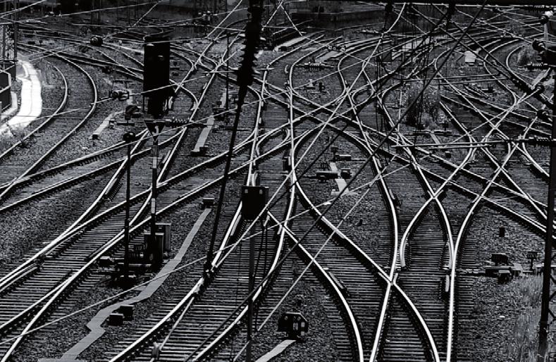
3 *somepictures
4 *somepictures

5 *somepictures

6 *somepictures

7 *somepictures

8 *somepictures

9 *somepictures

10 *somepictures


11 DEVERSOIR DE LA BOUILLIE *large scale landscape This project deals with an 300-hectares flood area at the entry of the city called Blois. Blois is a people town, situated on the banks of the lower river Loire between Orléans and Tours in france.. The wide range of activities ( agriculture, breeding, protected area, housing sectors) that can be found in this area make this project very interresting and complex. The goal was to distroy a whole neigbourhood constructed in the flood aea and give this space back to the population for leisure and entertainment. The area was also important for the city because it is a major entrance point to the city center.

12 DEVERSOIR DE LA BOUILLIE *large scale landscape This page shows the landscaping in the flood area next to the river. The project bring people to a sustainable use of the environment. It helps people to discover again the nature through different kinks of educational pathways.


13 DEVERSOIR DE LA BOUILLIE *large scale landscape This page shows technical details for the project. It is especially describing a bridge for pedestrians and bicycles. It shows also wood pathways for the flood areas.


14 LILLE SUD *urban project Lille is the main city of France s fourth largest metropolitan area (consisting of Lille, Roubaix, Tourcoing and their suburbs). It is is located to the country s north, on the Deûle River. It is the capital of the Nord-Pas de Calais région. It lies near the border with Belgium. The project is about the south neigborhood of the city. It is an area with many problems. It used to be the industrial neighbourhood but today all is an obsolete industrial zone. Many people who are living there are unemployed. In this context, an urban renovation project was developed to regenerate the area of 300 hectares to convert it into an active neigborhood. The proposal is a new planning for a part of this neighborhood mainly composed by 4 huge residential towers. Just next to this area, the city is building a reserach center with a hospital. This facility is going to create new jobs and will bring new people into the neiborhood.


15 LILLE SUD *urban project This page shows the central area of the project. Its a large pathways which includes playgroungs and green spaces for leisure and entertainement.


16 LILLE SUD *urban project This plan is a lighting plan for the neigborhood. It will especially bring a better night life quality for pedestrians during the night.


17 TEL AVIV 2000 *urban project The Tel Aviv 2000 project plays a key role not only into the development of the city as such but also as a regional planning factor influencing the whole country and its future; locally the site encompasses the three main business areas of Givataim, Ramat Gan and Tel Aviv-Yafo, and as a regional asset it is located on the main traffic connections by bus, rail and car throughout the country being therefore some kind of traffic interconnecting core as per the North, the South and the East of the country. Architecturally it is located exactly at the outskirt of the historical city recently listed in the World Heritage of the UNESCO Program, and deserve to be designed as a contemporary gate to the city referring to modern concepts and exhibiting a possible future image and way of living of 21st century Israel. The landscape design for the Tel Aviv 2000 site is in response to the multiple landscape forces that affect the site. These include the historic urban


18 TEL AVIV 2000 *urban project fabric of tree lined streets and garden blocks; the flow of the river and the freeway; the memory of the natural landscape of Israel; the activity of the urban corridors and street life and the recreational life of an urban park. These influences are brought together in a landscape framework that weaves pedestrian and vehicular circulation, civic buildings and spaces, cafes and retail frontages and the transportation center together into a landscape whole. The layers of the site reflect these forces in use, character, formality, planting and paving. This layered environment is structured and punctured to reveal both what lies below in a literal and a symbolic way. Openings in the plazas reveal the infrastructure of the transportation center below; the canopy is punctured to reveal the sky, the garden and park landscape is opened to reveal the natural rocky desert landscape of Israel. The historic city and the new city are stitched together with garden corridors lined with cafes, retail and civic plazas.

19 parking planting parking drive lane parking pedestrian lane green link parking parking planting parking drive lane parking planting pedestrian planting parking lane parking planting parking drive lane parking planting pedestrian planting parking lane *urban project This page shows some sections an plans for a sustainable parking lot. This work is part of a master plan made for the chabot collecge community campus in California parking planting parking drive lane parking planting pedestrian planting parking lane PARKING SCHEME 1 PARKING SCHEME 2 PARKING SCHEME 3


20 *urban project This drawing presents three design possibilities for a water feature located in a fancy courtyard of a residential building in San Francisco, CA glowing seats light shower shower & light stainless steel pipes spotlight steel plaque paving green cascade concrete seat planted wall glowing rocks glowing seats black stones glowing walls

21 *urban project This plan presents the design for the surrounding of a hospital facility in California


22 *urban project Model made to show two proposals for a private courtyard of a residential building. The 15 stories building is located in the heart of San francisco, CA.

23 *large scale landscape This sensitive map of a landscape was made for a site analysis. It shows which are the keypoints of this landscape. The project is about the construction of a new deviation road around the city of Vendôme in France.


24 *large scale landscape 3D modeling of a landscape. This work was made with Vectorworks.


25 *web design Samples of some websites made with dreamweaver.
26 Skecth for a flash webpage. *web design
ROYAL MINT COURT SECURES PLANNING CONSENT FOR 600,000 SQ. FT. COMMERCIAL SCHEME FOR OVER 6,000 LONDON WORKERS
 PAGE 1 OF 5 ROYAL MINT COURT SECURES PLANNING CONSENT FOR 600,000 SQ. FT. COMMERCIAL SCHEME FOR OVER 6,000 LONDON WORKERS JULY 2016 Approved plans will transform the historic 5.2 acre central London site
Seneca Meadows. Block 4 Locate office, technology, and medical development adjacent to I Screen views of garage structures from I-270.
 Seneca Meadows Seneca Meadows has an industrial park in its southern end and a mixed-use employment area planned for the north end. The district benefits from extensive I-270 visibility, stream valley
LAND USE AMENDMENT DOWNTOWN COMMERCIAL CORE (WARD 7) MACLEOD TRAIL SE AND 5 AVENUE SE BYLAW 254D2017
 MACLEOD TRAIL SE AND 5 AVENUE SE BYLAW 254D2017") Page 1 of 10 EXECUTIVE SUMMARY This Land Use Amendment application seeks to redesignate a full downtown block (currently the YWCA site) from a Direct Control based on the CM-2 District (Land Use Bylaw
Page 1 of 10 EXECUTIVE SUMMARY This Land Use Amendment application seeks to redesignate a full downtown block (currently the YWCA site) from a Direct Control based on the CM-2 District (Land Use Bylaw
Town Center. Block 5 Existing multifamily residential units are expected to remain.
 Area Guidelines Germantown s districts should be developed as distinct communities with unique features that are supported through the guidelines. The guidelines not only help distinguish these districts
Keystone Business Park Precinct Structure Plan North East Industrial Precinct. Part 2 Design Principles
 Keystone Business Park Precinct Structure Plan North East Industrial Precinct Part 2 Design Principles Context Issues Services Landform Issues Geotech and contamination Ecology Traffic and access Issues
milano santa giulia Our Project, Your Retail
 milano santa giulia Our Project, Your 2 A new city district for a global city population density 3 Milan is the most populous city in Italy and the country s main industrial, financial and commercial centre,
chapter DESIGN GUIDELINES NEW RIVER MASTER PLAN REPORT
 chapter DESIGN GUIDELINES NEW RIVER MASTER PLAN REPORT .76 DESIGN GUIDELINES An Overview design guidelines NEW RIVER MASTER PLAN Design Guidelines can transform the image of a city. Specific, design-based
Rotherhithe Rotherhithe Area Vision Map
 Area Vision Map CWAAP1 Improved pedestrian and cycle links to the wider area Improved link from town centre to River Thames and docks CWAAP2 Brunel Museum NSP79 CWAAP3 Proposed Thames Crossing Station
3.3. Urban Structure Defining a New Hierarchy of Routes and Spaces >Images
 Section 3.0 I The Masterplan Framework 18 >Images Examples of high quality routes and spaces 3.3. Urban Structure The success of any masterplan lies in a clear definition of the future urban structure
THE NEIGHBORHOOD TODAY
 THE NEIGHBORHOOD TODAY CORE AREA VISION How are we Good Urbanism A Site s DNA thinking about Elements of great Unique elements urban communities embedded in a place the site and design? ELEMENTS LIKE:
DOWNTOWN RESIDENTIAL DISTRICT DEVELOPMENT OPPORTUNITES
 DOWNTOWN RESIDENTIAL DISTRICT DEVELOPMENT OPPORTUNITES Out of all the areas in Downtown Painesville, this district provides the greatest opportunity for change with the vacation of Lake East Hospital.
UNIVERSITY TOWN NEIGHBOURHOODS 5.2 ECO-CORRIDOR MELBOURNE CAMPUS MASTER PLAN 2014
 5.2 ECO-CORRIDOR 37 ECO-CORRIDOR EXISTING CONDITIONS & VISION NEIGHBOURHOOD VISION Investment in the Eco-corridor Neighbourhood will signify the University s commitment to supporting local ecology and
4 C OMMUNITY D ISTRICTS
 4 C OMMUNITY D ISTRICTS N ew development in the Area will include many different types of land uses, including a destination retail area that attracts people from all over the region; recreation opportunities
Metro. Activity Center Design Guidelines. Recommendations For Developing Focused, Mixed-Use Commercial/Residential Centers
 Metro Activity Center Design Guidelines Recommendations For Developing Focused, Mixed-Use Commercial/Residential Centers Metro Activity Centers What is a MAC? Legacy, the adopted guide for the future growth
01 the vision NEW LYNN IS WAITING FOR THE GREAT LEAP FORWARD
 [A] FRAMEWORK 01 the vision 02 the framework 03 urban design principles 04 c o n t e x t 05 issues a n d o p p o r t u n i t i e s 06 creating a t.o.d. 07 key recommendations 08 seven strategic areas of
PROPOSED REDEVELOPMENT OF THE GLEN ABBEY GOLF CLUB. STREETSCAPE DESIGN STUDY (excerpt from the Urban Design Brief) TOWN OF OAKVILLE.
 TOWN OF OAKVILLE.") PROPOSED REDEVELOPMENT OF THE GLEN ABBEY GOLF CLUB STREETSCAPE DESIGN STUDY (excerpt from the Urban Design Brief) TOWN OF OAKVILLE OCTOBER, 2016 for 2.4.2 STREETS Streets are the single largest component
PROPOSED REDEVELOPMENT OF THE GLEN ABBEY GOLF CLUB STREETSCAPE DESIGN STUDY (excerpt from the Urban Design Brief) TOWN OF OAKVILLE OCTOBER, 2016 for 2.4.2 STREETS Streets are the single largest component
Legal & General Launches Walbrook Square
 Press release 19 May 2006 Legal & General Launches Walbrook Square Legal &General has today submitted plans for a striking new office and retail development, to be known as Walbrook Square. The development
5. Bankside and The Borough 5.1. Bankside and The Borough Area Vision
 5. 5.1. Area Vision 5.1.1. are: A globally significant central London business district which is home to international business headquarters; At the heart of the commercial and cultural life of the capital
Colchester Northern Gateway Master Plan Vision Review Draft. July 2016
 Colchester Northern Gateway Master Plan Vision Review Draft July 2016 Contents Introduction 4 Context 8 Purpose of the Report 8 Strategic Position 9 Overview of the Process 11 2012 Master Plan Vision 12
Sheffield Victoria Station Development Prospectus January 2014
 6 Billion extra GVA growth for Sheffield City Region s economy Sheffield Victoria Station Development Prospectus January 2014 Document produced by Sheffield City Council Introduction The construction of
Metropolitan Park System
 Metropolitan Park System Central Public Space Location Distinct Park Districts Distinct Parkway System Determine Character of the Public Realm Define Civic Institutional Building locations What are the
A Plan for the Heart of the Region: Tukwila, WA
 : Tukwila, WA 1 The Plan orchestrates the Restructuring of a 1,000-acre Regional Shopping Area into a Social and Symbolic for the Region. REGIONAL CONTEXT Downtown Seattle (Metropolitan ) 20 miles Bellevue
URBAN REGENERATION STRATEGIES
 TK8 Exploring the examples of urban regeneration strategies Subject: Specialised CAAD Studio Name of lecturer: doc. Ing. arch. Viera Joklová, PhD. School: Slovak University of Technology, Faculty of architecture
SECTION TWO: Urban Design Concepts
 SECTION TWO: Urban Design Concepts The Gardnerville Plan for Prosperity shapes economic opportunities presented by regional growth. The Urban Design Concepts provide policies and concepts for land use,
The Floyds Fork Area Plan
 The Floyds Fork Area Plan Growth Framework and Design Principles Presented by: Wallace Roberts & Todd, LLC March 24, 2009 Ted Wathen / Quadrant Agenda Project overview and purpose Growth framework Design
V. Gateways GATEWAYS / V-1
 V. GATEWAYS / V-1 Many of Chesapeake s gateways are located on highways and call for bold and attractive designs that motorists can understand, appreciate, and enjoy. can also take the form of natural
UNIVERSITY TOWN NEIGHBOURHOODS 5.5 HOUSING MELBOURNE CAMPUS MASTER PLAN 2014
 5.5 169 EXISTING CONDITIONS & VISION NEIGHBOURHOOD VISION The provision of on-campus housing into the future will continue to be an important element of the La Trobe University experience. A long-term
Landscape Architecture (LARC)
") Landscape Architecture (LARC) 1 Landscape Architecture (LARC) Courses LARC 0841. Sustainable Design. 3 Credit Hours. What's the big deal about global warming and how should we respond to it? Explore the
Landscape Architecture (LARC) 1 Landscape Architecture (LARC) Courses LARC 0841. Sustainable Design. 3 Credit Hours. What's the big deal about global warming and how should we respond to it? Explore the
Page 1 of 19 URBAN DESIGN FRAMEWORK FOR BOLTON STREET WATERFORD
 Page 1 of 19 URBAN DESIGN FRAMEWORK FOR BOLTON STREET WATERFORD 1.0 Introduction: The relocation of the City Council stores and depot from Bolton Street creates an exciting opportunity for development
> Create a campus of activity. > Plan for the people already on the site. > Work contextually with the site
 URBAN CAMPUS >>SITE GOALS > Create a campus of activity > Plan for the people already on the site students, visitors, high tech workers, low income residents > Work contextually with the site > Maintain
Colorado Station 2.0
 Colorado Station 2.0 Spring 2016 MURP Workshop UC Denver Ellen Ittelson Gregory Meek Megan Yonke Katelyn Puga Nathan Silverstein Claire Dalby Matthias Helfen Mark Richardson Jake Schmitz Gaby Hart Lauren
Stowford Mill, Ivybridge Introduction
 Stowford Mill, Ivybridge Introduction 1. What is the purpose of this exhibition? Burrington Estates would like residents and interested parties to have the opportunity to review updated proposals for the
16. Peckham Peckham Area Vision
 16. 16.1. Area Vision 16.1.1. is: A lively town centre providing a range of daytime and night time activities on Rye Lane including a Library, a Leisure Centre and many independent retailers which specialise
The Renaissance of Medway - Rochester Riverside
 - Rochester Riverside - Development Context - Rochester Riverside Scheme The Scheme Key Components Design Codes A new sustainable neighbourhood Housing Offices Hotels/Conference Centre Primary School
WESTERN ILLINOIS UNIVERSITY
 WESTERN ILLINOIS UNIVERSITY Quad Cities Riverfront Campus Master Plan March 1, 2006 Preliminary Master Plan Total Site Build Out Western Illinois University Quad Cities Municipal Park Mississippi River
COURTHOUSE CAMPUS BARNSLEY Executive Summary March 2010
 COURTHOUSE CAMPUS BARNSLEY Executive Summary March 2010 Estell Warren Cartwright Pickard Buro Happold King Sturge BWA Barnsley Metropolitan Borough Council introduction Courthouse Campus is the last major
(DC1) Direct Development Control Provision DC1 Area 4
 Direct Development Control Provision DC1 Area 4") . General Purpose (DC) Direct Development Control Provision DC Area 4 The purpose of this Provision is to provide for an area of commercial office employment and residential development in support of the
. General Purpose (DC) Direct Development Control Provision DC Area 4 The purpose of this Provision is to provide for an area of commercial office employment and residential development in support of the
The River Hub: NEW BUILDINGS
 Summary The River Hub includes 6 municipalities that all boarder the Fraser River. Combined, they are expected to double in population over the next 50 years. To accommodate this new population, 138,831
Standards (R-3) Figure B-11: R-3 Residential Standards Exhibit
 Figure B-11: R-3 Residential Standards Exhibit") Avila Ranch Avila Ranch Specific Plan Development Standards High Medium Density - High Residential Density Residential Lot and Building Lot and Standards Building (R-3) Standards (R-3) EXAMPLES These sketches
Avila Ranch Avila Ranch Specific Plan Development Standards High Medium Density - High Residential Density Residential Lot and Building Lot and Standards Building (R-3) Standards (R-3) EXAMPLES These sketches
Urban Analysis. Downtown Zanesville like any city, has been physically modified through time as it
 Urban Analysis As a part of the consulting team s reconnaissance effort, an urban analysis was performed. Before the future of a place can be envisioned, one must understand the physical characteristics
East Grove Public Realm
 H - - MP - Elephant Park Public Realm RO EY DN NEW KENT ROAD E AC PL The public realm has been designed to create an environment which is easy to move through, accessible to all, safe and playful. The
theme 4 : Penn connects...
 38TH STREET STREETSCAPE WALNUT STREET STREETSCAPE GENERATIONAL BRIDGE LOCUST WALK RESTORATION SHOEMAKER GREEN 34TH STREET STREETSCAPE LOCUST WALK RESTORATION penn park SPRUCE STREET PLAZA HAMILTON WALK
North Oakville East Parks Facilities Distribution Plan. November, 2009
 North Oakville East November, 2009 POLICY CONTEXT 1) Purpose a) The purpose of this document is to be a guide for the location, configuration, design and development of the parks system for the North Oakville
The Master Plan Framework
 The Master Plan Framework The East Harbour Master Plan advances the development of 60 acres of former industrial lands east of the Don River. The Master Plan outlines a vision for a vibrant, transit-oriented
SFMTA PHELAN LOOP AND PUBLIC PLAZA PHELAN OCEAN AVENUE
 SFMTA Municipal Transportation Agency Image: a bus in front of the Palace of the Legion of honor SFMTA PHELAN LOOP AND PUBLIC PLAZA PHELAN AVENUE @ OCEAN AVENUE Community Meeting May 23, 2012 San Francisco,
Greater Langley: NEW BUILDINGS
 District Scale Overview The Liveable Region Strategic Plan (LRSP) identifies four main growth strategies: Protect the green zone; build complete communities; achieve a compact metropolitan area and increase
Exploring a new student life through the buildings in Bovisa. Zahra Ziaee Lorzad. Mc. Politecnico di Milano, 2014
 Exploring a new student life through the buildings in Bovisa By Zahra Ziaee Lorzad Mc. Politecnico di Milano, 2014 1 Problem statement The thesis questions the role and mutation of architecture in the
MASTERPLAN AND PARK IMPROVEMENTS
 ST.JAMES PARK MASTERPLAN AND PARK IMPROVEMENTS Stakeholder Meeting 3 April 26, 2016 Team: PMA Landscape Architects Ltd. Lead Landscape Architects MASS LBP Public Facilitation Consultant RAW Design Architectural
A. The sites in Table 16 below, as identified on the Policies Map, are allocated for retail-led development:
 SWDP 44: Worcester City Centre A. The sites in Table 16 below, as identified on the Policies Map, are allocated for retail-led development: Table 16: Sites Allocated for Retail-Led Development Policy Reference
WHAT IS THE GRAVESEND HERITAGE QUARTER PROJECT?
 01 WELCOME Hello and welcome to this consultation event showing Reef Group s proposals for. The project team is here today to explain what is proposed for these important town centre sites and answer questions
Chapter 03 Planning framework
 Vauxhall Nine Elms Battersea Opportunity Area Planning Framework Chapter 03 Planning framework Mayor of London 25 preferred option - 16,000 residential units 20,000-25,000 jobs northern line extension
Planning Districts INTRODUCTION
 INTRODUCTION To facilitate detailed examination of development prospects for all areas of the community, Delano has been divided into 14 planning districts. The location of these planning districts is
ITEM #8. Regional Smart Growth Program. Regional Smart Growth Program. Presentation Overview. Coast Highway Vision and Stategic Plan.
 Regional Smart Growth Program Economic Development Commission What is Smart Growth? Adopted as part of the Regional Comprehensive Plan (RCP) RCP provides vision for region based on Smart Growth and sustainability
Carlsbad Village Redevelopment Concept Summary of Features
 Carlsbad Village Redevelopment Concept Summary of Features Calthorpe Associates November 5, 2003 The Redevelopment Concept illustrates a vision for the future of Carlsbad Village. The overall vision of
PUBLIC RIGHT-OF-WAY IN THIS CHAPTER PUBLIC REALM
 PUBLIC RIGHT-OF-WAY This section provides design guidelines for improvements in the public right-of-way. The public right-of-way refers to streets, sidewalks, non-vehicular thoroughfares, parks and greenways
Transportation Working Team Duane Diggs, Co-Chair (VOICE Buffalo) Kelly Dixon, Co-Chair (GBNRTC) Paul Ray, Facilitator (UB Regional Institute)
 Kelly Dixon, Co-Chair (GBNRTC) Paul Ray, Facilitator (UB Regional Institute)") towards a more sustainable Buffalo Niagara Transportation Working Team Duane Diggs, Co-Chair (VOICE Buffalo) Kelly Dixon, Co-Chair (GBNRTC) Paul Ray, Facilitator (UB Regional Institute) Agenda Welcome,
towards a more sustainable Buffalo Niagara Transportation Working Team Duane Diggs, Co-Chair (VOICE Buffalo) Kelly Dixon, Co-Chair (GBNRTC) Paul Ray, Facilitator (UB Regional Institute) Agenda Welcome,
CAMPUS MASTER PLAN DRAFT PLAN UPDATE JANUARY
 NEW MEXICO HIGHLANDS UNIVERSITY CAMPUS MASTER PLAN DRAFT PLAN UPDATE JANUARY 27 2010 MASTER PLANNING GOALS TO BALANCE THE STRATEGIC GOALS OF THE UNIVERSITY WITH THE PHYSICAL CAMPUS through the assessment
Chapter 4. Linking Land Use with Transportation. Chapter 4
 Chapter 4 Linking Land Use with Transportation Chapter 4 59 Chapter 4 Linking Land Use with Transportation Community Design and Transportation Program Introduction Since the 1950s, the predominant development
 Welcome Welcome to this public consultation which outlines our proposals for the redevelopment of the Old Southwark Fire Station located on Southwark Bridge Road. The purpose of this consultation is to
2. Form and Character. 2.1 Introduction. 2.2 The Downtown Addition Plan. 2.1 Introduction
 2.1 Introduction 2.1 Introduction This section of the Specific Plan describes and illustrates the desired form, character and uses of the Downtown Addition and explains the underlying design principles.
Landscape Heritage Plan
 University of California, Berkeley Landscape Heritage Plan UC Berkeley Physical and Environmental Planning Sasaki Associates The Getty Foundation Planning Framework SAFER Study Seismic analysis and $1.2
The Vision. Photo provided by The Minervini Group. 46 Vision, Objectives & Strategies
 Vision, Objectives & Strategies The is the public framework and guide for future development of the Grand Traverse Commons. The establishes public polices for infrastructure, the preservation of natural
New Homes at Winton East
 View toward Winton East from Caerketton Hill Aerial photograph of South Edinburgh: Winton East Site Location Indicative proposal Welcome Thank you for coming to the Winton East public exhibition. We would
Policies and Code Intent Sections Related to Town Center
 Policies and Code Intent Sections Related to Town Center The Town Center Vision is scattered throughout the Comprehensive Plan, development code and the 1994 Town Center Plan. What follows are sections
Linking Land Use and Transportation
 Linking Land Use and Transportation NJ s Experience January 18, 2006 NYMTC - PFAC Mark Stout Planning & Development New Jersey Department of Transportation Where We Are Los Angeles, CA San Francisco, CA
Making the case for Sustainable Transport Project Potential
 Making the case for Sustainable Transport Project Potential The Structural Investment Fund (SIF) Strategy for Greater Lincolnshire identifies the barriers to growth identified by having poor transport
ELK GROVE TOWN CENTER DESIGN GUIDELINES
 ......... ELK GROVE TOWN CENTER DESIGN GUIDELINES LAGUNA RIDGE SPECIFIC PLAN... June 2008 ............ DESIGN GUIDELINES Table of Contents Contents Section A: Town Center Overview...1 A.1. Purpose and
Anatomy of A Vibrant Downtown. Anatomy of a Vibrant Downtown
 Anatomy of A Vibrant Downtown The goal of MAIN ST. REVITALIZATION PLANNING is to provide a framework that will help transform your downtown into a VIBRANT DOWNTOWN a place where people love to LIVE, WORK,
Section 2 Core Area 2.1 Downtown Area / Station Area. Introduction DOWNTOWN AREA
 Section 2 Core Area Introduction DOWNTOWN AREA Many Thanks Austin, Texas Santa Rosa Downtown Figure 2.1.1 Santa Rosa circa. 1885 Courtesy of Burger and Evans Lithograph The City of Santa Rosa wishes to
Valuing Historic Places
 Valuing Historic Places Introduction Historic buildings and places have played an increasingly central role in the delivery of a range of public benefits, including education, economic development, sustainable
Overview of the Plan. The Building Blocks of Centers, Neighborhoods and Network INTERNAL DRAFT
 Overview of the Plan 4 East Davidson Ramah Church Rd June Washam Rd Bradford District Park Bradford Shearer Rd Campus District NC 73 Davidson-Concord North Rocky River This Master Plan projects an approximate
Vision & Land Use. Discussion. Historic Preservation Plan. Foggy Bottom Campus Plan:
 Vision & Land Use Foggy Bottom Campus Plan: 2006-2025 Historic Preservation Plan Discussion Community Meeting Presentation August 2, 2006 Presentation Format Overview Sherry Rutherford, GW Foggy Bottom
Walnut Creek BART Station
 Walnut Creek BART Station Mixed Use Transit Oriented Project Design Review Commission Study Session May 17, 2006 Applicant: Walnut Creek Transit Lifestyles Associates Joint Venture: Transit Village Associates
Philip A. Ginsburg, General Manager Toks Ajike, Acting Planning and Capital Program Director
 Date: March 7, 2018 To: Through: From: Subject: Recreation and Park Commission Capital Committee Philip A. Ginsburg, General Manager Toks Ajike, Acting Planning and Capital Program Director Dan Mauer,
Speers Road Corridor Study. Livable Oakville (Official Plan) Council Sub Committee March 20, 2017
 Council Sub Committee March 20, 2017") Speers Road Corridor Study Livable Oakville (Official Plan) Council Sub Committee March 20, 2017 Overview 1) Study Purpose & Background 2) Study Area 3) Policy Context and Plan Review 4) Speers Road Corridor
Speers Road Corridor Study Livable Oakville (Official Plan) Council Sub Committee March 20, 2017 Overview 1) Study Purpose & Background 2) Study Area 3) Policy Context and Plan Review 4) Speers Road Corridor
a vibrant office and retail development enters the gateway to rutherford county
 a vibrant office and retail development enters the gateway to rutherford county PF UP Introducing Fountains at Gateway in Rutherford County Fountains at Gateway is a new 31-acre Class A multi-tenant office
Urban Design Review Panel Submission. The Ottawa Train Yards - Office Development. 405 Terminal Avenue. 17 April Table of Contents.
 Table of Contents PHOTOGRAPHS OF EXISTING SITE CONDITION URBAN DESIGN BRIEF PART A: Summary and Response to City Urban Design Guidelines and Policies PART B: Site Specific Urban Design Objectives PART
RA1.01. Project Description:
 Project Description: Designed around a philosophy of "healthy building for healthy bodies," the University s recreation center inspires personal health and wellness. As the University s campus continues
PLANNING STATEMENT. Market House Market Place Kingston upon Thames KT1 1JS
 PLANNING STATEMENT To support planning and listed building consent applications for change of use from Class A1 shop and Class A3 cafe to Class A3 restaurant at: Market House Market Place Kingston upon
here today Public exhibition
 Public exhibition here today Find out more about Central England Co-operative and Hawkstone Vale Developments Ltd s redevelopment proposal to bring new retail and community facilities to Wilnecote. The
Bayshore Boulevard Home Improvement District Design Guidelines
 Bayshore Boulevard Home Improvement District Design Guidelines guidelines for New construction projects and major alterations IN the bayshore boulevard home improvement special use DISTRICT SAN FRANCISCO
Section 4 - Public Realm & Landscape proposals Landscape Masterplan. Section 4 52
 - Public Realm & Landscape proposals Landscape Masterplan 52 Proposed Masterplan - Green Infrastructure Strategy District Park 4.33 Ha to provide Passive and active recreation with a large play area which
PUBLIC REALM STRATEGY
 CONSULTATION DRAFT PUBLIC REALM STRATEGY Trenchard Street & Frogmore Street City Design Group Place Directorate Public Realm Strategy Trenchard Street & Frogmore Street Contents 1. Introduction 2. Understanding
A DYNAMIC CITY AND ITS ASSETS
 A DYNAMIC CITY AND ITS ASSETS Great new urban projects are being completed Significant funding for public realm upgrades in the commercial core Population growth and skills on the rise Growing internal
AUSTIN MEDICAL DISTRICT MASTER PLAN"
 AUSTIN MEDICAL DISTRICT MASTER PLAN"!"#$%&'"()(&$*+,--$ ,$?+,'=2,)0$!)=@,+'=03$AB,+-(C)'$ DE,$!)=@,+'=03$C/$D,F-'$-0$%&'()$ $?-),H='0'P$.(/$0&1"23$ $ G,)=C+$,$?+,'=2,)0$ G,0C)$
SECTION ONE: INTRODUCTION. introduction
 introduction 1 INTRODUCTION Since it was first established in 1843 as a trading post for the Hudson s Bay Company, Victoria has evolved into a Provincial capital city that is recognized across Canada and
HARBOR. Harbor Lofts. 435 West Center Street Promenade. Anaheim, CA
 Harbor Lofts 435 West Center Street Promenade Anaheim, CA 92805 714.535.2181 HARBOR L O F T S O N T H E P R O M E N A D E Harbor Lofts. Anaheim s most desirable location. It s the first for sale loft project
Land at Three Elms, Hereford PRE-SUBMISSION EXHIBITION June 2016
 Design Principles Emanating from the key themes from the Community Planning Weekend and technical assessment conducted, a series of design principles were developed.these principles were presented during
elbridge Core Strategy
 C elbridge Core Strategy Celbridge is designated as a Moderate Growth Town in the RPGs. The County Development Plan reinforces this designation in its settlement strategy. Moderate Growth Towns within
Local Placemaking Opportunities
 What if We Built Elmira Around Places? Elmira Downtown Development Annual Meeting April 26, 2006 Planning & Design PPS Highlights 48 states, 24 countries 1200 communities 1 million visitors to our web
appendix and street interface guidelines
 appendix five: building and street interface guidelines appendix 5 building and street interface guidelines BOULEVARDS Boulevards are generally characterized by higher levels of traffic movement at higher
EXISTING CONDITIONS 41. Existing Conditions
 EXISTING CONDITIONS 41 Existing Conditions The Existing Analysis phase of the planning process involved a study of the existing conditions on the campus in order to identify key planning issues to be addressed
Joshua H Shaw. 127 Colonial Circle Unit C Chicopee MA
 Joshua H Shaw 127 Colonial Circle Unit C Chicopee MA 01020 617 821 5112 josh.shaw79@gmail.com Education Boston Architectural College Candidate for Bachelors Of Architecture 2007-present Springfield Technical
CHAPTER 12 DESIGN GUIDELINES FOR PUBLIC IMPROVEMENTS
 CHAPTER 12 DESIGN GUIDELINES FOR PUBLIC IMPROVEMENTS Introduction This chapter provides design guidelines for public sector improvements in the downtown. This includes streetscape design, as well as the
UDF PLANS AND GUIDELINES
 UDF PLANS AND GUIDELINES 5 Land Use Land Use Development Plan Plan no. 3 Land Use Development Mixed Use Retail / Leisure Residential Civic and Institutional Proposed Zoning Table Development Edges Plan
Planning Board Briefing
 Planning Board Briefing Why Now? The Sector Plan Implementation Chapter States: Before Stage 1 begins, the following must occur: Approval of the Sectional Map Amendment. Approval of the Greater Lyttonsville
intu Bromley Planning Summary Bringing more to Bromley February 2014
 intu Bromley Planning Summary February 2014 Bringing more to Bromley Contents Introduction 1 Description of the Proposals 2 Economic Benefits 4 Planning Policy 6 Cinema and Catering Assessment 7 Design
 Health Sciences City The available land area, although limited, combined with the unique partnership between the primary institutions and the supporting partnerships of the development interests within
Site 5 Development Brief
 Union Street Crichton Street South Crichton Street Thomson Avenue (Northern Boulevard) Site 5 South Union Street Earl Grey Place West Site 6 Riverside Esplanade (Southern Boulevard) South Crichton Street
GUIDELINES BAYVIEW INSTITUTIONS CONTEXT PLAN LOCATION PLAN COMPONENTS URBAN DESIGN GUIDELINES
 Development in the Bayview Sunnybrook area will be consistent with the following urban design guidelines. They provide a framework for development in the area and are to be read in conjunction with the