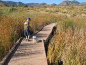
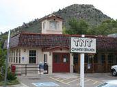
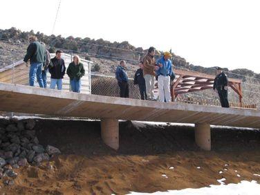
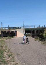
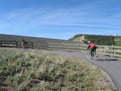
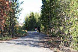
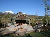
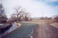
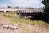
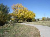
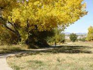
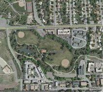
Downtown Denver Morrison. Located 30 minutes from downtown Denver behind the hogback
|
|
|
- Ralph Richard
- 5 years ago
- Views:
Transcription

1

2
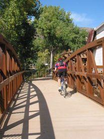
3 Downtown Denver Morrison Located 30 minutes from downtown Denver behind the hogback


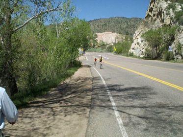
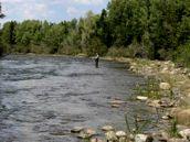
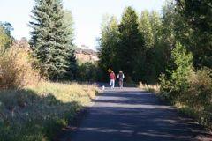
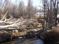
4 Founded in 1874 as a passageway gold mines to the west. Morrison is the gateway to the Bear Creek Canyon. Surrounded with parks and open space including Red Rocks natural amphitheater. Highway parallels Bear Creek which was hardly visible from its banks. Rock climbing at canyon opening


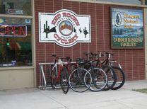
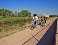
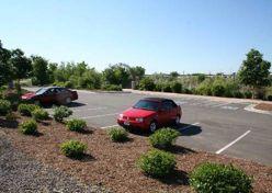
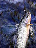
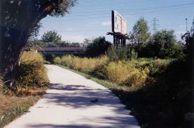
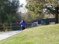
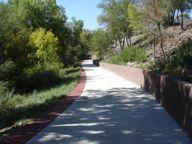
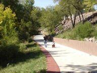
5 Population of 450 people Downtown comprised of antique shops, restaurants, boutiques and other stores. Area draws thousands of bicyclists, hikers, and those interested in the rich geologic and cultural landscape. Morrison had limited off-street bicycle facilities With disjointed downtown walkways, hardly accessible. Heavy concert and weekend traffic.

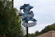
6 TNT, El Mercado, Blue Cow
7

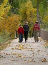
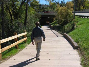
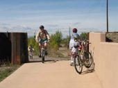
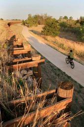
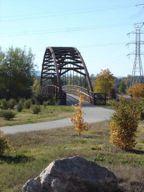
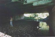
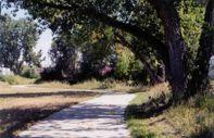
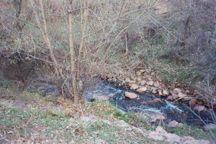
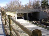
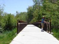
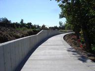
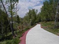
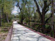
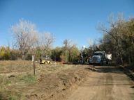
8 Project: 1999 to 2004 Budget: $ 2.7 million Funded by: Jefferson County Open Space, Great Outdoors Colorado State Trails Program, and the Town of Morrison, Urban Drainage,! miles of 10 wide multi-use trail, pedestrian walks, signature bridge, decking, trail amenities, and revegetation of creek banks. Trail provides connectivity to the regional trail system of Denver.


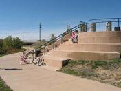
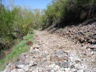
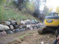
9 CHALLENGES Tight Corridor Highway Traffic Pedestrian/ Bike Safety Eroding Creek Banks Downtown Parking Perception of Change Town Council Design Team Included: Greenway Planners Landscape Architects Civil Engineers Structural Engineers Traffic Engineers Ecologists


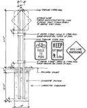
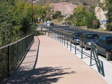
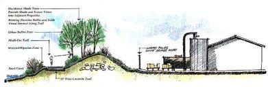
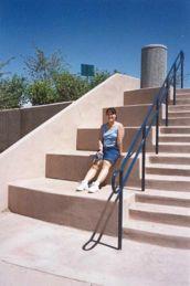
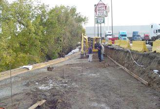
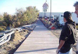
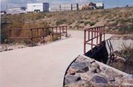
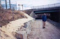
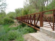
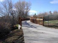
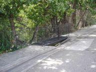
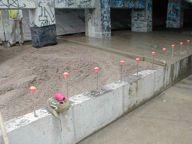
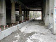
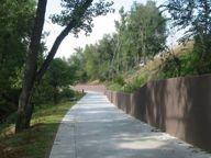
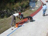
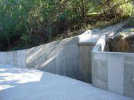
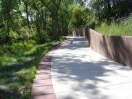
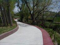
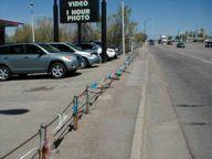
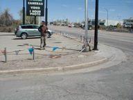
10 STREET INTERFACE Customized Concrete Barrier to accommodate grade change and limited width. Adjusted Lane Striping measured to the inch Reset Guardrail-Pedestrian Rail


11 STREET INTERFACE Custom Pedestrian Railing protecting trail users from back of guardrail


12 PARKING INTERFACE Parking Layout to maintain existing count Paving Treatment to demark pedestrians, car doors and bicycles Signage to direct and separate user types


13 PARKING INTERFACE Working with property owners to gain support and accomplish trail corridor


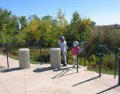
14 SIGNAGE Signage-Simple, attractive mounting, meeting MUTSCO


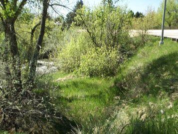
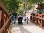
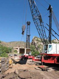
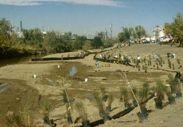
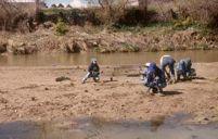
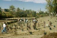
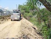
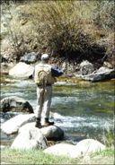
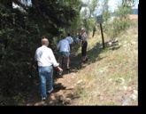
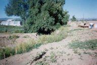
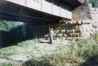
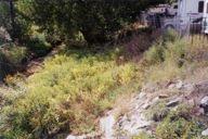
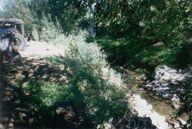
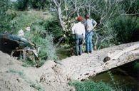
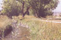
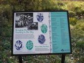
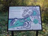
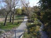
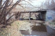
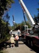
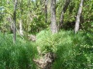
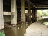
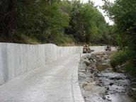
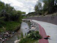
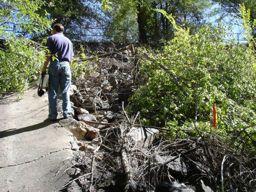
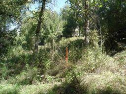
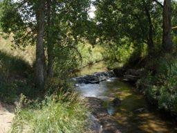
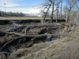
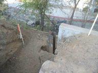
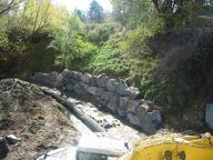
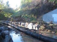
15 CREEK EXPERIENCE Volunteer plantings to restore creek banks, reducing erosion and making attractive. History


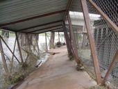
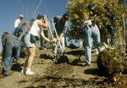
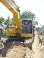
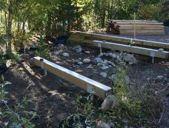
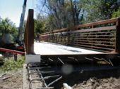
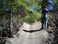
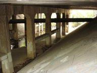
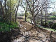
16 CREEK EXPERIENCE Deck structures constructed and poured in place. Preserved trees, but did disturb creek banks. Still less excavation and disturbance than a structural wall with footings or piles.
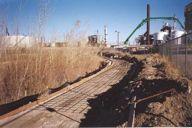
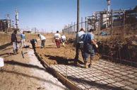
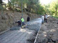
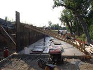
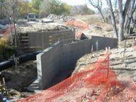
17 CREEK EXPERIENCE
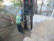
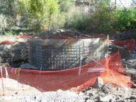
18 CREEK EXPERIENCE
19 CREEK EXPERIENCE


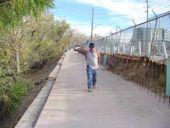
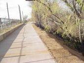
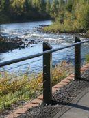
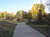
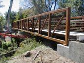
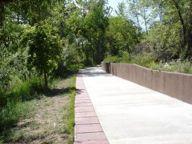
20 CREEK EXPERIENCE Transparent Pedestrian Rail Place Trail along Creek Edge Provide Overlooks


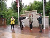
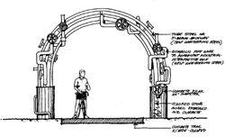
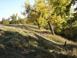
21 CREEK EXPERIENCE Rest Area with seating and trash receptacles Gardens and Dining Along Trail


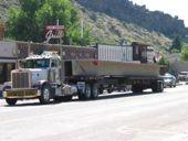
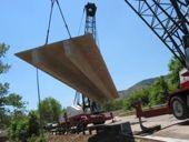
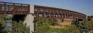
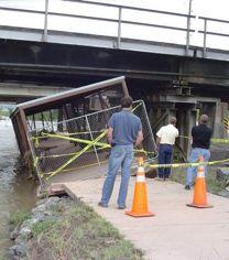
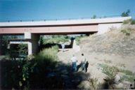
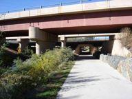
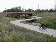
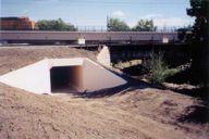
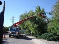
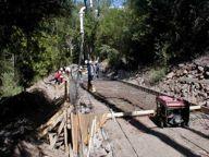
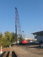
22 BRIDGE INSTALLATION Narrow Corridor- Just Feet From Restaurant Careful Installation-Seismic Monitoring Power shut-off, generators for freezers, lost revenue Bridge From California (Eisenhower Tunnel)
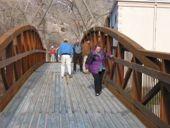
23 BRIDGE INSTALLATION Trail Accessible To All
24 DECK INSTALLATION


25 DECK INSTALLATION Difficult Construction Engineering Field Changes Piles moved horizontally when driven into bedrock 2 Precast Twin T s fit together to form deck
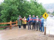
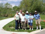
26 DECK INSTALLATION


27 DECK INSTALLATION Realign Highway at intersection Working with traffic engineer and CDOT


28 VETERAN S MEMORIAL Preserving The Past Working with veterans group to design plan that accepts trail while reestablishing an important memorial.


29 VETERAN S MEMORIAL Working With Veterans Group Integrating the Trail

30 VETERAN S MEMORIAL


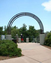
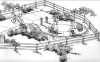
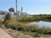
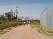
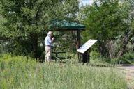
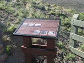
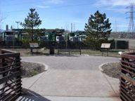
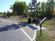
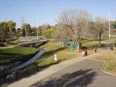
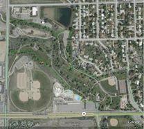
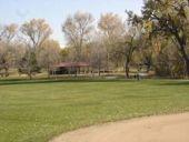
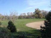
31 TWO CREEKS PARK Urban Park-Rest Area Benches/ Bike Racks Trail Connection Interpretive Kiosk and Mural

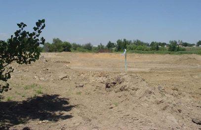
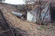
32 TWO CREEKS PARK

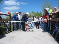
33 RIBBON CUTTING
34
35
36 Downtown Denver Commerce City Located north of downtown Denver adjacent to The Rocky Mountain Wildlife Refuge


37 Population of 45,000 people City businesses include refineries, trucking companies, manufacturing plants and the new Colorado Rapid s Soccer Stadium
38 INDUSTRIAL CHARACTER!!! Active Petroleum and Chemical Plants Multiple Railroad Crossings Utilities and Security


39 INDUSTRIAL CHARACTER!!! Gravel Mining Devastated Landscapes Dumping


40 EXISTING BARRIERS!!! Highways/ Roadway Structures/ Railroads/ Canals Gabion Blankets Steep Slopes with debris/trash


41 DIVERSE LANDSCAPE!!! Wetlands Riparian Areas Cottonwood Galleries


42 WILDLIFE!!! Large number of Bird Species Reptiles and Fish Fox, Deer and Small Mammals

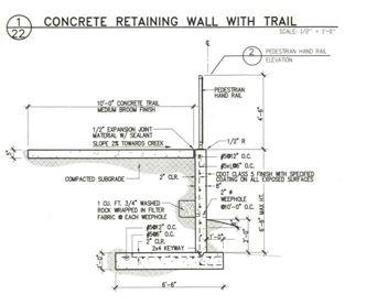
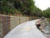
43 Master Plan Greenway extends 3 miles connecting Commerce City and eastern Cities into the Platte River Greenway system, which extends for over 50 miles Construction Cost of approx. $6 million Funded by GOCO/State Trails grants, Adams Co. Open Space funds, Regional Greenway, City, In kind donations Design Team Included: Greenway Planners Landscape Architects Civil Engineers Structural Engineers Geotechnical Engineers Ecologists


44 SEGMENT ONE: THE CONFLUENCE Challenges:!River and irrigation ditch crossing.!property acquisition / Landfill & concrete rubble.!gateway to the city / Image of overall corridor.


45 SEGMENT ONE: THE CONFLUENCE!Signature Bridge

46 SEGMENT ONE: THE CONFLUENCE

47 SEGMENT ONE: THE CONFLUENCE!Canal Crossings


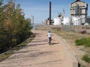
48 SEGMENT ONE: THE CONFLUENCE!Confluence Design!Overlook Concept Challenges:! River and irrigation ditch crossing.! Property acquisition.! Landfill and concrete rubble.! Gateway to the city.! Image of overall corridor.


49 SEGMENT TWO: RESTORATION ZONE Challenges:!Steep slopes with landfill!adjacent property storage!sheet piles controlling drainage!railroad Crossings and Accessibility


50 SEGMENT TWO: RESTORATION ZONE Integral Retaining Wall/ Trail, Reduces Excavation Watch for hazardous materials when digging


51 SEGMENT TWO: RESTORATION ZONE!!!! Protection from falling debris. Removable panels. Frequent flooding. Adjacent traffic.

52 SEGMENT TWO: RESTORATION ZONE! Lessons Learned

53 SEGMENT TWO: RESTORATION ZONE! Lessons Learned


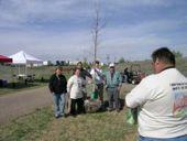
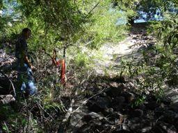
54 SEGMENT TWO: RESTORATION ZONE!! Fill used to create berming Images added to walls for interest

55 SEGMENT THREE: INDUSTRIAL ZONE Challenges:!Security for adjacent property owners!concerns about fire hazards!trail User safety and frequent flooding

56 SEGMENT THREE: INDUSTRIAL ZONE

57 SEGMENT THREE: INDUSTRIAL ZONE


58 SEGMENT FOUR: FOX FOREST Challenges:!Security for adjacent property owners!concerns about fire hazards!trail User safety and frequent flooding

59 SEGMENT THREE: INDUSTRIAL ZONE


60 SEGMENT FOUR: FOX FOREST Challenges:! Heavy landfill.! Creek not visible.! Screen industrial storage.! Railroad crossing.! Security for adjacent properties.


61 SEGMENT FOUR: FOX FOREST Site cleanup and grading. Volunteer opportunities.

62 SEGMENT FOUR: FOX FOREST

63 SEGMENT FOUR: FOX FOREST

64 SEGMENT FOUR: FOX FOREST

65 SEGMENT FOUR: FOX FOREST


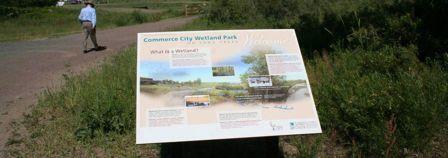
66 SEGMENT FIVE: WETLAND PARK Challenges:!Steep slopes with landfill!utilities!protection of wetlands!accessible Trailhead


67 SEGMENT FIVE: WETLAND PARK


68 SEGMENT FIVE: WETLAND PARK

69 SEGMENT FIVE: WETLAND PARK


70 SEGMENT FIVE: WETLAND PARK


71 SEGMENT FIVE: WETLAND PARK


72 SEGMENT FIVE: WETLAND PARK

73 SEGMENT FIVE: WETLAND PARK


74 SEGMENT FIVE: WETLAND PARK Before After


75 SEGMENT FIVE: WETLAND PARK


76 SEGMENT FIVE: WETLAND PARK


77 SEGMENT FIVE: WETLAND PARK


78 SEGMENT FIVE: WETLAND PARK


79 SEGMENT FIVE: WETLAND PARK


80 SEGMENT FIVE: WETLAND PARK


81 SEGMENT SIX: COTTONWOOD GALLERY Challenges:!Steep slopes!adjacent land uses!protection of existing vegetation

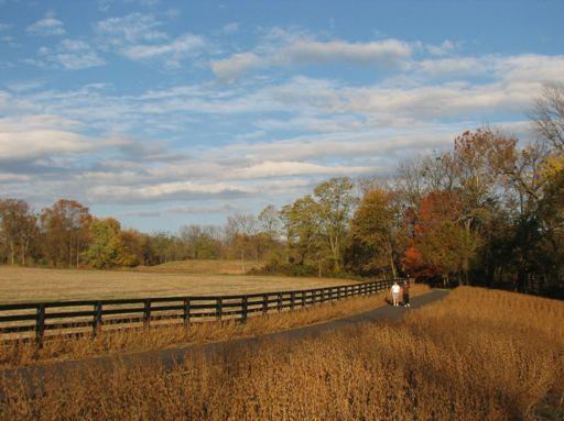
82 SEGMENT SIX: COTTONWOOD GALLERY

83 SEGMENT SIX: COTTONWOOD GALLERY

84 SEGMENT SIX: COTTONWOOD GALLERY

85

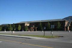
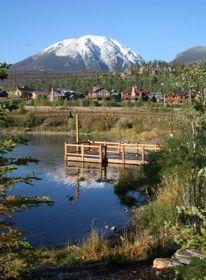
86 Continental Divide Silverthorne Dillon Population of 3,200 people Located approx. 75 miles west of Denver City businesses include refineries, trucking companies, manufacturing plants and the new Colorado Rapid s Soccer Stadium


87 Lake Dillon- Major Water Supply for Denver Factory Outlet Stores Yearround and Seasonal Residents
88


89 DILLON LAKE CONNECTION Connects Dillon with Silverthorne 200 Vertical Grade Change Series of Ramps with Landings Concerns with Security Design Team Included: Greenway Planners Landscape Architects Civil Engineers Structural Engineers Ecologists Wildlife Biologist


90 DILLON LAKE CONNECTION Protective Railing Signage Rest Areas with Seating

91 DILLON LAKE CONNECTION

92 DILLON LAKE CONNECTION

93 DILLON LAKE CONNECTION


94 BLUE RIVER Total Cost to date $1.5 Million

95 BLUE RIVER

96 BLUE RIVER


97 BLUE RIVER Majority of Trail is 10 Wide Asphalt on Grade Decking Through Riparian Areas

98 BLUE RIVER

99 BLUE RIVER

100 BLUE RIVER


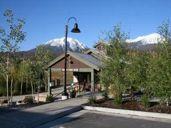
101 BLUE RIVER Decking Through Riparian Areas Minimal Railings to Allow for Wildlife Movement

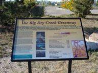
102 BLUE RIVER

103 BLUE RIVER

104 BLUE RIVER MSE Retaining Walls to Accommodate Grade Change Transparent Railing to Maintain Views of River

105 BLUE RIVER
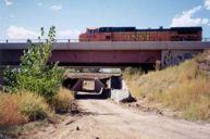
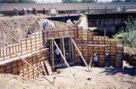
106 Elementary School

107 NORTH POND
108 NORTH POND Destination-Public Park & School Fishing, Docks, Ice Skating, Fire Pit Trailhead

109 Big Dry Creek Trail An Urban Greenway Corridor S. Platte River Bridge S. Platte Windermere St. Belleview Park Progress Park Phase 2B Lehow Ave. to Broadway Phase 2A Broadway to Greenwood Point Phase 1 Progress Park to Lehow Funding Challenges South!Urbanized Suburban Area Park & Recreation District Phase 3 Greenwood Point to Washington St.!South!Multiple Suburban Jurisdiction Park Foundation!!City of Englewood!!City of Englewood!!City of Littleton!!City of Littleton!!City!!City of of Greenwood Greenwood Village Village!Constricted/encroached!!City of Cherry Hills Village corridor Arapahoe!Private County land acquisitions!numerous!!urban roadway Drainage & & railway Flood crossings Control
 with minimal deck thickness.")
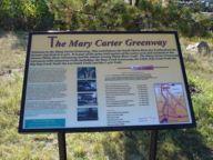
110 Bridge Span Across South Platte River Connection to Mary Carter Greenway Challenges Cross Channelized River with little freeboard available. Solutions Design free span bridge (200ft) with minimal deck thickness. Total Cost $385,000 Completed 2002 Completed 2002


111 Bridge Span Across South Platte River Connection to Mary Carter Greenway - Construction


112 Bridge Span Across South Platte River Connection to Mary Carter Greenway - Completion

113 S. Platte River to S. Windermere Street Challenges Underpass designs for 5 crossings BNRR RTD BNRR SPUR Santa Fe Drive S. Windermere Total Cost $592,530 Trail Length 2,500 LF Completed 2001

114 S. Platte River to S. Windermere Street Pre Construction & Construction

115 S. Platte River to S. Windermere Street Post Construction


116 Belleview Park City of Englewood


117 Progress Park City of Littleton

118 Phase 1 Progress Park to Lehow Avenue City of Englewood Challenges Eroding channel Creek crossing solution 100-yr floodplain Total Cost $417,600 Total Length 1,100 LF Completed 2004


119 Phase 1 Progress Park to Lehow Avenue City of Englewood Pre Construction and Construction


120 Phase 1 Progress Park to Lehow Avenue City of Englewood Completed

121 Phase 2A Broadway to Greenwood Point Challenges Narrow/encroached channel Steep channel banks Limited access Broadway underpass Total Cost $518,388 Total Length 1,000 LF Completed 2007


122 Phase 2A Broadway to Greenwood Point Pre Construction


123 Phase 2A Broadway to Greenwood Point Construction


124 Phase 2A Broadway to Greenwood Point Path with Wall Construction

125 Phase 2A Broadway to Greenwood Point Tributary Drainage Rundown


126 Phase 2A Broadway to Greenwood Point Completed

127 Phase 3 Greenwood Point to Washington Street City of Littleton Challenges Narrow encroached channel Steep channel banks Limited access Eroding channel Total Cost $680,000 Total Length 2,500 LF Completed 2006

128 Phase 3 Greenwood Point to Washington Street City of Littleton Pre Construction

129 Phase 3 Greenwood Point to Washington Street City of Littleton Construction

130 Phase 3 Greenwood Point to Washington Street City of Littleton Completed

131 Phase 2B Lehow Ave. to Broadway Challenges Eroding channel Two Crossings Ramp to Broadway Unsuitable soils Total Cost $631,577 (bid) Total Length 1,200 LF Est. Completion 2009


132 Phase 2B Lehow Ave. to Broadway Pre Construction and Construction

133 Big Dry Creek Trail An Urban Greenway Corridor Total Cost: $3.2 million Federal Enhancement Funds : $600,000

134
The following principles guide the development of goals and strategies to protect and promote these amenities:
 OPEN SPACE/PARKS/TRAILS/RECREATION GOALS/STRATEGIES Cherry Hills Village is a living environment that offers low density development, open areas, public scenic vistas, public trails and public parks. This
GOCO Grants Awarded to Projects in Arapahoe County through June 2015
 Grant Type Open Space Fiscal Year Applicant Project Title Grant Amount 2015 City of Aurora Acres Protected Triple Creek Greenway Corridor Phase 3 $2,050,000.00 0 Planning 2015 Arapahoe County High Line
Potential Green Infrastructure Strategies May 6, 2015 Workshop
 Potential Green Infrastructure Strategies May 6, 2015 Workshop Background The City of Cortland is developing the Tioughnioga Urban Headwaters Green Infrastructure Action Plan with funding from the National
Mendota Heights 2040 Comprehensive Plan Draft Vers
 4 Parks and Trails The City of Mendota Heights boasts a variety of recreational and open space opportunities. Few cities can claim access to regional trails, riverside and lakeside parks, scenic bluffs
Enhance the High Line Canal Projects
 Enhance the High Line Canal Projects Joint Project Proposal for Arapahoe County Open Spaces Funding Partner Sponsors: South Suburban Park and Recreation District City of Centennial City of Littleton October
2017 General Obligation Bond
 2017 General Obligation Bond Presentation of Public and Council Projects to the Transportation & Mobility Stakeholder Committee April 13, 2017 Agenda Deferred Maintenance Project Development Process Projects
OPPORTUNITIES AND CONSTRAINTS - OXBOW PARK ENTRANCE AND PUT-IN
 OPPORTUNITIES AT OXBOW EXISTING WETLANDS Site is undeveloped and we can design a park that works well from the start. SAND BEACH Potential to eliminate invasive species. DEBRIS (CONCRETE, OLD CARS) VEGETATION
2011 ASLA Design Awards. Coyote Gulch Honor Award and Land Stewardship Designation Valerian LLC. Environmental Restoration and Reclamation
 2011 ASLA Design Awards Honor Award and Land Stewardship Designation Valerian LLC Environmental Restoration and Reclamation Project Name: Category : Project Location: 5 2011 Environmental Restoration and
Working together to leverage limited Funds
 Working together to leverage limited Funds ARAPAHOE COUNTY OPEN SPACES 10 County Budget Conference September 20, 2013 The Power of Partnerships 2013 SORP Conference 5/23/2014 Why Talk About Open Space?
City of Plattsburgh DRI: Downtown Streetscapes & Riverfront Access. Downtown Streetscape and Riverfront Access Design
 City of Plattsburgh DRI: Downtown Streetscapes & Riverfront Access Welcome Thank you for coming this evening. Agenda PART I - Project Context The Downtown Revitalization Program Our DRI Projects Other
San Diego River Coalition 2012 Work Plan
 San Diego River Coalition 2012 Work Plan Adopted November 18, 2011 The mission of the San Diego River Coalition is preserve and enhance the San Diego River, its watershed, and its natural, cultural and
AESTHETIC APPEARANCE. Design Guidelines for Grade-Separated Pedestrian, Cyclist and Equestrian Structures
 III. AESTHETIC APPEARANCE The aesthetic qualities of a grade-separated structure are as important as the specific design criteria. For example, a structure may be constructed to the exact criteria set
Yadkin River Greenway Feasibility Study Fact Sheet Village of Clemmons, Town of Lewisville, Town of Bermuda Run
 Fact Sheet Village of Clemmons, Town of Lewisville, Town of Bermuda Run Project Background The Yadkin River Greenway Feasibility Study is a joint project with the Village of Clemmons, the Town of Bermuda
Urban runoff in my neighborhood (Capitol Hill) is heavy with trash and other debris.
 is heavy with trash and other debris.") South Platte River Meeting Comments & s #1 I am a huge fan of river areas and would love the Platte and surrounding waterways to improve to allow habitat for wildlife and recreation opportunities for citizens.
South Platte River Meeting Comments & s #1 I am a huge fan of river areas and would love the Platte and surrounding waterways to improve to allow habitat for wildlife and recreation opportunities for citizens.
West Dennis Center: Bass River to Old Main Street. West Dennis Business District: Old Main Street to Dennis Commons
 West Dennis Center: Bass River to Old Main Street West Dennis Business District: Old Main Street to Dennis Commons Dennisport Center: Dennis Commons to Division Street Main Street Project Goals Project
1. Parks & Recreation Neighborhood Parks Community Parks Special Use Sites 2. Open Space 3. Trails
 Appendix A: Park Classifications The intent of parks and recreation classifications is to aid in making acquisition and design decisions for park sites, facilities and the organization of recreation space
Open House RIVER DES PERES GREENWAY: LANSDOWNE SHREWSBURY METROLINK TO FRANCIS R. SLAY PARK
 Open House 10.12.16 RIVER DES PERES GREENWAY: LANSDOWNE SHREWSBURY METROLINK TO FRANCIS R. SLAY PARK MEETING AGENDA Great Rivers Greenway and Project Partners River des Peres Greenway Overview Project
5. Father Hennepin Blufs Park and Hennepin Island Father Hennepin Bluffs Park Supporting Initiatives (see Figure 36): 7-22
: 7-22") 5. Father Hennepin Blufs Park and Hennepin Island As described in existing conditions portion of Chapter 2, Father Hennepin Blufs Park lies on the upland portion of the park and Hennepin Island spans the
5. Father Hennepin Blufs Park and Hennepin Island As described in existing conditions portion of Chapter 2, Father Hennepin Blufs Park lies on the upland portion of the park and Hennepin Island spans the
Preliminary Sketch Plan for Fort Hunter Park
 Preliminary Sketch Plan for Fort Hunter Park Public Presentation November 19, 2009 Dauphin County Parks and Recreation 100 Fort Hunter Road Harrisburg, PA 17110 (717) 599-5188 www.dauphinc.org THOMAS COMITTA
CHAPTER 7: Transportation, Mobility and Circulation
 AGLE AREA COMMUNITY Plan CHAPTER 7 CHAPTER 7: Transportation, Mobility and Circulation Transportation, Mobility and Circulation The purpose of the Transportation, Mobility and Circulation Chapter is to
2011 ASLA Design Awards. Centennial Park Merit Award Design Concepts CLA, Inc. Design over $500,000 Construction Budget
 2011 ASLA Design Awards Centennial Park Merit Award Design Concepts CLA, Inc. Design over $500,000 Construction Budget 2011 ASLA Colorado Professional Design Awards Project Name: Category: Location: Const.
PROJECT UPDATE BON AIR ROAD BRIDGE REPLACEMENT AND MAGNOLIA AVENUE WATER QUALITY FACILITIES
 CITY OF LARKSPUR PROJECT UPDATE BON AIR ROAD BRIDGE REPLACEMENT AND MAGNOLIA AVENUE WATER QUALITY FACILITIES PRESENTED BY Julian Skinner Larkspur Public Works Director DATE July 13, 2016 Bon Air Bridge
Floodplain Technical Memorandum
 Southeast Extension Project Lincoln Station to RidgeGate Parkway Prepared for: Federal Transit Administration Prepared by: Denver Regional Transportation District May 2014 Table of Contents Page No. Chapter
Illustration of Eastlake Farmer s Cooperative Grain Elevator. Chapter 5: implementation 5-1
 Illustration of Eastlake Farmer s Cooperative Grain Elevator Chapter 5: implementation 5-1 chapter 5: implementation Introduction The Eastlake Subarea Plan includes a wide range of recommendations intended
River Corridor Overlay Zone (RCOZ) Article 5
 Article 5") River Corridor Overlay Zone (RCOZ) Article 5 The site is in one of two designated districts. The first is the CBD (central business district) River District, which recognizes the urban character and unique
River Corridor Overlay Zone (RCOZ) Article 5 The site is in one of two designated districts. The first is the CBD (central business district) River District, which recognizes the urban character and unique
Johnson Street Bridge Public Realm Update
 Johnson Street Bridge Public Realm Update August 20, 2015 Background Johnson Street Bridge Replacement Project impacts a diverse range of stakeholders In addition to a new bridge, the project also includes
4.1 AESTHETICS AND VISUAL QUALITY
 SCOPE AND METHODOLOGY 4.1 AESTHETICS AND VISUAL QUALITY This section evaluates the potential impacts to aesthetics and visual quality. Aesthetics refers to visual resources and the quality of what can
To: Planning Commission D.. June 3, 2009
 Agenda Item No. 9(a~ CITY OF WOODINVILLE, WA REPORT TO THE PLANNING COMMIS ION 17301 133 1'd Avenue NE, Woodinville, WA 98072 WWW.CI.WOODINVILLE.WA.US To: Planning Commission D.. June 3, 2009 From: Subject:
Durango Parks & Recreation Department. Strategic Plan
 Durango Parks & Recreation Department Strategic 2019-2023 Adopted April 2019 Overview The purpose of the adopted 2010 Parks, Open Space, Trails and Recreation Master is to provide a 10-year road map for
A G E N D A Council Update Training Room September 26, :45 p.m.
 CITY OF THORNTON CITY MANAGER S OFFICE A G E N D A Council Update Training Room September 26, 2017 5:45 p.m. A. Boards and Committees Reports (Estimated 20 Minutes) 1. Rangeview Library District Meeting
Special Revenue Funds
 Special Revenue Funds Special Revenue Funds account for the proceeds of specific revenue sources (other than special assessments for major capital projects) that are legally restricted to expenditures
MCCOYS CREEK RESTORATION 30% DESIGN
 MCCOYS CREEK RESTORATION 30% DESIGN THE MCCOYS CREEK RESTORATION PLAN The restoration plan aims to reduce flooding, restore ecosystem health, expand recreational opportunities along the creek, and connect
alum creek park public workshop January 16, 2014
 alum creek park public workshop January 16, 2014 brief History Schneider Park Early 2000 s - Clean Ohio Fund - Acquisition & Invasive Species Removal SWBMP - Capital University agrees to assist with land
RIVERFRONT REDEVELOPMENT PLAN
 RIVERFRONT REDEVELOPMENT PLAN PROJECT BACKGROUND DEVELOPMENT OPPORTUNITIES This project strives to connect St. Francisville s downtown Historic District to the Mississippi River through river tourism,
Rosemount Greenway Master Plan Executive Summary. draft. Spring for more information visit
 Rosemount Greenway Master Plan Executive Summary Spring 2012 draft for more information visit www.hkgi.com/projects/dakota INTRODUCTION The Rosemount Greenway Master Plan portrays a vision to establish
OVERMOUNTAIN VICTORY TRAIL BURKE CALDELL CORRIDOR FEASIBLITY STUDY REQUEST FOR QUALIFICATIONS CALDWELL COUNTY PATHWAYS
 OVERMOUNTAIN VICTORY TRAIL BURKE CALDELL CORRIDOR FEASIBLITY STUDY REQUEST FOR QUALIFICATIONS CALDWELL COUNTY PATHWAYS Caldwell County Pathways along with our co-partners City of Lenoir, Town of Gamewell,
Play areas overlooking climbing hill. School & playgrounds overlooking pond bottom ballfields. Project experience while at Loris and Associates, Inc.
 City of Thornton Parks & Open Space Cherrywood Park Thornton, CO Architect: Design Concepts Construction of this seven-acre City park, located adjacent to Adams Twelve Five Star Prairie Hills Elementary
Santa Cruz River Master Plan. Presented to the Arizona Floodplain Management Association Spring Conference June 8-10, 2011
 Santa Cruz River Master Plan Presented to the Arizona Floodplain Management Association Spring Conference June 8-10, 2011 Introduction Who is FICO? 2 Project Team Kimley-Horn and Associates, Inc. River
MAYFIELD VILLAGE GREENWAY TRAIL
 1 Shared use 10 wide asphalt all purpose trail Includes 60 ft. steel truss bridge, 549 ft. of boardwalk, three underpasses Connects Village center to Library, Metroparks, and Village recreational areas
3.5. Visual and Aesthetic Qualities
 3.5 Visual and Aesthetic Qualities 3.5 Visual and Aesthetic Qualities 3.5.1 Introduction to Analysis 3.5.1.1 Summary of Results Implementation of the Preferred Alternative would involve the installation
SECTION 5: REACH RECOMMENDATIONS/MAPS
 SECTION 5: REACH RECOMMENDATIONS/MAPS This section describes areas of concern and provides specific recommendations for each project reach. Locations of stormwater drains were from GIS coverage supplied
Parker Pine Curve Master Plan January 28th, 2009, Public Workshop Comments
 Group 1 Big Ideas Pedestrian friendly within and to development - bridge over Main Street from downtown. Campus feel. Parking garage like Castle Rocks - Taj garage may be tucked in hillside. Large (big
7.0 SOCIAL, ECONOMIC, AND ENVIRONMENTAL ISSUES
 7.0 SOCIAL, ECONOMIC, AND ENVIRONMENTAL ISSUES The following list of social, economic, and environmental issues have been identified based on a preliminary inventory of resources in the project area, an
Draft Stillwater 2030 Comprehensive Plan- Goals and Policies
 Draft Stillwater 2030 Comprehensive Plan- Goals and Policies Instructions- Review each goal and policy and discuss with group any changes, deletions for additions to the list using your groups pen. Keep
Route 347. New York State Department of Transportation Region 10, Long Island. THE GREENING of ROUTE 347
 The GREENING of Route 347 The Greening of Route 347 The Greening of Route 347: History 3 The Greening of Route 347 4 The Greening of Route 347 5 The Greening of Route 347 Smith Haven Mall 6 The Greening
TABLE 5-3. EXISTING AND PROPOSED YAKIMA GREENWAY FACILITIES
 TABLE 5-3. Selah Recreation Area (Proposed) Greenway Pathway: Multi-use, recreational pathway Gravel Pit Ponds: Boating, canoeing, fishing, swimming Selah Boat Landing: To serve as northernmost river access
SOUTHWEST CORRIDOR EXTENSION. Environmental Evaluation and Basic Engineering Results PUBLIC MEETING/OPEN HOUSE November 18, 2009
 SOUTHWEST CORRIDOR EXTENSION Environmental Evaluation and Basic Engineering Results PUBLIC MEETING/OPEN HOUSE November 18, 2009 AGENDA I. Welcome/Introductions II. Project Review and Status III. Environmental
Welcome to the Information Session for Little Sugar Creek Greenway, Tyvola Road through Huntingtowne Farms Park
 Welcome to the Information Session for Little Sugar Creek Greenway, Tyvola Road through Huntingtowne Farms Park What is a Greenway? Active Transportation Linear Public Park Recreation Health and Fitness
GYPSUM PARKWAY CORRIDOR ENHANCEMENT Gypsum, Colorado. Schematic Design January 2015
 GYPSUM PARKWAY CORRIDOR ENHANCEMENT Gypsum, Colorado Schematic Design January 2015 1 2 3 4 5 6 7 8 9 DESIGN WORKSHOP Landscape Architecture Land Planning Urban Design Tourism Planning Asheville Aspen Austin
Chapter 5: Recreation
 Chapter 5: Recreation Introduction and Setting Recreational opportunities within Nevada County are varied, ranging from public parks with intensively used active recreational facilities, to vast tracts
An Ambitious Plan: Transforming the blighted South Platte River and surrounding environment into Denver s greatest natural resource.
 CONNECTING THE PEOPLE TO THEIR RIVER SOUTH PLATTE RIVER VISION IMPLEMENTATION PROGRAM: GRANT-FRONTIER PARK TO OVERLAND POND PARK REACH The South Platte River Vision Implementation Program (River Vision)
3.5 VISUAL AND AESTHETIC QUALITIES
 3.5 VISUAL AND AESTHETIC QUALITIES 3.5.1 Introduction to Analysis 3.5.1.1 Summary of Results The Preferred Alternative would represent a minimal change to the visual character of the existing rail corridor.
Meridian. Pathways Master Plan 2. EXISTING CONDITIONS. Needs Overview. Recreational Needs. Utilitarian Needs
 Meridian Pathways Master Plan 2. EXISTING CONDITIONS Needs Overview This section provides an overview of user needs identified for the City s pathways system. The existing pathways system currently attracts
Mariposa Lakes. Planned Community. Project Overview. Stockton, CA
 Planned Community Stockton, CA Project Overview March 2007 Summary of Proposed Community is a master-planned community proposed for development on approximately 3,810 acres in southeast Stockton. In 2004,
Public input has been an important part of the plan development process.
 Lakewood s Comprehensive Plan recognizes that transportation helps shape the community, and that the way the community provides for the safe and efficient movement of people affects the character of the
METROPOLITAN COUNCIL 390 North Robert Street, St. Paul, MN Phone (651) ; TDD (651)
 ; TDD (651)") DATE: December 20, 2011 METROPOLITAN COUNCIL 390 North Robert Street, St. Paul, MN 55101 Phone (651) 602-1000; TDD (651) 291-0904 TO: Metropolitan Parks and Open Space Commission FROM: Tori Dupre, Senior
DATE: December 20, 2011 METROPOLITAN COUNCIL 390 North Robert Street, St. Paul, MN 55101 Phone (651) 602-1000; TDD (651) 291-0904 TO: Metropolitan Parks and Open Space Commission FROM: Tori Dupre, Senior
Daniels Park Master Plan
 Daniels Park Master Plan Prepared for: Douglas County & The City and County of Denver October, 2007 EXHIBIT A Contents Daniels Park Overview 2 Project History & Goals 2-3 Regional Context Map 4 Park Zone
Northeast Anthony Henday Drive Manning Freeway to Whitemud Drive Welcome to this Construction Information Session
 Manning Freeway to Whitemud Drive Welcome to this Construction Information Session Purpose To inform interested residents and businesses about the plans accommodation. Background: The Government of Alberta
T O W N O F H I G H R I V E R
 T O W N O F H I G H R I V E R o p e n s p a c e p l a n The Town of High River, 30 minutes South of Calgary, still retains much of its distinctive small town character and provides residents with a high
Balancing Conservation and Development on the Jordan River
 Balancing Conservation and Development on the Jordan River Jordan River Parkway Trail Regional Athletic Complex Conservation & Restoration Balancing Conservation and Development on the Jordan River Jordan
Town of Lyons Parks Flood Recovery Planning Process. Photograph courtesy of Ed Bruder
 Town of Lyons Parks Flood Recovery Planning Process Photograph courtesy of Ed Bruder Lyons Parks and Recreation Flood Recovery Update 1. Meadow Park Phase II - Project PW20B1 Estimated Completion: Summer
2011 ASLA Design Awards
 2011 ASLA Design Awards Interstate 70 Mountain Corridor Aesthetic Guidance Honor Award Design Workshop, Aspen / THK Associates, Inc. / CH2MHill Planning and Urban Design Project Title: Interstate70 Mountain
Public Meeting May 20, 2014
 Public Meeting May 20, 2014 Overview Study Purpose Study Area Overview Strategies Potential Opportunities Implementation and Discussion Skeo Solutions Raleigh Walkable Watershed Pilot 2 Purpose Develop
CRESCENT PARK GREENWAY VISION
 CRESCENT PARK GREENWAY VISION City of Hillsboro Trails Master Plan CRESCENT PARK GREENWAY Members of the Hillsboro community came together to determine the following vision and goals for the Crescent Park
Welcome. Northern Segment of Hwy 100 I-90 to South of Madison Street Meeting Goals:
 Welcome Northern Segment of Hwy 100 I-90 to South of Madison Street Meeting Goals: - Review Environmental Assessment - Share Preferred Alternative -Receive Public Comments 2003 EA Preferred Alternative
Green Infrastructure The Indianapolis Greenways Connection
 Green Infrastructure The Indianapolis Greenways Connection Fewer things in the transportation industry today make better since than combining the needs for pedestrian and bike trails with the need to locate,
A larger version of this map is located on the last page of this PDF.
 MAP Committee Input McLoughlin Area Draft Vision Map A larger version of this map is located on the last page of this PDF. 1. The map above is intended to portray a vision for the McLoughlin area. It highlights
Gold Line Bus Rapid Transit Transit Oriented Development (BRTOD) Helmo Station Area Plan
 Helmo Station Area Plan") Appendix F Gold Line Bus Rapid Transit Transit Oriented Development (BRTOD) Helmo Station Area Plan Introduction and Purpose of the Plan The Gold Line Bus Rapid Transit facility is an eleven-mile dedicated
Appendix F Gold Line Bus Rapid Transit Transit Oriented Development (BRTOD) Helmo Station Area Plan Introduction and Purpose of the Plan The Gold Line Bus Rapid Transit facility is an eleven-mile dedicated
Project Goal. RRRC Living Towns Planning Workshp. Town of Halifax Revitalization Project. Dynamic Planning & Management Duo: July 12, 2006
 Project Goal Town of Halifax Revitalization Project RRRC Living Towns Planning Workshp July 12, 2006 Town of Halifax Halifax County *** Revitalization Project Goal*** To create Economic Opportunity and
City of Nogales General Plan
 Open Space, Parks, Recreation and Trails City of Nogales General Plan Residents of Nogales place a high priority in the development of a comprehensive system of open space, parks, recreation and trails
Project Consulting Team:
 THE DOWNTOWN CHERRYVILLE LAND USE + STREETSCAPE MASTER PLAN WAS FUNDED THROUGH THE GENEROUS DONATIONS OF THE FOLLOWING: The Community Foundation of Gaston County ElectriCities of North Carolina The Cherryville
RLRC COMMUNITIES THIEF RIVER FALLS AREA CHARACTER COMMUNITY TRAIL OPTIONS OAKLAND PARK EXISTING CONDITIONS OAKLAND PARK DESIGN DESIGN DETAILS
 THIEF RIVER FALLS AREA CHARACTER COMMUNITY TRAIL OPTIONS OAKLAND PARK EXISTING CONDITIONS OAKLAND PARK DESIGN DESIGN DETAILS 61 THIEF RIVER FALLS AREA CHARACTER Thief River Falls has a number of existing
Municipality of Anchorage. Community Council Survey Capital Projects Needs Ranking Survey (ALPHABETICAL) Airport Heights
 Airport Heights") ANCHORAGE PARKS & RECREATION Nichols Park Design and improve neighborhood park 2008 Challenge Grant applicant. 2008 $500K State Grant for Neighborhood Parks. Tikishla Park Lighting, paved parking, hockey
ANCHORAGE PARKS & RECREATION Nichols Park Design and improve neighborhood park 2008 Challenge Grant applicant. 2008 $500K State Grant for Neighborhood Parks. Tikishla Park Lighting, paved parking, hockey
1.0 Introduction. Purpose and Basis for Updating the TMP. Introduction 1
 1.0 Introduction The Town of Castle Rock is situated between the metropolitan areas of Denver and Colorado Springs, amidst a unique terrain of rolling hills, mesas, ravines, and waterways. Like many Front
Regional Transportation District
 NORTHEAST AREA TRANSIT EVALUATION FINAL REPORT Prepared for: Regional Transportation District Prepared by: David Evans and Associates, Inc. URS, Corporation November 2007 LIST OF FIGURES Figure 1: Northeast
W&OD PARK MASTER PLAN. The City s Greenest Street. DRAFT W&OD Trail Master Plan v4.docx Page 1
 W&OD PARK MASTER PLAN Adopted XXX-XX-XXXX The City s Greenest Street DRAFT W&OD Trail Master Plan v4.docx Page 1 Introduction and Purpose The Washington & Old Dominion Railroad Regional Park (W&OD) (which
Objective: Resolution to recommend adoption of the Big Thompson Assessment to the Planning Commission
 Type of Meeting: Administrative Matters Name of requestor: Zac Wiebe - 619-4534, Kerri Rollins - 619-4577, Gary Buffington - 619-4560 Department: Natural Resources Preferred appearance date: 8/18/2015
ADOPTED CAPITAL IMPROVEMENT PROGRAM BUDGET ARROYO PROJECTS
 ADOPTED CAPITAL IMPROVEMENT PROGRAM BUDGET ARROYO PROJECTS HAHAMONGNA FY 212-216 Capital Improvement Program Priority Description Total Estimated Costs Appropriated Through FY 211 Adopted FY 212 FY 213
university OF colorado boulder
 university OF colorado boulder Systems biotechnology building B elt Collins was hired as the landscape architect on the HDR/ Robert A.M. Stern Architecture team to assist with the site and planting design
Appendix A. Park Land Definitions
 Appendix A Park Land Definitions Mini Park May serve specific function for any and all ages, depending on need of the user area. Size range 1-5 acres with optimum size being 3 acres. Service area is sub-neighborhood
Las Colonias Park Master Plan
 2013 Las Colonias Park Master Plan City of Grand Junction June 2013 Introduction Las Colonias Park, a 101 acre parcel on the edge of the Colorado River south of downtown, was deeded to the City of Grand
ARTICLE IV: DEVELOPMENT STANDARDS 404 MASTER PLANNING
 IV 13 404 MASTER PLANNING Master Planning through the Site Analysis (Master Planning Site Analysis) or Planned Development (Master Planning Planned Development) is provided to encourage development which
APPENDIX K WINDSOR OFFICIAL PLAN
 CEAA ENVIRONMENTAL ENVIRONMENTAL IMPACT ASSESSMENT AMBASSADOR BRIDGE ENHANCEMENT PROJECT Replacement Span and Plaza Expansion APPENDIX K WINDSOR OFFICIAL PLAN Avalon Consulting Professionals of Ontario,
Introduction. Integrating Ecological Restoration of Estuarine Shorelines with Urban Community Revitalization Efforts. Ed Morgereth Biohabitats, Inc.
 Introduction Integrating Ecological Restoration of Estuarine Shorelines with Urban Community Revitalization Efforts Ed Morgereth Biohabitats, Inc. 5 th National Conference & Expo on Coastal and Estuarine
REGIONAL ACTIVITY CENTER
 DRAFT REGIONAL ACTIVITY CENTER 70 EAST BENCH MASTER PLAN DRAFT 06 Introduction The East Bench Regional Activity center is comprised of large educational, research, medical, and employment centers. These
A Vision for Walnut Creek
 A Vision for Walnut Creek Photo: City of Clive Walnut Creek Booklet 8 of 8 Greater Des Moines Water Trails and Greenways 1 Table of Contents Booklet 1: Water Trails Strategies and Policies Booklet 2: Beaver
PARTF Scoring System for Grants
 PARTF Scoring System for Grants The members of the N.C. Parks and Recreation Authority use the PARTF scoring system as one of several tools to select grant recipients. Please provide all of the information
WELCOME! 8 8:30 6: TH STREET IMPROVEMENTS. Open House. Presentation & Q&A
 WELCOME! 168 TH STREET IMPROVEMENTS 6:30 Open House 7 8 Presentation & Q&A 8 8:30 Open House WELCOME Todd Pfitzer City of Omaha Engineer Bob Stubbe City of Omaha Public Works Director Jon Meyer Project
Rotary Park / Railroad Lake
 Rotary Park / Railroad Lake Park Location: 600 NW Vesper St. Park Land Established: 1975 Park Size: 12 acres Developed Acres: 12 acres Undeveloped Acres: 0 acres Park Type: Community Park Amenities: 2
To qualify for federal Transportation Enhancement (TE) funds a project must meet two basic federal requirements:
 funds a project must meet two basic federal requirements:") Eligibility Requirements To qualify for federal Transportation Enhancement (TE) funds a project must meet two basic federal requirements: 1) Relate to surface transportation and 2) Be one of the 12 designated
Eligibility Requirements To qualify for federal Transportation Enhancement (TE) funds a project must meet two basic federal requirements: 1) Relate to surface transportation and 2) Be one of the 12 designated
Stormwater Regulations & Considerations Morse Study Area. Pam Fortun, P.E. CFM Senior Stormwater Treatment Engineer Engineering Services Division
 Stormwater Regulations & Considerations Morse Study Area Pam Fortun, P.E. CFM Senior Stormwater Treatment Engineer Engineering Services Division Stormwater Regulations Development Considerations Floodplain
MetroParks Board Meeting 2018 Capital Improvement Projects
 MetroParks Board Meeting 2018 Capital Improvement Projects Stephen L. Avery Planning & Operations Director Last Edited: 3.12.18 Presentation Outline MetroParks Mission Statement Strategic Master Plan MetroParks
The Trinity River Corridor Project Update
 The Trinity River Corridor Project Update Councilmember Carolyn A. Davis Community Meeting October 14, 2008 The project covers 20 miles of the Trinity River, approx. 10,000 acres 2 Trinity River Corridor
SOUTH PARK. Construction of a Portion of South Park at Fresh Kills Park, Staten Island
 SOUTH PARK Construction of a Portion of South Park at Fresh Kills Park, Staten Island FRESHKILLS PARK FIRST PHASE OF SOUTH PARK FRESHKILLS PARK CONTEXT SOUTH PARK EXISTING CONDITIONS PROJECT OPPORTUNITIES
Farmers Investment Co. (FICO) Continental Farms
 Continental Farms") Farmers Investment Co. (FICO) Continental Farms Planning & Zoning Commission Study Session (River Master Plan) January 25, 2012 FICO Property 7,000 acres total area 6,000 acres in Town of Sahuarita 1,000
Farmers Investment Co. (FICO) Continental Farms Planning & Zoning Commission Study Session (River Master Plan) January 25, 2012 FICO Property 7,000 acres total area 6,000 acres in Town of Sahuarita 1,000
Mendota-Lebanon Hills Greenway Master Plan Executive Summary. August draft for more information visit
 Mendota-Lebanon Hills Greenway Master Plan Executive Summary August 2013 draft for more information visit www.hkgi.com/projects/dakota INTRODUCTION The Mendota-Lebanon Hills Greenway Master Plan portrays
Great Rivers Greenway CLEAN GREEN CONNEC TED T RAILS
 Great Rivers CLEAN GREEN CONNEC TED T RAILS Great Rivers (GRG) was established in 2000 to create a clean, green, connected St. Louis region. Today, many new and exciting projects demonstrate the social,
Planning Districts INTRODUCTION
 INTRODUCTION To facilitate detailed examination of development prospects for all areas of the community, Delano has been divided into 14 planning districts. The location of these planning districts is
ALTERNATIVE STATION AREA -
 ALTERNATIVE STATION AREA - THE 10 TH STREET GARDEN STATION Two alternative land use scenarios and designs are illustrated here: Scheme A - Transit-Oriented Development High to Mid-Density Residential /Office
VEHICULAR AND PEDESTRIAN CIRCULATION
 This perspective sketch communicates the intended character and quality of a proposed streetscape design. Locate benches near a major intersection where people tend to gather. Seating and lighting provide