Town Center Vision Plan Venetia
|
|
|
- Baldwin Walters
- 5 years ago
- Views:
Transcription
1

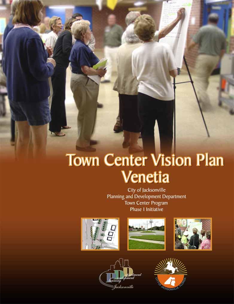
2 Town Center Vision Plan Venetia City of Jacksonville Planning and Development Department Town Center Program Phase I Initiative February 2005
3 Acknowledgments This document was prepared for the City of Jacksonville Planning and Development Department. It was developed through input from dozens of local participants. The development process spanned 7 months, from July 2004 through February We are grateful to the many community members who participated in the neighborhood workshops and contributed their time, energy, and Visions to this report. John Peyton Mayor City of Jacksonville Michael Corrigan District 14 Representative Jacksonville City Council Jeannie Fewell Director Planning and Development Department A special recognition is due JaxPride, a nonprofit coalition for visual enhancement, for their early and ongoing community visioning activities in Jacksonville. Their volunteer efforts have helped raise community awareness about the importance of having a Vision for neighborhood improvement. Jennifer Hewett-Apperson, AICP Town Center Program Project Manager Planning and Development Department Sponsoring Organization Old Ortega Preservation Society Richard Hardin, President Hugh Morris, Venetia lead representative i Thanks is also extended to the Venetia Elementary School staff for graciously hosting the public workshop Sutton Park Drive South Suite 200 Jacksonville, Florida fax Project Consultant This document was prepared by: Prosser Hallock, Inc.
4 Contents 1. Overview Community Vision Focusing the Vision Expanding the Vision Implementing the Vision Maintaining the Vision Final Recommendations Conclusion ii

5 1 Overview What is a town center? The phrase conjures an image of Main Street, of activity and livelihood, of a space that is historic, active, interesting, and inviting. A Town Center can take several forms. It may be an urbanized area, condensed and pedestrian oriented, with commercial enterprises that serve the local community and other amenities such as parks and plazas. Alternatively, it may be a commercial corridor that links several neighborhoods together, serving both vehicles and pedestrians. Because they serve as community hubs, Town Centers should be attractive and wellmaintained. This report represents an effort by the Venetia community to redefine their Town Center with assistance from the City of Jacksonville. To be part of the City s Town Center Program, a Town Center must be at least 30 years old and must have been at one time an established commercial district or corridor at the heart of an existing community or neighborhood. The central Venetia business district is a prime example of a Town Center that continues to support the local community. Despite many changes in development trends, this area has begun a new era of improvement and is in an active growth mode. With a renewed interest in historic preservation and rising real estate values, the Venetia community recognizes the value of preserving and enhancing its historic, central district. This Vision Plan is an effort to restore and improve this Town Center through a community-based initiative and with the help and resources of the City of Jacksonville. Background The City of Jacksonville, through the leadership of City Council member Suzanne Jenkins, developed the Town Center Program as a means of providing support to local organizations for redeveloping areas of town that have served the community and that still retain historic or aesthetic character. The City also recognizes the role these Town Centers can serve as Jacksonville grows: to provide shopping, service, and entertainment alternatives, support small and local businesses, and create meaningful and memorable places that define the City s cultural and economic identity. Older communities want their commercial corridors that are the front doors to their neighborhood to reflect the character of their community It s about the community first coming together because the plan has to be put together by the community not done to them or for them, but done with them. - Suzanne Jenkins, Jacksonville City Council In the spring of 2004, the Old Ortega Preservation Society (Ortega Preservation) applied for and received a grant from the City of Jacksonville for Phase I Visioning as part of the Town Center 1
6 Program. The focus of this Vision is the commercial district located at the intersection of Roosevelt Boulevard (U.S. 17) and Timuquana Road. This district extends several blocks north and south of the intersection and includes a segment of Ortega Boulevard which intersects Roosevelt just north of Timuquana. Once a Phase I Vision is completed, organizations are eligible to apply for Phase II funding which will enable development of construction plans. Phase I recipients, however, are not guaranteed Phase II funding through the program. Phase III applicants seek construction funds to apply toward implementation. The Town Center Program is administered by the City of Jacksonville Planning and Development Department. The Project Team then conducted a series of site visits to walk the area, discuss opportunities and constraints, and record information. After preliminary analysis and information gathering, the Team conducted a public workshop that was carefully organized to allow direct input of the participants at both personal and communal levels. Participants concluded the workshop by prioritizing projects based on estimated cost and desirability. This input, detailed in the next section, allowed the Team to develop plans for Phase II and Phase III implementations, as presented in this report. Mission The mission of this project is to develop a Vision for Venetia that satisfies the needs and desires of the local community while incorporating the realities of cost, conditions, and other constraints. A neighborhood workshop was conducted on October 25, 2004 to gather community ideas and opinions. This Vision Plan report is a direct result of that input. INITIAL PROGRAMMING GOALS & OBJECTIVES SITE VISITS and DATA A COLLECTION PUBLIC WORKSHOPS 2 Planning Process To generate a Vision, the City formed a Project Team composed of staff from the Planning and Development Department, along with professional planners, landscape architects, and engineers from Prosser Hallock, Inc. The Team developed a streamlined process to encourage as much public participation and input as possible. Team leaders initiated the process by meeting with Ortega Preservation representatives to identify key issues in the area. VISION DEVELOPMENT DRAFT REPORT CITY & ORGANIZA GANIZATION REVIEW FINAL VISION PLAN
7 Plan Area The Venetia Town Center is the commercial district surrounding the intersection of Roosevelt Boulevard (US 17) and Timuquana Road. The project area extends south from the intersection to include the Roosevelt Boulevard frontage to where Larry s Giant Subs is currently located. North of the intersection, the project area extends to the Venetia Plaza commercial development. The project area also includes the segment of Ortega Boulevard between Venetia Boulevard and Roosevelt Boulevard. A map depicting the plan area is shown on the following page. Area History Venetia is a part of the greater land development called Ortega, named after an old plantation dating back to the early 1800 s. In 1906, the Ortega Company, owned by J.N.C. Stockton, purchased the 5,000 acre tract. The Ortega bridge was constructed in 1908 and the land platted in Residential development surged during the Florida land boom of the 1920 s. The Venetia subdivision was founded by Colonel Raymond C. Turck, who built Los Cedros, one of the finest mansions in Jacksonville. The original planning and engineering for Venetia was completed by George Washington Simon, Jr. 3

8 e N Not to scale PROJECT AREA 4 US 1 I-95 US 17 I-295 Edgewood Ave. MLK Pkwy I-10 Atlantic Blvd. Beach Blvd. I-95 B. lvd R i r v e JTB N US 21 US 17 J o h n s US 1 Sout d hsi S t Scale in Miles

9 2 Community Vision At the heart of this Visioning process are the comments, concerns, and dreams of the area residents. These are the people who know Venetia best, who live and work in the area, who use the roads and sidewalks, who work to improve local conditions, and who enjoy the use of the neighborhood businesses and community facilities. A realistic Vision for redevelopment and revitalization of this area must include their input. Therefore, the Project Team developed a careful program to gather as much direct input as possible within a short time frame. Background Data Prior to the workshop on October 25, 2004 the Team conducted a site analysis and site visit to confirm significant existing conditions that would likely influence Town Center planning. A background data summary and zoning map are provided at the end of this section. The FDOT maintains jurisdiction over the Roosevelt Boulevard right-of-way and the City of Jacksonville maintain jurisdiction over the Timuquana Road (east of Roosevelt Boulevard) and Ortega Boulevard right-of-ways. There are three improvement projects planned for Venetia that may affect this Town Center vision. Venetia walk-through participants U.S. 17/Timuquana Road Intersection The Better Jacksonville Plan (BJP) calls for improvements to the intersection at Roosevelt (U.S. 17) and Timuquana Road. This is a JTA/BJP project. A new interchange was originally envisioned for this intersection, but an intensive investigation by the JTA will determine what improvements are necessary. The community will also have opportunities to input during the planning and design stages. The following information is provided for this project: Description: The current project description is: reduce congestion and air pollution and improve safety by implementing roadway improvements. During planning, various alternatives will be investigated. Public meetings will be held to involve citizens and to define solutions. Status: Current Activity: The contract with Ayres & Associates has been approved by the JTA Board. Data collection and existing conditions analysis will begin in the fourth quarter of Funding: Program allocation is $25 million. Schedule: Planning work to start in the fourth quarter of Design is scheduled to begin in the first quarter of 2006 and be completed in the fourth quarter of Right-of-way acquisition is scheduled to begin in the first quarter of 2007 and be completed in the fourth quarter of Construction is scheduled to begin in the first quarter of 2008 and be completed in the first quarter of
10 Significant Issues: Traffic maintenance during construction will be a high priority. Coordination with the railroad must be detailed. Contact: Wendy Morrow, (904) wmorrow@jtafla.com While this project is in the early planning phases, workshop participants supported a planning approach for the vision that did not include or anticipate changes to the intersection. Because there is not concrete data to work from at this stage, this Town Center Vision is based upon current conditions. Workshop participants did not favor an interchange with an elevated overpass, which could be a potential option under the intersection improvement project approved by voters as part of the Better Jacksonville Plan. An overpass would dramatically alter the functional and aesthetic qualities of the commercial district, especially if a new structure is oriented east-west, over Roosevelt Boulevard. Workshop participants favored at-grade improvements instead. Venetia Terrace Drainage Improvements The City of Jacksonville has plans to improve the surface drainage conditions within the Venetia community (called Venetia Terrace by the City). The project has already begun and if the proposed schedule is maintained, the drainage improvements will not adversely affect the improvements recommended in Section 3 of this report. Otherwise, this project would need to be coordinated with Phase III construction. Significant project issues are: Project Objective: Provide stormwater flooding relief to the area. Anticipated Timeline: Introductory Design Community Meeting: May 10, % Plans Community Meeting: TBD Pre-Construction Community Meeting: Late 2005 Construction Start Date: Late 2005 Current Situation: The project area has a history of inadequate stormwater drainage capabilities. Existing drainage features include poorly functioning roadside ditches, curb inlets and pipe collection systems. Salerno Road, Rapallo Place, Capri Road, Timuquana Road, Della Robbia Way, Ortega Boulevard, Venetia Boulevard and Roma Avenue comprise the primary collection systems. Project Limits: The 189-acre study area includes those residential parcels located north of Salerno Road South, south of the Venetia Yacht Basin, west of the Timuquana Country Club and east of Ortega Boulevard. Potential Improvements: Install larger sized pipes and upgrade ditches throughout the project area Clean existing structures (i.e., flushing of clogged pipes and inlets, excess vegetation removal from natural drainage ditches, etc.) Pipe the existing ditch along the western side of the Timuquana Country Club Right of Way: Present drainage and right of way easements are adequate for project construction. Temporary construction easements may be needed; this will be determined when the design is further along and will be addressed with each individual property owner should the need arise. Project Budget: $2 million Contact Information: Tom Fallin England-Thims & Miller (904) fallint@etminc.com 6
, former City Council")
11 Roosevelt Boulevard Landscaping Euthenics Studio has generated planting plans for the Roosevelt Boulevard right-of-way between Collins Road and Timuquana Road. The plans were commissioned by Greenscape (a local, nonprofit organization dedicated to enriching the community through planting, protection, and promotion of trees ), former City Council Representative Jim Overton, and concerned citizens and neighborhoods of Roosevelt Boulevard. October 25, 2004 at Venetia Elementary School. The workshop was carefully organized to garner as much input and participation as possible from attendees. The project Team utilized a simple and streamlined approach that enabled small groups to formulate their own creative ideas for improving The plans were prepared according to the FDOT s landscaping requirements and include regularly planted crape myrtles, oleanders, and pampas grass along the east side of the road and crape myrtles and live oaks in the median space. The landscaping will be installed by Greenscape volunteers. It is not clear who will assume maintenance of the new plants. Because of these plans, the project area south of Timuquana Road was not designated for landscaping through the Town Center Program. Contact Information: Greenscape 4401 Emerson Street Suite 3 Jacksonville, Florida (904) info@greenscapeofjacksonville.org Community Vision Workshop Community contributions are the heart of this Visioning effort. The Town Center Program was initiated not only to provide a physical improvement of Jacksonville neighborhoods, but also to help bring the people of each community together and encourage renewed interest, activity, relationships, and organization. A cross-section of 26 business owners and area residents attended the public workshop held on the community. Community Demographics The following census data summary is based on an analysis of census tract 131, block groups 1 and 2. The boundary of this area incorporates all of Venetia as well as the southern portion of Ortega Forest. This sample provides a profile of the community proximate to the Town Center. The total population has remained almost unchanged over the last decade, having decreased by about 3% (from 2,616 in 1990 to 2,542 in 2000). The median age has decreased slightly from 40.0 in 1990 to 39.4 in The minority population has increased from 11.3% in 1990 to 15.6% in 2000 (from 297 in 1990 to 397 in 2000). There were 241 high school graduates and 464 college bachelor degrees recorded in No census data was available for The median home value has increased by about 30% ($80,000 in 1990 to $103,750 in 2000). 7
12 The median year for structures built is The majority of the study area is commercial (CGC-1, CCG-2, and CN) along the corridor and mainly low density residential (RLD-G) in the surrounding community. Venetia Elementary School (PBF-1) is located nearby. Census Conclusions The census data indicates a stable, mature community. Real estate values have not increased as steeply as neighboring Ortega or Avondale, but still reflect the market upswing within the county as a whole. The rise in minority population may reflect some movement from the escalated property values in Riverside, Avondale, and Ortega areas toward more affordable housing in Venetia. As Duval County continues to grow, communities which are historic, stable, affordable, and centrallylocated like Venetia will become increasingly more in demand. The Venetia Town Center serves Venetia as well as Ortega, Ortega Forest, and NAS Jacksonville to the south. It is not only a viable shopping district for the community, but also a potential public gathering place and a contributor to the character and ambience of Venetia. Group Planning Following the workshop introductions, the Project Team directed participants into small groups to begin the process of examining their community and formulating ideas and strategies for improvement. The Team provided plan sheets, aerial photographs, zoning maps, and plenty of pens, markers, scales, tape, tracing paper, and other tools needed to translate group ideas into images. Team members were on hand to help in the translation process, with the goal of developing a graphic Vision that represented group concerns or ideas. After capturing their initial ideas, each group presented their plan or Vision concept to the overall group and responded to questions and comments. Project Team members recorded group ideas by table: Group 1 Add 3rd turn lane to Timuquana Improve alley access Improve bus stops, add shelters Add landscaping along Della Robbia to screen McDonald s Close Garibaldi/Ortega access Add entry markers at Genoa/Della Robbia and Timuquana and Della Robbia Upgrade street name signs Upgrade sidewalks with brick Add bike lanes for Ortega and Timuquana Add walking lanes Group 2 Add tree buffer along Roosevelt in front of commercial shops Add trees in front of gas station at corner of Roosevelt and Timuquana Improve bus stops, add shelters Group 3 Add landscaping in front of shops Add right turn lane to Timuquana Road Implement commercial sign height restrictions Add speed bumps to Della Robbia Add traffic light on Roosevelt at Long Bow Road Add entry marker in island on Roosevelt Create new park at corner of Ortega and 8
13 Venetia Boulevards Group 4 Close off Ortega access to Roosevelt and reclaim space for park Add landscaping and new bus shelter for Della Robbia Proposed overpass should be located at Roosevelt and Collins Road instead of Timuquana Locate overhead electric underground Add landscaping to Timuquana as gateway corridor Group 5 Add Venetia sign near Larry s Giant Subs Install new ornamental lighting Add fountain/feature in Ortega/Roosevelt triangle and at Venetia Boulevard Add statuary or monuments at Della Robbia and Timuquana Improve bus shelters Group 6 Create entry for southbound Ortega Boulevard traffic West side of Timuquana needs improvements too Create a visual theme for Venetia Add landscaping Add trees to buffer parking lots Slow traffic turning from Roosevelt to Ortega Boulevard Need better City upkeep for right-of-way, especially along Della Robbia Group 7 Add speed bumps to slow traffic from Roosevelt onto Timuquana Improve sidewalk and add greenery at Blockbuster store Add period lighting Close Ortega/Roosevelt intersection, make right turn further north Install new clock, sign, or monument in captured space Reduce curb cuts to businesses and encourage them to clean up frontage No overpass needed at Timuquana Group 8 No overpass needed or desired at Timuquana Construct new road through Westside Regional Park to carry NAS Jax traffic around Timuquana intersection Create one-way access into Blockbuster Get City to buy Flash Foods and turn into park Close Roosevelt/Ortega intersection Improve bus stops Landscape around JEA transformer on Ortega Screen exposed dumpsters Install new ornamental lighting, sidewalks, and shrubs Group 9 Add new entry identification Use raised crosswalks to identify 3 main entries Install new 4 way stops and decorative paving, especially at Genoa and Venetia Boulevards Create strong visual pattern along Ortega using new landscaping Create a walking trail around the Venetia 9
.")
14 community Group Prioritizing Once the groups presented their Vision plans, the Team prepared a master list of projects that could be funded through the Town Center Program. Other projects not eligible for funding through the Town Center Program will require funding from other sources identified in this report (see Section 5). Details such as timeline and budget were factored in when determining the priority of each project. Participants prioritized the master list by voting with colored sticky dots. Each participant was given three dots to place next to the projects they desired most, whether all on one project or spread among their top three choices. Once everyone had placed their dots, the most popular projects were visible to the group. The results were discussed for clarification and group consensus. Prioritized Master List 1 Close Ortega Boulevard and Roosevelt Boulevard intersection to slow traffic and reclaim open space for park, entry feature. 2 Install new, decorative crosswalks at major intersections in the community. 3 Install new ornamental light fixtures within the commercial area to identify the Town Center. 4 Add landscaping in front of shopping centers, especially along Roosevelt Boulevard. 5 Install speed bumps on Timuquana Road. 6 Install new traffic signal at Long Bow Road to slow traffic. Replace hanging signals at Roosevelt with decorative type. 7 Install new entry monuments at primary entries into Venetia. 8 Install a fountain or other focal point near the Town Center. 9 Replace street name signs with decorative signs that identify Venetia. 10 Upgrade bus stops with new seating and shelters. 10 From this exercise, the Project Team identified a staging approach that echoed participant desires. The resulting program, described fully in the next section, is a logical sequence that allows for projects important to the community to be designed and built within the funding framework of the Town Center Program. Items 5, 6, and 9 from this list are described in Section 4 along with other projects identified by the community as part of the Vision, but are not Town Center fundable because of their dependence on further study, additional funding, or other program limitations.
15 Project Background Summary The following summary provides general information about the project area considered in establishing the Vision: Project Limits: Roosevelt Boulevard, Ortega Boulevard, Timuquana Road Planning District: Southwest City Council District: 14 City Council District Representative: Michael Corrigan Length of Corridor:.6 miles Corridor Right-of-Way Jurisdiction: FDOT and COJ Width of Right of Way: Roosevelt Boulevard: 260 feet Ortega Boulevard: 100 feet Major Cross Streets: Timuquana Road (Signalized) Genoa Avenue Curb to Curb Road Width: Roosevelt Boulevard: approx. 100 feet Ortega Boulevard (no curb): 20 feet Road Classification: Roosevelt Boulevard: Principal Arterial Ortega Boulevard: Collector Posted Speed Limit: Roosevelt Boulevard: 45 mph Ortega Boulevard: 35 mph Number of Lanes: Roosevelt Boulevard: 6 Ortega Boulevard: 2 Lane Width: Roosevelt Boulevard: 12 feet Ortega Boulevard: 10 feet 2003 Level of Service: Roosevelt Boulevard: D Ortega Boulevard: C Number of Bus Stops: 6 Electrical Service Location: Overhead Historic Buildings and Sites: None Churches along Corridor: None Government Buildings along Corridor: None Public Parks along Corridor: None Typical Sidewalk Material: Concrete Typical Width of Sidewalks: 6 feet Typical Street Light Type: Cobra Head Typical Street Light Spacing: 150 feet 11

16 12
17 3 Focusing the Vision Working within the Town Center Program This section describes the projects selected by the community that support their Vision and that could be funded through the Town Center Program. While funding is not assured because a new application must be submitted and approved for Phase II and Phase III projects, the projects listed in this section meet Town Center funding requirements. Section 4 describes other projects supported by the community as part of the long range Vision that are not eligible for Town Center funding or that are not suitable as a Town Center funded project due to their projected budget or complexity. conceptual nature of this report, the primary purpose of the cost estimate is to allow the community to prioritize projects based on cost in relation to desirability. This gives the projects an added dimension of reality. The projects in this section are listed in order of priority according to the community s responses during the workshops and their understanding of projected costs. This order is intended to guide future decisions in the event full funding is not available, or if the program must be separated into different design or construction phases. Not all of the projects envisioned by the community can be installed within the limited budget of the Town Center Program, a maximum of $828,750 per Town Center applicant at the time of this report. Therefore, this section represents an effort to prioritize those projects supported by the community that can utilize Town Center funds for design and implementation. With community input, the Project Team has also attempted to distribute potential funding among the projects to achieve the maximum visual and functional impact for the given dollars. The following program has been developed with the assumption that full Town Center funds would be available for design and implementation. It has also been developed with the understanding that certain projects might also be eligible for funding through other programs, such as the City of Jacksonville s Tree Mitigation Trust Fund (section 5 describes funding alternatives). The cost estimate found at the end of this section lists the proposed projects and an estimated cost for installation. While reasonably accurate given the Right-of-Way Improvements Town Center funds are limited to public right-ofway improvements. The Project Team s effort focused primarily on improvements within the right-of-way. The FDOT maintains jurisdiction over the right-of-way along Roosevelt Boulevard, and the City of Jacksonville maintains jurisdiction over the other right-of-ways within the project area. Proposed improvements and associated maintenance within these rights-of-way are subject to their final approval. The improvements recommended in this section are typically agreeable to the FDOT, the City of Jacksonville, and other governing bodies, provided they meet established design guidelines and that provisions are made regarding additional maintenance requirements. While Phase II of the Town Center Program will deal with final design and permitting issues, we have attempted, even at this conceptual level, to avoid design approaches that could become contentious or problematic. Section 6 of this report addresses maintenance issues for the 13


18 proposed improvements. The maintenance recommendations may be used to guide final design and, ultimately, to build an acceptable partnership with the City for ongoing maintenance. The projects described in this section were identified as first priority projects that would qualify for Phase II and Phase III funding under the Town Center Program, if those phases are awarded to Venetia. These projects would make a significant, positive impact to the corridor and are right-ofway improvements that could be completed without excessive difficulty. They fit together as a package that meets many of the objectives identified by the workshop participants. Some of these improvements encourage private property enhancements that respond to participant visions for renewal. Most importantly, these improvements are highly visible and fit within the available funding parameters. Other viable projects identified as part of the Vision that fall outside the funding parameters of the Town Center Program are described in Section 4. A graphic plan at the end of this section illustrates the potential locations and dimensions of these improvements. Roosevelt and Ortega Boulevard Intersection Improvement Reconfigure Roosevelt and Ortega Boulevard intersection to change traffic flow and create new civic open space. Workshop participants identified the need to close the intersection of Ortega Boulevard and Roosevelt Boulevard. The primary reason for this action is to reduce the speed and volume of northbound traffic exiting from Roosevelt onto Ortega. Reconfiguring this intersection to create a deceleration lane and dedicated right turn onto Genoa Avenue would slow exiting traffic and would also Existing Ortega and Roosevelt Boulevard intersection create new space within the right-of-way that could be used for meeting another community objective, creating a new park and focal point for Venetia. Participants gave overwhelming support to this project as their first priority. 14 Existing Ortega Boulevard right-of-way conditions Existing Roosevelt Boulevard right-of-way conditions The graphic plan on page 22 illustrates how this improvement project could be implemented in a functional and aesthetically pleasing way. The plan illustrates that space is available to support this improvement and that the road alteration would permit a new and unique open space where the intersection used to be. In this green space, a central feature such as a San Marco entry monument
 aligned with the center of Ortega Boulevard, creating a dramatic terminus that would be visible for hundreds of yards up the road, especially when lit at")

19 tall monument could be constructed that would serve as a Venetia icon. The plan shows this monument (or fountain) aligned with the center of Ortega Boulevard, creating a dramatic terminus that would be visible for hundreds of yards up the road, especially when lit at night. The remaining space could be configured around the monument with decorative paving and lighting, ample seating, and new landscaping. The proposed plan for the intersection was developed without the benefit of a traffic study or detailed survey. These, along with other due diligence measures, will be required in Phase II to support the proposed intersection improvement. A complete study of the intersection to analyze existing and past conditions will be used to developed the plans for the intersection to a construction-level of detail. The FDOT and City will be involved throughout Phase II to ensure compatibility, appropriateness, and safety. The Phase II process will also include measures for additional public involvement, maintenance, and funding. Crosswalks Install new crosswalks at primary intersections within the district. Workshop participants identified the need for more visible and functional pedestrian crosswalks within the project area. New crosswalks should be at least 8 feet wide and constructed with a durable and decorative treatment. The use of colored and textured road pavers or other ornamental paving material is recommended as a key element of intersection improvements. Colored brick or concrete pavers have been Brick paver crosswalk in LaVilla used with success throughout the city. They provide better visual definition of crosswalks and intersections; drivers notice the sound and slight bumps they create when passing over them. At a minimum, they create a more sophisticated and finished look in each intersection. Specific crosswalk surface treatment such as color and pattern will be determined during Phase II development. Crosswalks should be constructed at all intersections, clearly identifying pedestrian crossings. Recommended locations for new decorative crosswalks are shown in the graphic plan. Ornamental Lighting Install new ornamental light fixtures at high-use intersections and focal points. Workshop participants indicated a strong desire to install new, decorative light fixtures within the Town Center district to provide supplemental lighting and improve area aesthetics. The fixture type discussed would be pedestrian-scaled and not intended to replace existing street lights or provide required street lighting. Pedestrian-scale ornamental lights should be installed at primary intersection or where pedestrian use is greatest. They would create a heightened appearance for those locations, as well as provide some additional lighting. A 10 to 12-foot height is appropriate and a spacing of approximately every 20 or 30 feet would focus attention at a lower level, creating a more pedestrian feel. The fixture type that is selected should complement the age and general architecture of the district. Consideration should be given toward maintenance of these lights as well. If a fixture is selected that is not a JEA standard, then the community must assume JEA standard ornamental single globe maintenance of 15
20 those fixtures, including replacement of dead bulbs and damaged poles. The community must also consider collision liability if they assume responsibility for the fixtures. Selective use of pedestrian-scale decorative fixtures would give Venetia a renewed and individual identity within the City. However, Town Center funds are limited and new light fixtures are the most expensive feature identified in the cost estimate. It may not be possible or pragmatic to distribute ornamental fixtures throughout the entire project area. Instead, new lights should be concentrated at intersections and focal points for best visual impact and best distribution of Town Center funding. Final selection of fixture type and specific locations will be determined during Phase II. Nevertheless, the following locations and quantities are offered for guidance and estimating purposes. New open space (20) Timuquana and Roosevelt (6) Ortega Boulevard and Genoa Avenue (6) Timuquana and Della Robbia (6) Bus stops (12) Landscaping Install new landscaping within the project area where possible. Workshop participants identified the need for additional landscaping within the project area to help mitigate objectionable commercial storefronts and parking lots and to create a more consistent and appealing look for the district. New trees along the right-of-way, especially along the storefronts south of Timuquana Road, were cited by the community as a primary consideration. There does not appear to be enough space, however, to support trees in this location. The FDOT requires a setback for trees of at least 4 feet from the edge of the travel lane for restricted (or more urban) roads. Alternatively, ornamental grasses are recommended for available spaces within the clear zone to offer a low-maintenance and more appealing appearance. Section 4 describes how adjacent property owners could install parking islands with trees at regular intervals to better meet community desires. This proposal is also illustrated in the graphic plan at the end of this section. North of Timuquana along Roosevelt, there appears to be more space opposite the sidewalk for small trees. The overhead electric lines and adjacent property lines prohibit large tree plantings in this space. The Ortega Boulevard right-of-way is quite wide (100 feet) in relation to the width of the road (20 feet), offering a superb opportunity for large tree planting. Large trees such as live oaks should be planted at regular intervals along both sides of the road where possible, between Venetia Boulevard and Genoa Avenue (the proposed terminus of Ortega Boulevard). At intersections and within planters, new groundcovers should be installed for added visual interest. Groundcovers should be low-growing and hardy. Sod is recommended where access and visibility are important, and remains the most inexpensive groundcover plant. A turf species such as zoysia or seaside paspalum would be more attractive and hardier than St. Augustine. For more decorative applications and where irrigation and maintenance are assured, species such as liriope, juniper, and coontie palm have proven to be good commercial choices. Flowering annuals and perennials should be coordinated by Ortega Preservation for a consistent look and upkeep. Flowering plants should be located where they are most visible, such as at intersections. Irrigation is strongly recommended where annual plants are proposed. The graphic plan at the end of this section shows possible locations for new landscape elements and Table 1 below offers recommendations for plant types and spacing. Final plant species selection and locations will be determined during the Phase II process. 16
 Where roadside space is less than 6 feet between curbs or sidewalks, or less than 12 feet between median curb faces: Cord grass (Spartina bakerii) As")
21 Landscape Species and Spacing: Where space between the face of median curbs is 12 feet or greater: Live oak (Quercus virginiana) Where space between the back of curb and the sidewalks is 6 to 8 feet: Foster holly tree (Ilex X attenuata Foster #2 ) Where roadside space is less than 6 feet between curbs or sidewalks, or less than 12 feet between median curb faces: Cord grass (Spartina bakerii) As an additional measure of identification, a new paving treatment matching the Venetia crosswalks should be installed across Ortega Boulevard near the Pirate s Cove crossing. A decorative railing structure could also be installed which, along with the pavement change, would simulate a bridge, reinforcing the boundary between Ortega and Venetia. Entry monuments should have an affixed sign face, preferably metal, that announces the entry to the Venetia Town Center. Each sign also could include other information, such as a new logo, area history, or community leaders. Monuments should be externally lighted for night visibility. Recommended Spacing: Live oak: 40 feet, on center Small tree: 20 feet, on center Cord grass: 2 feet, on center Entry Monuments Install new entry monuments at primary entrances to Venetia Workshop participants identified a strong desire to better identify the Venetia Town Center. New entry monuments were proposed at the intersection of Timuquana Road and Della Robbia and on Ortega Boulevard just south of the Pirates Cove crossing. Both of these locations would help identify the two primary entry points into Venetia. Participants selected nearby entry monuments located at the corner of Ortega Boulevard and Yacht Club Road as prime examples from which to base new Venetia monuments. A similar, if not exact, replica of the originals would serve as an appropriate and attractive feature, while serving to visually associate Venetia and Ortega. Ample space is available within the right-of-way at the proposed locations to construct entry monuments of this type. Historic entry monuments at Ortega Boulevard and Yacht Club Road Bus Shelters Install new bus shelters New bus shelters should be installed at the highest-use bus stops within the district and where space allows. New bus shelters would enhance district aesthetics and encourage use of public transit. New shelters should be selected or designed to harmonize with the historic quality of the surrounding buildings and perhaps utilize an appropriate architectural or historic theme. The graphic plan at the end of this section identifies recommended locations for new bus shelters. Final design and location of these structures will occur during Phase II. 17


22 Existing, decorative bus shelter in San Marco Street Furniture Install new benches and trash receptacles within the district in appropriate locations and as space allows. Workshop participants indicated a desire for new outdoor seating and trash receptacles within the commercial district, especially at pedestrian activity nodes, that would replace mismatched and aging pieces. Participants indicated a preference for durable and attractive types similar to the ones pictured on the following page. Typical street furniture appropriate for Avondale A cost for 30 benches and trash receptacles is provided in the cost estimate. All old benches and trash receptacles should be removed and new benches and trash receptacles installed near each intersection and at each bus stop where space allows. Where new bump-outs are installed, benches should be located in the available space. Specific street furniture types, colors, and locations will be identified during the Phase II design process. Irrigation Supplemental irrigation for the plants specified in this report is recommended but is not critical to their success. The recommended plant species are hardy and well suited to the harsh urban environments typical of this corridor. Once established, ordinarily a one-year process, these plants will live without supplemental irrigation. Nonetheless, workshop participants expressed a desire to irrigate landscape improvements, and this improvement project is included as part of the overall vision. The cost estimate provides a broad estimate for an automated irrigation system for the plants recommended in this section. The Department of Public Works will provide final requirements, designs, and feasibility of irrigation systems as a part of Phases II and III. In every circumstance, maintenance responsibility for an automated irrigation system must be resolved prior to completion of Phase II plans. Cost Estimate The Project Team prepared a cost estimate for the projects described in this section. It is based upon current construction trends and material and labor costs. It is also based upon a conceptual plan. Dimensions and takeoffs are averages and based upon some assumptions. This estimate must be accepted as such and not be interpreted as absolute. A more accurate budget will be developed during the Phase II construction plan development. An effort has been made to give the sponsoring association the widest range of options in Phase II by providing the costs for individual components of a project. A note on methodology: Each project was broken into its major components and calculated with fixed unit costs representative of current construction averages. Unit costs include labor and installation hardware. Quantities were taken from the plan shown at the end of this section. All totals include a 15 percent contingency to allow for non-included and unforeseen costs, such as mobilization, permitting, and buried hazards. 18
23 Cost Estimate Venetia Town Center Maximum Construction Budget: $828,000 Project Type Quantity Unit Unit Cost Sub- Total Ortega/Roosevelt Intersection Improvements $301, Traffic study 1 LS $15, $15, Pavement removal 466 SY $20.00 $9, New asphalt pavement 2,000 SY $20.00 $40, Concrete curbing 500 LF $15.00 $7, Pavement marking and signs 1 LS $5, $5, New sidewalk paving 4,703 SF $11.00 $51, Small trees 25 EA $ $6, Tree grates 10 EA $ $2, Sod 15,000 SF $0.45 $6, Benches/ trash receptacles 15 EA $1, $18, New central fountain or monument 1 EA $100, $100, Contingency 15% $39, New Crosswalks $58, Decorative Crosswalks 635 LF $80.00 $50, Contingency 15% $7, Ornamental Lighting $258, Ornamental light with post 50 EA $4, $225, Contingency 15% $33, Roadside Landscaping $121, Shade trees 102 EA $ $76, Small trees 43 EA $ $10, Shrubs and Groundcovers 4,000 SF $4.00 $16, Sod 5,000 SF $0.45 $2, Contingency 15% New Entry Features $15, $46, Entry monuments (Timuquana Road) 2 EA $20, $40, Contingency 15% New Bus shelters $6, $34, New bus shelters 3 EA $10, $30, Contingency 15% Street Furniture $4, $46, Benches 20 EA $1, $24, Trash Receptacles 20 EA $ $16, Contingency 15% Irrigation $6, $113, Trees 170 EA $ $51, Sod and Groundcovers 24,000 SF $2.00 $48, Contingency 15% $14, Subtotal $980, Tree Mitigation Reimbursables $158, Trees $87, Irrigation $51, Contingency 15% $20, Total Estimate $821,218.45
24 N Page 2 Page 1 R o o s e v e l t B l v d. ( U.S. 17 ) Encourage private improvement of shopping center with new landscaping Winn-Dixie 20 New bus shelter Larry s Giant Subs Venetia Town Center CONCEPT PLAN Page One 0 50' 100' Scale in Feet

25 N Page 3 Page 2 Install new decorative crosswalks at primary intersections Gas Station Install new landscaped median Della l Rob b ia Way Install new bus shelter Install new Venetia entry monuments T imucu u ana a B lvd. Install new bus shelter Remove parking and expand sidewalk with new ornamental lighting and street trees Blockbuster Video 21 Install new decorative crosswalks at primary intersections Encourage private improvement of shopping center with new landscaping and outdoor seating R o o s e v e l t B l v d. ( U.S. 17 ) Venetia Town Center CONCEPT PLAN Page Two Page 2 Page ' 100' Scale in Feet

26 G e n o a A v e. Page 4 Page 3 N Install new street trees, east side of street where space allows R o o s e v e l t B l v d. ( U.S. 17 ) O r t e g a B l v d. Install new street trees, along both sides of street where space allows Use reclaimed space for new green space and Venetia monument Install new decorative crosswalks at primary intersections 22 Close intersection and add new turn lane Install new ornamental lights in high visibility areas Venetia Town Center CONCEPT PLAN Page Three Page 3 Page 2 Clean out existing understory and install new street trees along wall where space allows Della Robbia Way 0 50' 100' Scale in Feet
 RPM Automotive O r t e g a B l v d.")
27 N Pirates Cove Install new textured and colored paving to simulate bridge Venetia Plaza Install new Venetia entry monuments Install new street trees, east side of street where space allows Venetia Blvd. Pizza Hut R o o s e v e l t B l v d. ( U.S.17) RPM Automotive O r t e g a B l v d. Install new street trees, both sides of street where space allows 23 Venetia Town Center CONCEPT PLAN Page Four Page 4 Page ' 100' Scale in Feet

28 4 Expanding the Vision Non-Town Center Program Projects The following projects and improvements are listed outside of the primary group because of their dependency on outside elements, budget constraints, or unknown variables. They are important projects that were identified and discussed in the workshops, and they should continue to be considered for coordination, funding, design, and implementation. If political and financial support is found for some or all of these projects, they could be designed and installed at the same time as the primary projects described in Section 3. Alternative and supplemental funding options are listed in Section 5 to give Ortega Preservation and the community alternatives. Overhead Utilities Workshop participants unanimously agreed that locating overhead utilities underground would improve the aesthetics of the corridor. Aging utility poles could be removed, sidewalk space expanded, ugly wires buried from sight, and trees would no longer require severe pruning. As mentioned previously, however, this is an expensive process when not coupled with other infrastructure improvements, costing roughly $1 million per mile. Overhead electric lines in the Venetia Town Center JEA, as the electrical utility provider, has indicated in word and practice a desire to locate their wires underground, and this is their general preference with new development. Burying existing wires in an older neighborhood, however, presents major challenges. The technology exists to jack and bore the wires underground without disturbing the surface, but is a costly procedure. Additionally, other service providers that share the overhead lines with JEA (telephone and cable) must also agree with this direction for it to occur. It is not clear who would be responsible for paying for this service; no one party feels they should assume the full cost. In other areas of town, JEA has participated in burying their overhead lines when major road or utility work has occurred. Repair or replacement of existing underground utilities, like storm sewers or water lines, are prime examples of projects that require major roadway construction ideal for relocating utilities underground. As stated before, the most likely scenario for procuring underground corridor utilities would be during the planning stage of the next major roadway construction. Placing utilities underground is a very effective way to improve aesthetic conditions along roadways and is included as part of the long-term vision for Venetia. Speed Bumps Workshop participants placed speed bumps within the district, especially at Timuquana Road, as their fifth most desirable project. This project represents a drastic measure to reduce traffic speeds through the residential portions of the community. Because participants were clear in the location of speed bumps outside the commercial area, this project is listed as a future vision. 24


29 Implementation of speed bumps would require further study through the Public Works Department to determine their real need and specific design and location. Ideally, the district improvements recommended in Section 3 will provide traffic calming measures, eliminating the need for speed bumps. Ortega Preservation should adopt a wait-and-see position until Phase III implementation is complete. If traffic rates are not reduced after that effort, then Ortega Preservation should proceed with coordinating speed bumps through the Public Works Department. Traffic Signals Workshop participants ranked the creation of a new signalized intersection at Long Bow Road sixth on their list of Town Center improvement priorities. Because this intersection is outside of the direct Town Center area and because a traffic study would be required to support this proposal, the project is located in this section, outside of the Town Center funded program. Single mast arm signal type in Deerwood To satisfy the community s desire for improved signalization, Ortega Preservation should coordinate with the FDOT a more detailed study of the intersection. If new signals are warranted, single mast arm types should be used as a more decorative and visible feature within the community. Perhaps at that time, the hanging signals at the intersection with Timuquana could also be upgraded to a single mast arm type. Unique Street Name Signs Workshop participants desired to upgrade the street name signs within Venetia to a different color or type as a means of creating a stronger community identity. Riverside Avondale Preservation, Inc. (RAP) undertook a similar program several years ago which resulted in a new, approved street name sign for the district. However, the cost for removal of the old signs and installation of each new sign fell solely on RAP. Venetia faces two obstacles in taking a similar direction. The city and/or the FDOT would have to approve a new, unique sign color or design for Venetia if the RAP sign (or other pre-approved sign) is not desired. The Venetia community would have to pay for and maintain nonstandard street name signs. Because of these variables and because this is a community-wide vision project not limited to the Town Center, the project is located in this section, outside of the Town Center funded program. Dedicated Right Turn Lane for Timuquana Road Several workshop groups noted the need to add a dedicated right-turn lane on Timuquana Road at Roosevelt Boulevard for westbound traffic turning north. There are two westbound travel lanes. However, the south lane is a left-only lane, and the right lane is marked for both through traffic and right-turning traffic. Residents noted that this arrangement causes significant backup at the light that could be relieved with a right-turn lane. Space is available within the right-of-way for a new turn lane, but this would require encroachment into the existing sidewalks or parking areas on either side of the intersection. More significantly, a traffic study is required to determine the need for this improvement in measurable terms. The proposed median at this intersection, which is shown in the graphic Timuquana and Roosevelt intersection existing conditions 25
30 plan in Section 3, is instead a first measure toward answering community concerns. A new median would be less disruptive to the existing conditions and would introduce needed green space to the location. For these reasons, an additional turn lane is a viable Town Center project but is considered a future project requiring further study and additional funding. Neighborhood Park In addition to the civic space created with the closure of the Ortega and Roosevelt Boulevard intersection as proposed in Section 3, the Venetia community identified the need for a neighborhood park. Workshop participants selected a vacant parcel of land which could be purchased by the city (or other viable entity) for use as a community park with a playground and other recreational opportunities. The vacant parcel is located on the east side of Ortega Boulevard and bordering Pirate s Cove. This parcel is zoned RLD-G and appears to be unimproved. The City s tax records indicate the property s land value at $55,000. Ortega Preservation should initiate a dialogue between the City of Jacksonville s Parks and Recreation Department, the district City Council representatives, and perhaps the property owner, to investigate the viability of this parcel as a future park. If this parcel proves unsuitable, Ortega Preservation should continue to locate another parcel within the community that could serve as a neighborhood park. Private Property Building Improvements In addition to projects within the right-of-way but outside the Town Center funding parameters, opportunities exist for private property owners to make improvements that would complement the recommended projects. Buildings are one of the primary elements defining the Town Center corridor. Their architectural style, history, arrangement, and use create a sense of place more than any other single corridor feature. Buildings older than 40 or 50 years (from the date of this report) were built in an era when raw materials, especially lumber, were of a much higher quality. Craftsmanship had a higher social value at that time, and attention to form and detail was important. Location of these buildings is also significant; they typically were built with storefronts facing the primary road and close to the right-of-way. This placement contrasts with development trends that evolved with the automobile and shifted priorities toward parking convenience, resulting in buildings being pushed toward rears of lots. The placement of buildings close to the road is a visually defining element that is desirable from a pedestrian point of view. Buildings from the older era are visually apparent and an immediate indicator of a historic place. Older buildings are usually worth preserving and renovating, especially in a historic district. Preservation and renovation can be tedious and expensive however, which is why old buildings are often forsaken for new construction. In addition, current building codes are written with new development in mind and can complicate or limit the process of renovation. Still, if a viable Town Center is sought, these difficulties must be overcome through encouragement programs that ease financial and permitting burdens. The following recommendations are among the most important for creating an appealing Town Center: Awnings for commercial storefronts that abut the right-of-way. Building awnings add visual interest as well as much needed shelter from the elements, especially at building entrances. Awnings that project from the building facade are preferable over ones that hang vertically. Awnings should extend a minimum of 4 feet to provide adequate shelter for pedestrians. Restoration of storefront windows. Traditional storefront windows should be preserved, and alteration with metal frames or excessive paint should be avoided. 26
31 Removal of burglar bars on windows. Invisible security measures, such as automated electrical systems, should be implemented in place of metal window burglar bars that are visually unappealing and promote the perception that crime is a problem in the area. Traditional door replacement. Traditional building doors are wood with possibly a glass insert. Replacement doors, if made of modern materials such as metal or fiberglass, should be manufactured to appear historically correct or at least in keeping with the prevailing historic theme. Do not paint exposed brick. Many of the storefronts along the corridor are unpainted brick. They should remain unpainted to preserve the original appearance. Painting of brick is most often irreversible and should be avoided whenever possible. Dilapidated buildings should be demolished. Dumpsters and trash containers should be screened from public view. 27
32 5 Implementing the Vision The previous two sections describe many projects that make up the overall Vision for Venetia. Those projects described in Section 3 qualify for Phase II funding* and fit within the established budget. At least some of the Vision elements could be realized within a relatively short time, probably 2 to 4 years from the date of this report. Nevertheless, these measures alone are not enough to ensure that Venetia will grow into the energetic, pedestrian-oriented community envisioned by the workshop participants. Several implementation measures remain to be considered by Ortega Preservation and the community. Fortunately, a model exists that provides an established framework on which Ortega Preservation could base their own Town Center initiative. The Florida Main Street Approach The Town Center corridor that is the heart of Venetia functions similarly to a small town Main Street. The Florida Main Street program provides a helpful model for developing implementation strategies. Florida Main Street is a program of the Department of State, Division of Historical Resources, Bureau of Historic Preservation. The program provides training and technical assistance to local Florida Main Street programs in accordance with the National Main Street Center Four Point Approach and with assistance from the Nation Main Street Center. * Funding for Phase II and Phase III requires a separate application and approval process through the Planning and Development Department. Satisfactory completion of Phase I Visioning does not guarantee funding for Phase II and Phase III of the Town Center Program. Design improvements alone will not bring about meaningful change; effective marketing, a strong organizational base and solid economic development strategies are all necessary to reverse the cycle of decay from which many downtowns suffer and to sustain preservation activity. (Florida Main Street) Organization Organization means building consensus and cooperation among the groups that play roles in downtown. Many individuals have a stake in the economic viability of the downtown, including: bankers, property owners, city and county officials, merchants, downtown residents, professionals, chamber of commerce representatives, local industries, civic groups, historic societies, schools, consumers, real estate agents, and local media. (Florida Main Street) Form a Steering Committee Organization is at the heart of Main Street success. Main Street programs always have a dedicated manager. Often this is a full-time paid position. Ortega Preservation, the Phase I sponsor, is already a dedicated organization. To ensure that needs specific to this Vision are met, however, a Town Center steering committee should be formed that is dedicated to overseeing its implementation. The steering committee would be responsible for enacting the other three points of the program. Design Design involves improving the downtown s image by enhancing its physical appearance not just the appearance of buildings, but also that of street lights, window displays, parking areas, signs, sidewalks, promotional materials and all other elements that convey a visual message about the downtown and what it has to offer. (Florida Main Street) 28
33 Of the four points, design is the one most frequently addressed in this report. Through this study and its subsequent Town Center phases, major design initiatives will be implemented. Other important issues however, remain to be addressed. Develop a Logo Ortega Preservation should commission a design competition or hire a professional graphic designer to create a new logo for Venetia. The logo should be simple and recognizable, ideally incorporating some visual element of Venetia that best embodies the Town Center. The logo should be used by Ortega Preservation on all marketing materials. While initially useful for promoting the Town Center, a successful logo also will help strengthen the entire community s identity. Develop a Handout Ortega Preservation should design a handout dedicated to the Venetia Town Center that outlines Vision goals and progress to date and solicits involvement and input. This handout could be distributed by members of Ortega Preservation and local merchants and offices. Form a Subcommittee Dedicated to Future Programming Projects listed in Section 4 are not funded under the City s Town Center Program. A Town Center subcommittee should be formed to be responsible for coordination with Parks and Recreation, City Council representatives, the Planning and Development Department, area business representatives, and other stakeholders affected by the proposed projects. Additionally, this subcommittee should identify alternative funding sources to create more development options. through retail promotional activity, special events and ongoing programs. Create a New Event. Regular events are an excellent means of generating interest and activity for a Town Center. Ortega Preservation should create at least one new event that is unique to the area that would attract local residents as well as people from around the city. Nearby Avondale has had good success with new events such as Dancing in the Streets of Avondale. Events such as these not only promote the Town Center, but help support local merchants and encourage their participation. Economic Restructuring Economic restructuring means strengthening the existing economic base of the downtown while diversifying it. Economic restructuring activities include helping existing downtown businesses expand, recruiting new businesses to provide a balanced mix, converting unused space into productive property and sharpening the competitiveness of downtown merchants. By strengthening the downtown s economy, communities are able to support the ongoing use of historic commercial buildings, preserving unique community assets. (Florida Main Street) Conduct a Market Study A market study would examine in detail the economic and demographic conditions specific to Venetia. Initial efforts might include identifying sources of funding to pay for a professional analysis. Alternatively, Ortega Preservation could conduct their own market study (using volunteers to research available data) and draw conclusions regarding the current and potential conditions of the environment. In either case, this would be a significant first effort toward economic restructuring, lending the necessary information to make informed decisions. 29 Promotion Promotion involves marketing the area s unique characteristics to shoppers, investors, new businesses, residents, tourists, and others. Effective promotion creates a positive image for the area
34 Town Center Program Phase II On completion of this report, the Venetia community is eligible to apply for Phase II funding through the City s Town Center Program. Ortega Preservation, as the Phase I sponsor, is the logical choice to make the Phase II application. The types of improvements found in Section 3 of this report and their estimated costs can serve as the guide for the Phase II application. Phase II will continue development of the Vision, generally resulting in construction plans and a final cost estimate. Additional community input to refine the plan is also a part of the Phase II process. Phase II will require continued coordination by Ortega Preservation and the community with area stakeholders, District Council representatives, the City, and other affected agencies such as JEA and JTA. Other Funding Opportunities Several funding opportunities could be used by Ortega Preservation (or other viable party) to help implement the Future Projects described earlier in Section 4. The following list is meant to be a starting point. Numerous other opportunities exist and may provide the best fit for implementing one or more of these projects. City of Jacksonville The following City programs are accessible but often competitive, requiring the sponsoring agent to be organized and persistent, as recommended earlier. Nevertheless, the projects outlined in this report as community building initiatives are ideal candidates for funding from many of these sources. The following list is meant to be a starting point as other opportunities exist and may provide a better fit for implementing one or more of these projects. Small Business Development Initiative Program This program is aimed at small and start-up businesses, providing low interest loans to qualified applicants for up to 30% of the project cost, not to exceed $250,000. Mayor s Neighborhood Matching Grants Program The Mayor s Neighborhood Matching Grants (MNMG) Program makes awards of up to $5,000 to specific neighborhood projects that build relationships and enhance the physical attractiveness of a community. As part of the city s continuing efforts to improve and strengthen Jacksonville neighborhoods, the Mayor proposed and the City Council approved an appropriation of $250,000 for the Fiscal Year budget cycle. Any neighborhood association, civic organization or community group that has been in existence for at least six months and is located in Duval County was eligible to submit an application. This year more than 50 eligible applications were received. Each project is being evaluated on the basis of how well it addresses the program s main purpose of improving the physical appearance of neighborhoods. ( The Matching Grant Program offers neighborhood organizations the opportunity to initiate and implement smaller scale projects and manage the projects themselves. This program may offer opportunities to develop some of the smaller projects identified in this report or pieces of larger ones. Information about the program can be obtained at or on-line at Historic Properties In November 1992, the State of Florida authorized local governments to provide a partial tax exemption on historic properties. The City of Jacksonville approved an ad valorem tax exemption for locally designated properties that undergo a substantial rehabilitation. ( 30
35 To be eligible for Historic Property benefits, the property or area must have a historic designation. Properties can seek landmark status at the local level or apply for a listing on the National Register of Historic Properties through the Trust for Historic Preservation. Venetia is not part of an established historic district; therefore, each building or property would apply individually. Tree Protection and Related Expenses Trust Fund The Jacksonville City Council approved the creation of the Tree Protection and Related Expenses Trust Fund to provide for the establishment and care of new trees within the public rightof-way. These new trees would help mitigate the loss of protected trees (as defined by the Jacksonville Ordinance Code) throughout the county. Contributions to the fund come primarily from property owners that remove protected trees from their property and elect to pay for them (at $107 per caliper inch for 2004) instead of replacing them with new trees that meet code requirements. Property owners include both private and public entities, with the exception of the FDOT which is exempt statewide from local ordinance requirements. The new trees proposed in this report are located in the right-of-way and may be eligible for funding through the Tree Protection and Related Expenses Trust Fund. State of Florida The following resources and contact information are listed for potential state funding and assistance. Florida Department of Transportation The current Transportation Enhancement Program (TEP) provides enhancement funds for improvements that are recommended in this report as well as other improvements not specifically addressed, such as provisions for bike lanes. ISTEA Enhancement Program Transportation enhancement projects, including bike and pedestrian trails. Robert Crimm (850) Suwannee Street Tallahassee, Florida The Transportation Enhancement Program (TEP) is a federal program administered by the Florida Department of Transportation (FDOT). TEP guidance and direction are provided by the Environmental Management Office, whereas the selection and implementation of most enhancement projects are handled by the FDOT District Offices with input from Metropolitan Planning Organizations or County Commissions. Funding for transportation enhancement projects is provided by the Federal Highway Administration (FHWA) through the Federal Transportation Equity Act for the 21st Century (TEA-21). This funding is intended for projects or features that go beyond what has been customarily provided with transportation improvements. This program is for projects that are related to the transportation system but are beyond what is required through normal mitigation or routinely provided features is transportation improvements. TEP is not a grant program, rather projects are undertaken by project sponsors, and eligible costs are reimbursed. TEP Activities Defined - 1. Provision of facilities for pedestrians and bicycles. 2. Provision of safety and educational activities for pedestrians and bicyclists. 3. Acquisition of scenic easements and scenic or historic sites. 4. Scenic or historic highway programs (including the provision of tourist and welcome center facilities). 5. Landscaping and other scenic beautification. 6. Historic preservation. 7. Rehabilitation and operation of historic transportation buildings, structures, or facilities (including historic railroad facilities and canals). 8. Preservation of abandoned railway corridors (including the conversion and use thereof for pedestrian or bicycle trails). 31
36 9. Control and removal of outdoor advertising. 10. Archaeological planning and research. 11. Environmental mitigation to address water pollution due to highway runoff or reduce vehicle-caused wildlife mortality while maintaining habitat connectivity. 12. Establishment of transportation museums. ( Florida Communities Trust (Department of Community Affairs) This program could provide another funding mechanism to acquire land for the proposed parks described in Section 4. Florida Communities Trust (FCT) is a state land acquisition grant program housed at the Florida Department of Community Affairs. FCT provides funding to local governments and eligible nonprofit environmental organizations for acquisition of community-based parks, open space and greenways that further outdoor recreation and natural resource protection needs identified in local government comprehensive plans. ( Janice Browning (850) Shumard Oak Boulevard Tallahassee, Florida State Historic Preservation Grants-in-Aid Program (Department of State) Historic and archaeological site identification, preservation, restoration and education. Fred Gaske (850) South Bronough Street Tallahassee, Florida Cultural Facilities Program (Department of State) Funding for acquisition, construction and renovation of cultural facilities. Don Blancett (850) DeSoto Park Tallahassee, Florida Challenge Grant Program (Department of State) Funding to support unique or innovative cultural projects. Dr. Gaylen Phillips (850) DeSoto Park Tallahassee, Florida Historical Museums Grants-In-Aid Program (Department of State) Development of exhibits on Florida history. David Gregory (850) The Old Capitol, Room B South Monroe Street Tallahassee, Florida

37 6 Maintaining the Vision Maintenance is a significant issue deter mining the success or failure of proposed improvements, whether on public or private land. Maintenance represents care, and the care of a place is visually apparent even from a fast-moving car. The degree of care offered to a place, whether a building or a landscape, is usually a factor of time and money, but also depends greatly on varying attitudes about what is visually acceptable to a community. The broad design measures recommended in this report are prepared with the benefit of training and expertise. The use of certain materials and their arrangement will create a more ordered and appealing environment, even with minimal ongoing maintenance. Where a more manicured appearance is desired, an additional level of maintenance will be required. The recommendations in this section are aimed at providing the necessary coordination and practice to achieve a higher quality appearance and longer lasting product for the proposed corridor improvements. Partnerships With regard to public right-of-ways, the immediate solution for elevated maintenance is the creation of partnerships. Partnerships between public and private entities allow for a win-win situation. Public agencies aim to please the community while maintaining a budget; private entities desire a higher degree of control over the look and upkeep of their shared environment. In many partnerships, all or a percentage of the public maintenance budget is allotted to the private entity for maintenance purposes under a contract clearly stating minimum requirements. In some cases, the established public budget is adequate to Roadside maintenance in Deerwood, a public/private partnership fund the desired maintenance when supplemented with volunteer labor, donations, and other resources not available to the public entity. The FDOT is the public agency that maintains jurisdiction over the right-of-way along Roosevelt Boulevard, and the City of Jacksonville maintains jurisdiction over the Ortega Boulevard, Timuquana Road, and other local roads in the Venetia community. To move this Vision forward, Ortega Preservation must coordinate the implementation goals of this plan with the City. To achieve a consistency in maintenance along the entire corridor, a contract may be required between all public agencies, the residents, and the businesses Landscaping Landscape plants are one of the most visible clues to the degree of maintenance an area or place undertakes. Basic landscape maintenance is relatively inexpensive when compared to the cost of roadway, infrastructure, utility, building, or other maintenance efforts. Typical landscape routines for public sector entities are limited to regular mowing with occasional edging and trimming. 33
38 Extended Maintenance Period The critical maintenance period for landscape plants is the first year following installation. Typical City of Jacksonville landscape contracts require a 90-day maintenance period. This is not long enough to ensure proper plant establishment. The duration of maintenance through the establishment period is further necessitated when there is no automated irrigation system, and this plan has been developed to not be reliant upon such a system. Therefore, installation contracts should include an extended maintenance program for a minimum of one year to allow proper establishment of new plants. General Maintenance Practices General maintenance practices should conform to industry standards. While the plants recommended in this report are hardy and should do well with little attention once established, they will grow faster, be healthier, and be more attractive with regular attendance. Plants should be fertilized according to their specific need. Plants should be inspected annually for pests or disease, and pesticides should be applied as needed to infested or diseased plants. Pruning should be accomplished only by licensed personnel and according to ANSI A-300 pruning standards. Pruning should only be performed to remove dead or low-hanging branches. Crape myrtles especially should not be cut back severely from the top but instead allowed to achieve a natural, small tree form. Weeds should be removed at least twice per year during establishment, and after shrubs and ground covers have been established, on an as-needed basis. To limit weed intrusion, an annual application of mulch and pre-emergent herbicide is recommended for all planting beds. Pine straw and pine bark are recommended mulch selections. Cypress bark should be avoided as it is a nonrenewable resource and artificially colored mulches avoided due to their unnatural appearance. Sidewalks, Crosswalks, and Seating Areas Paved areas outside of the roadway itself need to be inspected annually for cracking, settlement, and other conditions that pose a hazard to pedestrians. Weeds that appear in cracks and spaces should be spot-treated with herbicide as needed. Light Posts and Signal Posts Light and signal posts should be inspected annually and damage should be reported to JEA. Repainting should occur when fading or peeling is visible. Buildings Older buildings require continual maintenance. Facade treatments, storefronts, and street-facing, publicly visible features are the primary areas of concern in this report. Exposed wood materials should be painted, stained, or treated to maintain the quality of the wood and a well-kept appearance. Jacksonville s climatic conditions necessitate repainting on a five-year average. Faded or torn awnings, or other cloth or plastic material mounted to the facade, should be replaced with new material. Property owners should keep their sidewalks in good repair and free of litter and debris. Graffiti should be removed immediately from sidewalks or building walls. Graffiti that lingers signals to residents and vandals that the neighborhood does not care, while prompt removal has the opposite effect. 34
39 7 Final Recommendations As a final measure of ensuring the ongoing realization of the Venetia Town Center Vision, some recommendations are offered to address other issues discussed by the group. Overlay District During the workshops, participants discussed the value of creating an overlay district for all or part of the Venetia area. An overlay district would allow Venetia property owners to develop written guidelines specific to the neighborhood that are geared toward protection and promotion of its valuable assets. Guidelines would give greater understanding, form, and direction to renovation and development efforts. Establishment of a district could also give an added measure of protection to historic properties. Initially, there are two primary areas of concern discussed in the workshops: commercial signs and commercial building renovation. Commercial Signs Signs along the corridor including commercial signs and transportation signs have significant visual impact. Because transportation signs must maintain universality for effectiveness, the commercial signs along the corridor should be the primary focus. As part of the overlay guidelines, Ortega Preservation should develop sign guidelines that are specific to Venetia. Sign guidelines will aid new businesses attracted to the Town Center through this initiative by developing a consistent approach. Guidelines also will aid existing business owners in communicating the long-term objectives of the program and, while not obligating them to change or replace their current signs, will at least inform them of the Vision. Sign attributes such as size, location, height, color, shape, and material should be considered. Architectural Guidelines As with sign guidelines, Ortega Preservation should create architectural guidelines for the overlay district, specific to the needs and Vision of the Venetia Town Center. Such guidelines would assist business owners in providing renovation standards, while boosting investor confidence in the strength of local commitment to the Town Center Program. As the most visible and public aspect of commercial buildings, architectural guidelines should initially address facade improvements. General guidelines for facade improvements are offered in Sections 4 and 6, but additional measures specific to the district should be developed. CPTED CPTED is the acronym for Crime Prevention Through Environmental Design. CPTED is defined as the proper design and effective use of the built environment that can lead to a reduction in the fear and incidence of crime and an improvement in the quality of life. CPTED addresses crime problems through controlling the environment. CPTED is based on these three overlapping strategies: 1. Natural Surveillance - The placement and design or physical features to maximize visibility. This includes building orientation, windows, entrances and exits, parking lots, walkways, guard gates, landscape trees and shrubs, fences or walls, signage and any other physical obstruction. 35
40 2. Natural Access Control - The use of sidewalks, pavement, lighting and landscaping to clearly guide the public to and from entrances and exits. Also, the use of fences, walls or landscaping to prevent and/or discourage public access to or from dark and/or unmonitored areas. 3. Territorial Reinforcement - The use of pavement treatments, landscaping, art, signage, screening and fences to define and outline ownership or property. Program Goals The goal of CPTED is to reduce opportunities for crime that may be inherent in the design of structures or in the design of neighborhoods. The goal is accomplished through the involvement of CPTED trained law enforcement officers in the planning, development, and design review of community projects. How does CPTED impact me? CPTED impacts each citizen by increasing safety, promoting secure environments and improving the appearance of neighborhoods and public amenities. CPTED improves existing services by working with neighborhoods, businesses, community groups and law enforcement. ( Called septed, this City of Jacksonville Sheriff s Office (JSO) program helps communities identify crime-causing elements in the environment and solutions to rectify them. The JSO has designated specially trained officers to communicate this process to the community and to find solutions specific to the area. Many of their observations are intriguing and escape notice by the layperson. Small changes to the environment can make big differences in reducing crime. Ortega Preservation should take advantage of this free service and coordinate a CPTED survey through the JSO. Officer Laurie Dill (904) JSO Community Affairs Division 501 East Bay Street, Room 204 Jacksonville, Florida Code Enforcement Workshop participants cited greater code enforcement as a very high priority to ensure a cleaner and more appealing corridor. Significant problems noted by participants included: Private property maintenance, especially concerning deteriorating residences and yard maintenance Trash removal from the right-of-way Cars parked in front yards Vandalism and graffiti Crime The Jacksonville Ordinance Code provides for minimum acceptable social practices to maintain a consistent appearance and a pleasant, healthy living environment. Citizens may register complaints and violations directly with the City through City Link and the C.A.R.E. system. City Link 17 W. Duval Street Suite M-150, City Hall Jacksonville, FL (904) or 630CITY@coj.net JaxPride, a Coalition for Visual Enhancement, is another resource available for assisting with local code enforcement through their Neighborhood Inventory of Visual Pollution (NIVP) program. This program provides assistance to local communities for identifying code violations in their neighborhood that cause visual blight. The program has been very successful in helping inform and empower concerned citizens, as well as improving the visual quality of the city. JaxPride jaxpride@fcol.com 36

41 8 Conclusion The Venetia commercial district has a viable opportunity through the City s Town Center Initiative to restore and revitalize its character, provide better and safer shopping, service, and entertainment alternatives for area residents, and create a more meaningful and aesthetically pleasing environment. This report represents the first step in effecting those changes. The Vision for Venetia as conceived in this plan through data collection, community input, Vision concepts, and implementation recommendations is a fundamental requirement for moving forward. This report meets Town Center Program Phase II funding requirements and contains the necessary ingredients to steer development of construction drawings. Phase I recipients, however, are not guaranteed Phase II funding through the program. If selected by the City for Phase II funding, the Phase II design consultant should use this report to identify the primary themes and recommendations developed for Venetia. The Vision Plan illustrations provided in this report are intended to be a guide for developing construction drawings. They should be utilized by the Phase II consultant until more accurate survey and base information is developed. Where changes must occur due to unforeseen circumstances, the Phase II consultant should make needed adjustments while keeping the theme of the Vision in mind. Ortega Preservation has taken a strong first step in pursuing this program to create a revitalized Venetia Town Center. This Vision plan is an outgrowth of that effort and responds directly to the needs and desires of the community. Through the fulfillment of this Vision, the Venetia community will become more attractive, safe, and prosperous, recognized as a unique and desirable place within the greater city of Jacksonville. 37
3 Focusing the Vision Following the second workshop, the Project
 3 Focusing the Vision Following the second workshop, the Project Team undertook the task of refining the Vision developed during the workshops. The final plan addresses participant desires while incorporating
Table of Contents. Elm Avenue Improvement Plan City of Waco, Texas. Introduction 1. Existing Context 1 Figure 1 2.
 Table of Contents Introduction 1 Existing Context 1 Figure 1 2 Plan Guidelines 3 Future Urban Form 4 The West-End 4 Main Street 6 The East-End 7 Figure 2 9 Public Improvement Recommendations 7 General
Town Center Vision Plan. Murray Hill. City of Jacksonville. Planning and Development Department. Town Center Program Phase I Initiative
 Town Center Vision Plan Murray Hill City of Jacksonville Planning and Development Department Town Center Program Phase 1 Initiative Town Center Vision Plan Murray Hill City of Jacksonville Planning and
Town Center Vision Plan Myrtle and Moncrief
 Town Center Vision Plan Myrtle and Moncrief City of Jacksonville Planning and Development Department Town Center Program Phase I Initiative May 2004 Acknowledgments This document was prepared for the City
Town Center Vision Plan 103 rd Street
 Town Center Vision Plan 103 rd Street City of Jacksonville Planning and Development Department Town Center Program Phase I Initiative November 2004 Acknowledgments This document was prepared for the City
Town Center Vision Plan Lakewood
 Town Center Vision Plan Lakewood City of Jacksonville Planning and Development Department Town Center Program Phase I Initiative June 2006 Acknowledgments This document was prepared for the City of Jacksonville
Community Design Plan
 Gardena General Plan 2006 Authority While the is not a required element of a General Plan, it is included because improving the community appearance and image is paramount to the overall quality of life
The transportation system in a community is an
 7 TRANSPORTATION The transportation system in a community is an important factor contributing to the quality of life of the residents. Without a sound transportation system to bring both goods and patrons
GREENING THE BOULEVARD Master Plan Concepts for Venice Boulevard between Lincoln and Sawtelle
 GREENING THE BOULEVARD Katherine Spitz Associates Inc. 4212½ Glencoe Avenue Marina Del Rey, CA 90292 310 574 4460 Fax 574 4462 January 2008 Table of Contents Overview Proposed Design Improvements Illustration
Executive Summary. NY 7 / NY 2 Corridor
 Executive Summary NY 7 / NY 2 Corridor Transportation and Land Use Study December 2005 Prepared for: Town of Colonie Capital District Transportation Committee Prepared by: Introduction: Land use decisions
SDOT DPD. SDOT Director s Rule DPD Director s Rule DCLU DR SED DR of 7 CITY OF SEATTLE
 SDOT SDOT Director s Rule 2-07 DPD Applicant: CITY OF SEATTLE Page 1 of 7 Supersedes: DCLU DR 11-93 SED DR 93-4 Seattle Department of Transportation (SDOT) Department of Planning and Development (DPD)
9 th Street Sub Area Plan
 9 th Street Sub Area Plan In the 1990 s, when the Township prepared the last Master Plan, the 9 th Street corridor was studied as part of a larger 9 th Street Focus Area that included the West Main Street
July 12, Columbus City Council City Hall 90 West Broad Street Columbus, OH RE: I-70/71 Columbus Crossroads Project
 OHIO DEPARTMENT OF TRANSPORTATION DISTRICT 6 400 EAST WILLIAM STREET DELAWARE, OHIO 43015 800.372.7714 Columbus City Council City Hall 90 West Broad Street Columbus, OH 43215-9015 RE: I-70/71 Columbus
SFMTA PHELAN LOOP AND PUBLIC PLAZA PHELAN OCEAN AVENUE
 SFMTA Municipal Transportation Agency Image: a bus in front of the Palace of the Legion of honor SFMTA PHELAN LOOP AND PUBLIC PLAZA PHELAN AVENUE @ OCEAN AVENUE Community Meeting May 23, 2012 San Francisco,
VEHICULAR AND PEDESTRIAN CIRCULATION
 This perspective sketch communicates the intended character and quality of a proposed streetscape design. Locate benches near a major intersection where people tend to gather. Seating and lighting provide
FDOT D4 Complete Streets
 FDOT D4 Complete Streets Context Sensitive Solutions Directs that complete street solutions will complement the context of the community. Collaborative approach to decision making, project development,
The Lower SaLuda Greenway
 The Lower SaLuda Greenway InITIaTIve a FLourIShInG Greenway. a hub For economic GrowTh. a ConneCTIon BeTween CoMMunITIeS. In April 2017 the Michael J. Mungo Foundation and Lexington County commissioned
City of Farmington. Downtown Plan. Amendment to the 1998 Master Plan Adopted October 11, 2004
 City of Farmington Amendment to the 1998 Master Plan Adopted October 11, 2004 Introduction Planning Background 1 Scope and Components of the Plan Amendment 2 Concept Introduction 3 Plan Concepts 3 Conceptual
COMMUNITY DESIGN. GOAL: Create livable and attractive communities. Intent
 COMMUNITY DESIGN Intent An attractive, well-designed County will attract quality development, instill civic pride, improve the visual character of the community, and create a strong, positive image for
Main Street Reconstruction From Ninth Line to Stouffer Street. Town of Whitchurch-Stouffville. Public Information Centre
 Main Street Reconstruction From Ninth Line to Stouffer Street Town of Whitchurch-Stouffville Public Information Centre November 23, 2016 4:30 to 6:00 pm & 7:00 to 8:00 pm 6240 Main Street, Stouffville
COMPLETE GREEN STREET CHECKLIST
 COMPLETE GREEN STREET CHECKLIST This document was developed to dissect the structure of an urban street and explore opportunities to make our streets more complete while also integrating green street strategies.
Concluding Improvement Recommendations and Opinions of Probable Cost (calculated in may 2010 construction rates).
.") Pelican Bay Community Improvement Plan Traffic,JI Concluding Improvement Recommendations and Opinions of Probable Cost (calculated in may 2010 construction rates). D1 -A: Provide consistent signing, marking
Pelican Bay Community Improvement Plan Traffic,JI Concluding Improvement Recommendations and Opinions of Probable Cost (calculated in may 2010 construction rates). D1 -A: Provide consistent signing, marking
Johnson Street Bridge Public Realm Update
 Johnson Street Bridge Public Realm Update August 20, 2015 Background Johnson Street Bridge Replacement Project impacts a diverse range of stakeholders In addition to a new bridge, the project also includes
3.0 master plan concept
 3.0 master plan concept 3.1 introduction The purpose of the Huron Church Road Master Plan Concept is to provide an overview of the Master Plan design process, identify preliminary streetscape installations
Request for Statement of Interest in Implementation of the Roosevelt Road Redevelopment Plan
 425 Hillside Avenue Request for Statement of Interest in Implementation of the Roosevelt Road Redevelopment Plan I. INTRODUCTION The is seeking the services of a qualified consulting firm to prepare plans
The open space system should provide connective elements, relate to natural resources, and enhance the suburban character of the landscape..
 The open space system should provide connective elements, relate to natural resources, and enhance the suburban character of the landscape.. Mixed-use and infill development should maintain or enhance
Atlanta BeltLine Subarea 3 Master Plan Update
 Atlanta BeltLine Subarea 3 Master Plan Update April 14, 2018 Workshop Meeting 1 22 miles, connecting 45 neighborhoods 22 MILES of transit 46 MILES of streetscapes and complete streets 33 MILES of urban
Rezoning Transportation Analysis Petition Number: General Location Identifier:
 From: Kelsie Anderson, PE Kelsie.Anderson@charlottenc.gov 704-432-5492 Staff Reviewer: Kory Hedrick, PE, PMP Khedrick@charlottenc.gov 704-432-6511 CDOT s review of this rezoning petition is intended to
DRAFT. 10% Common Open Space
 % OF CHARLOTTE IS CATEGORIZED AS A. LAND USES : Placeholder map displaying location of Place Type GOALS: Accommodate XX% of future growth. Provide a concentration of primarily commercial and civic activity
COMMUNICATION URBAN DESIGN REVIEW BOARD CITY OF DES MOINES, IOWA MAY 16, 2017 MEETING
 COMMUNICATION URBAN DESIGN REVIEW BOARD CITY OF DES MOINES, IOWA MAY 16, 2017 MEETING Subject: Recommendation Prepared by: PRELIMINARY DESIGN REVIEW OF LOCUST STREET BRIDGE CONSTRUCTION & COURT AVENUE,
A BLUEPRINT FOR BROCKTON A CITY-WIDE COMPREHENSIVE PLAN
 A BLUEPRINT FOR BROCKTON A CITY-WIDE COMPREHENSIVE PLAN Public Meeting October 2016 1 Plan Summary and Discussion Public Meeting May 4 2017 City of Brockton Bill Carpenter, Mayor Department of Planning
GYPSUM PARKWAY CORRIDOR ENHANCEMENT Gypsum, Colorado. Schematic Design January 2015
 GYPSUM PARKWAY CORRIDOR ENHANCEMENT Gypsum, Colorado Schematic Design January 2015 1 2 3 4 5 6 7 8 9 DESIGN WORKSHOP Landscape Architecture Land Planning Urban Design Tourism Planning Asheville Aspen Austin
Lehigh Acres Land Development Regulations Community Planning Project
 Lehigh Acres Land Development Regulations Planning Effort Summary In July, 2010 Commissioner Frank Mann invited the Lehigh Acres community to start discussing how to achieve their recently adopted community
PIKE PINE RENAISSANCE: ACT ONE. October 19, 2017
 PIKE PINE RENAISSANCE: ACT ONE October 19, 2017 WATERFRONT SEATTLE PROGRAM PROJECT INTRODUCTION Pike and Pine streets, between First and Melrose avenues Pedestrian and streetscape improvements Budget:
Toronto Complete Streets Guidelines
 Toronto Complete Streets Guidelines 108 110 7.1 Green Infrastructure Design Principles 112 7.2 Context-Sensitive Green Streets 114 7.3 Key Green Street Elements Green infrastructure refers to natural and
DRAFT Amsterdam/Churchill Community Plan (4/17/08) Adopted By the Gallatin County Commission
 Adopted By the Gallatin County Commission") DRAFT Amsterdam/Churchill Community Plan (4/17/08) Adopted By the Gallatin County Commission Table of Contents Acknowledgements Chapter 1: Introduction A Brief History What s Next Authority Organization
DRAFT Amsterdam/Churchill Community Plan (4/17/08) Adopted By the Gallatin County Commission Table of Contents Acknowledgements Chapter 1: Introduction A Brief History What s Next Authority Organization
Policies and Code Intent Sections Related to Town Center
 Policies and Code Intent Sections Related to Town Center The Town Center Vision is scattered throughout the Comprehensive Plan, development code and the 1994 Town Center Plan. What follows are sections
CARVER COUNTY DIVISION OF PUBLIC WORKS LANDSCAPE POLICY. Adopted by the Carver County Board of Commissioners March 3, 2015
 CARVER COUNTY DIVISION OF PUBLIC WORKS LANDSCAPE POLICY Adopted by the Carver County Board of Commissioners March 3, 2015 Policy Statement Goals It is the goal of Carver County Public Works to provide
Today Land & People. Northeast Nampa Gateway District. Employment. Land Use Characteristics. Demographics. Current Zoning
 Today Land & People Employment Major employers include Saint Alphonsus, the College of Western Idaho, the Auto Mall, Sorrento Lactalis and Walmart. 3,004 jobs in 2010 (COMPASS-CIM 2040 TAZ data) 4,345
City of Bristol Route 6 Corridor Implementation Program
 City of Bristol Route 6 Corridor Implementation Program FITZGERALD & HALLIDAY, INC. Innovative Planning, Better Communities June 2017 Route 6 Corridor Plan IMPLEMENTATION PROGRAM The following Implementation
Hockessin Community Redevelopment Plan
 Hockessin Community Redevelopment Plan 3.1 Introduction The Community Redevelopment Plan for the Village of Hockessin is the result of the people s vision for a distinct village center that serves as the
Town Center (part of the Comprehensive Plan)
") Town Center (part of the Comprehensive Plan) Mercer Island Town Center Looking North (2014) In 1994, a year-long process culminated in a set of design guidelines and code requirements for the Town Center
Town Center (part of the Comprehensive Plan) Mercer Island Town Center Looking North (2014) In 1994, a year-long process culminated in a set of design guidelines and code requirements for the Town Center
Urban Planning and Land Use
 Urban Planning and Land Use 701 North 7 th Street, Room 423 Phone: (913) 573-5750 Kansas City, Kansas 66101 Fax: (913) 573-5796 Email: planninginfo@wycokck.org www.wycokck.org/planning To: From: City Planning
This Review Is Divided Into Two Phases:
 Semiahmoo Town Centre Review The purpose of this review: To review the Semiahmoo Town Centre Concept Plan, originally approved in 1993, to ensure that this centre will continue to serve the needs of South
Scope of Services. River Oaks Boulevard (SH 183) Corridor Master Plan
 Corridor Master Plan") Scope of Services River Oaks Boulevard (SH 183) Corridor Master Plan PROJECT AREA The project area consists of the River Oaks Boulevard (SH 183) corridor bounded by SH 199 at the northern end and the Trinity
Scope of Services River Oaks Boulevard (SH 183) Corridor Master Plan PROJECT AREA The project area consists of the River Oaks Boulevard (SH 183) corridor bounded by SH 199 at the northern end and the Trinity
Gold Line Bus Rapid Transit Transit Oriented Development (BRTOD) Helmo Station Area Plan
 Helmo Station Area Plan") Appendix F Gold Line Bus Rapid Transit Transit Oriented Development (BRTOD) Helmo Station Area Plan Introduction and Purpose of the Plan The Gold Line Bus Rapid Transit facility is an eleven-mile dedicated
Appendix F Gold Line Bus Rapid Transit Transit Oriented Development (BRTOD) Helmo Station Area Plan Introduction and Purpose of the Plan The Gold Line Bus Rapid Transit facility is an eleven-mile dedicated
3. VISION AND GOALS. Vision Statement. Goals, Objectives and Policies
 Vision Statement Queen Creek s interconnected network of parks, trails, open spaces and recreation opportunities provide safe and diverse activities and programs that sustain its unique, small town, equestrian
5.1.1 The streetscape along US Highway 64 (Brevard Road); and, The built environment within new residential developments; and,
; and, The built environment within new residential developments; and,") Article 5. Landscaping 5.1 Purpose The Town of Laurel Park s landscape standards are designed to create a beautiful, aesthetically pleasing built environment that will complement and enhance community
Article 5. Landscaping 5.1 Purpose The Town of Laurel Park s landscape standards are designed to create a beautiful, aesthetically pleasing built environment that will complement and enhance community
Town of Yucca Valley Capital Improvement Projects Report July 24, 2014
 Town of Yucca Valley Capital Improvement Projects Report July 24, 2014 SR 62 Traffic and Pedestrian Improvements from Apache Trail to Palm Avenue (PLHD) The project includes construction of curbs, gutters,
Danvers High Street I-1 District Study
 Danvers High Street I-1 District Study Presentation of Final Recommendations Planning Board Presentation June 26 th, 2018 1 Introductions Metropolitan Area Planning Council Sam Cleaves AICP, Principal
BRADENTON RIVERWALK EXPANSION MASTER PLAN
 BRADENTON RIVERWALK EXPANSION MASTER PLAN INTRODUCTION & AGENDA Process Update Community Engagement Summary Center for Active Design (CfAD) Recommendations Context and Existing Conditions Master Plan Alternatives
Carlsbad Village Redevelopment Concept Summary of Features
 Carlsbad Village Redevelopment Concept Summary of Features Calthorpe Associates November 5, 2003 The Redevelopment Concept illustrates a vision for the future of Carlsbad Village. The overall vision of
Mitchell Ranch South MPUD Application for Master Planned Unit Development Approval Project Narrative. Introduction
 Mitchell Ranch South MPUD Application for Master Planned Unit Development Approval Project Narrative Introduction Mitchell Ranch South is a proposed single family (detached) residential development on
Design Guidelines for the Route 30 Corridor Master Plan: Subdivision and Land Development Elements
 Design Guidelines for the Route 30 Corridor Master Plan: Subdivision and Land Development Elements East Whiteland Township- Chester County, PA Prepared by: Draft: May 7, 2018 Design Guidelines for the
AGENDA ACTION ITEMS INFORMATION ITEMS
 NOACA Bicycle and Pedestrian Advisory Council Meeting Friday, March 21 st, 2014 10:30 a.m. NOACA Office 1299 Superior Avenue Cleveland, Ohio 44114 Phone: (216) 241-2414; website: www.noaca.org AGENDA ACTION
BUSINESS DISTRICT DESIGN GUIDELINES
 Des Plaines, Illinois Prepared for the City of Des Plaines by: The Lakota Group Laurie Marston, AICP March 2005 Section 5: Streetscape Elements Business District Design Guidelines STREETSCAPE ELEMENTS
Establish a network of streetscaped vehicle and pedestrian routes that connect within and outside the Plan area.
 This Plan s urban design goals are to create an urban scale, walkable community with connections to transit, parks, and services and with amenities and facilities for residents and employees. The 1992
Atlanta BeltLine. Subareas 9 & 10. Master Plan Updates. March 26, Washington Park Jamboree 1
 Atlanta BeltLine Subareas 9 & 10 Master Plan Updates March 26, 2018 Washington Park Jamboree 1 22 miles, connecting 45 neighborhoods 22 MILES of transit 46 MILES of streetscapes and complete streets 33
Northwest Rail Corridor and US 36 BRT Development Oriented Transit Analysis 4.4 STATION AREA FINDINGS
 4.4 STATION AREA FINDINGS Each station is different, and each one requires a separate set of recommendations based on the vision for the site. This section outlines an initial TOD strategy and recommendations
Section 9 NEIGHBORHOOD DESIGN
 Section 9 NEIGHBORHOOD DESIGN City of Lancaster Comprehensive Plan D u n k i n, S e f k o & A s s o c i a t e s, I n c. NEIGHBORHOOD DESIGN INTRODUCTION There are many ways in which a neighborhood can
Port Lavaca Future Land Use
 Port Lavaca Future Land Use Introduction The City of Port Lavaca is beginning to see sustained growth, after many years of relative stable population. New single family homes, apartments, and businesses
City of Lafayette Staff Report Design Review Commission
 City of Lafayette Staff Report Design Review Commission Meeting Date: February 13, 2017 Staff: Subject: Niroop K. Srivatsa DR13-14DDII Lennar Homes (Applicant), C-Zoning: Request for: (1) Review of Phase
Southern Gateway Project and Public Green
 Southern Gateway Project and Public Green Transportation and Trinity River Project Committee May 23, 2016 Purpose of Presentation Provide the history and an overview of the Southern Gateway Project (SGP)
Figure Example of out door dining in the public right-of-way.
 Section 2 Core Area Goal 2.2.1 To maintain and enhance the character of existing streets in the Downtown Area. Character Figure 2.2.1 Example of out door dining in the public right-of-way. A. Provide street
Chapter 7: Streetscape & Design Elements
 OVERVIEW Chapter 7: Streetscape & Design Elements During the public input phase of The Dixie Fix, the area of streetscape generated much interest. While safety and traffic flow are primary objectives of
New York Avenue Streetscape and Trail Project Public Meeting #1 Summary
 New York Avenue Streetscape and Trail Project Public Meeting #1 Summary I. King Jordan Student Academic Center (SAC) Gallaudet University, Washington, DC February 23, 2017 Table of Contents 1.0 Introduction...
CHAPTER 7: VISION AND ACTION STATEMENTS. Noble 2025 Vision Statement
 CHAPTER 7: VISION AND ACTION STATEMENTS This chapter presents the vision, policy and action statements that transform the comprehensive planning study, an analysis of Noble s past, future trends and community
WELCOME TO OPEN HOUSE TWO November 28, 2018
 Langstaff Road Weston Road to Highway 7 Class Environmental Assessment Study WELCOME TO OPEN HOUSE TWO November 28, 2018 Please sign in and join our mailing list Study Overview York Region is conducting
ARLINGTON COUNTY, VIRGINIA
 ARLINGTON COUNTY, VIRGINIA County Board Agenda Item Meeting October 15, 2005 DATE: September 28, 2005 SUBJECT: Request to Advertise the adoption of the 2005 Clarendon Sector Plan C. M. RECOMMENDATION:
Section 1. Executive Summary
 Executive Summary (This page left blank intentionally) Executive Summary Background Economic growth in southern Leavenworth County over the past decade has been strong. As both the number of business and
Creating Complete Roadway Corridors:
 Creating Complete Roadway Corridors: The AASHTO Guide to Transportation Landscape Architecture and Environmental Design NCHRP Project 15-33 Status Report AASHTO Standing Committee on Design Technical Committee
4.9 Mendocino Avenue Corridor Plan Design Guidelines
 4.9 Mendocino Avenue Corridor Plan Design Guidelines The Mendocino Avenue Corridor Plan addresses the area between College Avenue and Steele Lane. Mendocino Avenue is a busy arterial that runs parallel
Planning Districts INTRODUCTION
 INTRODUCTION To facilitate detailed examination of development prospects for all areas of the community, Delano has been divided into 14 planning districts. The location of these planning districts is
CCI Concerned Citizens Group, Inc. Report on Community Survey Regarding Future Use of CCI Property after Cleanup July 1, 2005
 CCI Concerned Citizens Group, Inc. Report on Community Survey Regarding Future Use of CCI Property after Cleanup July 1, 2005 Introduction CCI is a 1.5 acre Superfund site at 320 South Blake Street, Olathe,
BUILDING SCALE AND SETBACKS 5 ELEMENTS:... 5 FAÇADES (COMMERCIAL/RESIDENTIAL) 5
 5") VISION STATEMENT 3 UTILIZATION OF THE GUIDELINES 3 IMPLEMENTATION 3 PROCEDURES FOR DESIGN REVIEW 3 LAND USE AND ZONING 4 LAND USE 4 ELEMENTS:... 4 ZONING 4 ELEMENTS:... 4 BUILDING SCALE AND SETBACKS 5
VISION STATEMENT 3 UTILIZATION OF THE GUIDELINES 3 IMPLEMENTATION 3 PROCEDURES FOR DESIGN REVIEW 3 LAND USE AND ZONING 4 LAND USE 4 ELEMENTS:... 4 ZONING 4 ELEMENTS:... 4 BUILDING SCALE AND SETBACKS 5
TOWN COUNCIL / PLANNING COMMISSION
 Workshop #3 TOWN COUNCIL / PLANNING COMMISSION January 20, 2011 Consultant Team In Attendance Tonight BMS Design Group Nevada City and San Francisco Michael Smiley, AICP, ASLA Partner-in-Charge Nancy L.
The Illinois Department of Transportation and Lake County Division of Transportation. Route 173, including the Millburn Bypass
 The Illinois Department of Transportation and Lake County Division of Transportation welcome you to this Public Hearing for U.S. Route 45 from Illinois Route 132 to Illinois Route 173, including the Millburn
IOWA HIGHWAY 57 / WEST 1 ST STREET STUDY PUBLIC INFORMATIONAL MEETING APRIL 22, 2014
 IOWA HIGHWAY 57 / WEST 1 ST STREET STUDY PUBLIC INFORMATIONAL MEETING APRIL 22, 2014 INTRODUCTION The City of Cedar Falls and the Iowa Department of Transportation are conducting a Public Informational
Olde Towne Vision Plan
 Olde Towne Vision Plan Introduction In 2016, the City of Bellevue will complete its move of City offices from Olde Towne Bellevue to its new municipal complex on Wall Street. The City intends to sell its
Allen Street Civic District Redevelopment Area Plan Redevelopment Plan & Proposal State College Planning Commission State College Redevelopment
 Allen Street Civic District Redevelopment Area Plan Redevelopment Plan & Proposal State College Planning Commission State College Redevelopment Authority September 17, 2015 Discussion Points Overview of
City Avenue Official Map Workshop Meeting Notes
 City Avenue Official Map Workshop Meeting Notes Saturday, January 28, 2012 10:00 12:00 p.m. GSB Building 1 Belmont Avenue (City Ave & Belmont Ave), 12 th Floor Bala Cynwyd, PA The City Avenue Official
hermitage town center
 hermitage town center A Community Vision prepared by Strada for The City of Hermitage and The Mercer County Regional Planning Commission January 2007 table of contents introduction 3 design principles
Land Use Amendment in Southwood (Ward 11) at and Elbow Drive SW, LOC
 at and Elbow Drive SW, LOC") 2018 November 15 Page 1 of 10 EXECUTIVE SUMMARY This land use amendment application was submitted by Rick Balbi Architect on 2017 August 31 on behalf of Sable Developments Ltd, and with authorization from
2018 November 15 Page 1 of 10 EXECUTIVE SUMMARY This land use amendment application was submitted by Rick Balbi Architect on 2017 August 31 on behalf of Sable Developments Ltd, and with authorization from
PLAN ELEMENTS WORKSHOP. April 5, 2016
 PLAN ELEMENTS WORKSHOP April 5, 2016 needs more housing. But there is no one-size fits-all solution. Every neighborhood has its own character. In some places, density is not only appropriate it is badly
FANSHAWE PARK ROAD/RICHMOND STREET INTERSECTION IMPROVEMENTS. PUBLIC INFORMATION CENTRE 2 June 16, 2016
 FANSHAWE PARK ROAD/RICHMOND STREET INTERSECTION IMPROVEMENTS Municipal Class Environmental Assessment PUBLIC INFORMATION CENTRE 2 June 16, 2016 ACCESSIBILITY Under the Accessibility Standards 2015 for
4. INDUSTRIAL 53 CASTLE ROCK DESIGN
 4. INDUSTRIAL 53 CASTLE ROCK DESIGN CASTLE ROCK DESIGN 54 4. INDUSTRIAL Overview Well-designed and attractive industrial centers are the product of blending economic realities with both functional and
A. WHAT IS A GENERAL PLAN?
 I. Introduction A. WHAT IS A GENERAL PLAN? A general plan is the planning guideline for the future of a city. It contains goals and policies which regulate urban development, the protection of the natural
Corridor Identity. Section 9. Introduction. Corridor Guiding Principles
 Corridor Identity An attractive and healthy community is a critical element of a quality place, and the design of quality places is a balance between environmental, economic, and social considerations.
Access Management: An Overview
 Figures 1-5 Below Evolution of development along a highway. In the early stages, land along the road is used for farming with little traffic generated. As time passes, the highway corridor becomes a de
PLANNED UNIT DEVELOPMENT Date: April 5, 2018
 PLANNED UNIT DEVELOPMENT Date: April 5, 2018 DEVELOPMENT NAME SUBDIVISION NAME LOCATION Robert Myers Robert Myers 2955 and 2989 Dauphin Street (Southeast corner of Dauphin Street and Sage Avenue) CITY
Project Goal. RRRC Living Towns Planning Workshp. Town of Halifax Revitalization Project. Dynamic Planning & Management Duo: July 12, 2006
 Project Goal Town of Halifax Revitalization Project RRRC Living Towns Planning Workshp July 12, 2006 Town of Halifax Halifax County *** Revitalization Project Goal*** To create Economic Opportunity and
EXISTING COMPREHENSIVE PLAN
 EXISTING COMPREHENSIVE PLAN Town Center Land Use Element: V. LAND USE POLICIES Town Center Mercer Island's business district vision as described in "Your Mercer Island Citizen-Designed Downtown" was an
5.1 Site Plan Guidelines
 5. Community Core Guidelines Development of the Community Core will take place by plan of subdivision and site plan approval. It will occur in a phased manner that will reflect the timing of residential
SUMMARY Downtown Malabar Meeting on July 30, 2013 State Road (SR) 514 (Malabar Road) Project Development and Environment (PD&E) Study
 514 (Malabar Road) Project Development and Environment (PD&E) Study") SUMMARY Downtown Malabar Meeting on July 30, 2013 State Road (SR) 514 (Malabar Road) Project Development and Environment (PD&E) Study www.sr514malabar.com LOCATION: TIME: ATTENDEES: Malabar Town Hall 2725
SUMMARY Downtown Malabar Meeting on July 30, 2013 State Road (SR) 514 (Malabar Road) Project Development and Environment (PD&E) Study www.sr514malabar.com LOCATION: TIME: ATTENDEES: Malabar Town Hall 2725
Ten Mile Creek Planning Area
 PLANNING AREA POLICIES TEN MILE CREEK Ten Mile Creek Planning Area Location and Context The Ten Mile Creek Planning Area ( Ten Mile Creek area ) is located south of the current Boise AOCI, generally south
City of Hermosa Beach Administrative Policy #
 City of Hermosa Beach Administrative Policy # SUBJECT: Living Streets Policy Date: Approved by: City Council Authority: Public Works Department & Community Development Department Mayor, PURPOSE The City
Streets Vision
 streets 86 2.9 Vision : The Most Prevalent and Important Public Spaces Fixed routes of human travel have served as corridors for commerce and places for human interaction from the earliest trails and foot
CITY OF CHARLOTTESVILLE, VIRGINIA CITY COUNCIL AGENDA
 CITY OF CHARLOTTESVILLE, VIRGINIA CITY COUNCIL AGENDA Agenda Date: December 16, 2013 Action Required: Adoption of Resolution Presenter: Staff Contacts: Title: James E. Tolbert, AICP, Director of NDS James
SCARBOROUGH SUBWAY EXTENSION. Scarborough Subway Extension. Final Terms of Reference
 Scarborough Subway Extension Final Terms of Reference 1 1.0 Introduction and Background 1.1 Introduction Toronto City Council recently confirmed support for an extension of the Bloor-Danforth Subway from
Public input has been an important part of the plan development process.
 Lakewood s Comprehensive Plan recognizes that transportation helps shape the community, and that the way the community provides for the safe and efficient movement of people affects the character of the